
Sevens
777 W Middlefield Rd,
Mountain View, CA 94043
$3,703 - $7,028 Total Monthly Price
Studio - 2 Beds

Bedrooms
1 bd
Bathrooms
1 ba
Square Feet
721 sq ft

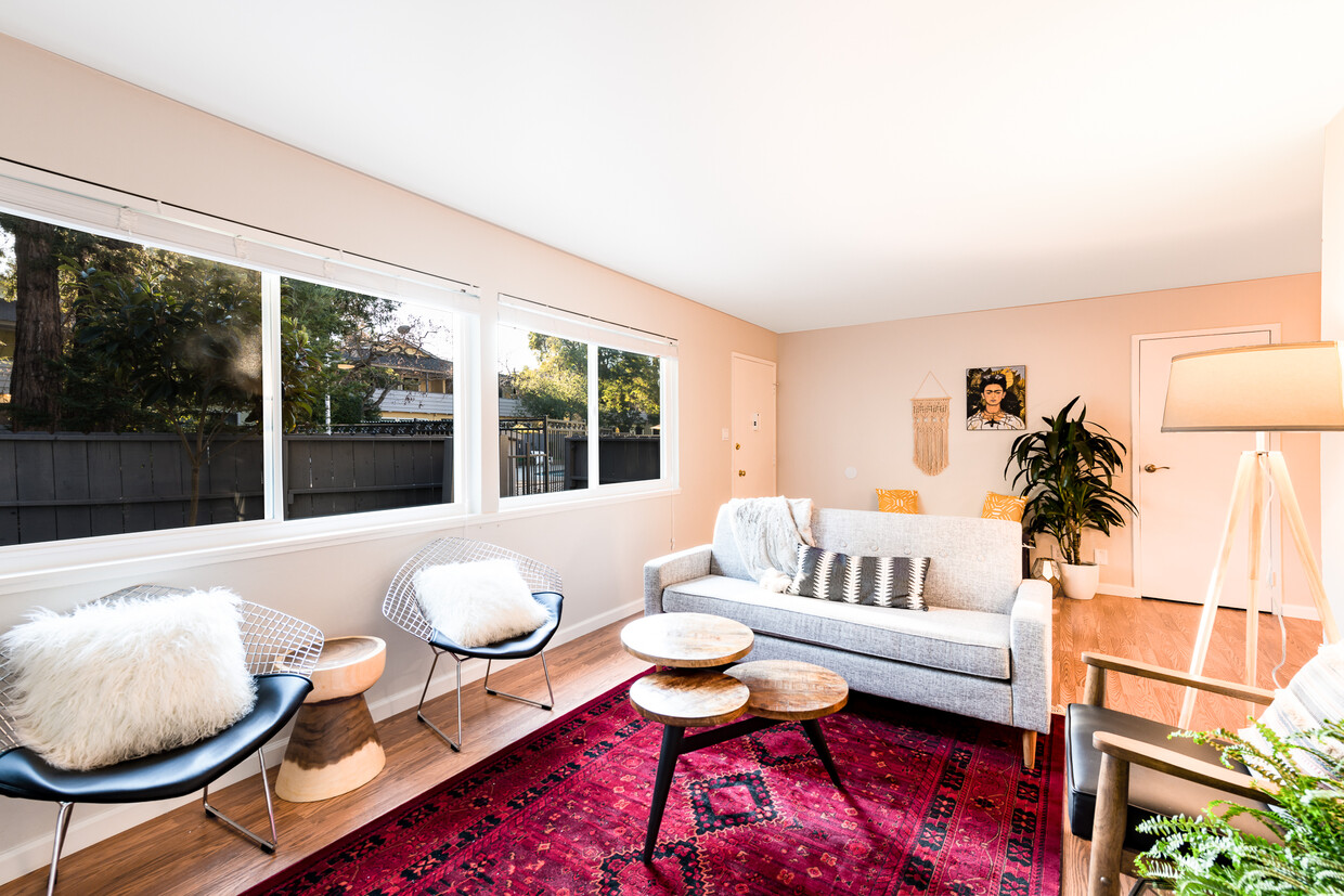
Welcome to Sunshine Gardens, a Green Certified apartment community! We are located on 132 - 150 West Dana Street in Mountain View, CA.Our garden apartments are located just an 8 minutes walk away from downtown Mountain View and the Caltrain Station and a short drive to major highways 237, 85 and 101. Enjoy an orange from our fruit trees, relax at the pool or bike through nearby Stevens Creek Pedestrian and Bike trail. We are in a peaceful oasis, located in the middle of Silicon Valley! We have a selection of unfurnished one, two and three bedrooms and furnished apartments with flexible lease options.
Welcome to Sunshine Gardens, a Green Certified apartment community! We are located on 132 - 150 West Dana Street in Mountain View, CA.Our garden apartments are located just an 8 minutes walk away from downtown Mountain View and the Caltrain Station and a short drive to major highways 237, 85 and 101. Enjoy an orange from our fruit trees, relax at the pool or bike through nearby Stevens Creek Pedestrian and Bike trail. We are in a peaceful oasis, located in the middle of Silicon Valley! We have a selection of unfurnished one, two and three bedrooms and furnished apartments with flexible lease options.
Sunshine Gardens Apartments is an apartment community located in Santa Clara County and the 94041 ZIP Code. This area is served by the Mountain View Whisman attendance zone.
Unique Features
Pool
Furnished Units Available
Playground
Laundry Service
Dishwasher
High Speed Internet Access
Hardwood Floors
Yard
Microwave
Refrigerator
Wi-Fi
Tub/Shower
Mountain View, California combines technological innovation with suburban living in Silicon Valley. The city, headquarters to companies like Google and Intuit, features a pedestrian-friendly downtown along Castro Street filled with dining options and local shops. The rental market shows steady activity, with current average rents ranging from $2,708 for studios to $4,898 for three-bedroom apartments, reflecting a modest year-over-year increase between 1.8% and 3.7%. Notable areas include the Monta Loma neighborhood, showcasing mid-century modern architecture, and the Cuernavaca district, characterized by Spanish-style homes.
The city offers abundant outdoor recreation at Shoreline Park along the San Francisco Bay, featuring trails, a golf course, and the Shoreline Amphitheatre. Stevens Creek Trail winds through the city, while landmarks like the NASA Ames Research Center and Computer History Museum highlight the area's scientific legacy.
Learn more about living in Mountain ViewCompare neighborhood and city base rent averages by bedroom.
| Downtown Mountain View | Mountain View, CA | |
|---|---|---|
| Studio | $2,256 | $2,792 |
| 1 Bedroom | $3,448 | $3,269 |
| 2 Bedrooms | $4,597 | $4,197 |
| 3 Bedrooms | $3,975 | $5,023 |
| Colleges & Universities | Distance | ||
|---|---|---|---|
| Colleges & Universities | Distance | ||
| Drive: | 9 min | 3.5 mi | |
| Drive: | 12 min | 4.9 mi | |
| Drive: | 10 min | 6.0 mi | |
| Drive: | 17 min | 7.0 mi |


Transportation options available in Mountain View include Mountain View Station, located 0.7 mile from Sunshine Gardens Apartments. Sunshine Gardens Apartments is near Norman Y Mineta San Jose International, located 9.4 miles or 15 minutes away, and San Francisco International, located 26.5 miles or 35 minutes away.
| Transit / Subway | Distance | ||
|---|---|---|---|
| Transit / Subway | Distance | ||
| Walk: | 13 min | 0.7 mi | |
|
|
Drive: | 3 min | 1.2 mi |
|
|
Drive: | 4 min | 1.9 mi |
| Drive: | 6 min | 2.5 mi | |
| Drive: | 7 min | 3.7 mi |
| Commuter Rail | Distance | ||
|---|---|---|---|
| Commuter Rail | Distance | ||
| Walk: | 11 min | 0.6 mi | |
| Drive: | 7 min | 2.6 mi | |
| Drive: | 6 min | 2.8 mi | |
| Drive: | 10 min | 5.2 mi | |
| Drive: | 13 min | 5.9 mi |
| Airports | Distance | ||
|---|---|---|---|
| Airports | Distance | ||
|
Norman Y Mineta San Jose International
|
Drive: | 15 min | 9.4 mi |
|
San Francisco International
|
Drive: | 35 min | 26.5 mi |
Time and distance from Sunshine Gardens Apartments.
| Shopping Centers | Distance | ||
|---|---|---|---|
| Shopping Centers | Distance | ||
| Walk: | 18 min | 1.0 mi | |
| Walk: | 19 min | 1.0 mi | |
| Walk: | 20 min | 1.1 mi |
| Parks and Recreation | Distance | ||
|---|---|---|---|
| Parks and Recreation | Distance | ||
|
Stevens Creek Shoreline Nature Study Area
|
Drive: | 10 min | 3.6 mi |
|
Redwood Grove
|
Drive: | 11 min | 4.3 mi |
|
Terman Park
|
Drive: | 11 min | 4.6 mi |
|
J. Pearce Mitchell Park
|
Drive: | 12 min | 4.8 mi |
|
Foothill College Observatory
|
Drive: | 13 min | 5.1 mi |
| Hospitals | Distance | ||
|---|---|---|---|
| Hospitals | Distance | ||
| Drive: | 4 min | 1.6 mi | |
| Drive: | 13 min | 7.7 mi | |
| Drive: | 13 min | 8.5 mi |
| Military Bases | Distance | ||
|---|---|---|---|
| Military Bases | Distance | ||
| Drive: | 9 min | 3.1 mi |
Pets Allowed Fitness Center Pool Walk-In Closets Stainless Steel Appliances Hardwood Floors EV Charging
Fitness Center Pool In Unit Washer & Dryer High-Speed Internet Stainless Steel Appliances Package Service
What Are Walk Score®, Transit Score®, and Bike Score® Ratings?
Walk Score® measures the walkability of any address. Transit Score® measures access to public transit. Bike Score® measures the bikeability of any address.
What is a Sound Score Rating?
A Sound Score Rating aggregates noise caused by vehicle traffic, airplane traffic and local sources
132-150 Dana St
Mountain View, CA 94041


