
Whisper Valley at Quartier
12899 Village Run Pky,
Alexander, AR 72002
$959 - $2,405
Studio - 3 Beds


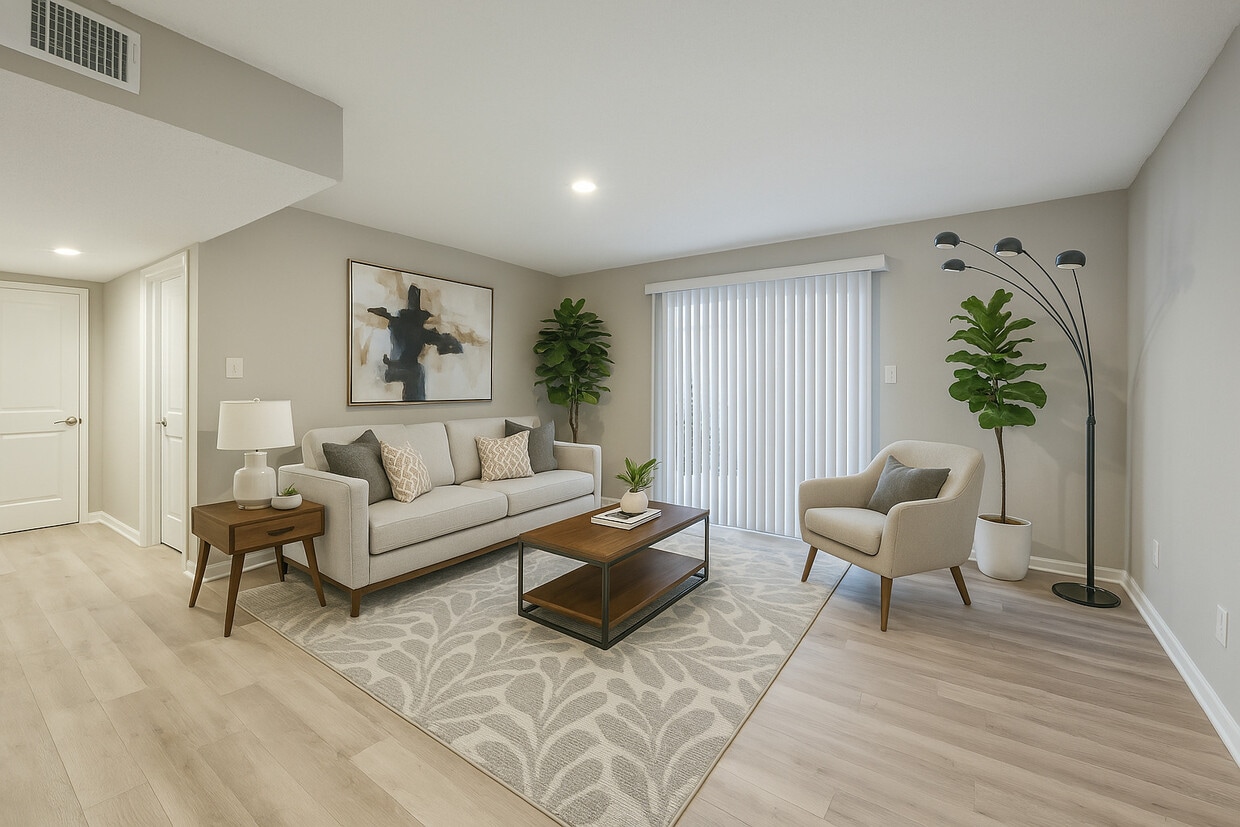
Summit at Geyer Springs offers affordable one- and two-bedroom apartments designed for comfortable, everyday living. Inside each home, you'll find practical layouts with generous space, classic finishes, and plenty of natural light—perfect for relaxing or entertaining. Our community is ideal for those seeking value without compromising on quality. Conveniently located in Little Rock, just off I-30, residents enjoy easy access to downtown, local shops, dining, and more. With dependable onsite management and a welcoming atmosphere, Summit at Geyer Springs is where comfort meets affordability.
The Summit at Geyer Springs is an apartment community located in Pulaski County and the 72209 ZIP Code. This area is served by the Little Rock School District attendance zone.
Unique Features
Laundry Facilities
Playground
Property Manager on Site
Maintenance on site
Wakefield is a largely residential community located about six miles southwest of Downtown Little Rock. Wakefield offers a wide variety of affordable apartments and houses available for rent in a quiet locale.
Wakefield’s main commercial thoroughfares are Geyer Springs Road and West 65th Street, where residents enjoy access to a host of everyday conveniences like grocery stores, casual restaurants, and service-oriented shops. The University of Arkansas at Little Rock is just a short drive north of the community while direct access to Interstate 30 connects Wakefield to all that Greater Little Rock has to offer.
Learn more about living in WakefieldCompare neighborhood and city base rent averages by bedroom.
| Wakefield | Little Rock, AR | |
|---|---|---|
| Studio | - | $831 |
| 1 Bedroom | $588 | $948 |
| 2 Bedrooms | $691 | $1,107 |
| 3 Bedrooms | $827 | $1,313 |
| Colleges & Universities | Distance | ||
|---|---|---|---|
| Colleges & Universities | Distance | ||
| Drive: | 5 min | 2.3 mi | |
| Drive: | 10 min | 5.0 mi | |
| Drive: | 11 min | 5.2 mi | |
| Drive: | 22 min | 11.7 mi |

Transportation options available in Little Rock include 2Nd St & Center St, located 7.6 miles from The Summit at Geyer Springs. The Summit at Geyer Springs is near Bill and Hillary Clinton Ntl/Adams Field, located 9.6 miles or 15 minutes away.
| Transit / Subway | Distance | ||
|---|---|---|---|
| Transit / Subway | Distance | ||
| Drive: | 12 min | 7.6 mi | |
| Drive: | 12 min | 7.7 mi | |
| Drive: | 13 min | 8.0 mi | |
| Drive: | 13 min | 8.0 mi | |
| Drive: | 13 min | 8.2 mi |
| Commuter Rail | Distance | ||
|---|---|---|---|
| Commuter Rail | Distance | ||
|
|
Drive: | 12 min | 6.8 mi |
| Airports | Distance | ||
|---|---|---|---|
| Airports | Distance | ||
|
Bill and Hillary Clinton Ntl/Adams Field
|
Drive: | 15 min | 9.6 mi |
Scores provided by
Traffic
ActiveAirport
CalmBusinesses
ActiveScores provided by
HowLoud What is a Sound Score Rating? A Sound Score Rating aggregates noise caused by vehicle traffic, airplane traffic and local sources. How It WorksTime and distance from The Summit at Geyer Springs.
| Shopping Centers | Distance | ||
|---|---|---|---|
| Shopping Centers | Distance | ||
| Walk: | 7 min | 0.4 mi | |
| Drive: | 3 min | 1.2 mi | |
| Drive: | 3 min | 1.3 mi |
| Parks and Recreation | Distance | ||
|---|---|---|---|
| Parks and Recreation | Distance | ||
|
Little Rock Zoo
|
Drive: | 8 min | 4.0 mi |
|
Central High School National Historic Site
|
Drive: | 9 min | 4.3 mi |
|
Little Rock Audubon Center
|
Drive: | 12 min | 7.5 mi |
|
Museum of Discovery
|
Drive: | 13 min | 8.2 mi |
|
Central Arkansas Nature Center
|
Drive: | 13 min | 8.2 mi |
| Hospitals | Distance | ||
|---|---|---|---|
| Hospitals | Distance | ||
| Drive: | 8 min | 4.6 mi | |
| Drive: | 9 min | 4.8 mi | |
| Drive: | 10 min | 6.0 mi |
| Military Bases | Distance | ||
|---|---|---|---|
| Military Bases | Distance | ||
| Drive: | 40 min | 23.2 mi | |
| Drive: | 40 min | 26.0 mi | |
| Drive: | 45 min | 30.8 mi |
What Are Walk Score®, Transit Score®, and Bike Score® Ratings?
Walk Score® measures the walkability of any address. Transit Score® measures access to public transit. Bike Score® measures the bikeability of any address.
What is a Sound Score Rating?
A Sound Score Rating aggregates noise caused by vehicle traffic, airplane traffic and local sources.
5201 Geyer Springs Rd
Little Rock, AR 72209


