
The Station Apartments
5959 Broadway,
Bronx, NY 10463
$1,750 - $2,300
Studio - 1 Bed
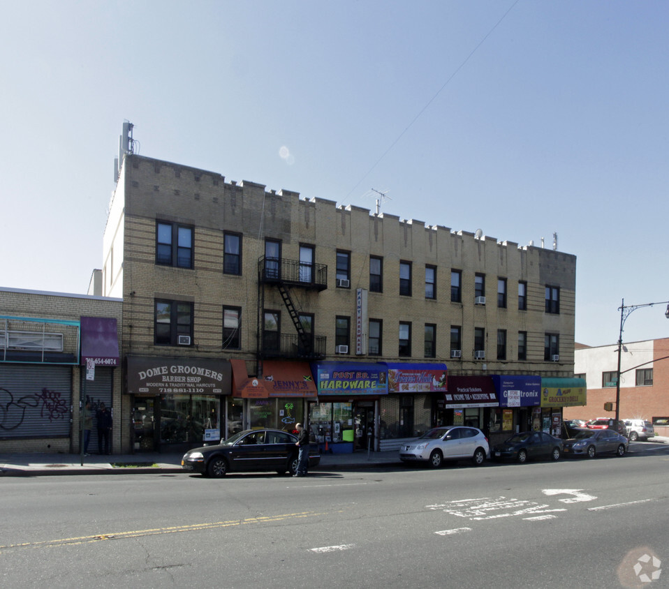
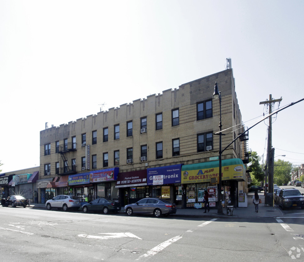

Enjoy Bronx living at Subway. The 10469 location in Bronx is an ideal place to move. Here at this community, the leasing team is ready to help you in finding your perfect floorplan. Be sure to come for a visit to see the available floorplan options. Visit Subway today.
Subway is an apartment community located in Bronx County and the 10469 ZIP Code. This area is served by the New York City Geographic District #11 attendance zone.
The Bronx is considered one of New York’s trendiest neighborhoods. Separated from Manhattan by the Harlem River, the Bronx is busy, chaotic, and diverse — in fact, more than 75 different languages are spoken here. While it’s famous for its attractions like Yankee Stadium and the Bronx Zoo, there’s much more to this iconic borough.
Overflowing with unique charm and classic brownstones, the Bronx also features art deco designs and amazing food in locations like Little Italy. Hip-hop originated in South Bronx during the 1980s, and music is still an integral part of the community.
You might think living in the Bronx means traffic horns, concrete, and pedestrian-filled sidewalks. And, yes, that’s all true, but there are several parks in the Bronx, as well. The New York Botanical Garden stands out with an impressive sprawl of 50 gardens and 30,000 trees. Orchard Beach provides a sweet waterside escape, while Wave Hill Public Gardens offers scenic views of the Hudson River.
Learn more about living in BronxCompare neighborhood and city base rent averages by bedroom.
| Laconia | Bronx, NY | |
|---|---|---|
| Studio | - | $1,635 |
| 1 Bedroom | $1,281 | $1,636 |
| 2 Bedrooms | $1,845 | $2,089 |
| 3 Bedrooms | - | $2,373 |
| Colleges & Universities | Distance | ||
|---|---|---|---|
| Colleges & Universities | Distance | ||
| Drive: | 3 min | 1.8 mi | |
| Drive: | 8 min | 3.0 mi | |
| Drive: | 7 min | 3.2 mi | |
| Drive: | 7 min | 3.6 mi |


Transportation options available in Bronx include Gun Hill Road (5 Line), located 0.6 mile from Subway. Subway is near LaGuardia, located 11.3 miles or 22 minutes away, and Westchester County, located 19.5 miles or 30 minutes away.
| Transit / Subway | Distance | ||
|---|---|---|---|
| Transit / Subway | Distance | ||
|
|
Walk: | 11 min | 0.6 mi |
|
|
Walk: | 14 min | 0.8 mi |
|
|
Drive: | 2 min | 1.1 mi |
|
|
Drive: | 4 min | 1.7 mi |
|
|
Drive: | 4 min | 1.8 mi |
| Commuter Rail | Distance | ||
|---|---|---|---|
| Commuter Rail | Distance | ||
|
|
Drive: | 2 min | 1.4 mi |
|
|
Drive: | 6 min | 2.3 mi |
|
|
Drive: | 5 min | 2.5 mi |
|
|
Drive: | 6 min | 3.0 mi |
|
|
Drive: | 6 min | 3.4 mi |
| Airports | Distance | ||
|---|---|---|---|
| Airports | Distance | ||
|
LaGuardia
|
Drive: | 22 min | 11.3 mi |
|
Westchester County
|
Drive: | 30 min | 19.5 mi |
Time and distance from Subway.
| Shopping Centers | Distance | ||
|---|---|---|---|
| Shopping Centers | Distance | ||
| Walk: | 20 min | 1.1 mi | |
| Drive: | 4 min | 1.4 mi | |
| Drive: | 3 min | 1.6 mi |
| Parks and Recreation | Distance | ||
|---|---|---|---|
| Parks and Recreation | Distance | ||
|
Seton Falls Park
|
Drive: | 3 min | 1.3 mi |
|
Williamsbridge Oval
|
Drive: | 5 min | 1.9 mi |
|
New York Botanical Garden
|
Drive: | 10 min | 3.3 mi |
|
Bronx Park
|
Drive: | 8 min | 3.4 mi |
|
Pelham Bay Park
|
Drive: | 7 min | 3.8 mi |
| Hospitals | Distance | ||
|---|---|---|---|
| Hospitals | Distance | ||
| Drive: | 4 min | 2.0 mi | |
| Drive: | 5 min | 2.2 mi | |
| Drive: | 5 min | 2.4 mi |
| Military Bases | Distance | ||
|---|---|---|---|
| Military Bases | Distance | ||
| Drive: | 18 min | 9.3 mi |
What Are Walk Score®, Transit Score®, and Bike Score® Ratings?
Walk Score® measures the walkability of any address. Transit Score® measures access to public transit. Bike Score® measures the bikeability of any address.
What is a Sound Score Rating?
A Sound Score Rating aggregates noise caused by vehicle traffic, airplane traffic and local sources


