
Cortland on Blake
1451 24th St,
Denver, CO 80205
$1,438 - $7,795
Studio - 3 Beds

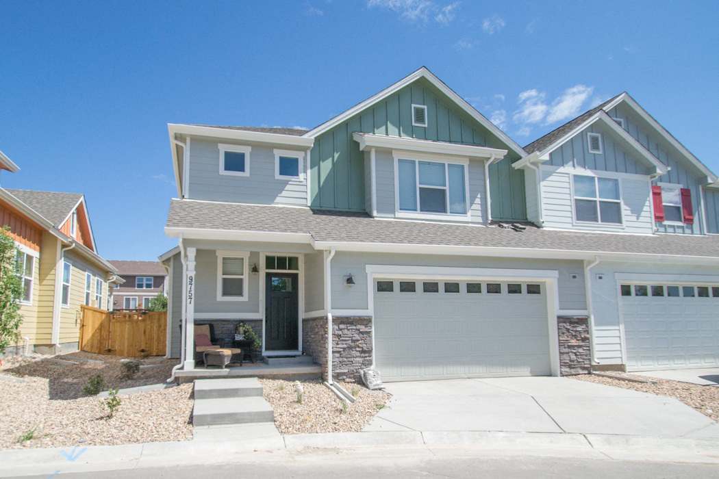
Stanford Commons es una exclusiva comunidad de viviendas energéticamente eficientes, diseñadas con características sostenibles para una vida saludable y eficiente. A los residentes les encantará estar cerca de restaurantes y lugares de entretenimiento en el centro de Littleton, ¡y a la vez vivir a solo minutos de las rutas de senderismo de Front Range! Stanford Commons también cuenta con fácil acceso a la autopista 285, la I-470 y Santa Fe Drive. ¡Solo toma la autopista y llega al centro de Denver en 20 minutos! ¡Solo contratos de arrendamiento a corto plazo hasta marzo de 2025! Nota: Las fotos pueden ser de una unidad similar en la comunidad. Licencia de alquiler n.° 2022-BFN-0025532
Stanford Commons is a townhouse community located in Denver County and the 80123 ZIP Code. This area is served by the Denver County 1 attendance zone.
Unique Features
Lavadora/Secadora
Aire acondicionado
Lavavajillas
Suelos de madera maciza
Like many neighborhoods in southwest Denver, Harvey Park South features views of both the Denver skyline and of the mountains from its open space and park areas. Residents in Harvey Park South have everything they need in the neighborhood: amazing views, safety, affordable homes and a 25-minute drive to the urban center in downtown Denver. Harvey Park South locals truly love their part of town, including its proximity to shopping and amenities such as schools and a health care center.
With access to major streets and highways, locals can travel to other parts of Denver and return to their beloved neighborhood just as quickly. For all these reasons, families love Harvey Park South and its close-knit feel.
Learn more about living in Southwest Denver| Colleges & Universities | Distance | ||
|---|---|---|---|
| Colleges & Universities | Distance | ||
| Drive: | 13 min | 6.9 mi | |
| Drive: | 14 min | 7.3 mi | |
| Drive: | 14 min | 7.7 mi | |
| Drive: | 17 min | 8.1 mi |


Transportation options available in Denver include Federal Center, located 7.1 miles from Stanford Commons. Stanford Commons is near Denver International, located 38.7 miles or 53 minutes away.
| Transit / Subway | Distance | ||
|---|---|---|---|
| Transit / Subway | Distance | ||
|
|
Drive: | 14 min | 7.1 mi |
|
|
Drive: | 13 min | 7.1 mi |
|
|
Drive: | 12 min | 7.8 mi |
|
|
Drive: | 12 min | 7.8 mi |
|
|
Drive: | 14 min | 8.3 mi |
| Commuter Rail | Distance | ||
|---|---|---|---|
| Commuter Rail | Distance | ||
| Drive: | 22 min | 11.9 mi | |
| Drive: | 22 min | 12.0 mi | |
| Drive: | 24 min | 12.5 mi | |
|
|
Drive: | 24 min | 15.1 mi |
|
|
Drive: | 24 min | 15.3 mi |
| Airports | Distance | ||
|---|---|---|---|
| Airports | Distance | ||
|
Denver International
|
Drive: | 53 min | 38.7 mi |
Time and distance from Stanford Commons.
| Shopping Centers | Distance | ||
|---|---|---|---|
| Shopping Centers | Distance | ||
| Walk: | 2 min | 0.1 mi | |
| Walk: | 16 min | 0.8 mi | |
| Walk: | 19 min | 1.0 mi |
| Parks and Recreation | Distance | ||
|---|---|---|---|
| Parks and Recreation | Distance | ||
|
Bear Creek Lake Park
|
Drive: | 9 min | 5.8 mi |
|
Bear Creek Park
|
Drive: | 10 min | 6.0 mi |
|
Morrison Natural History Museum
|
Drive: | 12 min | 6.7 mi |
|
Hudson Gardens
|
Drive: | 13 min | 7.4 mi |
|
South Platte Park
|
Drive: | 13 min | 7.8 mi |
| Hospitals | Distance | ||
|---|---|---|---|
| Hospitals | Distance | ||
| Drive: | 10 min | 6.4 mi | |
| Drive: | 13 min | 6.9 mi | |
| Drive: | 13 min | 6.9 mi |
| Military Bases | Distance | ||
|---|---|---|---|
| Military Bases | Distance | ||
| Drive: | 57 min | 27.0 mi | |
| Drive: | 85 min | 68.0 mi | |
| Drive: | 94 min | 77.7 mi |
What Are Walk Score®, Transit Score®, and Bike Score® Ratings?
Walk Score® measures the walkability of any address. Transit Score® measures access to public transit. Bike Score® measures the bikeability of any address.
What is a Sound Score Rating?
A Sound Score Rating aggregates noise caused by vehicle traffic, airplane traffic and local sources
9755-9785 W Stanford Ave
Denver, CO 80123


