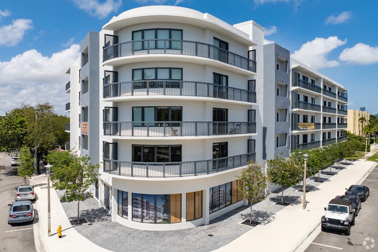
Silver Bluff Underline
2285 SW 27th St,
Miami,
FL
33133
Leasing Office:
800 West Ave, Miami Beach, FL 33139
-
Monthly Rent
$2,798 - $2,998
-
Bedrooms
1 - 2 bd
-
Bathrooms
2 - 3 ba
-
Square Feet
1,000 - 1,017 sq ft
Highlights
- Walking/Biking Trails
- Elevator
- Balcony
- Views
Pricing & Floor Plans
-
Unit 407price $2,998square feet 1,017availibility Now
-
Unit 407price $2,998square feet 1,017availibility Now
Fees and Policies
The fees below are based on community-supplied data and may exclude additional fees and utilities. Use the Cost Calculator to add these fees to the base price.
-
One-Time Basics
-
Due at Application
-
Application Fee Per ApplicantSubmit your complete application with the attached Trident Rental Application, recent income documentation, ID copies, and credit reports to Vanessa @ tridentmiami. com Renters insurance required. Water is not included. Charged per applicant.$150
-
-
Due at Application
Pet policies are negotiable.
-
Dogs
-
One-Time Pet FeeMax of 1. Charged per pet.$300
30 lbs. Weight Limit -
-
Cats
-
One-Time Pet FeeMax of 1. Charged per pet.$300
-
-
Surface Lot
-
OtherAssigned Parking Space
Property Fee Disclaimer: Based on community-supplied data and independent market research. Subject to change without notice. May exclude fees for mandatory or optional services and usage-based utilities.
Details
Utilities Included
-
Trash Removal
-
Sewer
-
Air Conditioning
Lease Options
-
12 mo
Property Information
-
Built in 2023
-
28 units/5 stories
About Silver Bluff Underline
28 modern apartment residences in the heart of Miami’s newest 10-mile linear park, urban trail, and public art destination. Ideally located near Coral Gables and Coconut Grove, this building offers the perfect mix of convenience and charm. This prime spot provides easy access to Miami's best dining, shopping, and cultural attractions, with major hubs like Brickell and downtown just minutes away. Enjoy the vibrant surroundings while retreating to a comfortable, modern space in one of Miami's most sought-after neighborhoods.
Silver Bluff Underline is an apartment community located in Miami/Dade County and the 33133 ZIP Code. This area is served by the Miami-Dade County Public Schools attendance zone.
Unique Features
- Gym
- New Building
Contact
Community Amenities
Fitness Center
Elevator
Trash Pickup - Curbside
Walking/Biking Trails
- Trash Pickup - Curbside
- EV Charging
- Elevator
- Fitness Center
- Walking/Biking Trails
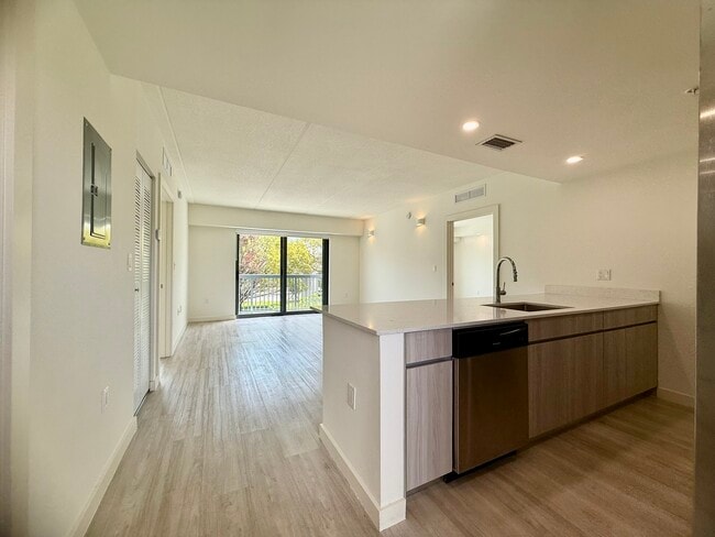
Apartment Features
Washer/Dryer
Air Conditioning
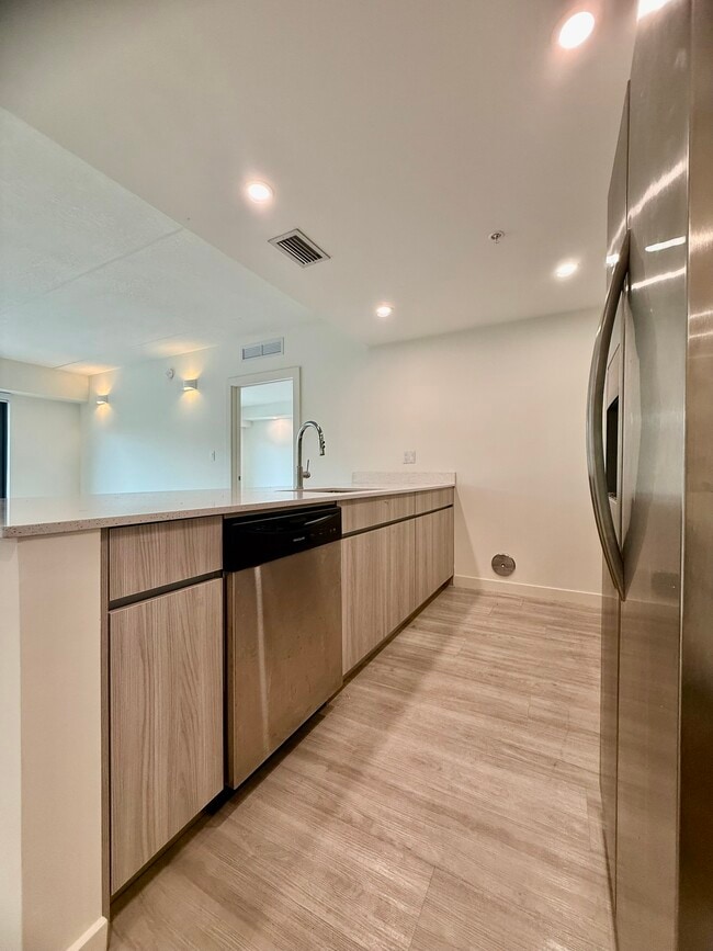
Dishwasher
High Speed Internet Access
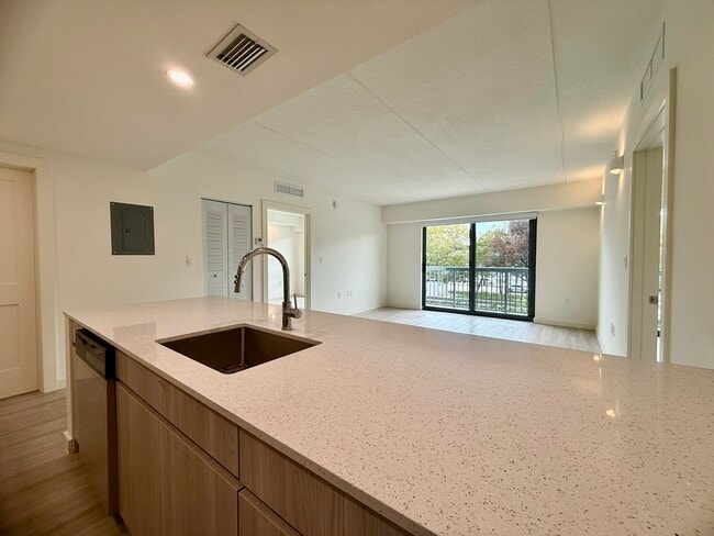
Granite Countertops
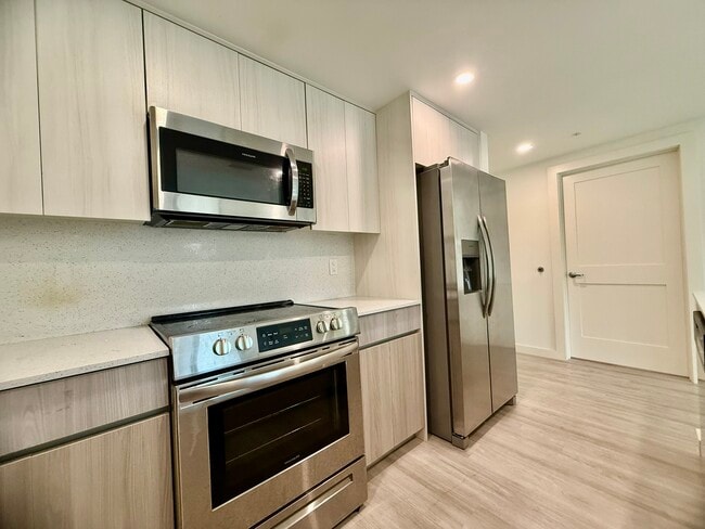
Microwave
Refrigerator
Tub/Shower
Indoor Features
- High Speed Internet Access
- Washer/Dryer
- Air Conditioning
- Heating
- Smoke Free
- Cable Ready
- Security System
- Tub/Shower
- Sprinkler System
Kitchen Features & Appliances
- Dishwasher
- Disposal
- Ice Maker
- Granite Countertops
- Stainless Steel Appliances
- Kitchen
- Microwave
- Oven
- Range
- Refrigerator
- Freezer
Model Details
- Vinyl Flooring
- Views
- Double Pane Windows
- Window Coverings
- Balcony
- Trash Pickup - Curbside
- EV Charging
- Elevator
- Fitness Center
- Walking/Biking Trails
- Gym
- New Building
- High Speed Internet Access
- Washer/Dryer
- Air Conditioning
- Heating
- Smoke Free
- Cable Ready
- Security System
- Tub/Shower
- Sprinkler System
- Dishwasher
- Disposal
- Ice Maker
- Granite Countertops
- Stainless Steel Appliances
- Kitchen
- Microwave
- Oven
- Range
- Refrigerator
- Freezer
- Vinyl Flooring
- Views
- Double Pane Windows
- Window Coverings
- Balcony
| Monday | By Appointment |
|---|---|
| Tuesday | By Appointment |
| Wednesday | By Appointment |
| Thursday | By Appointment |
| Friday | By Appointment |
| Saturday | By Appointment |
| Sunday | By Appointment |
Located just southwest of Brickell, Northeast Coconut Grove is a vibrant community brimming with desirable amenities. Northeast Coconut Grove is home to Vizcaya Museum and Gardens, a stunning estate with sculptures, grottos, gardens, and an ornate 1914 mansion turned museum.
In addition to a variety of rental options, Northeast Coconut Grove residents enjoy access to picturesque waterfront parks like David T. Kennedy Park, Alice Wainwright Park, Peacock Park, and the Barnacle Historic State Park. CocoWalk lies at the southwestern edge of the community, providing exceptional shopping and dining options close to home.
Mercy Hospital is also located in the community, making Northeast Coconut Grove an alluring option for many healthcare workers and their families. Commuting is easy with access to the Metrorail and U.S. Route 1.
Learn more about living in Northeast Coconut GroveCompare neighborhood and city base rent averages by bedroom.
| Northeast Coconut Grove | Miami, FL | |
|---|---|---|
| Studio | $1,464 | $2,077 |
| 1 Bedroom | $2,409 | $2,206 |
| 2 Bedrooms | $3,330 | $2,770 |
| 3 Bedrooms | $5,455 | $3,559 |
| Colleges & Universities | Distance | ||
|---|---|---|---|
| Colleges & Universities | Distance | ||
| Drive: | 5 min | 2.4 mi | |
| Drive: | 7 min | 3.4 mi | |
| Drive: | 8 min | 3.7 mi | |
| Drive: | 10 min | 4.5 mi |


View GreatSchools Rating Methodology
Data provided by GreatSchools.org © 2026. All rights reserved.
Transportation options available in Miami include Financial District, located 3.0 miles from Silver Bluff Underline. Silver Bluff Underline is near Miami International, located 11.4 miles or 23 minutes away, and Fort Lauderdale/Hollywood International, located 26.6 miles or 38 minutes away.
| Transit / Subway | Distance | ||
|---|---|---|---|
| Transit / Subway | Distance | ||
|
|
Drive: | 6 min | 3.0 mi |
|
|
Drive: | 7 min | 3.2 mi |
|
|
Drive: | 7 min | 3.5 mi |
|
|
Drive: | 7 min | 3.5 mi |
|
|
Drive: | 8 min | 3.7 mi |
| Commuter Rail | Distance | ||
|---|---|---|---|
| Commuter Rail | Distance | ||
|
|
Walk: | 10 min | 0.5 mi |
|
|
Drive: | 4 min | 1.8 mi |
|
|
Drive: | 4 min | 2.3 mi |
|
|
Drive: | 7 min | 3.5 mi |
|
|
Drive: | 8 min | 4.1 mi |
| Airports | Distance | ||
|---|---|---|---|
| Airports | Distance | ||
|
Miami International
|
Drive: | 23 min | 11.4 mi |
|
Fort Lauderdale/Hollywood International
|
Drive: | 38 min | 26.6 mi |
Time and distance from Silver Bluff Underline.
| Shopping Centers | Distance | ||
|---|---|---|---|
| Shopping Centers | Distance | ||
| Walk: | 9 min | 0.5 mi | |
| Walk: | 10 min | 0.6 mi | |
| Drive: | 3 min | 1.3 mi |
| Parks and Recreation | Distance | ||
|---|---|---|---|
| Parks and Recreation | Distance | ||
|
The Barnacle Historic State Park
|
Drive: | 4 min | 1.7 mi |
|
Miami Science Museum - Closed
|
Drive: | 4 min | 1.8 mi |
|
Vizcaya Museum and Gardens
|
Drive: | 5 min | 2.0 mi |
|
The Kampong
|
Drive: | 6 min | 2.9 mi |
|
Gifford Arboretum
|
Drive: | 8 min | 4.0 mi |
| Hospitals | Distance | ||
|---|---|---|---|
| Hospitals | Distance | ||
| Drive: | 7 min | 3.5 mi | |
| Drive: | 10 min | 4.4 mi | |
| Drive: | 10 min | 4.7 mi |
Silver Bluff Underline Photos
-
Silver Bluff Underline
-
-
-
-
-
-
-
-
Nearby Apartments
Within 50 Miles of Silver Bluff Underline
Silver Bluff Underline has units with in‑unit washers and dryers, making laundry day simple for residents.
Select utilities are included in rent at Silver Bluff Underline, including trash removal, sewer, and air conditioning. Residents are responsible for any other utilities not listed.
Parking is available at Silver Bluff Underline. Fees may apply depending on the type of parking offered. Contact this property for details.
Silver Bluff Underline has one to two-bedrooms with rent ranges from $2,798/mo. to $2,998/mo.
Yes, Silver Bluff Underline welcomes pets. Breed restrictions, weight limits, and additional fees may apply. View this property's pet policy.
A good rule of thumb is to spend no more than 30% of your gross income on rent. Based on the lowest available rent of $2,798 for a one-bedroom, you would need to earn about $101,000 per year to qualify. Want to double-check your budget? Try our Rent Affordability Calculator to see how much rent fits your income and lifestyle.
Silver Bluff Underline is offering Specials for eligible applicants, with rental rates starting at $2,798.
While Silver Bluff Underline does not offer Matterport 3D tours, renters can request a tour directly through our online platform.
What Are Walk Score®, Transit Score®, and Bike Score® Ratings?
Walk Score® measures the walkability of any address. Transit Score® measures access to public transit. Bike Score® measures the bikeability of any address.
What is a Sound Score Rating?
A Sound Score Rating aggregates noise caused by vehicle traffic, airplane traffic and local sources

2285 SW 27th St
Miami, FL 33133
Property Manager Responded