
Fayette Arms Apartments
2680 Fayette Dr,
Mountain View, CA 94040
$2,849 - $3,758
1-2 Beds
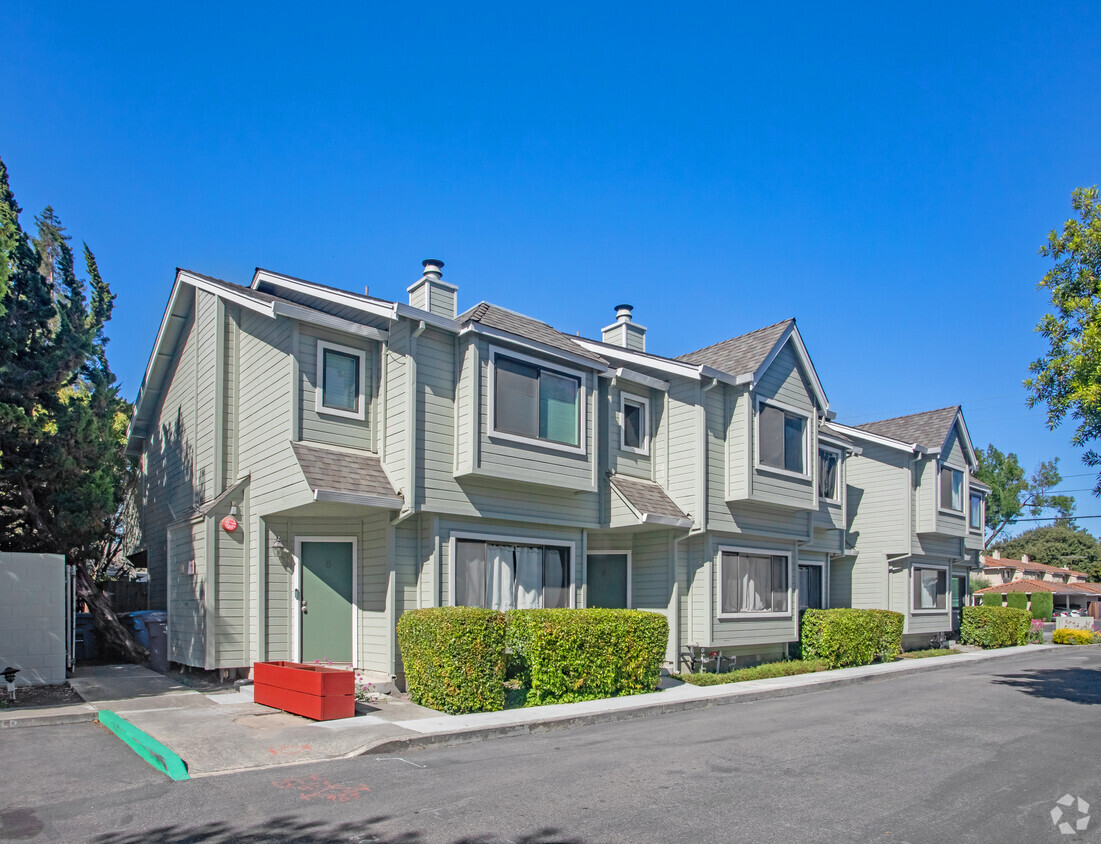
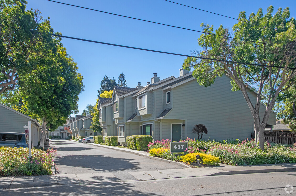
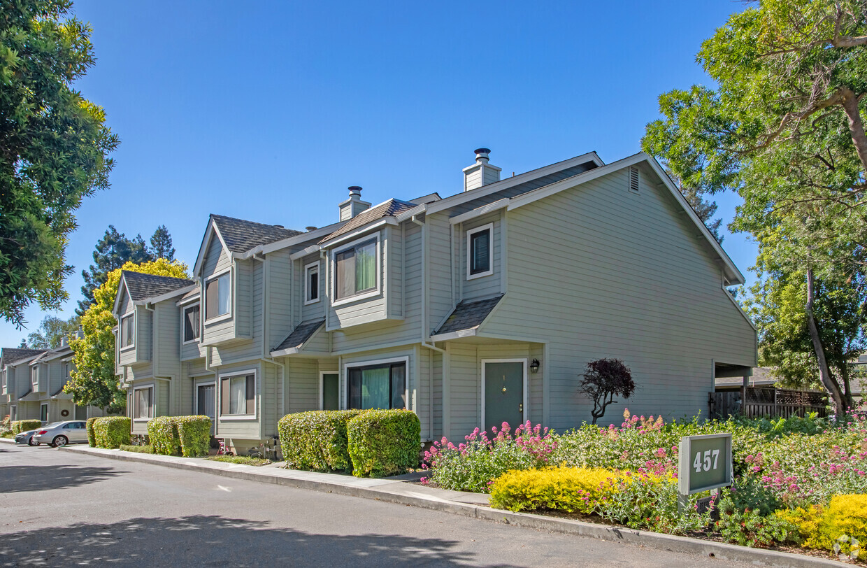
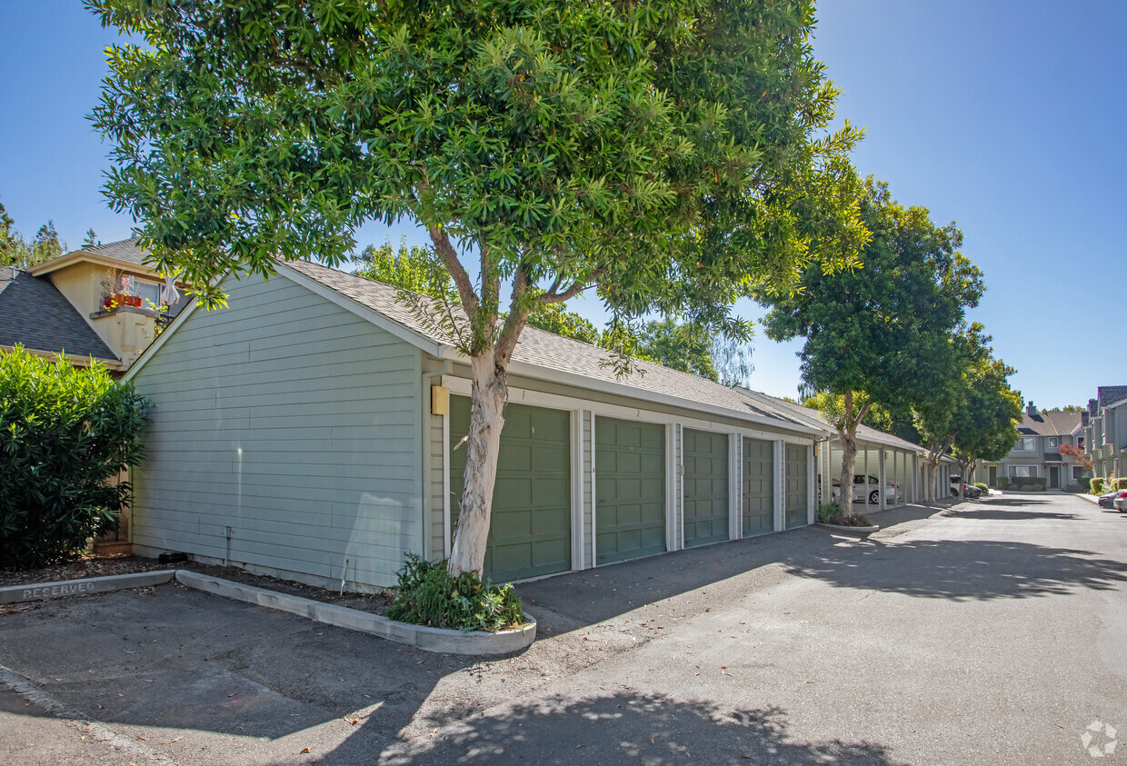
Nestled among beautiful trees, Sierra Vista is a very convenient place to live. The property is located in the heart of the Silicon Valley. This excellent Mountain View location provides easy access to Google, HP, Apple and many of the other Silicon Valley giants. Mountain View also offers a vibrant night life and easy living. Professionally managed by Prodesse Property Group, our 2 bedroom, 2 bath apartment homes live like your own condominium. Each is well appointed with recently remodeled kitchens, that include new appliances and granite counters. All have two large bedrooms, each with its own private bath and plenty of closet space. Every home has its own washer and dryer and includes a covered parking space. Additional parking spaces are available in the property's private parking lot. Outside you can enjoy beautiful Sierra Vista Park across the street, or travel downtown to enjoy people watching or sample the tastes of the many excellent restaurants along Castro Street. In
Sierra Vista Apartments is an apartment community located in Santa Clara County and the 94043 ZIP Code. This area is served by the Mountain View Whisman attendance zone.
Unique Features
Mountain View, California combines technological innovation with suburban living in Silicon Valley. The city, headquarters to companies like Google and Intuit, features a pedestrian-friendly downtown along Castro Street filled with dining options and local shops. The rental market shows steady activity, with current average rents ranging from $2,708 for studios to $4,898 for three-bedroom apartments, reflecting a modest year-over-year increase between 1.8% and 3.7%. Notable areas include the Monta Loma neighborhood, showcasing mid-century modern architecture, and the Cuernavaca district, characterized by Spanish-style homes.
The city offers abundant outdoor recreation at Shoreline Park along the San Francisco Bay, featuring trails, a golf course, and the Shoreline Amphitheatre. Stevens Creek Trail winds through the city, while landmarks like the NASA Ames Research Center and Computer History Museum highlight the area's scientific legacy.
Learn more about living in Mountain View| Colleges & Universities | Distance | ||
|---|---|---|---|
| Colleges & Universities | Distance | ||
| Drive: | 4 min | 1.5 mi | |
| Drive: | 13 min | 4.9 mi | |
| Drive: | 15 min | 5.6 mi | |
| Drive: | 17 min | 10.2 mi |


Transportation options available in Mountain View include Mountain View Station, located 1.5 miles from Sierra Vista Apartments. Sierra Vista Apartments is near Norman Y Mineta San Jose International, located 10.4 miles or 15 minutes away, and San Francisco International, located 23.9 miles or 31 minutes away.
| Transit / Subway | Distance | ||
|---|---|---|---|
| Transit / Subway | Distance | ||
| Drive: | 3 min | 1.5 mi | |
|
|
Drive: | 4 min | 1.5 mi |
|
|
Drive: | 6 min | 2.6 mi |
| Drive: | 5 min | 2.9 mi | |
|
|
Drive: | 6 min | 3.0 mi |
| Commuter Rail | Distance | ||
|---|---|---|---|
| Commuter Rail | Distance | ||
| Drive: | 5 min | 2.1 mi | |
| Drive: | 6 min | 2.1 mi | |
| Drive: | 6 min | 2.3 mi | |
| Drive: | 9 min | 4.1 mi | |
| Drive: | 10 min | 4.4 mi |
| Airports | Distance | ||
|---|---|---|---|
| Airports | Distance | ||
|
Norman Y Mineta San Jose International
|
Drive: | 15 min | 10.4 mi |
|
San Francisco International
|
Drive: | 31 min | 23.9 mi |
Time and distance from Sierra Vista Apartments.
| Shopping Centers | Distance | ||
|---|---|---|---|
| Shopping Centers | Distance | ||
| Walk: | 8 min | 0.4 mi | |
| Walk: | 16 min | 0.8 mi | |
| Walk: | 18 min | 1.0 mi |
| Parks and Recreation | Distance | ||
|---|---|---|---|
| Parks and Recreation | Distance | ||
|
J. Pearce Mitchell Park
|
Drive: | 7 min | 2.2 mi |
|
Stevens Creek Shoreline Nature Study Area
|
Drive: | 7 min | 2.8 mi |
|
Terman Park
|
Drive: | 8 min | 3.3 mi |
|
Bol Park
|
Drive: | 10 min | 4.1 mi |
|
Redwood Grove
|
Drive: | 11 min | 4.6 mi |
| Hospitals | Distance | ||
|---|---|---|---|
| Hospitals | Distance | ||
| Drive: | 8 min | 4.4 mi | |
| Drive: | 15 min | 6.3 mi | |
| Drive: | 17 min | 6.8 mi |
| Military Bases | Distance | ||
|---|---|---|---|
| Military Bases | Distance | ||
| Drive: | 8 min | 3.3 mi |
What Are Walk Score®, Transit Score®, and Bike Score® Ratings?
Walk Score® measures the walkability of any address. Transit Score® measures access to public transit. Bike Score® measures the bikeability of any address.
What is a Sound Score Rating?
A Sound Score Rating aggregates noise caused by vehicle traffic, airplane traffic and local sources

457 Sierra Vista Ave
Mountain View, CA 94043


