
Bridgepointe
1987 Bridgepointe Pky,
San Mateo, CA 94404
$3,500 - $5,915 Total Monthly Price
1-3 Beds
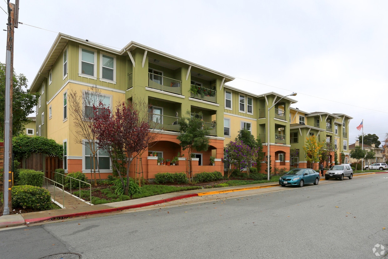
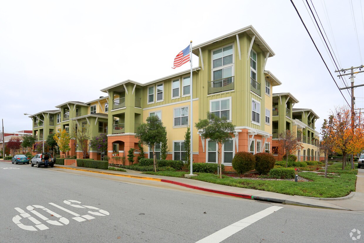
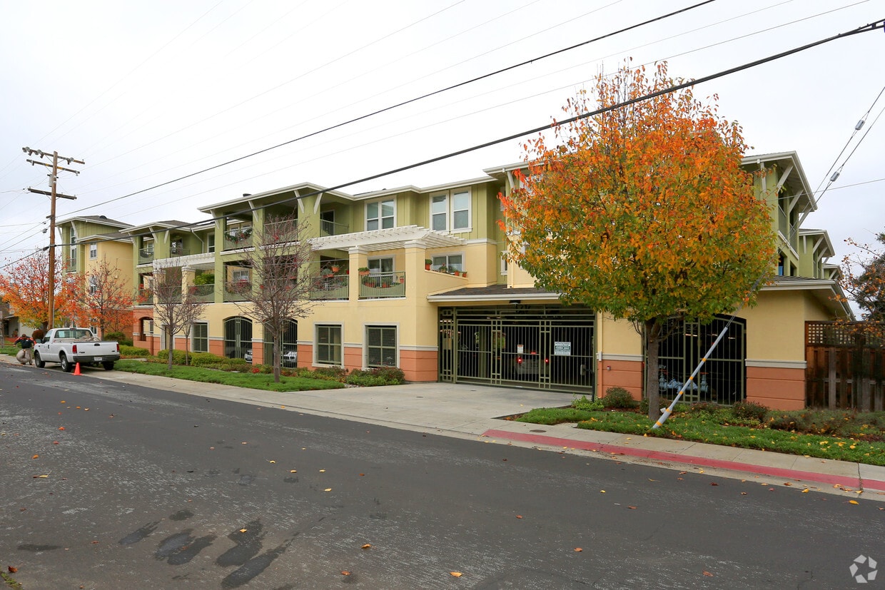
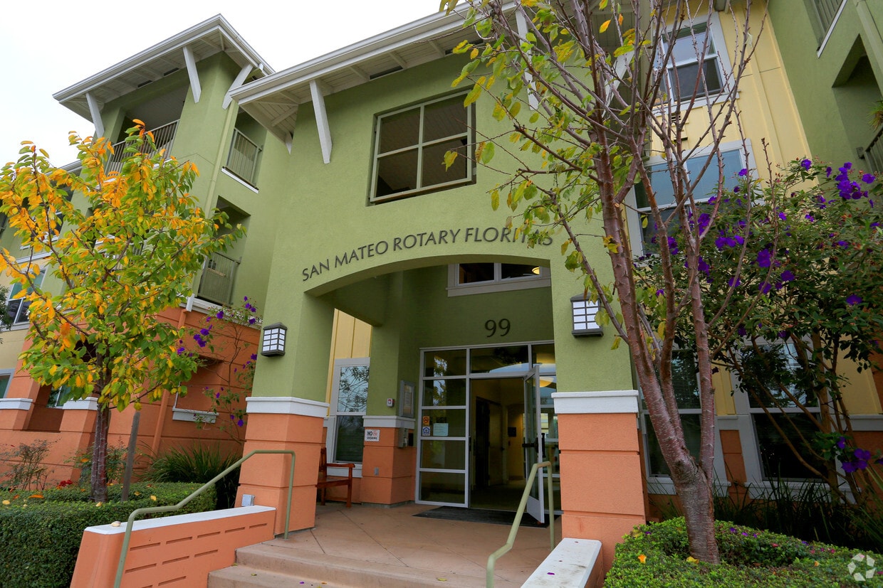

Find your new apartment at San Mateo Rotary Floritas in San Mateo, CA. This apartment community is located at 99 27th Ave in the 94403 area of San Mateo. Here at this community, the community staff is ready to help you in finding the perfect floorplan option. Be sure to check out the current floorplan options. Come see San Mateo Rotary Floritas today.
San Mateo Rotary Floritas is an apartment community located in San Mateo County and the 94403 ZIP Code. This area is served by the San Mateo-Foster City School District attendance zone.
Elevator
Controlled Access
24 Hour Access
Online Services
Refrigerator
Tub/Shower
Freezer
Oven
Great schools, excellent shopping, and the Peninsula Golf and Country Club provide reasons for renters to flock to the Beresford Park neighborhood of San Mateo. Condos and apartments tend to sit along the neighborhood's major boulevards, providing easy access to Interstates 92 and 101 for commutes up and down the San Francisco peninsula. Many residents of Beresford Park commute by train, as the CalTrain station sits right in the neighborhood.
This family-friendly community heads to Beresford Park, from which the neighborhood takes its name, to play sports, fire up a barbecue, and enjoy the community garden. This park features a wealth of activities, so you can join your neighbors at Pilates, Zumba, and art classes. Convenient shopping at the Hilldale Shopping Center gives you access to Nordstrom and Barnes & Noble, among other popular stores.
Learn more about living in Beresford ParkCompare neighborhood and city base rent averages by bedroom.
| Beresford Park | San Mateo, CA | |
|---|---|---|
| Studio | $3,117 | $2,543 |
| 1 Bedroom | $3,213 | $3,109 |
| 2 Bedrooms | $3,776 | $4,043 |
| 3 Bedrooms | $4,554 | $5,534 |
| Colleges & Universities | Distance | ||
|---|---|---|---|
| Colleges & Universities | Distance | ||
| Drive: | 5 min | 2.4 mi | |
| Drive: | 18 min | 11.1 mi | |
| Drive: | 19 min | 11.9 mi | |
| Drive: | 23 min | 15.2 mi |


Transportation options available in San Mateo include Millbrae (Caltrain Transfer Platform), located 8.5 miles from San Mateo Rotary Floritas. San Mateo Rotary Floritas is near San Francisco International, located 9.6 miles or 14 minutes away, and Metro Oakland International, located 25.2 miles or 32 minutes away.
| Transit / Subway | Distance | ||
|---|---|---|---|
| Transit / Subway | Distance | ||
|
|
Drive: | 13 min | 8.5 mi |
| Drive: | 14 min | 9.2 mi | |
| Drive: | 14 min | 9.4 mi | |
|
|
Drive: | 14 min | 9.6 mi |
|
|
Drive: | 16 min | 9.6 mi |
| Commuter Rail | Distance | ||
|---|---|---|---|
| Commuter Rail | Distance | ||
| Walk: | 5 min | 0.3 mi | |
| Walk: | 19 min | 1.0 mi | |
| Walk: | 20 min | 1.1 mi | |
| Drive: | 5 min | 2.4 mi | |
| Drive: | 5 min | 2.5 mi |
| Airports | Distance | ||
|---|---|---|---|
| Airports | Distance | ||
|
San Francisco International
|
Drive: | 14 min | 9.6 mi |
|
Metro Oakland International
|
Drive: | 32 min | 25.2 mi |
Scores provided by
Traffic
-Airport
-Businesses
-Scores provided by
HowLoud What is a Sound Score Rating? A Sound Score Rating aggregates noise caused by vehicle traffic, airplane traffic and local sources. How It WorksTime and distance from San Mateo Rotary Floritas.
| Shopping Centers | Distance | ||
|---|---|---|---|
| Shopping Centers | Distance | ||
| Walk: | 4 min | 0.2 mi | |
| Walk: | 11 min | 0.6 mi | |
| Walk: | 13 min | 0.7 mi |
| Parks and Recreation | Distance | ||
|---|---|---|---|
| Parks and Recreation | Distance | ||
|
San Mateo Arboretum
|
Drive: | 4 min | 1.7 mi |
|
Japanese Tea Garden (San Mateo)
|
Drive: | 5 min | 2.1 mi |
|
Shoreline Parks
|
Drive: | 7 min | 3.5 mi |
|
Crystal Springs Trail
|
Drive: | 10 min | 5.2 mi |
|
Coyote Point Recreational Area
|
Drive: | 10 min | 5.4 mi |
| Hospitals | Distance | ||
|---|---|---|---|
| Hospitals | Distance | ||
| Walk: | 19 min | 1.0 mi | |
| Drive: | 11 min | 5.9 mi | |
| Drive: | 13 min | 8.0 mi |
| Military Bases | Distance | ||
|---|---|---|---|
| Military Bases | Distance | ||
| Drive: | 27 min | 19.4 mi | |
| Drive: | 44 min | 32.6 mi | |
| Drive: | 45 min | 32.8 mi |
What Are Walk Score®, Transit Score®, and Bike Score® Ratings?
Walk Score® measures the walkability of any address. Transit Score® measures access to public transit. Bike Score® measures the bikeability of any address.
What is a Sound Score Rating?
A Sound Score Rating aggregates noise caused by vehicle traffic, airplane traffic and local sources.

99 27th Ave
San Mateo, CA 94403


