
Bridgepointe
1987 Bridgepointe Pky,
San Mateo, CA 94404
Call for Rent
1-3 Beds
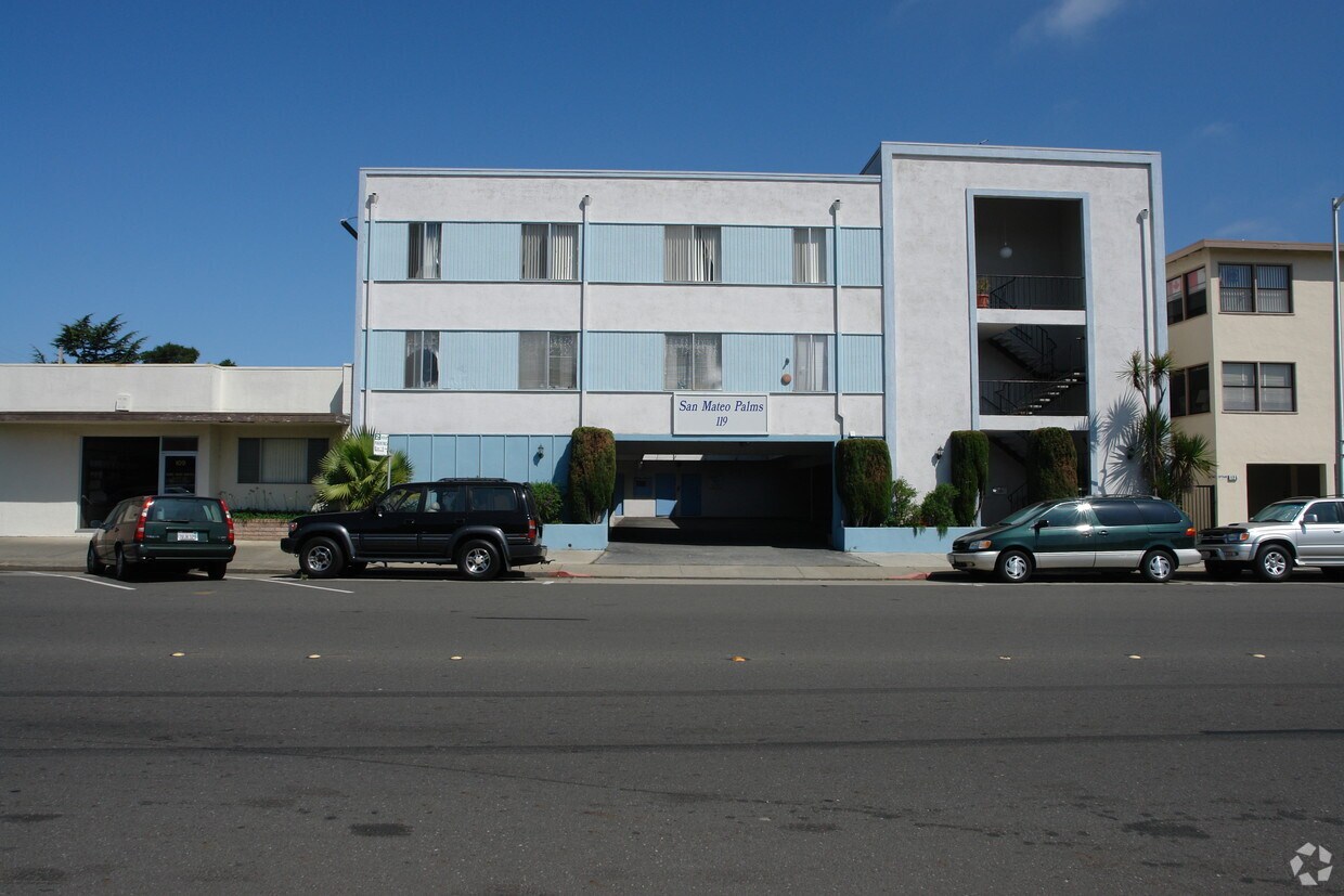
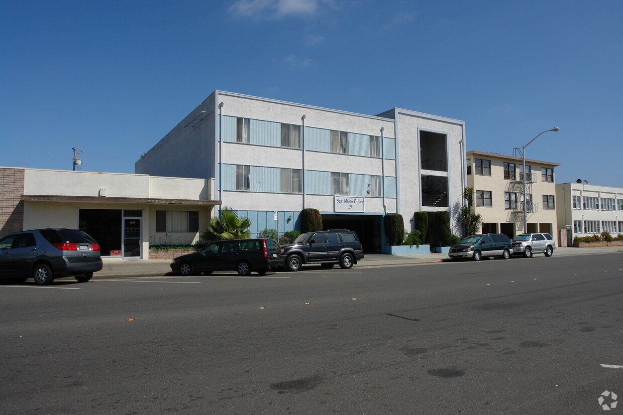

San Mateo Palms in San Mateo, CA is ready for you to move in. In a location on South Blvd in San Mateo's 94402 Zip code, renters can easily connect with a number of attractions nearby. Be sure to come for a visit to see the current floorplan options. From availability to location, the team of leasing professionals is ready to match you with your perfect home. Experience a new standard at San Mateo Palms.
San Mateo Palms is an apartment community located in San Mateo County and the 94402 ZIP Code. This area is served by the San Mateo-Foster City School District attendance zone.
Air Conditioning
Heating
Garden
Handrails
The quiet neighborhood of Hayward Park sits just south of Downtown San Mateo, with convenient access to Interstate 101, giving residents a 20-mile commute north to San Francisco or a 30-mile commute east to San Jose. Renters can choose between small Craftsman bungalows, Spanish revival single-family homes from the early 20th century, or more modern condos.
Head just to the edge of the neighborhood to relax in San Mateo's Central Park and enjoy the beauty of the well-tended Japanese garden. Residents enjoy the shopping at the Borel Square Shopping Center, and the restaurants scattered around the neighborhood as well.
Learn more about living in Hayward ParkCompare neighborhood and city base rent averages by bedroom.
| Hayward Park | San Mateo, CA | |
|---|---|---|
| Studio | $2,964 | $2,538 |
| 1 Bedroom | $3,575 | $3,097 |
| 2 Bedrooms | $4,758 | $4,025 |
| 3 Bedrooms | $5,167 | $5,514 |
| Colleges & Universities | Distance | ||
|---|---|---|---|
| Colleges & Universities | Distance | ||
| Drive: | 5 min | 2.9 mi | |
| Drive: | 17 min | 11.6 mi | |
| Drive: | 22 min | 11.8 mi | |
| Drive: | 19 min | 12.0 mi |


Transportation options available in San Mateo include Millbrae (Caltrain Transfer Platform), located 5.5 miles from San Mateo Palms. San Mateo Palms is near San Francisco International, located 8.2 miles or 14 minutes away, and Metro Oakland International, located 25.3 miles or 33 minutes away.
| Transit / Subway | Distance | ||
|---|---|---|---|
| Transit / Subway | Distance | ||
|
|
Drive: | 11 min | 5.5 mi |
| Drive: | 13 min | 7.8 mi | |
| Drive: | 13 min | 8.0 mi | |
|
|
Drive: | 13 min | 8.1 mi |
|
|
Drive: | 15 min | 8.2 mi |
| Commuter Rail | Distance | ||
|---|---|---|---|
| Commuter Rail | Distance | ||
| Walk: | 5 min | 0.3 mi | |
| Drive: | 3 min | 1.3 mi | |
| Drive: | 3 min | 1.4 mi | |
| Drive: | 4 min | 1.6 mi | |
| Drive: | 6 min | 2.9 mi |
| Airports | Distance | ||
|---|---|---|---|
| Airports | Distance | ||
|
San Francisco International
|
Drive: | 14 min | 8.2 mi |
|
Metro Oakland International
|
Drive: | 33 min | 25.3 mi |
Scores provided by
Traffic
-Airport
-Businesses
-Scores provided by
HowLoud What is a Sound Score Rating? A Sound Score Rating aggregates noise caused by vehicle traffic, airplane traffic and local sources. How It WorksTime and distance from San Mateo Palms.
| Shopping Centers | Distance | ||
|---|---|---|---|
| Shopping Centers | Distance | ||
| Walk: | 7 min | 0.4 mi | |
| Walk: | 9 min | 0.5 mi | |
| Walk: | 9 min | 0.5 mi |
| Parks and Recreation | Distance | ||
|---|---|---|---|
| Parks and Recreation | Distance | ||
|
San Mateo Arboretum
|
Walk: | 12 min | 0.6 mi |
|
Japanese Tea Garden (San Mateo)
|
Drive: | 3 min | 1.2 mi |
|
Shoreline Parks
|
Drive: | 5 min | 2.6 mi |
|
Coyote Point Recreational Area
|
Drive: | 9 min | 3.7 mi |
|
CuriOdyssey
|
Drive: | 9 min | 3.7 mi |
| Hospitals | Distance | ||
|---|---|---|---|
| Hospitals | Distance | ||
| Drive: | 6 min | 2.2 mi | |
| Drive: | 9 min | 5.0 mi | |
| Drive: | 14 min | 8.2 mi |
| Military Bases | Distance | ||
|---|---|---|---|
| Military Bases | Distance | ||
| Drive: | 27 min | 19.5 mi | |
| Drive: | 44 min | 32.7 mi | |
| Drive: | 45 min | 32.9 mi |
What Are Walk Score®, Transit Score®, and Bike Score® Ratings?
Walk Score® measures the walkability of any address. Transit Score® measures access to public transit. Bike Score® measures the bikeability of any address.
What is a Sound Score Rating?
A Sound Score Rating aggregates noise caused by vehicle traffic, airplane traffic and local sources.


