
Peninsula Pines Apartments
842-858 Antoinette Ln,
South San Francisco, CA 94080
$2,916 - $8,518
1-3 Beds

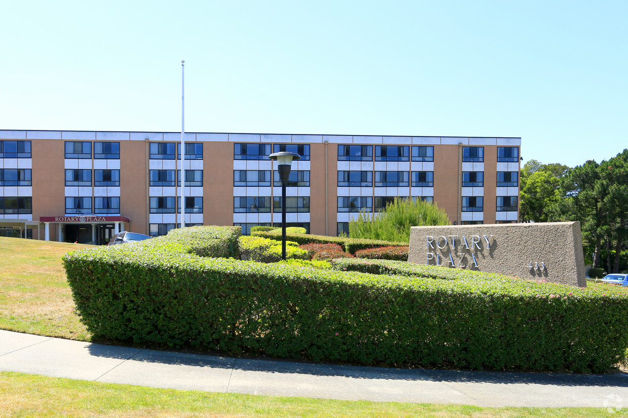
Find your new home at Rotary Plaza. Come by to check out the current floorplan options. The leasing team is ready to help you find your new home. At Rotary Plaza, you'll have access to top features and amenities. Some of these include: convenient on-site parking options, a game room, and balconies. Visit Rotary Plaza today.
Rotary Plaza is an apartment community located in San Mateo County and the 94080 ZIP Code. This area is served by the South San Francisco Unified attendance zone.
Laundry Facilities
Grill
Gameroom
Media Center/Movie Theatre
High Speed Internet Access
Microwave
Refrigerator
Disposal
Avalon is a cozy residential neighborhood along Interstate 280 in South San Francisco. The community is bordered to the north by California Golf Club of San Francisco and to the south by Golden Gate National Cemetery, giving the neighborhood a tranquil atmosphere. Ponderosa Elementary School and Baden High School are both located on the east side, with Los Cerritos Elementary and South San Francisco High School right across El Camino Real, making this a great location for those with school-age kids.
Residents enjoy close access to a handful of shopping centers, with the Shops at Tanforan mall offering up specialty shops, casual dining, and a multiplex movie theater. With the Interstate and San Francisco international Airport close at hand as well, it’s an ideal spot for commuters and frequent travelers.
Learn more about living in AvalonCompare neighborhood and city base rent averages by bedroom.
| Avalon | South San Francisco, CA | |
|---|---|---|
| Studio | - | $2,413 |
| 1 Bedroom | $2,494 | $2,936 |
| 2 Bedrooms | $3,232 | $3,443 |
| 3 Bedrooms | - | $4,074 |
| Colleges & Universities | Distance | ||
|---|---|---|---|
| Colleges & Universities | Distance | ||
| Drive: | 8 min | 4.0 mi | |
| Drive: | 14 min | 7.5 mi | |
| Drive: | 14 min | 7.9 mi | |
| Drive: | 20 min | 10.1 mi |


Transportation options available in South San Francisco include San Bruno Station, located 1.4 miles from Rotary Plaza. Rotary Plaza is near San Francisco International, located 4.4 miles or 10 minutes away, and Metro Oakland International, located 30.3 miles or 45 minutes away.
| Transit / Subway | Distance | ||
|---|---|---|---|
| Transit / Subway | Distance | ||
|
|
Drive: | 3 min | 1.4 mi |
|
|
Drive: | 4 min | 1.7 mi |
|
|
Drive: | 4 min | 1.7 mi |
| Drive: | 6 min | 2.9 mi | |
|
|
Drive: | 7 min | 3.1 mi |
| Commuter Rail | Distance | ||
|---|---|---|---|
| Commuter Rail | Distance | ||
| Drive: | 4 min | 1.9 mi | |
| Drive: | 6 min | 2.7 mi | |
| Drive: | 9 min | 4.7 mi | |
| Drive: | 11 min | 6.5 mi | |
| Drive: | 13 min | 7.1 mi |
| Airports | Distance | ||
|---|---|---|---|
| Airports | Distance | ||
|
San Francisco International
|
Drive: | 10 min | 4.4 mi |
|
Metro Oakland International
|
Drive: | 45 min | 30.3 mi |
Time and distance from Rotary Plaza.
| Shopping Centers | Distance | ||
|---|---|---|---|
| Shopping Centers | Distance | ||
| Walk: | 5 min | 0.3 mi | |
| Walk: | 8 min | 0.4 mi | |
| Walk: | 12 min | 0.7 mi |
| Parks and Recreation | Distance | ||
|---|---|---|---|
| Parks and Recreation | Distance | ||
|
Bayside Park
|
Drive: | 11 min | 6.8 mi |
|
Pacifica State Beach
|
Drive: | 14 min | 7.1 mi |
|
San Bruno Mountain State Park
|
Drive: | 18 min | 7.9 mi |
|
Candlestick Point State Recreation Area
|
Drive: | 16 min | 8.0 mi |
|
San Pedro Valley Park
|
Drive: | 21 min | 9.4 mi |
| Hospitals | Distance | ||
|---|---|---|---|
| Hospitals | Distance | ||
| Drive: | 3 min | 1.2 mi | |
| Drive: | 8 min | 4.0 mi | |
| Drive: | 8 min | 4.6 mi |
| Military Bases | Distance | ||
|---|---|---|---|
| Military Bases | Distance | ||
| Drive: | 27 min | 12.1 mi | |
| Drive: | 27 min | 12.7 mi |
What Are Walk Score®, Transit Score®, and Bike Score® Ratings?
Walk Score® measures the walkability of any address. Transit Score® measures access to public transit. Bike Score® measures the bikeability of any address.
What is a Sound Score Rating?
A Sound Score Rating aggregates noise caused by vehicle traffic, airplane traffic and local sources
433 Alida Way
South San Francisco, CA 94080


