
Williamsburg
200 W Galbraith Rd,
Cincinnati, OH 45215
$857 - $3,564
Studio - 3 Beds
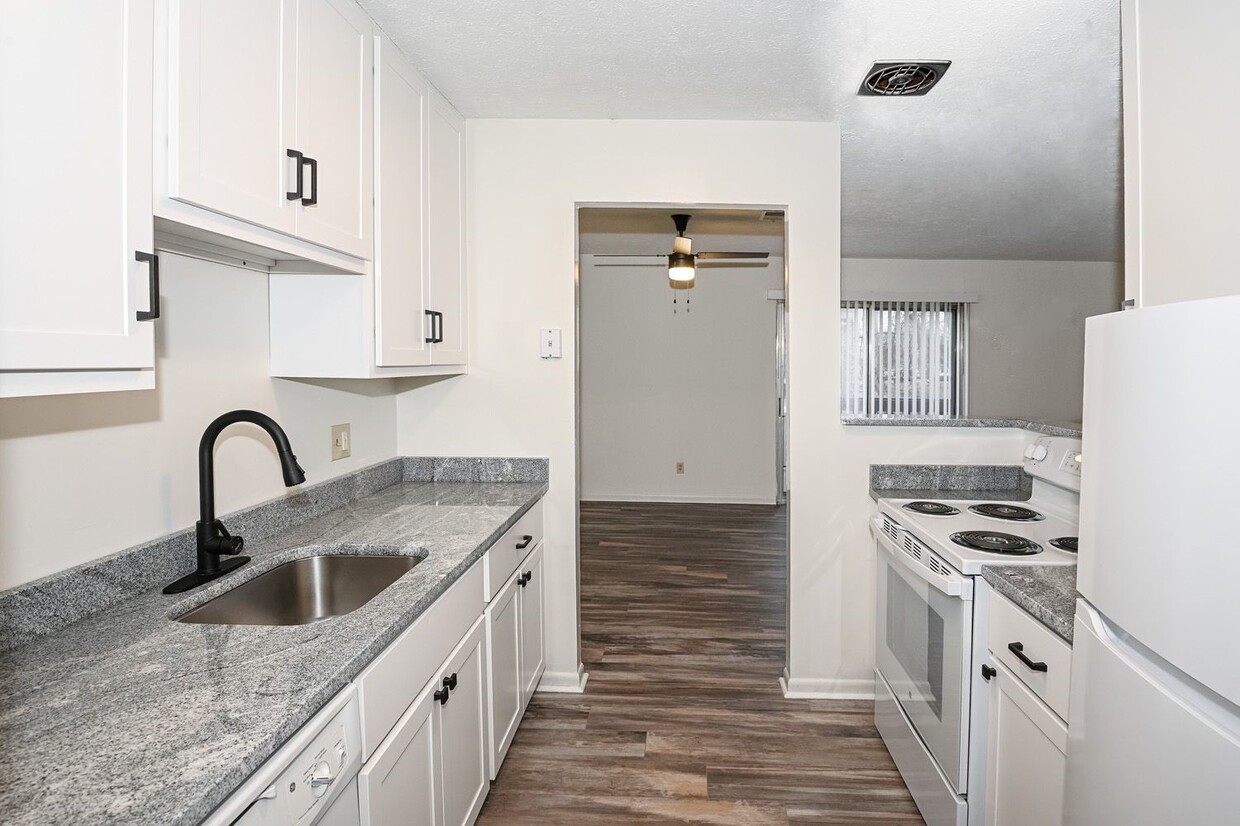

El complejo Ridgeview Apartment está en el lugar perfecto. Estas unidades se encuentran a 15 minutos en automóvil del centro de Cincinnati y a minutos del “The Mount Washington Water Tower District”. En The Water Tower District puedes encontrar varias tiendas y restaurantes, tanto locales como de cadenas. Mt. Washington es un vecindario familiar que se encuentra justo al límite de la ciudad. En menos de 5 minutos, puede llegar a las instalaciones recreativas del Monte Washington, así como al parque Stanbery, que ofrece uno de los senderos para caminatas más extensos de la ciudad, patios de juegos, refugios para picnics y colinas para trineos de primer nivel. Desde la cocina y el baño recientemente renovados hasta el amplio dormitorio y los servicios modernos adicionales, este es el apartamento perfecto para usted. Los pisos de alfombras y baldosas ofrecen un aspecto fresco y limpio. El inquilino paga una tarifa de 39 USD por servicios públicos de agua, alcantarillado y basura. La electricidad se factura por separado.
Ridgeview Apartments is an apartment community located in Hamilton County and the 45230 ZIP Code. This area is served by the Cincinnati Public Schools attendance zone.
Instalaciones de lavandería
Parque infantil
Senderos para caminar/montar en bicicleta
Almacén/trastero
Aire acondicionado
Lavavajillas
Acceso a Internet de alta velocidad
Suelos de madera maciza
Located about 14 miles east of Downtown Cincinnati, Turpin Hills affords its residents with the best of city living and suburban life. Nestled among tree-lined streets and rolling hillsides, Turpin Hills feels like you've stepped out of the city into a quiet suburb. The area is family-friendly with great schools and several parks and shopping plazas nearby like Anderson Towne Center, a popular commercial hub. This predominantly residential area has rental options for every budget and style including houses, apartments, and townhomes. With a thriving community council that publishes a neighborhood newsletter and hosts annual events, newcomers and long-time residents alike feel welcome in Turpin Hills.
Learn more about living in Turpin HillsCompare neighborhood and city base rent averages by bedroom.
| Turpin Hills | Cincinnati, OH | |
|---|---|---|
| Studio | $1,280 | $1,063 |
| 1 Bedroom | $1,380 | $1,130 |
| 2 Bedrooms | $1,598 | $1,409 |
| 3 Bedrooms | $2,582 | $1,701 |
| Colleges & Universities | Distance | ||
|---|---|---|---|
| Colleges & Universities | Distance | ||
| Drive: | 15 min | 6.4 mi | |
| Drive: | 17 min | 8.4 mi | |
| Drive: | 18 min | 8.5 mi | |
| Drive: | 18 min | 8.8 mi |


Transportation options available in Cincinnati include Richter & Phillips Station - 6Th & Main, located 8.8 miles from Ridgeview Apartments. Ridgeview Apartments is near Cincinnati/Northern Kentucky International, located 21.2 miles or 39 minutes away.
| Transit / Subway | Distance | ||
|---|---|---|---|
| Transit / Subway | Distance | ||
| Drive: | 16 min | 8.8 mi | |
| Drive: | 16 min | 8.9 mi | |
| Drive: | 16 min | 8.9 mi | |
| Drive: | 16 min | 8.9 mi | |
| Drive: | 17 min | 8.9 mi |
| Commuter Rail | Distance | ||
|---|---|---|---|
| Commuter Rail | Distance | ||
|
|
Drive: | 20 min | 10.8 mi |
| Airports | Distance | ||
|---|---|---|---|
| Airports | Distance | ||
|
Cincinnati/Northern Kentucky International
|
Drive: | 39 min | 21.2 mi |
Time and distance from Ridgeview Apartments.
| Shopping Centers | Distance | ||
|---|---|---|---|
| Shopping Centers | Distance | ||
| Drive: | 4 min | 1.2 mi | |
| Drive: | 4 min | 1.2 mi | |
| Drive: | 8 min | 3.8 mi |
| Parks and Recreation | Distance | ||
|---|---|---|---|
| Parks and Recreation | Distance | ||
|
Stanbery Park
|
Walk: | 17 min | 0.9 mi |
|
Otto Armleder Park
|
Drive: | 6 min | 2.5 mi |
|
Ault Park
|
Drive: | 8 min | 3.7 mi |
|
Cincinnati Observatory
|
Drive: | 8 min | 3.9 mi |
|
California Woods Nature Preserve
|
Drive: | 12 min | 5.8 mi |
| Hospitals | Distance | ||
|---|---|---|---|
| Hospitals | Distance | ||
| Drive: | 8 min | 3.6 mi | |
| Drive: | 16 min | 8.1 mi | |
| Drive: | 17 min | 8.3 mi |
| Military Bases | Distance | ||
|---|---|---|---|
| Military Bases | Distance | ||
| Drive: | 78 min | 58.2 mi | |
| Drive: | 84 min | 63.2 mi | |
| Drive: | 86 min | 66.5 mi |
What Are Walk Score®, Transit Score®, and Bike Score® Ratings?
Walk Score® measures the walkability of any address. Transit Score® measures access to public transit. Bike Score® measures the bikeability of any address.
What is a Sound Score Rating?
A Sound Score Rating aggregates noise caused by vehicle traffic, airplane traffic and local sources

5462-5470 Beechmont Ave
Cincinnati, OH 45230


