
Central Parker Crossing
1 Center St,
Clifton, NJ 07011
$3,000 - $3,500
2 Beds
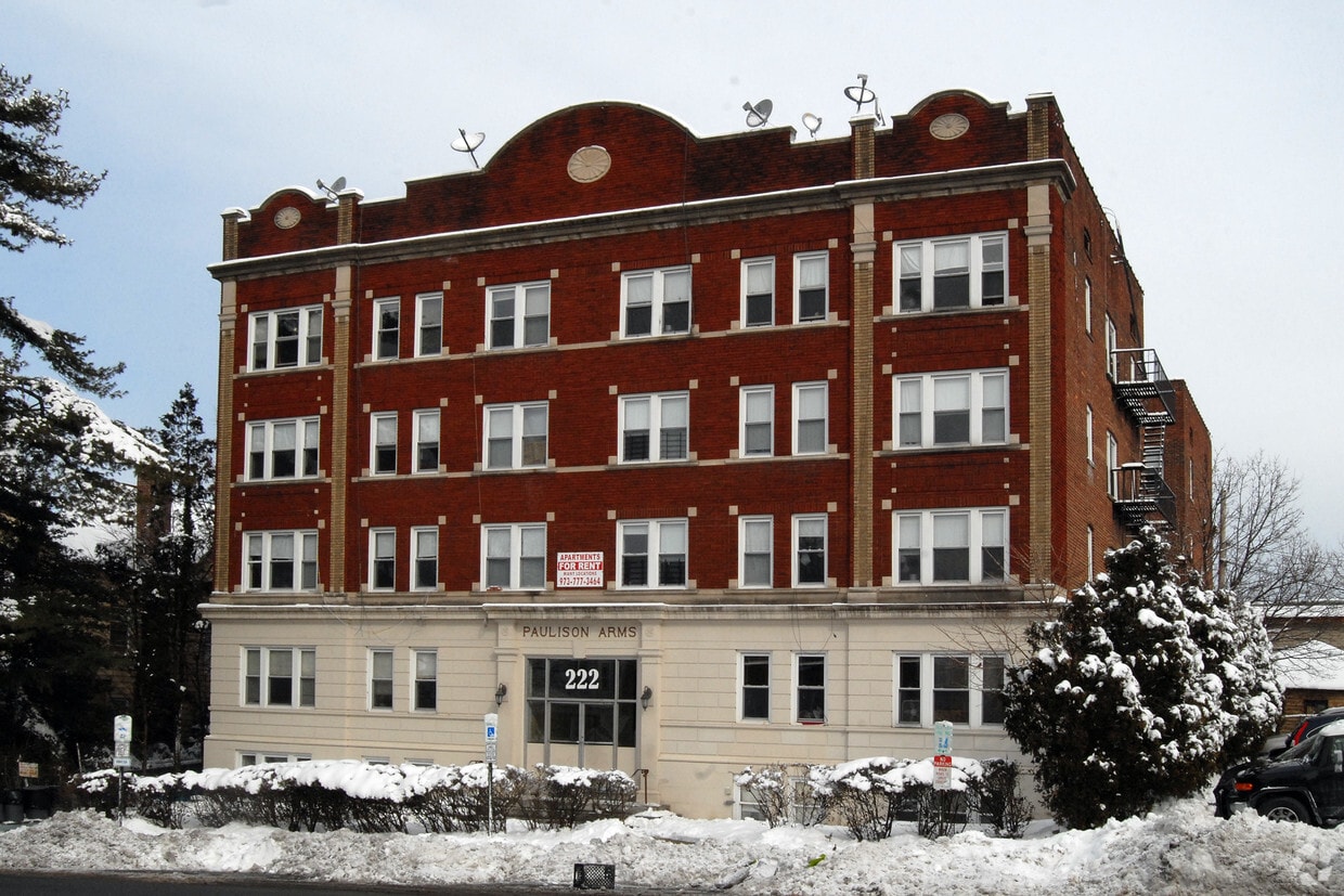

At Paulison Arms in Passaic, experience great living. In a location on Paulison Ave in Passaic's 07055 Zip code, you can easily connect with a number of entertainment options found in the surrounding area. Be sure to see the available floorplan options. From amenities to location, the leasing team is ready to help match you with the perfect apartment. Life is great at Paulison Arms. Contact or drop by to schedule your tour.
Paulison Arms is an apartment community located in Passaic County and the 07055 ZIP Code. This area is served by the Passaic City Public attendance zone.
Heating
Oven
Range
Kitchen
Located about ten miles north of Newark, Passaic is a densely populated city strewn alongside the banks of the Passaic River. Passaic offers residents the best of urban and suburban living, from the bustle of Main Avenue to the natural beauty of the city’s many tranquil parks.
Main Avenue lies at the heart of Passaic, boasting an array of diverse restaurants, shops, and businesses in a vibrant, walkable locale. Passaic residents flock to the local Mayor Johnson Park, Third Ward Park, and Pulaski Park for outdoor recreation and to get in touch with nature close to home.
Residents have their choice of rentals in Passaic, which provides a broad range of apartments, condos, and townhomes available for rent. The city is often a popular choice for commuters, offering quick access to Route 21, Route 3, U.S. 46, and the Garden State Parkway as well as NJ Transit’s Port Jervis and Main/Bergen County lines.
Learn more about living in Passaic| Colleges & Universities | Distance | ||
|---|---|---|---|
| Colleges & Universities | Distance | ||
| Walk: | 11 min | 0.6 mi | |
| Drive: | 8 min | 2.8 mi | |
| Drive: | 6 min | 2.8 mi | |
| Drive: | 9 min | 5.2 mi |


Transportation options available in Passaic include Grove Street, located 7.7 miles from Paulison Arms. Paulison Arms is near Newark Liberty International, located 15.4 miles or 19 minutes away, and LaGuardia, located 23.9 miles or 37 minutes away.
| Transit / Subway | Distance | ||
|---|---|---|---|
| Transit / Subway | Distance | ||
|
|
Drive: | 14 min | 7.7 mi |
|
|
Drive: | 12 min | 8.1 mi |
|
|
Drive: | 13 min | 8.5 mi |
|
|
Drive: | 13 min | 8.5 mi |
|
|
Drive: | 11 min | 9.1 mi |
| Commuter Rail | Distance | ||
|---|---|---|---|
| Commuter Rail | Distance | ||
|
|
Walk: | 12 min | 0.6 mi |
|
|
Drive: | 4 min | 1.6 mi |
|
|
Drive: | 3 min | 2.0 mi |
|
|
Drive: | 4 min | 2.5 mi |
| Drive: | 8 min | 3.2 mi |
| Airports | Distance | ||
|---|---|---|---|
| Airports | Distance | ||
|
Newark Liberty International
|
Drive: | 19 min | 15.4 mi |
|
LaGuardia
|
Drive: | 37 min | 23.9 mi |
Time and distance from Paulison Arms.
| Shopping Centers | Distance | ||
|---|---|---|---|
| Shopping Centers | Distance | ||
| Drive: | 2 min | 1.2 mi | |
| Drive: | 3 min | 1.6 mi | |
| Drive: | 4 min | 1.8 mi |
| Parks and Recreation | Distance | ||
|---|---|---|---|
| Parks and Recreation | Distance | ||
|
Presby Memorial Iris Gardens
|
Drive: | 10 min | 6.2 mi |
|
Van Vleck House & Gardens
|
Drive: | 12 min | 6.3 mi |
|
Meadowlands Environment Center
|
Drive: | 16 min | 6.7 mi |
|
McDowell Observatory
|
Drive: | 16 min | 6.7 mi |
|
Richard W. DeKorte Park
|
Drive: | 15 min | 8.3 mi |
| Hospitals | Distance | ||
|---|---|---|---|
| Hospitals | Distance | ||
| Walk: | 11 min | 0.6 mi | |
| Drive: | 6 min | 3.9 mi | |
| Drive: | 11 min | 7.3 mi |
| Military Bases | Distance | ||
|---|---|---|---|
| Military Bases | Distance | ||
| Drive: | 28 min | 17.7 mi | |
| Drive: | 25 min | 18.7 mi |
What Are Walk Score®, Transit Score®, and Bike Score® Ratings?
Walk Score® measures the walkability of any address. Transit Score® measures access to public transit. Bike Score® measures the bikeability of any address.
What is a Sound Score Rating?
A Sound Score Rating aggregates noise caused by vehicle traffic, airplane traffic and local sources


