
19 East
19 E 19th St,
Bayonne, NJ 07002
$2,200 - $3,150 Total Monthly Price
Studio - 2 Beds

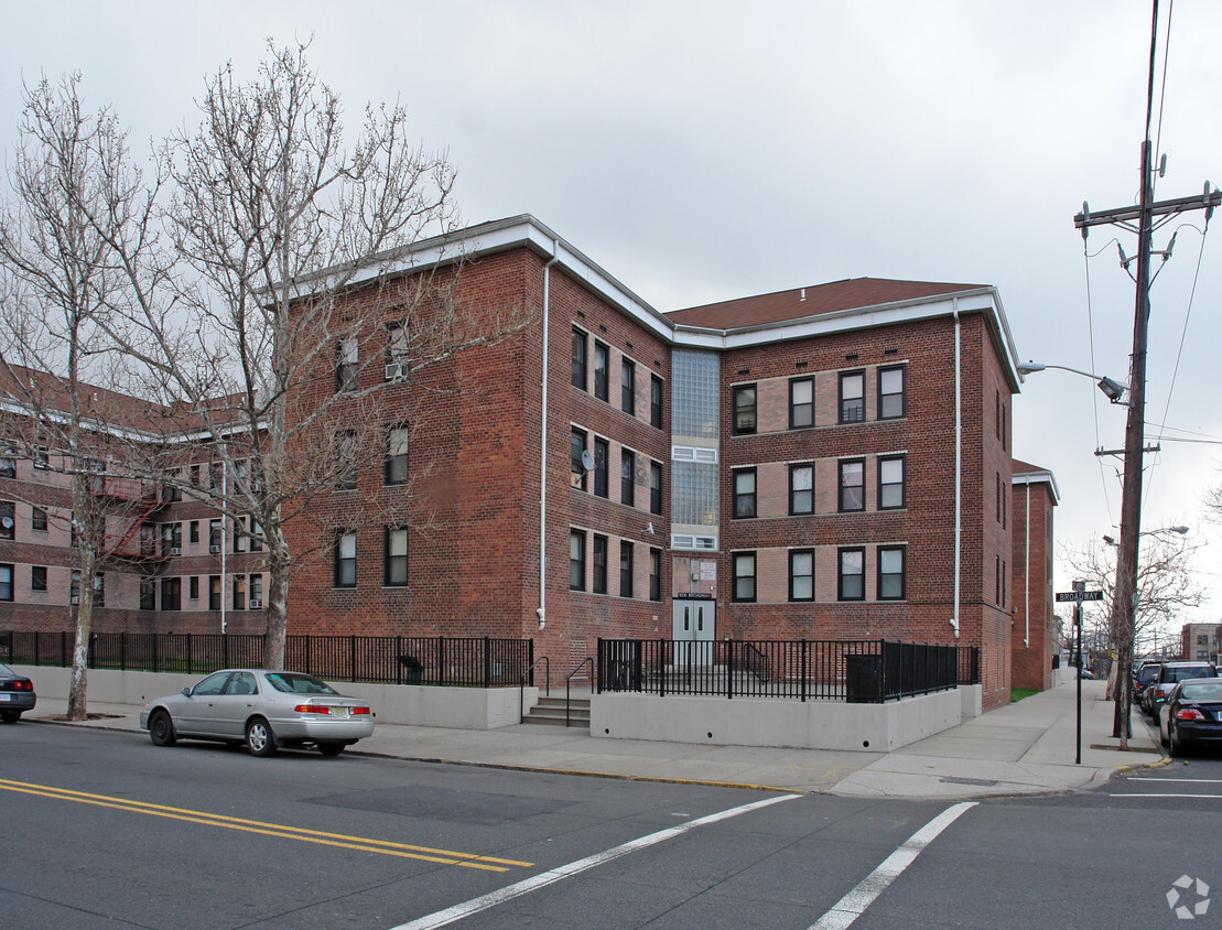

Find a new place to live at Pamrapo Gardens in Bayonne. The location in Bayonne's 07002 area has much to offer its residents. The community staff is excited to help you find your perfect apartment. Make sure you to view the available floorplans. Get moving on finding your next place. Contact or stop by the Pamrapo Gardens leasing office to check the current floorplan availability.
Pamrapo Gardens is an apartment community located in Hudson County and the 07002 ZIP Code. This area is served by the Bayonne School District attendance zone.
Bayonne sits on a narrow peninsula between Newark Bay and New York Harbor, giving it a geography that shapes nearly everything about daily life here. The city occupies just 12 square miles, yet it carries a distinct identity rooted in maritime history, close-knit blocks, and an increasingly sought-after position within the broader New York metro. A well-connected Hudson-Bergen Light Rail system with stops at 8th, 22nd, 34th, and 45th Streets makes Jersey City and Hoboken straightforward commutes, while the Bayonne Bridge links the city to Staten Island.
Neighborhoods range from the historic streets of Bergen Point near the southern tip to the waterfront development at Peninsula at Bayonne Harbor, where the former Military Ocean Terminal has been reimagined as a residential and recreational destination. The Uptown area around 34th Street anchors everyday commerce, while Broadway serves as the city's main corridor throughout.
Learn more about living in Bayonne| Colleges & Universities | Distance | ||
|---|---|---|---|
| Colleges & Universities | Distance | ||
| Drive: | 7 min | 2.7 mi | |
| Drive: | 9 min | 5.4 mi | |
| Drive: | 10 min | 5.6 mi | |
| Drive: | 21 min | 9.2 mi |


Transportation options available in Bayonne include 34Th Street, located 0.9 mile from Pamrapo Gardens. Pamrapo Gardens is near Newark Liberty International, located 5.3 miles or 8 minutes away, and LaGuardia, located 17.7 miles or 34 minutes away.
| Transit / Subway | Distance | ||
|---|---|---|---|
| Transit / Subway | Distance | ||
|
|
Walk: | 17 min | 0.9 mi |
|
|
Drive: | 4 min | 1.4 mi |
|
|
Drive: | 4 min | 1.5 mi |
|
|
Drive: | 5 min | 2.1 mi |
|
|
Drive: | 5 min | 2.3 mi |
| Commuter Rail | Distance | ||
|---|---|---|---|
| Commuter Rail | Distance | ||
|
|
Drive: | 7 min | 4.9 mi |
|
|
Drive: | 10 min | 5.6 mi |
|
|
Drive: | 22 min | 9.8 mi |
|
|
Drive: | 22 min | 10.1 mi |
|
|
Drive: | 22 min | 10.4 mi |
| Airports | Distance | ||
|---|---|---|---|
| Airports | Distance | ||
|
Newark Liberty International
|
Drive: | 8 min | 5.3 mi |
|
LaGuardia
|
Drive: | 34 min | 17.7 mi |
Scores provided by
Traffic
-Airport
-Businesses
-Scores provided by
HowLoud What is a Sound Score Rating? A Sound Score Rating aggregates noise caused by vehicle traffic, airplane traffic and local sources. How It WorksTime and distance from Pamrapo Gardens.
| Shopping Centers | Distance | ||
|---|---|---|---|
| Shopping Centers | Distance | ||
| Walk: | 7 min | 0.4 mi | |
| Walk: | 15 min | 0.8 mi | |
| Drive: | 4 min | 1.5 mi |
| Parks and Recreation | Distance | ||
|---|---|---|---|
| Parks and Recreation | Distance | ||
|
Stephen Gregg Park
|
Drive: | 4 min | 1.1 mi |
|
G. Thomas DiDomenico Park
|
Drive: | 7 min | 2.6 mi |
|
Snug Harbor Cultural Center & Botanical Garden
|
Drive: | 17 min | 8.2 mi |
|
Staten Island Children's Museum
|
Drive: | 17 min | 8.2 mi |
|
Mahoney Playground
|
Drive: | 18 min | 9.1 mi |
| Hospitals | Distance | ||
|---|---|---|---|
| Hospitals | Distance | ||
| Drive: | 4 min | 1.3 mi | |
| Drive: | 8 min | 4.2 mi | |
| Drive: | 8 min | 6.0 mi |
| Military Bases | Distance | ||
|---|---|---|---|
| Military Bases | Distance | ||
| Drive: | 5 min | 1.9 mi | |
| Drive: | 18 min | 9.9 mi | |
| Drive: | 24 min | 10.0 mi |
What Are Walk Score®, Transit Score®, and Bike Score® Ratings?
Walk Score® measures the walkability of any address. Transit Score® measures access to public transit. Bike Score® measures the bikeability of any address.
What is a Sound Score Rating?
A Sound Score Rating aggregates noise caused by vehicle traffic, airplane traffic and local sources.

1006-1016 Broadway
Bayonne, NJ 07002


