
Fayette Arms Apartments
2680 Fayette Dr,
Mountain View, CA 94040
$3,200 - $3,438
1-2 Beds
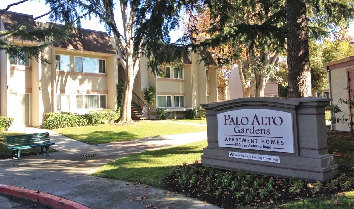
Explore Palo Alto Gardens in Palo Alto. The address for this community is in Palo Alto on San Antonio Rd. in the 94306 area. Experience a great selection of amenities and features like smoke free options, a clubhouse, and convenient on-site parking options. The professional leasing staff is waiting to show you all that this community has in store. Get a head start on your move right now. Contact or stop by the Palo Alto Gardens leasing office to talk about leasing your next apartment.
Palo Alto Gardens is an apartment community located in Santa Clara County and the 94306 ZIP Code. This area is served by the Mountain View Whisman School District attendance zone.
Laundry Facilities
Playground
Clubhouse
Grill
Air Conditioning
High Speed Internet Access
Refrigerator
Tub/Shower
Living in Palo Alto places you in Silicon Valley, where historic neighborhoods complement the city's technological presence. Tree-lined streets wind through the community, which is anchored by Stanford University. University Avenue features local boutiques and restaurants housed in preserved historic buildings, while the Stanford Shopping Center offers high-end retail destinations. The city maintains 36 parks and preserves, including the Baylands Nature Preserve and Foothills Park, where residents enjoy hiking trails and outdoor activities. Palo Alto's infrastructure supports alternative transportation, with dedicated bike lanes throughout the city.
The rental market in Palo Alto reflects the area's popularity, with current average rents ranging from $2,634 for studios to $6,139 for four-bedroom homes. Recent trends show steady growth, with rent increases varying from 1.8% to 17% across different unit sizes over the past year.
Learn more about living in Palo AltoCompare neighborhood and city base rent averages by bedroom.
| Monta Loma | Palo Alto, CA | |
|---|---|---|
| Studio | $2,177 | $2,980 |
| 1 Bedroom | $2,488 | $3,081 |
| 2 Bedrooms | $2,649 | $3,905 |
| 3 Bedrooms | - | $4,987 |
| Colleges & Universities | Distance | ||
|---|---|---|---|
| Colleges & Universities | Distance | ||
| Walk: | 17 min | 0.9 mi | |
| Drive: | 12 min | 5.0 mi | |
| Drive: | 14 min | 5.0 mi | |
| Drive: | 17 min | 9.6 mi |


Transportation options available in Palo Alto include Mountain View Station, located 2.8 miles from Palo Alto Gardens. Palo Alto Gardens is near Norman Y Mineta San Jose International, located 11.0 miles or 17 minutes away, and San Francisco International, located 23.3 miles or 31 minutes away.
| Transit / Subway | Distance | ||
|---|---|---|---|
| Transit / Subway | Distance | ||
| Drive: | 6 min | 2.8 mi | |
| Drive: | 7 min | 3.5 mi | |
|
|
Drive: | 8 min | 4.1 mi |
|
|
Drive: | 8 min | 4.1 mi |
| Drive: | 8 min | 4.4 mi |
| Commuter Rail | Distance | ||
|---|---|---|---|
| Commuter Rail | Distance | ||
| Drive: | 4 min | 1.4 mi | |
| Drive: | 8 min | 3.2 mi | |
| Drive: | 9 min | 3.7 mi | |
| Drive: | 12 min | 4.9 mi | |
| Drive: | 12 min | 6.3 mi |
| Airports | Distance | ||
|---|---|---|---|
| Airports | Distance | ||
|
Norman Y Mineta San Jose International
|
Drive: | 17 min | 11.0 mi |
|
San Francisco International
|
Drive: | 31 min | 23.3 mi |
Scores provided by
Traffic
ActiveAirport
CalmBusinesses
ActiveScores provided by
HowLoud What is a Sound Score Rating? A Sound Score Rating aggregates noise caused by vehicle traffic, airplane traffic and local sources. How It WorksTime and distance from Palo Alto Gardens.
| Shopping Centers | Distance | ||
|---|---|---|---|
| Shopping Centers | Distance | ||
| Walk: | 11 min | 0.6 mi | |
| Walk: | 11 min | 0.6 mi | |
| Walk: | 16 min | 0.9 mi |
| Parks and Recreation | Distance | ||
|---|---|---|---|
| Parks and Recreation | Distance | ||
|
J. Pearce Mitchell Park
|
Drive: | 5 min | 1.4 mi |
|
Terman Park
|
Drive: | 8 min | 2.6 mi |
|
Stevens Creek Shoreline Nature Study Area
|
Drive: | 9 min | 2.9 mi |
|
Bol Park
|
Drive: | 10 min | 3.4 mi |
|
Esther Clark Nature Preserve
|
Drive: | 10 min | 3.7 mi |
| Hospitals | Distance | ||
|---|---|---|---|
| Hospitals | Distance | ||
| Drive: | 9 min | 5.0 mi | |
| Drive: | 14 min | 5.6 mi | |
| Drive: | 16 min | 6.1 mi |
| Military Bases | Distance | ||
|---|---|---|---|
| Military Bases | Distance | ||
| Drive: | 10 min | 3.9 mi | |
| Drive: | 56 min | 39.5 mi | |
| Drive: | 56 min | 39.7 mi |
Fitness Center Pool In Unit Washer & Dryer High-Speed Internet Stainless Steel Appliances Package Service
What Are Walk Score®, Transit Score®, and Bike Score® Ratings?
Walk Score® measures the walkability of any address. Transit Score® measures access to public transit. Bike Score® measures the bikeability of any address.
What is a Sound Score Rating?
A Sound Score Rating aggregates noise caused by vehicle traffic, airplane traffic and local sources.

630-650 San Antonio Rd
Palo Alto, CA 94306


