
-
Monthly Rent
$1,845
-
Bedrooms
1 bd
-
Bathrooms
1 ba
-
Square Feet
700 sq ft
Pricing & Floor Plans
Check Back Soon for Upcoming Availability
| Beds | Baths | Average SF | Availability |
|---|---|---|---|
| 1 Bedroom 1 Bedroom 1 Br | 1 Bath 1 Bath 1 Ba | 700 SF | Call for Availability |
-
Unit C8price $1,845square feet 700availibility Call for Availability
Fees and Policies
The fees listed below are community-provided and may exclude utilities or add-ons. All payments are made directly to the property and are non-refundable unless otherwise specified.
-
Surface Lot
Property Fee Disclaimer: Based on community-supplied data and independent market research. Subject to change without notice. May exclude fees for mandatory or optional services and usage-based utilities.
Details
Utilities Included
-
Heat
Lease Options
-
12 mo
Property Information
-
Built in 1930
-
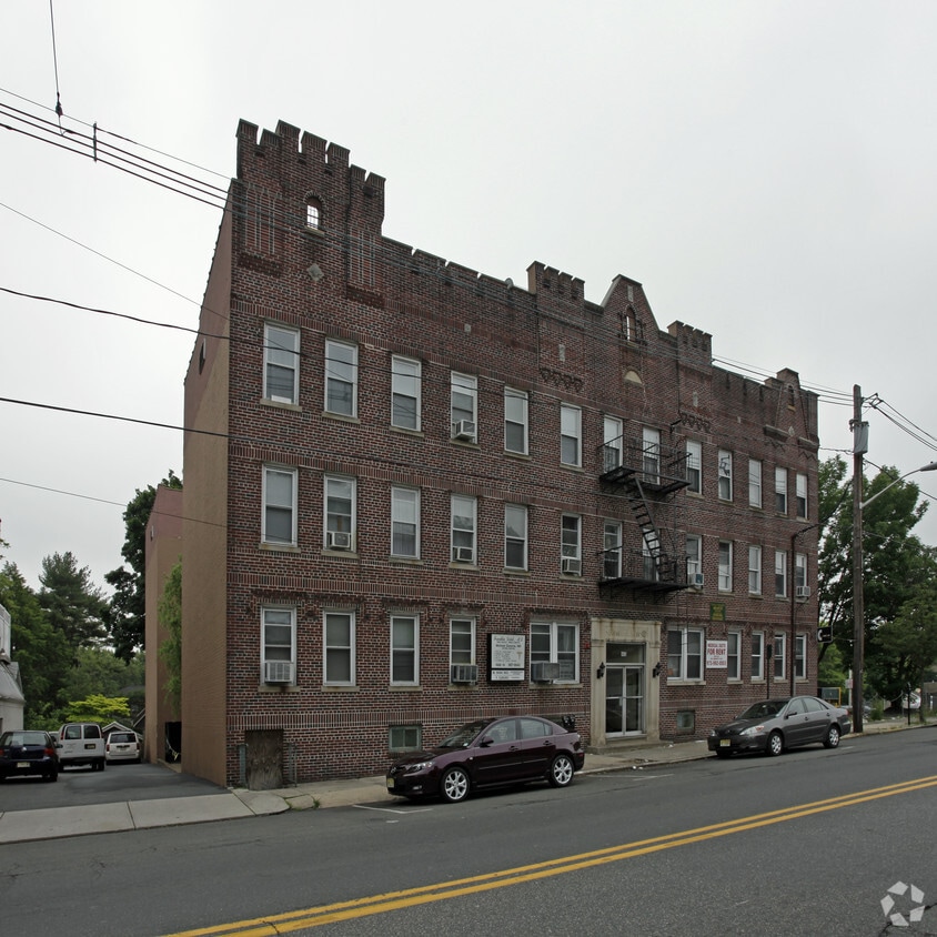
22 units/3 stories
About Nutley Arms
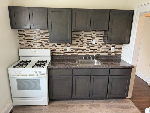
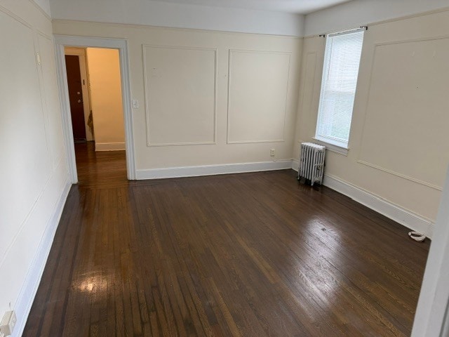
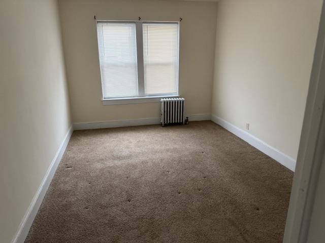
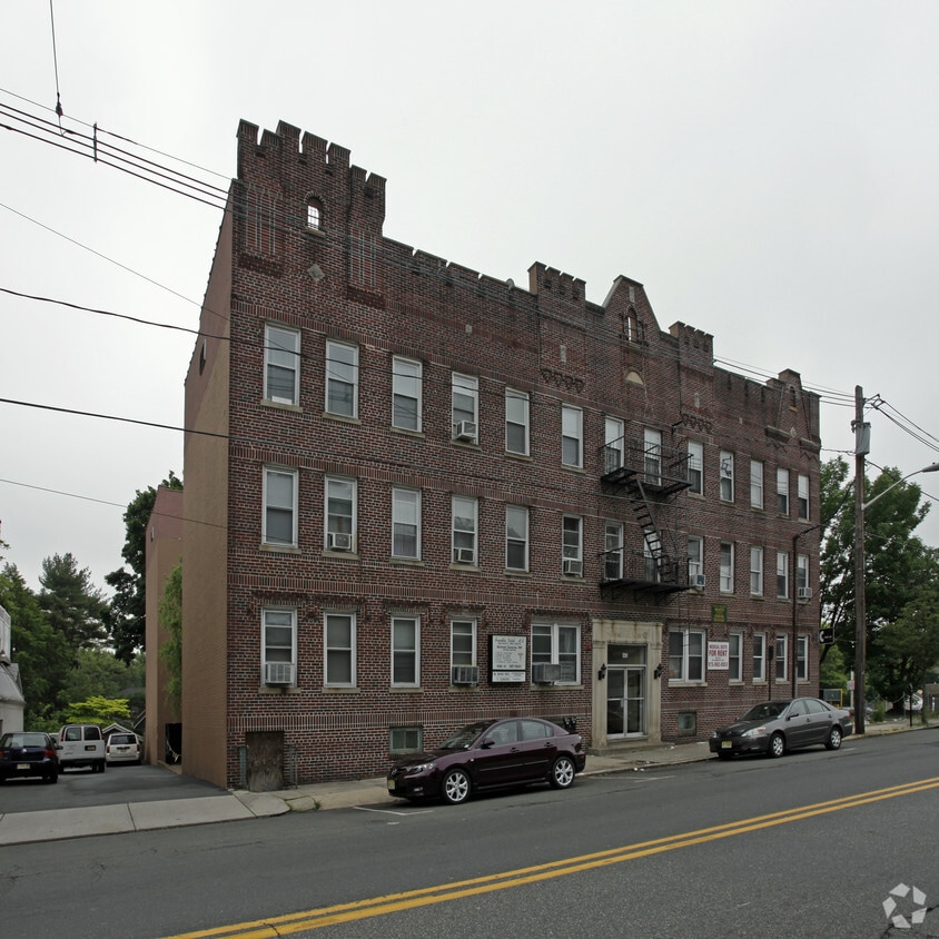
Large renovated 3rd floor one bedroom apartment with eat-in kitchen conveniently located on Franklin Avenue, across from Shop-Rite supermarket, just steps away from NYC transportation. Stainless steel appliances & hardwood floors. Resident superintendent and laundry room onsite. Heat & hot/cold water included in rent. Parking spot available for $50 a month. Cat friendly, no dogs. Pictures are of actual apartment in the same building. NO REALTOR FEE
Nutley Arms is an apartment community located in Essex County and the 07110 ZIP Code. This area is served by the Nutley Public School District attendance zone.
Contact
Community Amenities
- Laundry Facilities
Apartment Features
Hardwood Floors
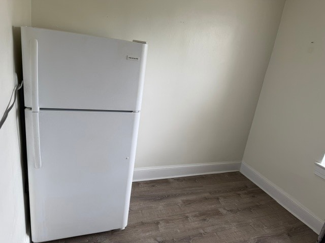
Refrigerator
Stainless Steel Appliances
Oven
- Stainless Steel Appliances
- Eat-in Kitchen
- Kitchen
- Oven
- Range
- Refrigerator
- Hardwood Floors
Nutley, NJ sits just 15 miles from Midtown Manhattan, giving it that rare quality of feeling genuinely removed from city life while staying closely connected to one of the world's busiest economic centers. Tucked into Essex County along the Passaic River, this compact township covers only four square miles yet holds a population of nearly 30,000 residents, making it one of the more densely settled communities in the Garden State.
The township carries a strong sense of place rooted in its early-20th-century roots. Originally incorporated as Franklin Township in 1874, Nutley grew into a close-knit community with tree-lined streets and well-kept residential blocks that still define its character today. The Downtown district along Franklin Avenue anchors the social and commercial life of the area, while surrounding neighborhoods offer a quieter, more settled pace.
Learn more about living in Nutley- Laundry Facilities
- Stainless Steel Appliances
- Eat-in Kitchen
- Kitchen
- Oven
- Range
- Refrigerator
- Hardwood Floors
| Monday | 9am - 5pm |
|---|---|
| Tuesday | 9am - 5pm |
| Wednesday | 9am - 5pm |
| Thursday | 9am - 5pm |
| Friday | 9am - 5pm |
| Saturday | Closed |
| Sunday | Closed |
| Colleges & Universities | Distance | ||
|---|---|---|---|
| Colleges & Universities | Distance | ||
| Drive: | 6 min | 3.1 mi | |
| Drive: | 7 min | 3.8 mi | |
| Drive: | 9 min | 3.9 mi | |
| Drive: | 7 min | 4.2 mi |


 The GreatSchools Rating helps parents compare schools within a state based on a variety of school quality indicators and provides a helpful picture of how effectively each school serves all of its students. Ratings are on a scale of 1 (below average) to 10 (above average) and can include test scores, college readiness, academic progress, advanced courses, equity, discipline and attendance data. We also advise parents to visit schools, consider other information on school performance and programs, and consider family needs as part of the school selection process.
View GreatSchools Rating Methodology
Data provided by GreatSchools.org © 2026. All rights reserved.
Transportation options available in Nutley include Branch Brook Park, located 3.3 miles from Nutley Arms. Nutley Arms is near Newark Liberty International, located 14.7 miles or 18 minutes away, and LaGuardia, located 21.2 miles or 38 minutes away.
| Transit / Subway | Distance | ||
|---|---|---|---|
| Transit / Subway | Distance | ||
|
|
Drive: | 6 min | 3.3 mi |
|
|
Drive: | 7 min | 3.7 mi |
|
|
Drive: | 7 min | 3.8 mi |
|
|
Drive: | 8 min | 4.3 mi |
|
|
Drive: | 9 min | 4.4 mi |
| Commuter Rail | Distance | ||
|---|---|---|---|
| Commuter Rail | Distance | ||
| Drive: | 4 min | 2.0 mi | |
| Drive: | 6 min | 2.8 mi | |
| Drive: | 5 min | 2.9 mi | |
| Drive: | 6 min | 3.4 mi | |
| Drive: | 7 min | 4.1 mi |
| Airports | Distance | ||
|---|---|---|---|
| Airports | Distance | ||
|
Newark Liberty International
|
Drive: | 18 min | 14.7 mi |
|
LaGuardia
|
Drive: | 38 min | 21.2 mi |
Scores provided by
 What do Walkability, Transit, Drivability, and Bikeability mean?
Walkability measures the walking distance to day-to-day needs.
Transit measures access to public transportation.
Drivability measures congestion, parking availability, and access to major roads.
Bikeability measures the suitability for cycling.
How It Works
What do Walkability, Transit, Drivability, and Bikeability mean?
Walkability measures the walking distance to day-to-day needs.
Transit measures access to public transportation.
Drivability measures congestion, parking availability, and access to major roads.
Bikeability measures the suitability for cycling.
How It Works
Traffic
BusyAirport
CalmBusinesses
ActiveScores provided by
HowLoud What is a Sound Score Rating? A Sound Score Rating aggregates noise caused by vehicle traffic, airplane traffic and local sources. How It WorksTime and distance from Nutley Arms.
| Shopping Centers | Distance | ||
|---|---|---|---|
| Shopping Centers | Distance | ||
| Walk: | 9 min | 0.5 mi | |
| Walk: | 19 min | 1.0 mi | |
| Drive: | 2 min | 1.2 mi |
| Parks and Recreation | Distance | ||
|---|---|---|---|
| Parks and Recreation | Distance | ||
|
Presby Memorial Iris Gardens
|
Drive: | 10 min | 4.8 mi |
|
Branch Brook Park
|
Drive: | 10 min | 5.0 mi |
|
Van Vleck House & Gardens
|
Drive: | 10 min | 5.1 mi |
|
Meadowlands Environment Center
|
Drive: | 15 min | 5.9 mi |
|
Richard W. DeKorte Park
|
Drive: | 13 min | 5.9 mi |
| Hospitals | Distance | ||
|---|---|---|---|
| Hospitals | Distance | ||
| Drive: | 5 min | 2.9 mi | |
| Drive: | 7 min | 3.9 mi | |
| Drive: | 13 min | 6.1 mi |
| Military Bases | Distance | ||
|---|---|---|---|
| Military Bases | Distance | ||
| Drive: | 25 min | 16.4 mi | |
| Drive: | 27 min | 16.9 mi | |
| Drive: | 41 min | 24.5 mi |
Nutley Arms Photos
-
Nutley Arms
-
-
-
-
-
-
Nearby Apartments
Within 50 Miles of Nutley Arms
-
TEN SAMPSON
10 Sampson St
Saddle Brook, NJ 07663
$2,495 - $3,350 Total Monthly Price
1-2 Br 12 Month Lease 6.1 mi
-
Marjam Realty
660-706 Cedar Ln
Teaneck, NJ 07666
$2,545 Total Monthly Price
2 Br 12 Month Lease 8.2 mi
-
The Johnson House
40 Zabriskie St
Hackensack, NJ 07601
$1,950 - $2,675
1-2 Br 8.5 mi
While Nutley Arms does not provide in‑unit laundry, on‑site laundry facilities are available for shared resident use.
Nutley Arms includes heat in rent. Residents are responsible for any other utilities not listed.
Parking is available at Nutley Arms. Contact this property for details.
Nutley Arms does not allow pets, though service animals are always welcome in accordance with applicable laws.
A good rule of thumb is to spend no more than 30% of your gross income on rent. Based on the lowest available rent of $1,845 for a one-bedroom, you would need to earn about $73,800 per year to qualify. Want to double-check your budget? Calculate how much rent you can afford with our Rent Affordability Calculator.
Nutley Arms is not currently offering any rent specials. Check back soon, as promotions change frequently.
While Nutley Arms does not offer Matterport 3D tours, renters can request a tour directly through our online platform.
Statewide service is free, confidential, multilingual and always open. Three easy ways to reach Social Services in NJ: Dial 2-1-1; text your zip code to 898-211; or chat at https://www.nj211.org
460 Franklin Ave
Nutley, NJ 07110
Property Manager Responded