
Williamsburg
200 W Galbraith Rd,
Cincinnati, OH 45215
$718 - $2,776
Studio - 3 Beds

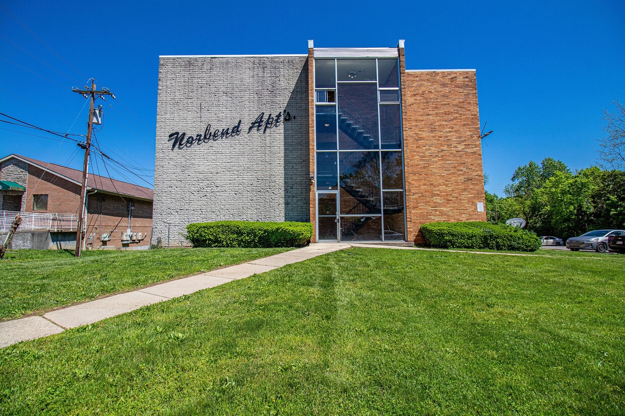
The building is equipped with a secured entrance, ensuring that only authorized individuals have access to the premises. The exterior includes surfaced parking lot, offering convenient parking spaces for tenants. The property also included on-site laundry facilities, making it easy for residents to take care of their laundry needs without leaving the building.
Norbend Apartments is an apartment community located in Hamilton County and the 45224 ZIP Code. This area is served by the Cincinnati Public Schools attendance zone.
Laundry Facilities
Elevator
Controlled Access
Trash Pickup - Curbside
High Speed Internet Access
Hardwood Floors
Walk-In Closets
Refrigerator
Located about five miles northwest of Downtown Cincinnati, College Hill blends the urban with the suburban, touting vibrant storefronts along Hamilton Avenue and historic residences along tranquil backroads. College Hill is home to a diverse, close-knit community known for being welcoming to all.
Delectable restaurants, independent shops, and cozy cafes are among the many eclectic businesses lining the charming and walkable Hamilton Avenue. Recreational opportunities abound at a number of neighborhood parks as well as the nearby Mount Airy Forest. College Hill is also within a 15-minute drive to Downtown Cincinnati.
Learn more about living in College HillCompare neighborhood and city base rent averages by bedroom.
| College Hill | Cincinnati, OH | |
|---|---|---|
| Studio | $697 | $1,065 |
| 1 Bedroom | $889 | $1,142 |
| 2 Bedrooms | $1,018 | $1,435 |
| 3 Bedrooms | $1,220 | $1,754 |
| Colleges & Universities | Distance | ||
|---|---|---|---|
| Colleges & Universities | Distance | ||
| Drive: | 14 min | 4.5 mi | |
| Drive: | 15 min | 6.9 mi | |
| Drive: | 16 min | 7.0 mi | |
| Drive: | 17 min | 7.3 mi |


Transportation options available in Cincinnati include Brewery District Station - Elm & Henry, located 7.5 miles from Norbend Apartments. Norbend Apartments is near Cincinnati/Northern Kentucky International, located 21.5 miles or 40 minutes away.
| Transit / Subway | Distance | ||
|---|---|---|---|
| Transit / Subway | Distance | ||
| Drive: | 16 min | 7.5 mi | |
| Drive: | 17 min | 7.6 mi | |
| Drive: | 17 min | 7.7 mi | |
| Drive: | 17 min | 7.7 mi | |
| Drive: | 17 min | 7.9 mi |
| Commuter Rail | Distance | ||
|---|---|---|---|
| Commuter Rail | Distance | ||
|
|
Drive: | 16 min | 7.5 mi |
| Airports | Distance | ||
|---|---|---|---|
| Airports | Distance | ||
|
Cincinnati/Northern Kentucky International
|
Drive: | 40 min | 21.5 mi |
Scores provided by
Traffic
-Airport
-Businesses
-Scores provided by
HowLoud What is a Sound Score Rating? A Sound Score Rating aggregates noise caused by vehicle traffic, airplane traffic and local sources. How It WorksTime and distance from Norbend Apartments.
| Shopping Centers | Distance | ||
|---|---|---|---|
| Shopping Centers | Distance | ||
| Walk: | 9 min | 0.5 mi | |
| Drive: | 3 min | 1.1 mi | |
| Drive: | 4 min | 1.3 mi |
| Parks and Recreation | Distance | ||
|---|---|---|---|
| Parks and Recreation | Distance | ||
|
LaBoiteaux Woods
|
Drive: | 4 min | 1.3 mi |
|
Buttercup Valley
|
Drive: | 6 min | 2.4 mi |
|
Caldwell Preserve
|
Drive: | 7 min | 3.3 mi |
|
Mt. Airy Forest
|
Drive: | 9 min | 3.6 mi |
|
Farbach-Werner Nature Preserve
|
Drive: | 10 min | 4.3 mi |
| Hospitals | Distance | ||
|---|---|---|---|
| Hospitals | Distance | ||
| Drive: | 10 min | 4.6 mi | |
| Drive: | 11 min | 4.7 mi | |
| Drive: | 13 min | 6.1 mi |
| Military Bases | Distance | ||
|---|---|---|---|
| Military Bases | Distance | ||
| Drive: | 67 min | 50.7 mi | |
| Drive: | 73 min | 55.7 mi | |
| Drive: | 76 min | 59.0 mi |
What Are Walk Score®, Transit Score®, and Bike Score® Ratings?
Walk Score® measures the walkability of any address. Transit Score® measures access to public transit. Bike Score® measures the bikeability of any address.
What is a Sound Score Rating?
A Sound Score Rating aggregates noise caused by vehicle traffic, airplane traffic and local sources.
1532-1542 W North Bend Rd
Cincinnati, OH 45224


