
1213 Walnut
1213 Walnut St,
Philadelphia, PA 19107
$1,940 - $7,055
Studio - 2 Beds
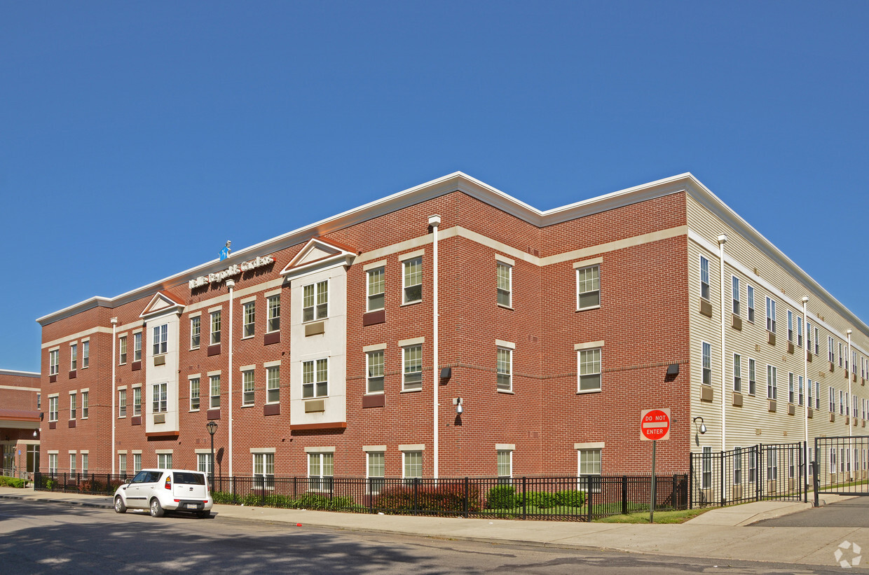
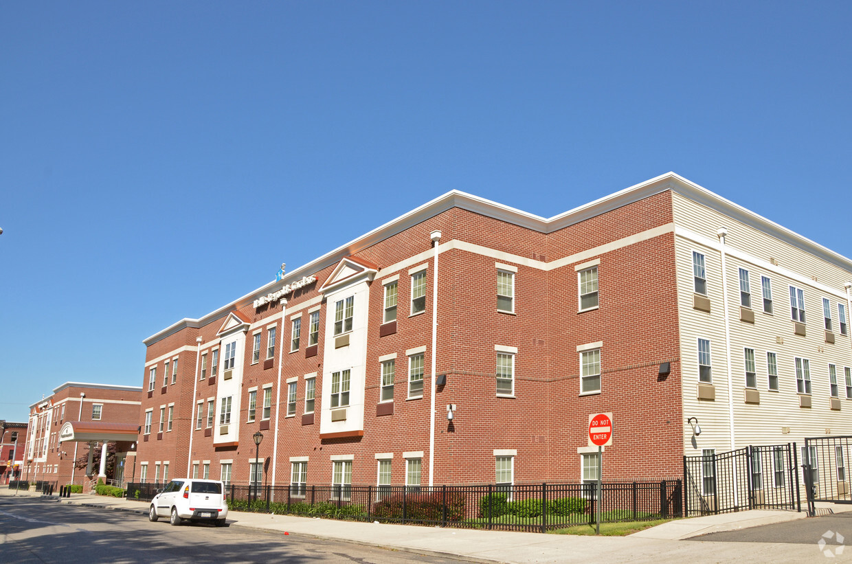
Experience your new place at Nellie Reynolds Gardens in Philadelphia. The address for this community is at 2653 W. Glenwood Ave in the 19121 area of Philadelphia. The team of leasing professionals is ready and waiting to take you for a tour. Enjoy a great selection of amenities and features like smoke free options, convenient on-site parking options, and washers and dryers. Welcome home to Nellie Reynolds Gardens. Contact or drop by to schedule a tour.
Nellie Reynolds Gardens is an apartment community located in Philadelphia County and the 19121 ZIP Code. This area is served by the The School District of Philadelphia attendance zone.
Washer/Dryer
Air Conditioning
Dishwasher
High Speed Internet Access
Running alongside Fairmount Park, North Philadelphia West encompasses the area between Girard and Lehigh Avenues, west of Broad Street. There’s an incredible diversity of rentals here, including modern apartments that display incredible architecture and amenities to long-standing brick townhomes. Residents delight in the wealth of outdoor opportunities afforded by their proximity to the park, including the Sedgley Woods disc golf course, home of the city's innovative blend of ultimate Frisbee and classic golf. The neighborhood includes the smaller residential areas of Stanton, Brewerytown and Strawberry Mansion, and counts Girard College and Temple University among its academic landmarks.
Learn more about living in North Philadelphia WestCompare neighborhood and city base rent averages by bedroom.
| North Philadelphia West | Philadelphia, PA | |
|---|---|---|
| Studio | $1,046 | $1,433 |
| 1 Bedroom | $1,355 | $1,786 |
| 2 Bedrooms | $1,473 | $2,227 |
| 3 Bedrooms | $1,898 | $2,919 |
| Colleges & Universities | Distance | ||
|---|---|---|---|
| Colleges & Universities | Distance | ||
| Drive: | 4 min | 1.6 mi | |
| Drive: | 6 min | 2.1 mi | |
| Drive: | 6 min | 2.2 mi | |
| Drive: | 6 min | 2.5 mi |


Transportation options available in Philadelphia include Girard Av & 28Th St, located 0.8 mile from Nellie Reynolds Gardens. Nellie Reynolds Gardens is near Philadelphia International, located 12.8 miles or 25 minutes away, and Trenton Mercer, located 35.3 miles or 52 minutes away.
| Transit / Subway | Distance | ||
|---|---|---|---|
| Transit / Subway | Distance | ||
| Walk: | 16 min | 0.8 mi | |
| Walk: | 16 min | 0.8 mi | |
| Walk: | 17 min | 0.9 mi | |
| Walk: | 17 min | 0.9 mi | |
| Walk: | 19 min | 1.0 mi |
| Commuter Rail | Distance | ||
|---|---|---|---|
| Commuter Rail | Distance | ||
|
|
Drive: | 5 min | 1.6 mi |
|
|
Drive: | 6 min | 1.7 mi |
|
|
Drive: | 5 min | 1.7 mi |
|
|
Drive: | 6 min | 1.9 mi |
|
|
Drive: | 5 min | 2.0 mi |
| Airports | Distance | ||
|---|---|---|---|
| Airports | Distance | ||
|
Philadelphia International
|
Drive: | 25 min | 12.8 mi |
|
Trenton Mercer
|
Drive: | 52 min | 35.3 mi |
Scores provided by
Traffic
ActiveAirport
CalmBusinesses
BusyScores provided by
HowLoud What is a Sound Score Rating? A Sound Score Rating aggregates noise caused by vehicle traffic, airplane traffic and local sources. How It WorksTime and distance from Nellie Reynolds Gardens.
| Shopping Centers | Distance | ||
|---|---|---|---|
| Shopping Centers | Distance | ||
| Walk: | 11 min | 0.6 mi | |
| Drive: | 4 min | 1.5 mi | |
| Drive: | 4 min | 1.6 mi |
| Parks and Recreation | Distance | ||
|---|---|---|---|
| Parks and Recreation | Distance | ||
|
Wagner Free Institute of Science
|
Drive: | 3 min | 1.2 mi |
|
Please Touch Museum
|
Drive: | 6 min | 2.4 mi |
|
Fels Planetarium
|
Drive: | 6 min | 2.4 mi |
|
Philadelphia Zoo
|
Drive: | 8 min | 2.4 mi |
|
Shofuso - Japanese House and Garden
|
Drive: | 8 min | 3.3 mi |
| Hospitals | Distance | ||
|---|---|---|---|
| Hospitals | Distance | ||
| Drive: | 6 min | 2.2 mi | |
| Drive: | 5 min | 2.3 mi | |
| Drive: | 6 min | 2.3 mi |
| Military Bases | Distance | ||
|---|---|---|---|
| Military Bases | Distance | ||
| Drive: | 16 min | 9.1 mi | |
| Drive: | 39 min | 18.5 mi | |
| Drive: | 41 min | 20.5 mi |
What Are Walk Score®, Transit Score®, and Bike Score® Ratings?
Walk Score® measures the walkability of any address. Transit Score® measures access to public transit. Bike Score® measures the bikeability of any address.
What is a Sound Score Rating?
A Sound Score Rating aggregates noise caused by vehicle traffic, airplane traffic and local sources.

2653 W Glenwood Ave
Philadelphia, PA 19121


