
Avana Southview
4930 Ashley Ln,
Inver Grove Heights, MN 55077
$1,504 - $3,319 Total Monthly Price
Studio - 2 Beds
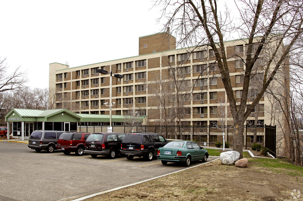
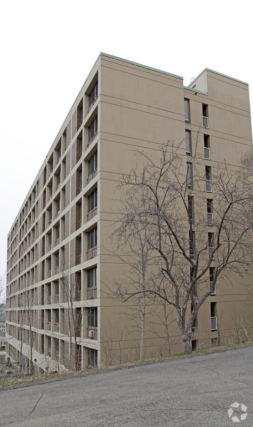

Nan McKay Building is ready for your visit. The 55075 location in South St. Paul is an ideal place for residents. From location to floorplan options, the professional leasing staff is ready to help you in finding the perfect new apartment. Make sure you to check out the current floorplan options. Come see Nan McKay Building today.
Nan McKay Building is an apartment community located in Dakota County and the 55075 ZIP Code. This area is served by the South St. Paul Public School Dist. attendance zone.
Air Conditioning
Tub/Shower
Heating
Oven
South St. Paul is southwest of the Minneapolis/St. Paul area and is conveniently located off Highway 494 along the banks of the Mississippi. With a rich historic background and cultural diversity, the South St. Paul area is known for a laid-back lifestyle while providing a comfortable and affordable way of life.
South St. Paul prides itself on being a family-friendly community while also offering easy access to all the comforts of big city life. The area has a wide range of entertainment and recreational opportunities and hosts community events all year around.
Learn more about living in South St Paul| Colleges & Universities | Distance | ||
|---|---|---|---|
| Colleges & Universities | Distance | ||
| Drive: | 11 min | 6.0 mi | |
| Drive: | 13 min | 6.5 mi | |
| Drive: | 13 min | 6.6 mi | |
| Drive: | 16 min | 9.4 mi |


Transportation options available in South Saint Paul include Central Station, located 5.3 miles from Nan McKay Building. Nan McKay Building is near Minneapolis-St Paul International/Wold-Chamberlain, located 12.1 miles or 20 minutes away.
| Transit / Subway | Distance | ||
|---|---|---|---|
| Transit / Subway | Distance | ||
| Drive: | 10 min | 5.3 mi | |
| Drive: | 10 min | 5.3 mi | |
| Drive: | 11 min | 5.5 mi | |
| Drive: | 11 min | 5.8 mi | |
| Drive: | 11 min | 5.9 mi |
| Commuter Rail | Distance | ||
|---|---|---|---|
| Commuter Rail | Distance | ||
|
|
Drive: | 11 min | 5.6 mi |
|
|
Drive: | 28 min | 16.2 mi |
|
|
Drive: | 31 min | 22.1 mi |
|
|
Drive: | 41 min | 30.2 mi |
|
|
Drive: | 43 min | 31.8 mi |
| Airports | Distance | ||
|---|---|---|---|
| Airports | Distance | ||
|
Minneapolis-St Paul International/Wold-Chamberlain
|
Drive: | 20 min | 12.1 mi |
Time and distance from Nan McKay Building.
| Shopping Centers | Distance | ||
|---|---|---|---|
| Shopping Centers | Distance | ||
| Drive: | 3 min | 1.1 mi | |
| Drive: | 6 min | 2.2 mi | |
| Drive: | 6 min | 2.5 mi |
| Parks and Recreation | Distance | ||
|---|---|---|---|
| Parks and Recreation | Distance | ||
|
Kellogg Mall Park
|
Drive: | 10 min | 5.3 mi |
|
Cherokee Regional Park
|
Drive: | 12 min | 5.4 mi |
|
Dodge Nature Center
|
Drive: | 10 min | 5.7 mi |
|
Science Museum of Minnesota
|
Drive: | 11 min | 6.2 mi |
|
Indian Mounds Park
|
Drive: | 13 min | 7.0 mi |
| Hospitals | Distance | ||
|---|---|---|---|
| Hospitals | Distance | ||
| Drive: | 12 min | 5.8 mi | |
| Drive: | 11 min | 5.9 mi | |
| Drive: | 11 min | 6.2 mi |
| Military Bases | Distance | ||
|---|---|---|---|
| Military Bases | Distance | ||
| Drive: | 18 min | 10.9 mi |
Pets Allowed Fitness Center Pool Dishwasher Refrigerator Clubhouse Maintenance on site
Pets Allowed Fitness Center Pool In Unit Washer & Dryer Walk-In Closets High-Speed Internet Controlled Access
Pets Allowed Fitness Center Pool Dishwasher Refrigerator Walk-In Closets
What Are Walk Score®, Transit Score®, and Bike Score® Ratings?
Walk Score® measures the walkability of any address. Transit Score® measures access to public transit. Bike Score® measures the bikeability of any address.
What is a Sound Score Rating?
A Sound Score Rating aggregates noise caused by vehicle traffic, airplane traffic and local sources

200 Marie Ave
South Saint Paul, MN 55075


