
75 Public Square
75 Public Sq,
Cleveland, OH 44113
1-2 Beds $1,300 - $2,490
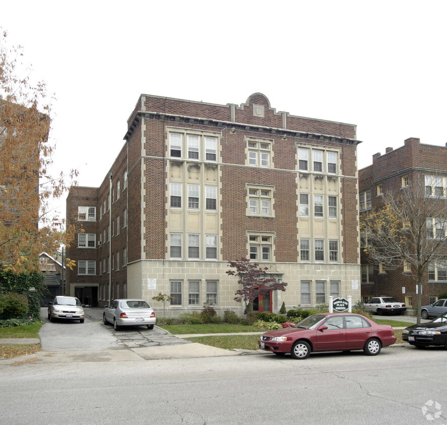
At Moreland Place in Cleveland, OH, experience stylish living. The convenient N. Moreland Blvd setting in the 44120 Zip code of Cleveland is a great place for those looking for their new place. Here at this community, the leasing team is ready to help you find your perfect new apartment. At this community, you'll have access to a variety of amenities and features like hardwood floors, convenient on-site parking options, and smoke free options. Drop by Moreland Place today.
Moreland Place is an apartment community located in Cuyahoga County and the 44120 ZIP Code. This area is served by the Shaker Heights City attendance zone.
High Speed Internet Access
Hardwood Floors
Refrigerator
Tub/Shower
Known as one of Cleveland, Ohio's, premiere shopping and dining districts, the Buckeye-Shaker neighborhood sits on the east side of the city and contains the old Buckeye, Larchmere, and Shaker Square areas. Originally known as Little Hungary, the area of Cleveland in and around Buckeye Road contains many older single-family homes and apartment buildings. The Larchmere and Shaker Square sections of the neighborhood hold a large selection of shops and restaurants, all within easy walking distance of one another.
Bordered by University Circle to the north, Shaker Heights to the east, Mount Pleasant to the south, and Woodland Hills to the west, the Buckeye-Shaker area lies roughly six miles to the east of downtown Cleveland. Getting from the Buckeye-Shaker area to downtown is made easier thanks to the rapid transit station located near the Shaker Square shopping district.
Learn more about living in Buckeye-Shaker| Colleges & Universities | Distance | ||
|---|---|---|---|
| Colleges & Universities | Distance | ||
| Drive: | 6 min | 2.7 mi | |
| Drive: | 7 min | 2.8 mi | |
| Drive: | 6 min | 3.0 mi | |
| Drive: | 10 min | 4.0 mi |


Transportation options available in Cleveland include Shaker Square, located 0.2 mile from Moreland Place. Moreland Place is near Cleveland-Hopkins International, located 17.1 miles or 30 minutes away.
| Transit / Subway | Distance | ||
|---|---|---|---|
| Transit / Subway | Distance | ||
|
|
Walk: | 2 min | 0.2 mi |
|
|
Walk: | 5 min | 0.3 mi |
|
|
Walk: | 8 min | 0.5 mi |
|
|
Walk: | 11 min | 0.6 mi |
|
|
Walk: | 16 min | 0.9 mi |
| Commuter Rail | Distance | ||
|---|---|---|---|
| Commuter Rail | Distance | ||
|
|
Drive: | 19 min | 8.0 mi |
| Drive: | 21 min | 8.7 mi | |
| Drive: | 23 min | 10.4 mi | |
| Drive: | 31 min | 18.7 mi | |
|
Boston Mill
|
Drive: | 36 min | 22.6 mi |
| Airports | Distance | ||
|---|---|---|---|
| Airports | Distance | ||
|
Cleveland-Hopkins International
|
Drive: | 30 min | 17.1 mi |
Time and distance from Moreland Place.
| Shopping Centers | Distance | ||
|---|---|---|---|
| Shopping Centers | Distance | ||
| Walk: | 4 min | 0.2 mi | |
| Walk: | 5 min | 0.3 mi | |
| Walk: | 17 min | 0.9 mi |
| Parks and Recreation | Distance | ||
|---|---|---|---|
| Parks and Recreation | Distance | ||
|
Nature Center at Shaker Lakes
|
Drive: | 3 min | 1.2 mi |
|
Children's Museum of Cleveland
|
Drive: | 5 min | 2.4 mi |
|
Cleveland Botanical Garden
|
Drive: | 6 min | 2.8 mi |
|
Cleveland Museum of Natural History
|
Drive: | 6 min | 3.1 mi |
|
Garfield Park Nature Center
|
Drive: | 12 min | 5.8 mi |
| Hospitals | Distance | ||
|---|---|---|---|
| Hospitals | Distance | ||
| Drive: | 2 min | 1.1 mi | |
| Drive: | 5 min | 2.6 mi | |
| Drive: | 5 min | 2.6 mi |
| Military Bases | Distance | ||
|---|---|---|---|
| Military Bases | Distance | ||
| Drive: | 105 min | 85.9 mi | |
| Drive: | 107 min | 87.1 mi |
What Are Walk Score®, Transit Score®, and Bike Score® Ratings?
Walk Score® measures the walkability of any address. Transit Score® measures access to public transit. Bike Score® measures the bikeability of any address.
What is a Sound Score Rating?
A Sound Score Rating aggregates noise caused by vehicle traffic, airplane traffic and local sources

2666 N Moreland Blvd
Cleveland, OH 44120


")


