
The Reef Apartments
2753 Mayport Rd,
Jacksonville, FL 32233
$1,510 - $2,557
1-3 Beds

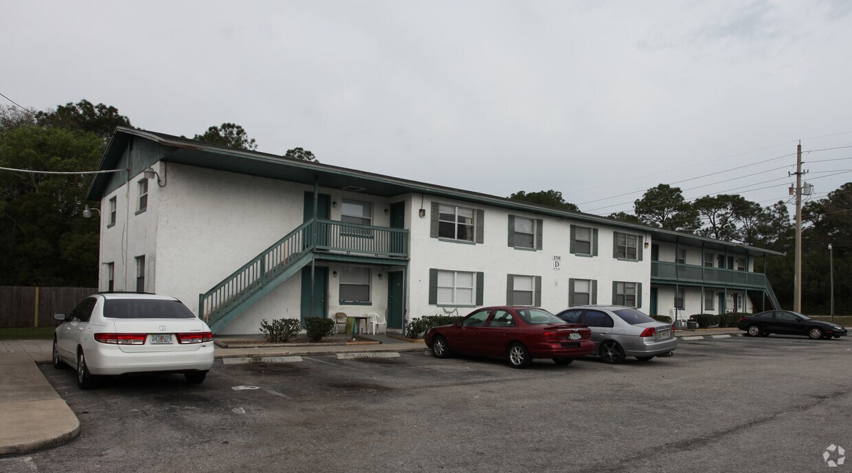

At Merrill Oaks Apartments, experience great living. In a location on Woolery Dr. in Jacksonville's 32211 area, local residents can easily connect with a number of nearby points of interest. Make a visit to check out the apartment floorplan options. The leasing staff is waiting to show you all that this community has in store. Contact us or stop by today.
Merrill Oaks Apartments is an apartment community located in Duval County and the 32211 ZIP Code. This area is served by the Duval County Public Schools attendance zone.
High Speed Internet Access
Refrigerator
Tub/Shower
Tile Floors
Jacksonville covers more than 800 square miles, making it the largest city by land area in the contiguous United States — a distinction that shapes everything about daily life here. That sheer scale means neighborhoods feel distinct from one another: Riverside and Avondale offer historic architecture and an arts-forward atmosphere close to the St. Johns River, San Marco delivers a walkable, boutique-lined character near Downtown, and Southside sits near the University of North Florida and major commercial corridors. The economy runs deep, anchored by major employers like CSX Corporation, Fidelity Information Services, and Naval Air Station Jacksonville, giving the city a broad and stable employment base. Florida State College at Jacksonville adds an academic presence woven throughout the urban core.
Learn more about living in JacksonvilleCompare neighborhood and city base rent averages by bedroom.
| Arlingwood | Jacksonville, FL | |
|---|---|---|
| Studio | - | $1,039 |
| 1 Bedroom | $1,188 | $1,299 |
| 2 Bedrooms | $1,459 | $1,531 |
| 3 Bedrooms | $1,890 | $1,884 |
| Colleges & Universities | Distance | ||
|---|---|---|---|
| Colleges & Universities | Distance | ||
| Drive: | 7 min | 3.0 mi | |
| Drive: | 16 min | 7.6 mi | |
| Drive: | 13 min | 8.5 mi | |
| Drive: | 22 min | 12.4 mi |


Transportation options available in Jacksonville include Rosa L. Parks/Fccj, located 7.3 miles from Merrill Oaks Apartments. Merrill Oaks Apartments is near Jacksonville International, located 16.1 miles or 24 minutes away.
| Transit / Subway | Distance | ||
|---|---|---|---|
| Transit / Subway | Distance | ||
|
|
Drive: | 14 min | 7.3 mi |
|
|
Drive: | 16 min | 7.7 mi |
|
|
Drive: | 16 min | 7.9 mi |
| Drive: | 18 min | 8.4 mi | |
|
|
Drive: | 18 min | 8.4 mi |
| Commuter Rail | Distance | ||
|---|---|---|---|
| Commuter Rail | Distance | ||
|
|
Drive: | 24 min | 13.3 mi |
| Airports | Distance | ||
|---|---|---|---|
| Airports | Distance | ||
|
Jacksonville International
|
Drive: | 24 min | 16.1 mi |
Scores provided by
Traffic
ActiveAirport
CalmBusinesses
ActiveScores provided by
HowLoud What is a Sound Score Rating? A Sound Score Rating aggregates noise caused by vehicle traffic, airplane traffic and local sources. How It WorksTime and distance from Merrill Oaks Apartments.
| Shopping Centers | Distance | ||
|---|---|---|---|
| Shopping Centers | Distance | ||
| Walk: | 6 min | 0.3 mi | |
| Walk: | 8 min | 0.4 mi | |
| Drive: | 2 min | 1.1 mi |
| Parks and Recreation | Distance | ||
|---|---|---|---|
| Parks and Recreation | Distance | ||
|
Jacksonville Arboretum and Gardens
|
Drive: | 3 min | 1.4 mi |
|
Tree Hill Nature Center
|
Drive: | 6 min | 2.5 mi |
|
Victory Park
|
Drive: | 7 min | 3.3 mi |
|
Blue Cypress Park
|
Drive: | 10 min | 4.5 mi |
|
Yellow Bluff Fort Historic State Park
|
Drive: | 11 min | 6.3 mi |
| Hospitals | Distance | ||
|---|---|---|---|
| Hospitals | Distance | ||
| Drive: | 14 min | 6.4 mi | |
| Drive: | 13 min | 7.7 mi | |
| Drive: | 18 min | 8.6 mi |
| Military Bases | Distance | ||
|---|---|---|---|
| Military Bases | Distance | ||
| Drive: | 19 min | 10.7 mi | |
| Drive: | 37 min | 29.0 mi |
What Are Walk Score®, Transit Score®, and Bike Score® Ratings?
Walk Score® measures the walkability of any address. Transit Score® measures access to public transit. Bike Score® measures the bikeability of any address.
What is a Sound Score Rating?
A Sound Score Rating aggregates noise caused by vehicle traffic, airplane traffic and local sources.
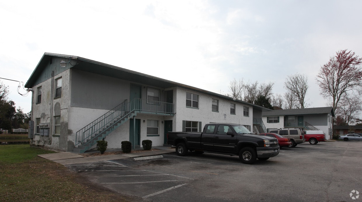
2791-2796 Woolery Dr
Jacksonville, FL 32211


