
Hue39
3909 San Fernando Rd,
Glendale, CA 91204
$2,650 - $3,550
1-2 Beds
Bedrooms
1 bd
Bathrooms
1 ba
Square Feet
645 sq ft
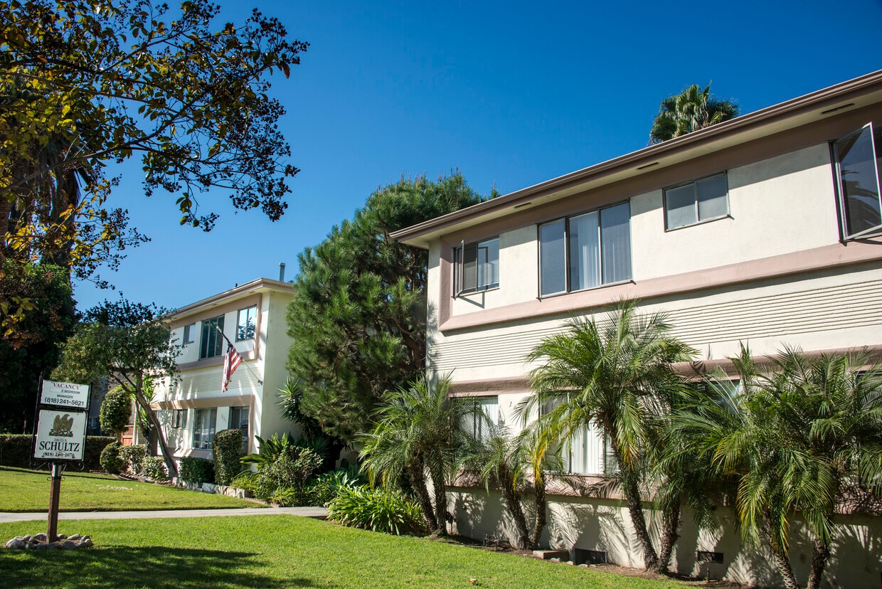
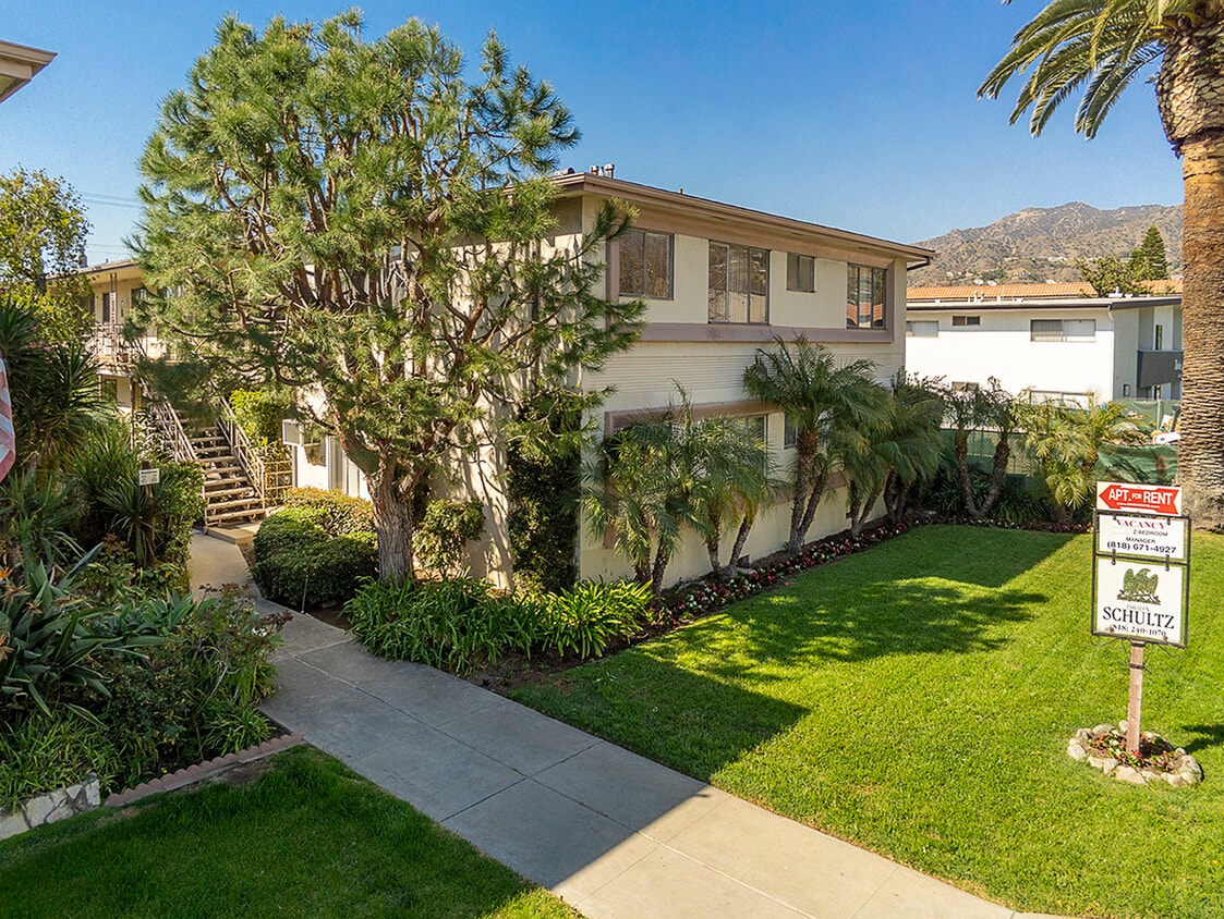
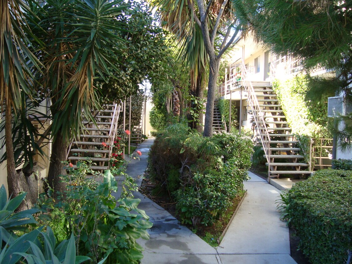
Experience Glendale living at 1025 Melrose Ave. You'll find this community in the Verdugo Viejo area of Glendale. The leasing staff is excited to help you find the perfect apartment. These apartments feature a variety of great amenities including: convenient on-site parking options and hardwood floors. At 1025 Melrose Ave you're home.
Experience Glendale living at 1025 Melrose Ave. You'll find this community in the Verdugo Viejo area of Glendale. The leasing staff is excited to help you find the perfect apartment. These apartments feature a variety of great amenities including: convenient on-site parking options and hardwood floors. At 1025 Melrose Ave you're home.
mel102 is an apartment community located in Los Angeles County and the 91202 ZIP Code. This area is served by the Glendale Unified attendance zone.
Air Conditioning
Hardwood Floors
Ceiling Fans
Oven
If you’re looking for a central location in the Los Angeles area, Verdugo Viejo is an excellent choice. This small community is located between Burbank and Downtown Glendale, giving residents easy access to plenty of dining, shopping, and entertainment options. Verdugo Viejo is also convenient to popular parks and hiking areas including the iconic Griffith Park and Verdugo Mountains Open Space Preserve. Access to Highway 134 and Interstate 5 allows residents to travel across Southern California with ease. Verdugo Viejo also has great schools and several restaurants and shops. The neighborhood has a variety of rental options including modern apartments, California bungalows, modern townhomes, and luxury condos.
Learn more about living in Verdugo Viejo| Colleges & Universities | Distance | ||
|---|---|---|---|
| Colleges & Universities | Distance | ||
| Drive: | 5 min | 2.2 mi | |
| Drive: | 10 min | 4.6 mi | |
| Drive: | 8 min | 4.9 mi | |
| Drive: | 15 min | 8.7 mi |


Transportation options available in Glendale include Vermont/Sunset Station, located 6.4 miles from mel102. mel102 is near Bob Hope, located 9.8 miles or 15 minutes away, and Los Angeles International, located 24.9 miles or 38 minutes away.
| Transit / Subway | Distance | ||
|---|---|---|---|
| Transit / Subway | Distance | ||
|
|
Drive: | 11 min | 6.4 mi |
|
|
Drive: | 14 min | 6.7 mi |
|
|
Drive: | 11 min | 6.9 mi |
|
|
Drive: | 12 min | 6.9 mi |
|
|
Drive: | 13 min | 7.7 mi |
| Commuter Rail | Distance | ||
|---|---|---|---|
| Commuter Rail | Distance | ||
|
|
Drive: | 6 min | 3.1 mi |
|
|
Drive: | 7 min | 4.3 mi |
|
|
Drive: | 11 min | 7.0 mi |
| Drive: | 11 min | 7.5 mi | |
|
|
Drive: | 16 min | 9.8 mi |
| Airports | Distance | ||
|---|---|---|---|
| Airports | Distance | ||
|
Bob Hope
|
Drive: | 15 min | 9.8 mi |
|
Los Angeles International
|
Drive: | 38 min | 24.9 mi |
Time and distance from mel102.
| Shopping Centers | Distance | ||
|---|---|---|---|
| Shopping Centers | Distance | ||
| Walk: | 7 min | 0.4 mi | |
| Walk: | 9 min | 0.5 mi | |
| Walk: | 10 min | 0.5 mi |
| Parks and Recreation | Distance | ||
|---|---|---|---|
| Parks and Recreation | Distance | ||
|
Los Angeles Zoo
|
Drive: | 14 min | 4.6 mi |
|
Bird Sanctuary
|
Drive: | 11 min | 5.9 mi |
|
Marsh Park
|
Drive: | 10 min | 6.1 mi |
|
Griffith Observatory
|
Drive: | 15 min | 7.1 mi |
|
Griffith Park
|
Drive: | 24 min | 9.3 mi |
| Hospitals | Distance | ||
|---|---|---|---|
| Hospitals | Distance | ||
| Drive: | 6 min | 2.8 mi | |
| Drive: | 7 min | 2.9 mi | |
| Drive: | 7 min | 4.5 mi |
| Military Bases | Distance | ||
|---|---|---|---|
| Military Bases | Distance | ||
| Drive: | 35 min | 26.5 mi |
What Are Walk Score®, Transit Score®, and Bike Score® Ratings?
Walk Score® measures the walkability of any address. Transit Score® measures access to public transit. Bike Score® measures the bikeability of any address.
What is a Sound Score Rating?
A Sound Score Rating aggregates noise caused by vehicle traffic, airplane traffic and local sources

1025 Melrose Ave
Glendale, CA 91202


