
The Marley
1100 Falls Creek Ln,
Charlotte, NC 28209
$1,013 - $1,474
Studio - 2 Beds
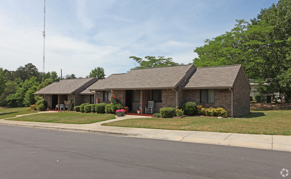
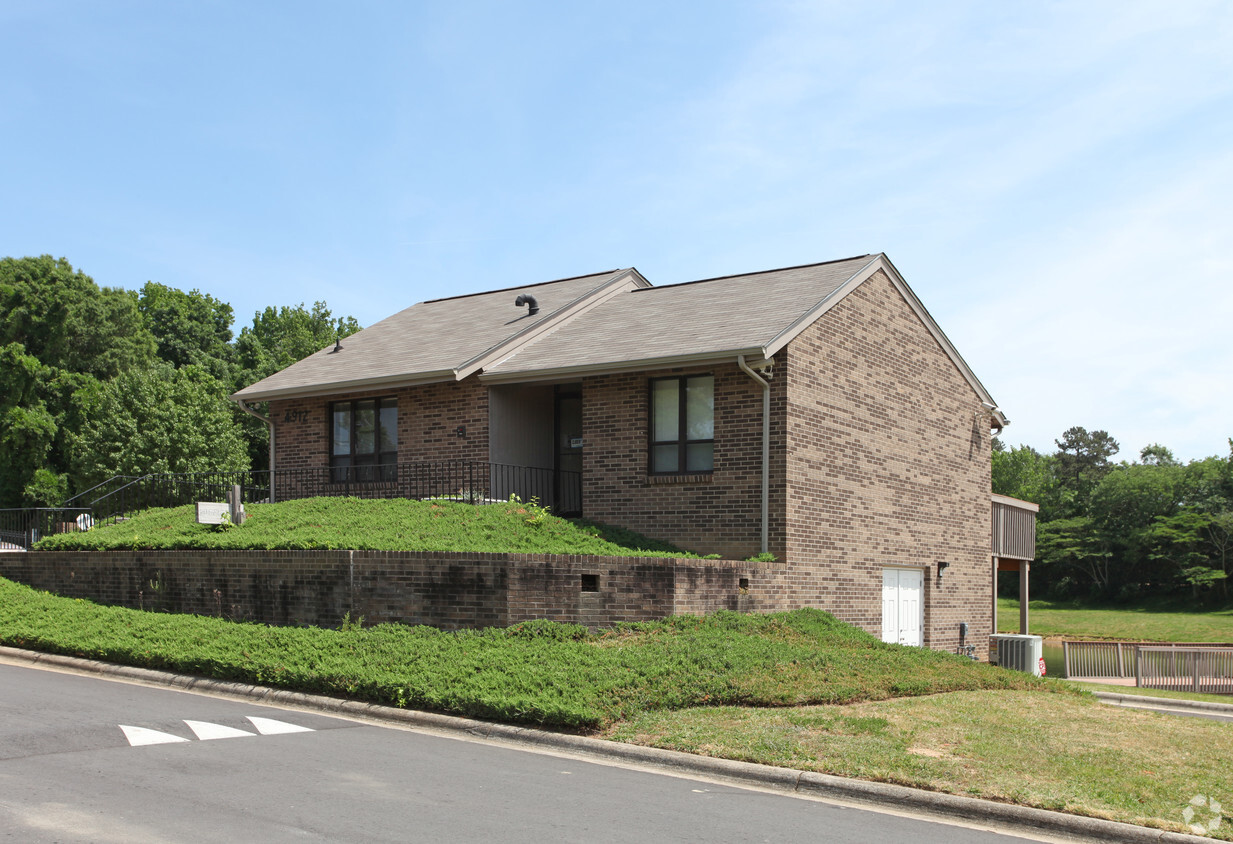
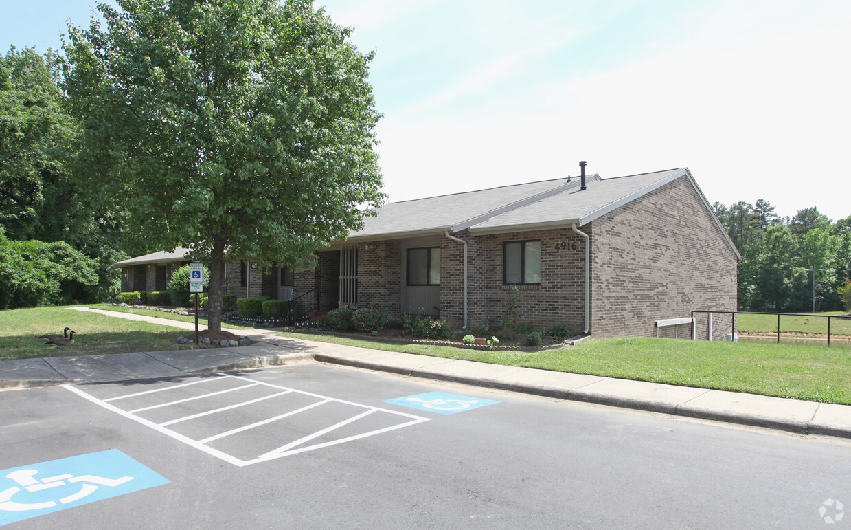
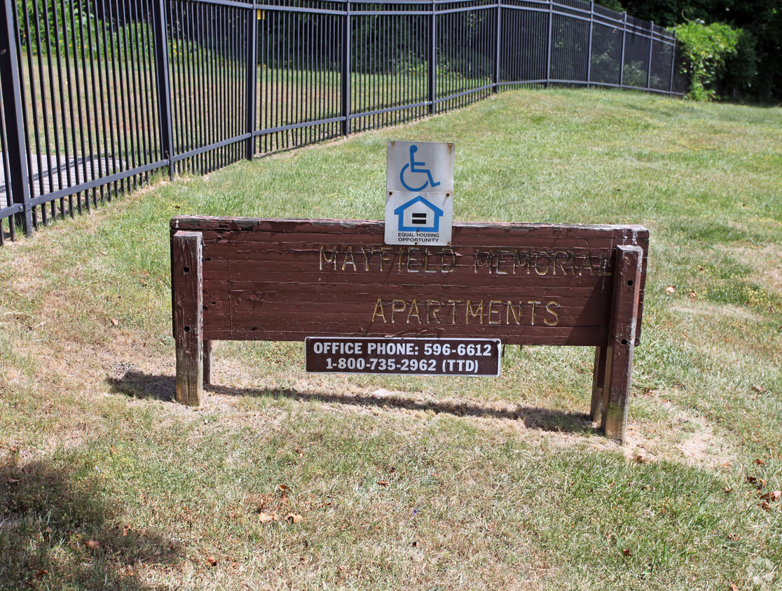

At Mayfield Memorial Apartments, find a great place to live. The location in Charlotte's 28269 area is an ideal place to move. Here at this community, the leasing team is excited to help you find your perfect new apartment. Make a visit to see the available floorplan options. It's time to get moving on finding your next place. Contact or stop by Mayfield Memorial Apartments to check the current floorplan availability!
Mayfield Memorial Apartments is an apartment community located in Mecklenburg County and the 28269 ZIP Code. This area is served by the Charlotte-Mecklenburg School District attendance zone.
Air Conditioning
Refrigerator
Heating
Range
Derita-Statesville lies about six miles northeast of downtown Charlotte, North Carolina. Apartments for rent near I-85 make the rest of the city easy to reach, including the University of North Carolina Charlotte six miles to the east.
The Derita-Statesville neighborhood includes a wide range of amenities. If you need furniture, swing over to Keziah's Furniture to shop for a funky lamp or classic dinette set. For dinner, order drinks and bar food at TCB 54 Hundred Bar and Grill, or head over to the Nile for dancing, drinks, and art presentations. Locals frequent US Fried Chicken to enjoy classic chicken recipes with a modern touch. For recreation, residents enjoy fitness programs at the YMCA and outdoor activities at Allen Hill Park.
Learn more about living in Derita-StatesvilleCompare neighborhood and city base rent averages by bedroom.
| Derita-Statesville | Charlotte, NC | |
|---|---|---|
| Studio | - | $1,400 |
| 1 Bedroom | $1,350 | $1,477 |
| 2 Bedrooms | $1,428 | $1,786 |
| 3 Bedrooms | $1,775 | $2,193 |
| Colleges & Universities | Distance | ||
|---|---|---|---|
| Colleges & Universities | Distance | ||
| Drive: | 10 min | 5.0 mi | |
| Drive: | 11 min | 5.8 mi | |
| Drive: | 12 min | 6.1 mi | |
| Drive: | 12 min | 6.1 mi |


Transportation options available in Charlotte include 36Th St Station, located 3.5 miles from Mayfield Memorial Apartments. Mayfield Memorial Apartments is near Concord-Padgett Regional, located 12.1 miles or 19 minutes away, and Charlotte/Douglas International, located 13.1 miles or 23 minutes away.
| Transit / Subway | Distance | ||
|---|---|---|---|
| Transit / Subway | Distance | ||
| Drive: | 8 min | 3.5 mi | |
| Drive: | 8 min | 3.9 mi | |
| Drive: | 7 min | 4.0 mi | |
| Drive: | 8 min | 4.5 mi | |
| Drive: | 10 min | 4.7 mi |
| Commuter Rail | Distance | ||
|---|---|---|---|
| Commuter Rail | Distance | ||
|
|
Drive: | 9 min | 4.0 mi |
| Drive: | 32 min | 22.9 mi | |
|
|
Drive: | 32 min | 23.2 mi |
| Drive: | 47 min | 37.5 mi |
| Airports | Distance | ||
|---|---|---|---|
| Airports | Distance | ||
|
Concord-Padgett Regional
|
Drive: | 19 min | 12.1 mi |
|
Charlotte/Douglas International
|
Drive: | 23 min | 13.1 mi |
Scores provided by
Traffic
-Airport
-Businesses
-Scores provided by
HowLoud What is a Sound Score Rating? A Sound Score Rating aggregates noise caused by vehicle traffic, airplane traffic and local sources. How It WorksTime and distance from Mayfield Memorial Apartments.
| Shopping Centers | Distance | ||
|---|---|---|---|
| Shopping Centers | Distance | ||
| Drive: | 4 min | 1.4 mi | |
| Drive: | 5 min | 2.1 mi | |
| Drive: | 5 min | 2.2 mi |
| Parks and Recreation | Distance | ||
|---|---|---|---|
| Parks and Recreation | Distance | ||
|
RibbonWalk Nature Preserve
|
Drive: | 5 min | 1.5 mi |
|
Discovery Place
|
Drive: | 10 min | 4.8 mi |
|
University of North Carolina at Charlotte Botanical Gardens
|
Drive: | 13 min | 6.7 mi |
|
Evergreen Nature Preserve
|
Drive: | 17 min | 8.5 mi |
|
Reedy Creek Nature Center & Preserve
|
Drive: | 20 min | 8.8 mi |
| Hospitals | Distance | ||
|---|---|---|---|
| Hospitals | Distance | ||
| Drive: | 9 min | 5.8 mi | |
| Drive: | 13 min | 6.4 mi | |
| Drive: | 14 min | 7.0 mi |
What Are Walk Score®, Transit Score®, and Bike Score® Ratings?
Walk Score® measures the walkability of any address. Transit Score® measures access to public transit. Bike Score® measures the bikeability of any address.
What is a Sound Score Rating?
A Sound Score Rating aggregates noise caused by vehicle traffic, airplane traffic and local sources.

4800-4916 Daybreak Dr
Charlotte, NC 28269


