Lynridge Apartments
3400 Lynridge Dr,
Austin,
TX
78723
Leasing Office:
2121 W William Cannon Dr, Austin, TX 78745
-
Monthly Rent
$875 - $1,050
-
Bedrooms
1 bd
-
Bathrooms
1 ba
-
Square Feet
488 sq ft

Highlights
- English and Spanish Speaking Staff
- Walk-In Closets
- Property Manager on Site
Pricing & Floor Plans
-
Unit 9Aprice $875square feet 488availibility Now
-
Unit 8Bprice $900square feet 488availibility Now
-
Unit 9Aprice $875square feet 488availibility Now
-
Unit 8Bprice $900square feet 488availibility Now
Fees and Policies
The fees below are based on community-supplied data and may exclude additional fees and utilities. Use the Cost Calculator to add these fees to the base price.
-
One-Time Basics
-
Amenity Fee$0
-
Move-In Fee$0
-
Other$0
-
Administrative Feemoving special 2 weeks free rent on 2nd month of the lease$100
-
Application Fee Per Applicantmoving special 2 weeks free rent pn 2nd month of the lease$50
-
Pet policies are negotiable.
-
Dogs
-
One-Time Pet FeeMax of 50. Charged per pet.$250
-
Pet DepositMax of 50. Charged per pet.$250
-
Monthly Pet FeeMax of 50. Charged per pet.$10 / mo
50 lbs. Weight Limit, Pet interviewRestrictions:We must need to analyze each case to decide about the pet Deposit that is refundableRead More Read Less -
-
Cats
-
One-Time Pet FeeMax of 20. Charged per pet.$250
-
Pet DepositMax of 20. Charged per pet.$250
-
Monthly Pet FeeMax of 20. Charged per pet.$10 / mo
20 lbs. Weight Limit, Pet interviewRestrictions: -
Property Fee Disclaimer: Based on community-supplied data and independent market research. Subject to change without notice. May exclude fees for mandatory or optional services and usage-based utilities.
Details
Utilities Included
-
Trash Removal
-
Sewer
Lease Options
-
12 mo
Property Information
-
Built in 1985
-
22 units/2 stories
About Lynridge Apartments
Small Apartment complex with a garden on it easy access to Highway 183,good location to all areas
Lynridge Apartments is an apartment community located in Travis County and the 78723 ZIP Code. This area is served by the Austin Independent attendance zone.
Contact
Community Amenities
- Laundry Facilities
- Property Manager on Site
Apartment Features
Air Conditioning
Dishwasher
High Speed Internet Access
Walk-In Closets
- High Speed Internet Access
- Air Conditioning
- Heating
- Smoke Free
- Wheelchair Accessible (Rooms)
- Dishwasher
- Disposal
- Oven
- Range
- Refrigerator
- Tile Floors
- Vinyl Flooring
- Walk-In Closets
- Laundry Facilities
- Property Manager on Site
- High Speed Internet Access
- Air Conditioning
- Heating
- Smoke Free
- Wheelchair Accessible (Rooms)
- Dishwasher
- Disposal
- Oven
- Range
- Refrigerator
- Tile Floors
- Vinyl Flooring
- Walk-In Closets
| Monday | By Appointment |
|---|---|
| Tuesday | By Appointment |
| Wednesday | By Appointment |
| Thursday | By Appointment |
| Friday | By Appointment |
| Saturday | By Appointment |
| Sunday | By Appointment |
University Hills is a quaint suburban neighborhood just a few miles northeast of Downtown Austin and the University of Texas at Austin. From Texas football games and art museums to the Texas Capitol and divine local restaurants, everything is at your fingertips when you live in University Hills!
This charming neighborhood attracts residents looking for quiet residential streets in a park-like atmosphere. Community parks, tree-lined streets, and welcoming neighbors await you just minutes from the hustle and bustle of Texas’s capital city.
Learn more about living in University HillsCompare neighborhood and city base rent averages by bedroom.
| University Hills | Austin, TX | |
|---|---|---|
| Studio | $880 | $1,227 |
| 1 Bedroom | $939 | $1,381 |
| 2 Bedrooms | $1,250 | $1,784 |
| 3 Bedrooms | - | $2,395 |
| Colleges & Universities | Distance | ||
|---|---|---|---|
| Colleges & Universities | Distance | ||
| Drive: | 10 min | 5.0 mi | |
| Drive: | 11 min | 6.0 mi | |
| Drive: | 12 min | 6.9 mi | |
| Drive: | 11 min | 7.7 mi |

View GreatSchools Rating Methodology
Data provided by GreatSchools.org © 2026. All rights reserved.
Transportation options available in Austin include Highland Station, located 4.3 miles from Lynridge Apartments. Lynridge Apartments is near Austin-Bergstrom International, located 13.9 miles or 23 minutes away.
| Transit / Subway | Distance | ||
|---|---|---|---|
| Transit / Subway | Distance | ||
| Drive: | 7 min | 4.3 mi | |
| Drive: | 8 min | 4.5 mi | |
| Drive: | 10 min | 4.7 mi | |
| Drive: | 12 min | 6.7 mi | |
| Drive: | 12 min | 6.8 mi |
| Commuter Rail | Distance | ||
|---|---|---|---|
| Commuter Rail | Distance | ||
|
|
Drive: | 16 min | 8.1 mi |
|
|
Drive: | 37 min | 29.9 mi |
|
|
Drive: | 47 min | 37.3 mi |
| Airports | Distance | ||
|---|---|---|---|
| Airports | Distance | ||
|
Austin-Bergstrom International
|
Drive: | 23 min | 13.9 mi |
Time and distance from Lynridge Apartments.
| Shopping Centers | Distance | ||
|---|---|---|---|
| Shopping Centers | Distance | ||
| Walk: | 10 min | 0.6 mi | |
| Walk: | 13 min | 0.7 mi | |
| Drive: | 4 min | 2.0 mi |
| Parks and Recreation | Distance | ||
|---|---|---|---|
| Parks and Recreation | Distance | ||
|
Thinkery
|
Drive: | 8 min | 3.6 mi |
|
Walter E. Long Park
|
Drive: | 9 min | 4.7 mi |
|
Jourdan-Bachman Pioneer Farms
|
Drive: | 12 min | 5.0 mi |
|
Boggy Creek Greenbelt
|
Drive: | 11 min | 5.1 mi |
|
Elisabet Ney Museum
|
Drive: | 11 min | 5.4 mi |
| Hospitals | Distance | ||
|---|---|---|---|
| Hospitals | Distance | ||
| Drive: | 5 min | 2.5 mi | |
| Drive: | 8 min | 3.6 mi | |
| Drive: | 10 min | 5.9 mi |
| Military Bases | Distance | ||
|---|---|---|---|
| Military Bases | Distance | ||
| Drive: | 90 min | 72.2 mi | |
| Drive: | 88 min | 74.1 mi |
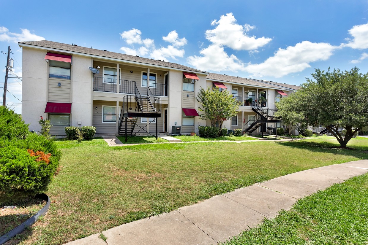
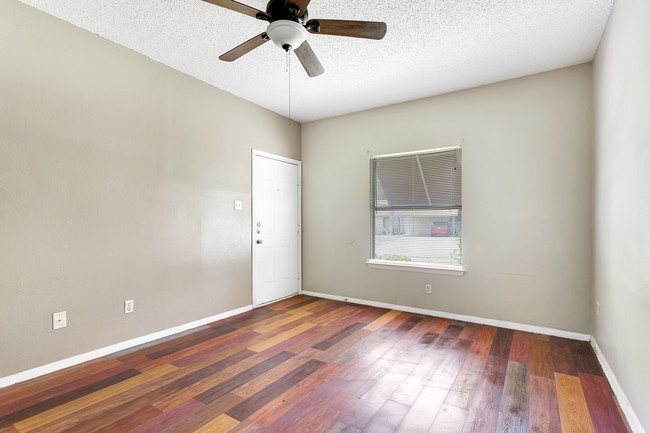
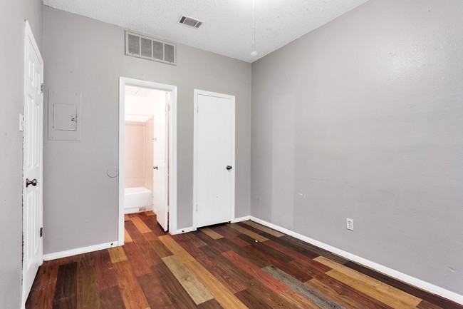
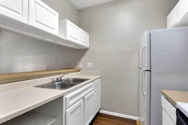
Lynridge Apartments Photos
-
Inside Building
-
Living area
-
Bedroom
-
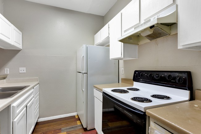
Kitchen
-
Kitchen
-
Main View
-
-
Street
-
Laundry
While Lynridge Apartments does not provide in‑unit laundry, on‑site laundry facilities are available for shared resident use.
Select utilities are included in rent at Lynridge Apartments, including trash removal and sewer. Residents are responsible for any other utilities not listed.
Parking is available at Lynridge Apartments and is free of charge for residents.
Lynridge Apartments has one-bedroom available with rent ranges from $875/mo. to $1,050/mo.
Yes, Lynridge Apartments welcomes pets. Breed restrictions, weight limits, and additional fees may apply. View this property's pet policy.
A good rule of thumb is to spend no more than 30% of your gross income on rent. Based on the lowest available rent of $875 for a one-bedroom, you would need to earn about $32,000 per year to qualify. Want to double-check your budget? Try our Rent Affordability Calculator to see how much rent fits your income and lifestyle.
Lynridge Apartments is offering 1 Month Free for eligible applicants, with rental rates starting at $875.
While Lynridge Apartments does not offer Matterport 3D tours, renters can request a tour directly through our online platform.
What Are Walk Score®, Transit Score®, and Bike Score® Ratings?
Walk Score® measures the walkability of any address. Transit Score® measures access to public transit. Bike Score® measures the bikeability of any address.
What is a Sound Score Rating?
A Sound Score Rating aggregates noise caused by vehicle traffic, airplane traffic and local sources

3400 Lynridge Dr
Austin, TX 78723