
Citrus Commons
14150 Riverside Dr,
Sherman Oaks, CA 91423
Studio - 2 Beds $2,945 - $6,995
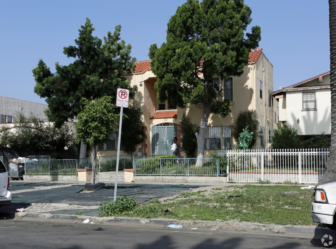
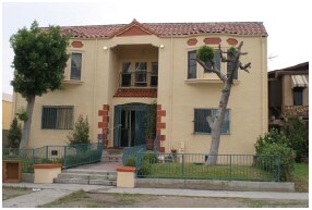
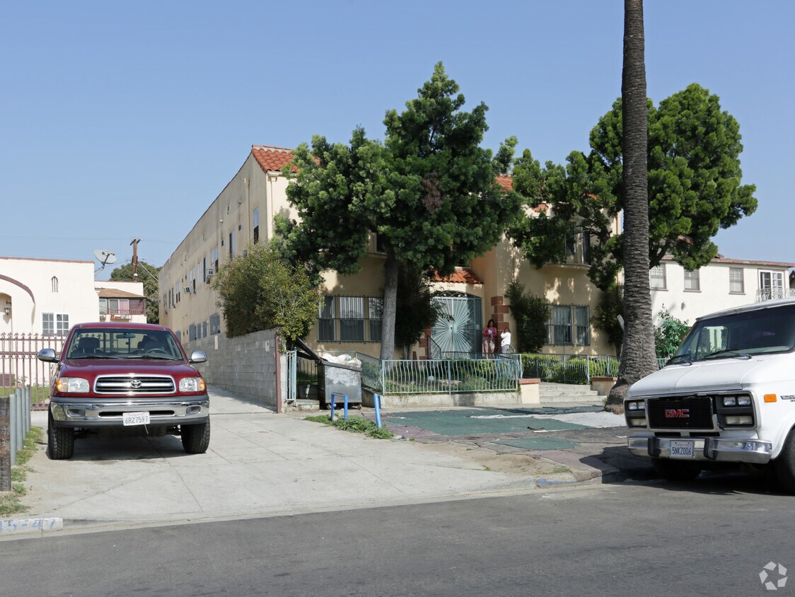

Explore your new apartment at Los Palos Apartments in Los Angeles, CA. The address for this community is on Browning Blvd in the 90037 area of Los Angeles. Be sure to check out the current floorplan options. Here at this community, the leasing staff is ready to match you with the perfect new place. Visit Los Palos Apartments today.
Los Palos Apartments is an apartment community located in Los Angeles County and the 90037 ZIP Code. This area is served by the Los Angeles Unified attendance zone.
Historic South-Central Los Angeles is a storied neighborhood in the South Los Angeles region. South LA is home to the University of Southern California, a top-ranking university founded in 1880, a close-knit community, and a rich past.
Renting an apartment in South Central LA places you in an active neighborhood near many LA hotspots. This neighborhood had one of America's first jazz scenes (often nicknamed the West Coast Harlem) and was home to Kid Ory, a famous trombonist, and bandleader. Today, South Central LA offers residents terrific proximity to downtown, USC, and a variety of historic sites in addition to numerous freeways.
Learn more about living in South Central LA| Colleges & Universities | Distance | ||
|---|---|---|---|
| Colleges & Universities | Distance | ||
| Drive: | 3 min | 1.5 mi | |
| Drive: | 5 min | 2.2 mi | |
| Drive: | 5 min | 2.3 mi | |
| Drive: | 7 min | 4.3 mi |


Transportation options available in Los Angeles include Expo/Vermont, located 0.5 mile from Los Palos Apartments. Los Palos Apartments is near Los Angeles International, located 10.3 miles or 19 minutes away, and Bob Hope, located 15.9 miles or 28 minutes away.
| Transit / Subway | Distance | ||
|---|---|---|---|
| Transit / Subway | Distance | ||
|
|
Walk: | 9 min | 0.5 mi |
|
|
Walk: | 15 min | 0.8 mi |
|
|
Drive: | 2 min | 1.7 mi |
|
|
Drive: | 3 min | 1.7 mi |
|
|
Drive: | 4 min | 2.2 mi |
| Commuter Rail | Distance | ||
|---|---|---|---|
| Commuter Rail | Distance | ||
|
|
Drive: | 10 min | 5.0 mi |
|
|
Drive: | 12 min | 5.3 mi |
| Drive: | 13 min | 9.0 mi | |
|
|
Drive: | 16 min | 10.7 mi |
|
|
Drive: | 19 min | 12.0 mi |
| Airports | Distance | ||
|---|---|---|---|
| Airports | Distance | ||
|
Los Angeles International
|
Drive: | 19 min | 10.3 mi |
|
Bob Hope
|
Drive: | 28 min | 15.9 mi |
Time and distance from Los Palos Apartments.
| Shopping Centers | Distance | ||
|---|---|---|---|
| Shopping Centers | Distance | ||
| Walk: | 2 min | 0.1 mi | |
| Walk: | 11 min | 0.6 mi | |
| Walk: | 15 min | 0.8 mi |
| Parks and Recreation | Distance | ||
|---|---|---|---|
| Parks and Recreation | Distance | ||
|
Natural History Museum of LA County
|
Walk: | 13 min | 0.7 mi |
|
Exposition Park Rose Garden
|
Walk: | 16 min | 0.9 mi |
|
California Science Center
|
Drive: | 3 min | 1.1 mi |
|
MacArthur Park Lake
|
Drive: | 8 min | 3.9 mi |
|
Augustus Hawkins Natural Park
|
Drive: | 7 min | 4.4 mi |
| Hospitals | Distance | ||
|---|---|---|---|
| Hospitals | Distance | ||
| Drive: | 6 min | 2.9 mi | |
| Drive: | 8 min | 4.2 mi | |
| Drive: | 8 min | 4.6 mi |
| Military Bases | Distance | ||
|---|---|---|---|
| Military Bases | Distance | ||
| Drive: | 18 min | 13.4 mi |
What Are Walk Score®, Transit Score®, and Bike Score® Ratings?
Walk Score® measures the walkability of any address. Transit Score® measures access to public transit. Bike Score® measures the bikeability of any address.
What is a Sound Score Rating?
A Sound Score Rating aggregates noise caused by vehicle traffic, airplane traffic and local sources

1041 Browning Blvd
Los Angeles, CA 90037


 - Violet on Virgil")


 - AVA Burbank")