
1213 Walnut
1213 Walnut St,
Philadelphia, PA 19107
$2,375 - $5,734
Studio - 2 Beds
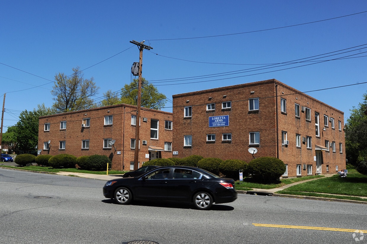

Experience Philadelphia living at Loretta Arms. This community is located on Faunce St. in Philadelphia. From location to floorplan options, the team of leasing professionals is ready to match you with your perfect new home. Come by to check out the apartment floorplan options. Get a head start on moving now. Contact or stop by Loretta Arms to find out the availability today!
Loretta Arms is an apartment community located in Philadelphia County and the 19111 ZIP Code. This area is served by the The School District of Philadelphia attendance zone.
Air Conditioning
Refrigerator
Heating
Oven
Located about 13 miles northeast of Center City, Rhawnhurst is a quiet, diverse residential neighborhood. Bordered by the natural beauty of Pennypack Creek, Rhawnhurst has a variety of townhouses, apartment buildings, and houses available for every budget for rent. Along with renowned schools, families love having access to recreational centers, parks, and plenty of amenities. Go shopping at Roosevelt Mall, savor authentic meals at global eateries along Cottman Avenue, or explore Pennypack Park, a lush creekside green space. Great for commuters looking for a calm retreat from the city, Center City is only a 25-minute drive away.
Learn more about living in RhawnhurstCompare neighborhood and city base rent averages by bedroom.
| Rhawnhurst | Philadelphia, PA | |
|---|---|---|
| Studio | $940 | $1,408 |
| 1 Bedroom | $1,213 | $1,765 |
| 2 Bedrooms | $1,539 | $2,205 |
| 3 Bedrooms | $1,674 | $2,932 |
| Colleges & Universities | Distance | ||
|---|---|---|---|
| Colleges & Universities | Distance | ||
| Drive: | 8 min | 4.6 mi | |
| Drive: | 10 min | 5.3 mi | |
| Drive: | 11 min | 5.9 mi | |
| Drive: | 14 min | 6.2 mi |


Transportation options available in Philadelphia include Frankford Transit Center, located 2.9 miles from Loretta Arms. Loretta Arms is near Philadelphia International, located 20.9 miles or 35 minutes away, and Trenton Mercer, located 22.8 miles or 37 minutes away.
| Transit / Subway | Distance | ||
|---|---|---|---|
| Transit / Subway | Distance | ||
| Drive: | 6 min | 2.9 mi | |
| Drive: | 7 min | 3.2 mi | |
|
|
Drive: | 8 min | 3.7 mi |
|
|
Drive: | 9 min | 4.6 mi |
| Drive: | 11 min | 5.3 mi |
| Commuter Rail | Distance | ||
|---|---|---|---|
| Commuter Rail | Distance | ||
|
|
Drive: | 3 min | 1.6 mi |
|
|
Drive: | 5 min | 2.2 mi |
|
|
Drive: | 5 min | 2.4 mi |
|
|
Drive: | 6 min | 3.0 mi |
|
|
Drive: | 8 min | 3.6 mi |
| Airports | Distance | ||
|---|---|---|---|
| Airports | Distance | ||
|
Philadelphia International
|
Drive: | 35 min | 20.9 mi |
|
Trenton Mercer
|
Drive: | 37 min | 22.8 mi |
Scores provided by
Traffic
-Airport
-Businesses
-Scores provided by
HowLoud What is a Sound Score Rating? A Sound Score Rating aggregates noise caused by vehicle traffic, airplane traffic and local sources. How It WorksTime and distance from Loretta Arms.
| Shopping Centers | Distance | ||
|---|---|---|---|
| Shopping Centers | Distance | ||
| Walk: | 9 min | 0.5 mi | |
| Walk: | 11 min | 0.6 mi | |
| Walk: | 12 min | 0.6 mi |
| Parks and Recreation | Distance | ||
|---|---|---|---|
| Parks and Recreation | Distance | ||
|
Pennypack Park
|
Drive: | 4 min | 1.7 mi |
|
Insectarium
|
Drive: | 6 min | 2.9 mi |
|
Tacony Creek Park
|
Drive: | 8 min | 3.7 mi |
|
Lorimer Park
|
Drive: | 10 min | 4.4 mi |
|
Palmyra Cove Nature Park and Environmental Discovery Center
|
Drive: | 14 min | 4.7 mi |
| Hospitals | Distance | ||
|---|---|---|---|
| Hospitals | Distance | ||
| Drive: | 4 min | 1.5 mi | |
| Drive: | 4 min | 2.1 mi | |
| Drive: | 7 min | 3.6 mi |
| Military Bases | Distance | ||
|---|---|---|---|
| Military Bases | Distance | ||
| Drive: | 27 min | 13.3 mi | |
| Drive: | 26 min | 13.9 mi |
What Are Walk Score®, Transit Score®, and Bike Score® Ratings?
Walk Score® measures the walkability of any address. Transit Score® measures access to public transit. Bike Score® measures the bikeability of any address.
What is a Sound Score Rating?
A Sound Score Rating aggregates noise caused by vehicle traffic, airplane traffic and local sources.

1901-1913 Faunce St
Philadelphia, PA 19111


