Median Age
53 Years
Largest Age Group
55-64 Years
Approximately 17% of Residents
Under 20
20%
Over 65
31%


Area Guide
Avg Rent
$2,864
Population
12,940
Renter Mix
12% Rent
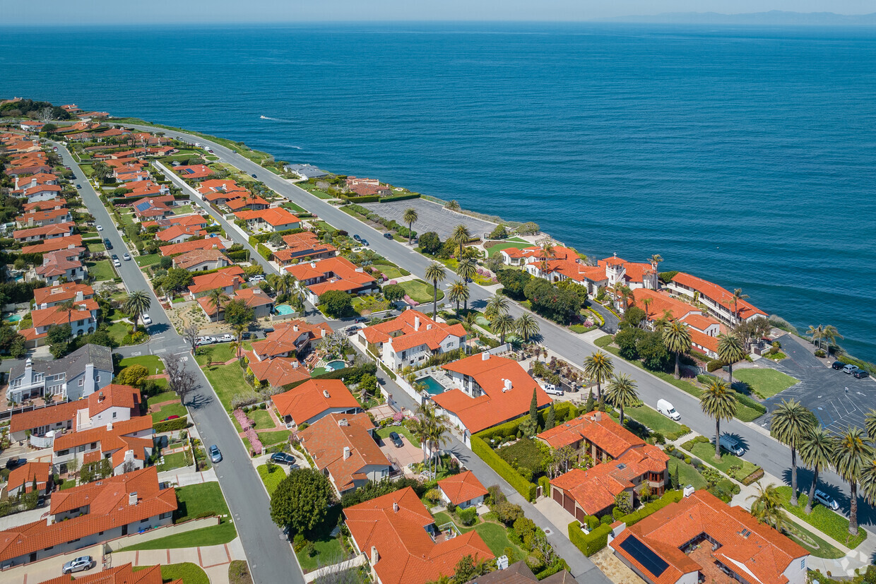
Perched on a dramatic bluff above the Pacific Ocean, Palos Verdes Estates is a master-planned coastal city in Los Angeles County where sweeping ocean views and carefully preserved open space define the character of everyday life. Designed in the early 20th century by renowned landscape architect Frederick Law Olmsted Jr., the city's curving streets, rolling hillsides, and protected greenbelts still reflect that original vision. Though small in size at just five square miles, the community offers a quietly refined atmosphere that feels worlds apart from the bustle of greater Los Angeles, while still keeping downtown LA and South Bay business corridors within a reasonable commute.
Palos Verdes Estates is almost entirely residential in character, anchored by two small neighborhood shopping centers rather than large commercial corridors. That intentional design keeps the pace of life unhurried. The city sits alongside neighboring communities Rancho Palos Verdes and Rolling Hills Estates, giving residents easy access to additional coastal trails, golf courses, and the broader peninsula lifestyle. The rental landscape here leans toward single-family homes, condominiums, and smaller apartment communities, many featuring architectural styles that echo the area's Spanish and Mediterranean influences. For those who value natural beauty, a strong sense of place, and proximity to the Southern California coast, Palos Verdes Estates is a genuinely compelling place to call home.
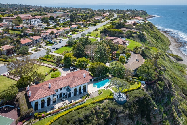
Jaw-dropping views can be found from Palos Verdes Estates, California.
Take selfies on the oceanside cliffs in Palos Verdes Estates.
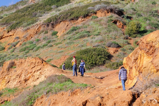
Go for hikes around the endless cliffside trails in Palos Verdes Estates, CA.
Ocean views are just outside your front door in Palos Verdes Estates, CA.
Get a taste of nature at Malaga Dunes in Palos Verdes Estates California.
Malaga Hills Hiking Trail in Palos Verdes Peninsula takes you up the hill for amazing views.
Median Household Income
$209,371
Average: $208,227
Education
7,926
Residents Have a Degree
Job Market
5,680
Workers Employed
Median Age
53 Years
Largest Age Group
55-64 Years
Approximately 17% of Residents
Under 20
20%
Over 65
31%
Housing Distribution
Palos Verdes Estates has more homeowners than renters.

Education Distribution
Review this city's overall education levels.

As of June 2026, the average apartment rent in Palos Verdes Estates, CA is $2,864 for one bedroom, $2,353 for two bedrooms, and $5,043 for three bedrooms. Apartment rent in Palos Verdes Estates has increased by 0.8% in the past year.
Explore how walkable, bikeable, drivable, and transit-friendly Palos Verdes Estates, CA is for everyday living.
Somewhat Walkable
Walkability
Limited Public Transit
Transit
Exceptionally Drivable
Drivability
Fairly Bikeable
Bikeability
Public
Grades K-5
416 Students

Public
Grades K-5
416 Students
Public
Grades K-5
329 Students
Public
Grades K-5
329 Students

Public
Grades 6-8
735 Students
Public
Grades 9-12
1,484 Students

Public
Grades 9-12
1,484 Students
† Our analysis of utilities, groceries, transportation, healthcare, home prices, and other goods and services is sourced from the Cost of Living Index, a respected benchmark published by the Council for Community and Economic Research (C2ER) that provides a thorough overview of living expenses across different regions.
Rent data is provided by CoStar Group’s Market Trend reports. As the industry leader in commercial real estate information, analytics, and news, CoStar conducts extensive research to produce and maintain a comprehensive database of commercial real estate information. We combine this data with public record to provide the most up-to-date rental information available.
Consumer goods, services, and home prices are sourced from the Cost of Living Index published by the Council for Community and Economic Research (C2ER). The data on this page is updated quarterly. It was last published in June 2026.
Demographic information comes from Neustar and combines detailed address data with U.S. Census and American Community Survey statistics to produce reliable local estimates.


