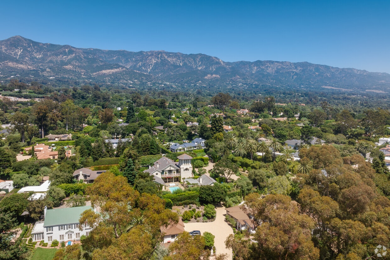
Montecito is located along the foothills of the Santa Ynez Mountains.
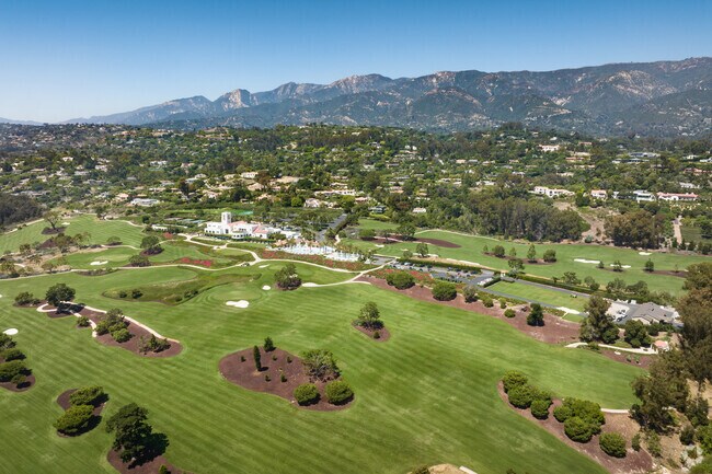
Montecito Club is a local country club and is a popular wedding venue.
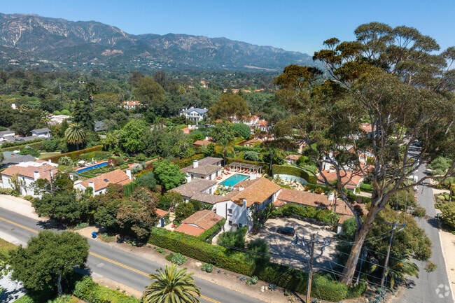
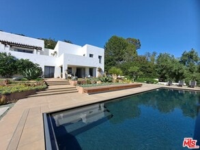
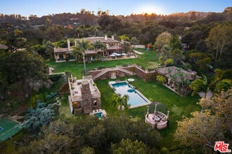
Large Spanish-style homes with private pools seen in Montecito.
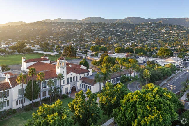
Santa Barbara Junior High School is housed in this gorgeous Mediterranean Revival complex, against the backdrop of the "Amerian Riviera."
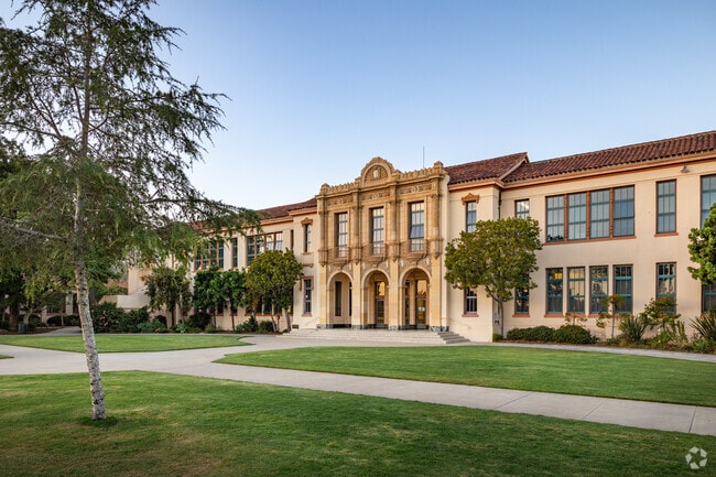
Santa Barbara Senior High School is an architectural gem with many athletic opportunities.

Montecito, CA Area Guide

A breathtaking enclave where the mountains meet the ocean

Beach Coastal Suburb

Tucked between the Santa Ynez Mountains and the Pacific Ocean, Montecito is an unincorporated coastal enclave where sprawling estates line tree-shaded streets and the beach is just minutes away. This census-designated community covers about 10 square miles on the eastern edge of Santa Barbara, and it carries a distinctly residential character.

Daily life centers on two compact village corridors -- Upper Village along San Ysidro Lane and Lower Village along Coast Village Road -- where residents find cafes, boutiques, and restaurants within easy reach. For broader dining, nightlife, and cultural offerings, downtown Santa Barbara is roughly five miles away. The name Montecito comes from archaic Spanish meaning "woodland" or "countryside" -- a fitting description of its lush, tree-canopied grounds.

Explore the City

Large Spanish-style homes with private pools seen in Montecito.

Santa Barbara Junior High School is housed in this gorgeous Mediterranean Revival complex, against the backdrop of the "Amerian Riviera."

Santa Barbara Senior High School is an architectural gem with many athletic opportunities.

Strolling down the boardwalk in nearby Santa Barbara.

Cycle down the pier at Stearns Wharf in nearby Santa Barbara.

Miramar Beach, the Four Seasons Biltmore Hotel, and the Coral Casino Beach & Cabana Club all lend to the beachy opulence of coastal Montecito.

Demographics

Median Household Income

$184,697

Average: $195,946

Education

5,393

Residents Have a Degree

Job Market

3,423

Workers Employed

Age Distribution
Get a sense of this area's population profile.

Median Age

51 Years

Largest Age Group

70-79 Years

Approximately 16% of Residents

Under 20

19%

Over 65

34%
Housing Distribution

Montecito has more homeowners than renters.

Renters
30%
Non-Renters
70%

Education Distribution

Review this city's overall education levels.

Bachelor's or Higher
54%
Other Education
46%

Learn More About Montecito

Getting Around

Somewhat Walkable

Walkability

20 / 100

Limited Public Transit

Transit

30 / 100

Exceptionally Drivable

Drivability

90 / 100

Somewhat Bikeable

Bikeability

30 / 100

Points of Interest

Parks and Recreation

  • Manning County Park
  • Ganna Walska Lotusland
  • Lookout County Park
  • Santa Barbara Zoo
  • Toro Canyon County Park

Airports

  • Santa Barbara Municipal

Top Apartments in Montecito

Houses for Rent in Montecito

Living in Montecito

History

-

Centuries before the estates arrived, the Chumash people inhabited the south coast of what is now Santa Barbara County, shaping the region for thousands of years. Montecito's modern identity began taking shape in the early 1900s, when industrialists arrived and commissioned estates. The George Owen Knapp estate dates to 1905, and the Oakleigh Thorne estate followed in 1917, designed by architect Francis W. Wilson. One of the most remarkable legacies of that era is Ganna Walska Lotusland, a 37-acre botanical garden created on the estate of Polish opera singer Ganna Walska. It opened to the public in 1993 and now welcomes visitors by reservation for guided tours through its extraordinary collection of themed gardens.

Restaurants

-

Dining in Montecito is spread across its two village centers, with Lower Village on Coast Village Road drawing the most foot traffic. Lucky's Steakhouse has been a cornerstone of that corridor for years. The Upper Village along San Ysidro Lane provides a quieter alternative, with Via Vai serving Italian fare alongside the casual Montecito Coffee Shop for everyday stops.

For a wider range of cuisines and price points, most residents head the short distance into Santa Barbara, where the options expand considerably.

Transportation

-

Getting around Montecito is primarily a matter of having a car. The community is spread out, and while each village center is walkable once you arrive, the distance between destinations and limited transit infrastructure makes driving the practical default for most daily trips. US-101 runs through the area and connects residents to downtown Santa Barbara in about five minutes and to Los Angeles roughly 90 miles to the south.

Amtrak service is accessible at the Santa Barbara station about five miles away and at the Carpinteria station roughly eight miles out, offering a car-free option for regional travel. Santa Barbara Municipal Airport is about 35 minutes away, and Los Angeles International Airport is approximately 90 miles down the coast.

Parks

-

Manning County Park sits less than a mile from the heart of the community and serves as a go-to spot for picnics, athletic fields, walking trails, and a playground. Just beyond it, Lookout County Park offers open space and coastal views, while Toro Canyon County Park, about five miles out, provides hiking trails through a natural landscape.

The San Ysidro Canyon trail system runs adjacent to the community and stretches nearly nine miles, accommodating hiking, horseback riding, and mountain biking. Los Padres National Forest borders the area to the north, offering hot springs, additional trails, and scenic viewpoints throughout the Santa Ynez Mountains. Butterfly Beach and Hammonds Beach are both minutes away, drawing residents to the shoreline for walks and sunset views.

Shopping

-

Both village districts that anchor daily life also anchor the shopping scene. Lower Village along Coast Village Road holds the Montecito Country Mart, a hub of boutiques and dining that draws residents and visitors alike. A weekly farmers market in the Lower Village adds a community-gathering dimension, with locally grown produce and artisan goods on offer.

Upper Village along San Ysidro Lane leans toward smaller boutiques and everyday needs, anchored by the Montecito Village Grocery for quick household staples. Plaza Del Sol Shopping Center and Montecito Village South and North round out the immediate retail options within roughly half a mile. For department stores, specialty retailers, and larger grocery chains, Santa Barbara's more extensive commercial corridors are a short drive away.

Highlights

-

A coastal enclave set between the Santa Ynez Mountains and the Pacific, Montecito offers Butterfly Beach and Hammonds Beach for shoreline access, nearly nine miles of San Ysidro Canyon trails for outdoor recreation, the world-class Ganna Walska Lotusland botanical garden for guided exploration, and two walkable village shopping corridors, all within five miles of downtown Santa Barbara.

Search Nearby Rentals

Methodology

† Our analysis of utilities, groceries, transportation, healthcare, home prices, and other goods and services is sourced from the Cost of Living Index, a respected benchmark published by the Council for Community and Economic Research (C2ER) that provides a thorough overview of living expenses across different regions.

Rent data is provided by CoStar Group’s Market Trend reports. As the industry leader in commercial real estate information, analytics, and news, CoStar conducts extensive research to produce and maintain a comprehensive database of commercial real estate information. We combine this data with public record to provide the most up-to-date rental information available.

Consumer goods, services, and home prices are sourced from the Cost of Living Index published by the Council for Community and Economic Research (C2ER). The data on this page is updated quarterly. It was last published in September 2026.

Demographic information comes from Neustar and combines detailed address data with U.S. Census and American Community Survey statistics to produce reliable local estimates.