
$4,500
/ Month
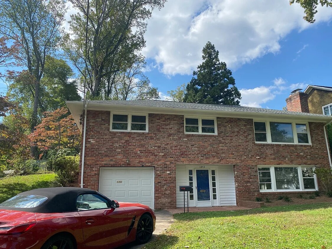
1453 Waggaman Cir
McLean, VA 22101
2 Weeks Ago
|
Edit
Favorites
1453 Waggaman Cir

Favorites
Check Back Soon for Upcoming Availability
| Beds | Baths | Average SF |
|---|---|---|
| 3 Bedrooms 3 Bedrooms 3 Br | 3 Baths 3 Baths 3 Ba | 1,550 SF |
About This Property
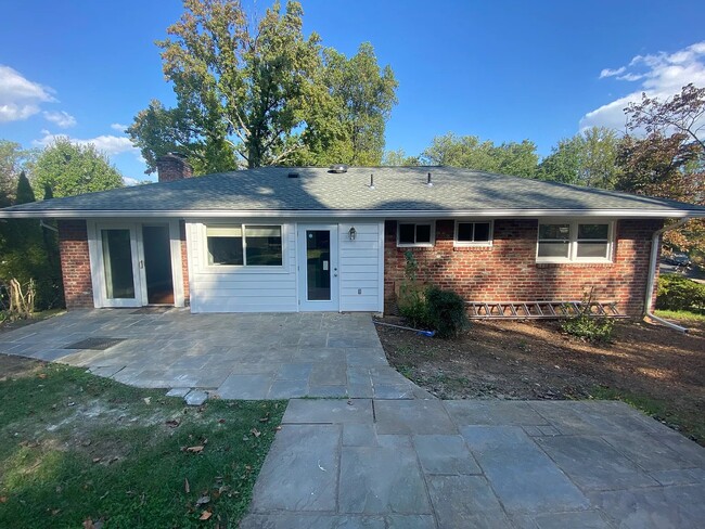
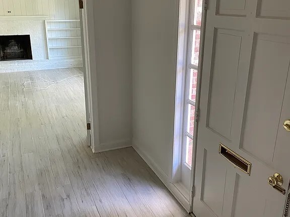
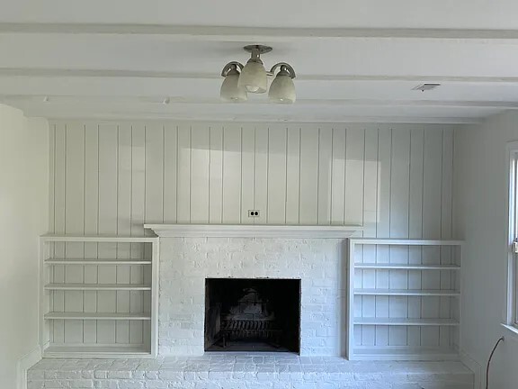
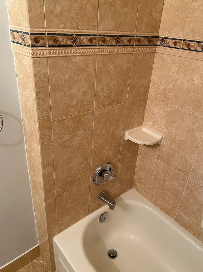
Charming 3+1 den which could be used as another bedroom) with ample day light , 2 fire places, updated kitchen and bathrooms, new roof, paint and resurfaced hardwood floor house located in downtown McLean at the prestigious Salona Village. The house sits on the top of a hill with a flag stone porch and sunny back yard with privacy. The property is minutes away from shops, restaurants and several grocery stores. Close access to Tyson's Silverline Metro and DC. The house is equipped with electricity, forced air, public water , central AC, one car garage with garage door opener, natural gas for heating, electricity for hot water and cooling, Internet . Schools: ES: Franklin Sherman MS: Longfellow HS: Mclean Date Available: Oct 10th 2024. $4,500/month rent. $4,500 security deposit required with good scores. Please submit the form on this page or contact Miss Armani at or to learn more. This property is managed by a responsible landlord using Avail landlord software.
1453 Waggaman Cir is a house located in Fairfax County and the 22101 ZIP Code. This area is served by the Fairfax County Public Schools attendance zone.
Location
Get Directions
McLean, Virginia combines suburban tranquility with convenient access to Washington, D.C. Located just minutes from the nation's capital, this Northern Virginia community spans nearly 25 square miles of tree-lined streets and established neighborhoods. The rental market offers a range of options, with average rents from $2,434 for studios to $5,156 for three-bedroom units.
McLean's outdoor spaces include Clemyjontri Park, featuring accessible playground equipment and recreational facilities. The community's location along the Potomac River provides opportunities for hiking and outdoor recreation, while shopping destinations like Tysons Corner Center and Tysons Galleria offer retail and dining options.
The Langley area houses the Central Intelligence Agency headquarters, and the recently completed Silver Line Metro station connects residents to the greater Washington metropolitan area. McLean's downtown area features locally owned shops and restaurants.
Learn more about living in McLean
Education
| Colleges & Universities | Distance | ||
|---|---|---|---|
| Colleges & Universities | Distance | ||
| Drive: | 12 min | 4.6 mi | |
| Drive: | 15 min | 6.4 mi | |
| Drive: | 18 min | 6.8 mi | |
| Drive: | 15 min | 6.9 mi |
1453 Waggaman Cir is within 12 minutes or 4.6 miles from Marymount University. It is also near GWU, Mount Vernon and George Mason Univ., Arlington.
Schools


Public Elementary School
Grades PK-6
337 Students
Attendance Zone
Public Middle School
Grades 7-8
1,225 Students
Attendance Zone
Public High School
Grades 9-12
2,441 Students
Attendance Zone
Private Elementary School
Grades K
Nearby
Private Elementary & Middle School
Grades PK-8
178 Students
Nearby
School data provided by
 The GreatSchools Rating helps parents compare schools within a state based on a variety of school quality indicators and provides a helpful picture of how effectively each school serves all of its students. Ratings are on a scale of 1 (below average) to 10 (above average) and can include test scores, college readiness, academic progress, advanced courses, equity, discipline and attendance data. We also advise parents to visit schools, consider other information on school performance and programs, and consider family needs as part of the school selection process.
View GreatSchools Rating Methodology
Data provided by GreatSchools.org © 2025. All rights reserved.
View GreatSchools Rating Methodology
Data provided by GreatSchools.org © 2025. All rights reserved.
Transportation options available in McLean include Mclean, located 3.2 miles from 1453 Waggaman Cir. 1453 Waggaman Cir is near Ronald Reagan Washington Ntl, located 13.1 miles or 25 minutes away, and Washington Dulles International, located 17.8 miles or 32 minutes away.
| Transit / Subway | Distance | ||
|---|---|---|---|
| Transit / Subway | Distance | ||
|
|
Drive: | 8 min | 3.2 mi |
|
|
Drive: | 10 min | 4.1 mi |
|
|
Drive: | 12 min | 5.5 mi |
|
|
Drive: | 20 min | 8.6 mi |
|
|
Drive: | 23 min | 12.2 mi |
| Commuter Rail | Distance | ||
|---|---|---|---|
| Commuter Rail | Distance | ||
|
|
Drive: | 22 min | 11.6 mi |
|
|
Drive: | 22 min | 12.0 mi |
|
|
Drive: | 26 min | 12.5 mi |
|
|
Drive: | 27 min | 13.0 mi |
|
|
Drive: | 25 min | 13.9 mi |
| Airports | Distance | ||
|---|---|---|---|
| Airports | Distance | ||
|
Ronald Reagan Washington Ntl
|
Drive: | 25 min | 13.1 mi |
|
Washington Dulles International
|
Drive: | 32 min | 17.8 mi |
Time and distance from 1453 Waggaman Cir.
| Shopping Centers | Distance | ||
|---|---|---|---|
| Shopping Centers | Distance | ||
| Walk: | 17 min | 0.9 mi | |
| Drive: | 4 min | 1.2 mi | |
| Drive: | 5 min | 1.3 mi |
1453 Waggaman Cir has 3 shopping centers within 1.3 miles, which is about a 5-minute walk. The miles and minutes will be for the farthest away property.
| Parks and Recreation | Distance | ||
|---|---|---|---|
| Parks and Recreation | Distance | ||
|
Clemyjontri Park
|
Drive: | 6 min | 2.5 mi |
|
Claude Moore Colonial Farm
|
Drive: | 9 min | 2.9 mi |
|
Rock Spring Park
|
Drive: | 10 min | 4.0 mi |
|
Lyndon Baines Johnson Memorial Grove
|
Drive: | 11 min | 5.5 mi |
|
George Washington Memorial Parkway/Turkey Run Park
|
Drive: | 13 min | 5.7 mi |
1453 Waggaman Cir has 5 parks within 5.7 miles, including Clemyjontri Park, Claude Moore Colonial Farm, and Rock Spring Park.
| Hospitals | Distance | ||
|---|---|---|---|
| Hospitals | Distance | ||
| Drive: | 14 min | 5.4 mi | |
| Drive: | 15 min | 5.9 mi | |
| Drive: | 13 min | 6.2 mi |
1453 Waggaman Cir has 3 hospitals within 6.2 miles, the nearest is Virginia Hospital Center which is 5.4 miles away and a 14 minute drive.
| Military Bases | Distance | ||
|---|---|---|---|
| Military Bases | Distance | ||
| Drive: | 19 min | 8.5 mi |
1453 Waggaman Cir is 8.5 miles and a 19 minute drive from Naval Observatory.
You May Also Like
Similar Rentals Nearby


What Are Walk Score®, Transit Score®, and Bike Score® Ratings?
Walk Score® measures the walkability of any address. Transit Score® measures access to public transit. Bike Score® measures the bikeability of any address.
What is a Sound Score Rating?
A Sound Score Rating aggregates noise caused by vehicle traffic, airplane traffic and local sources

1453 Waggaman Cir
McLean, VA 22101