

$1,400
/ Month
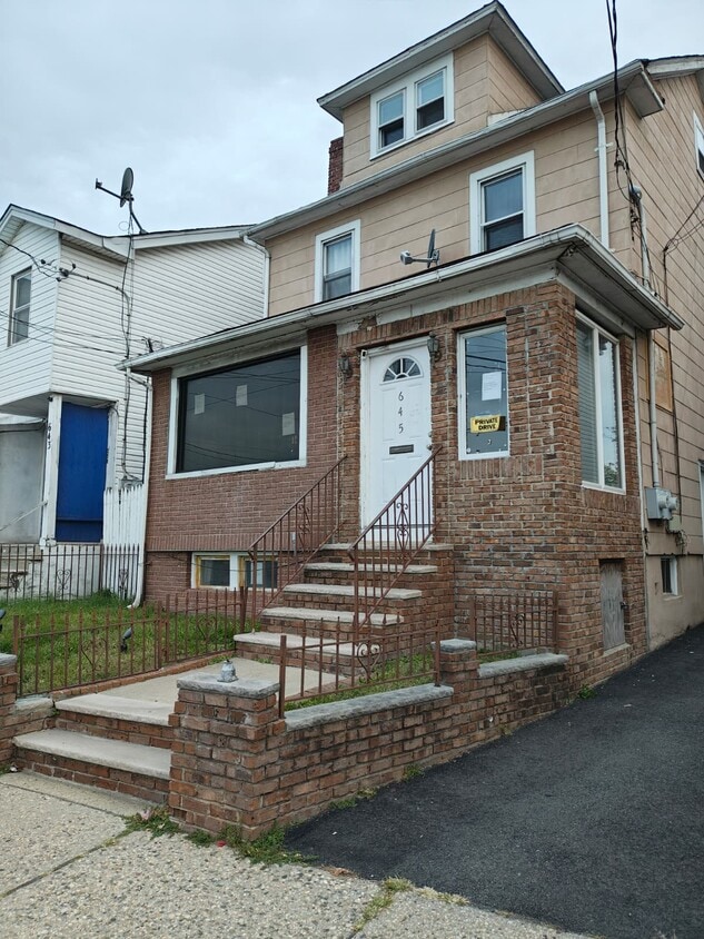
645 E St Georges Ave
Roselle, NJ 07203
Today
|
Edit
Favorites
718-283-4760
-
Bedrooms
1
-
Bathrooms
1
-
Square Feet
--
-
Available
Available Now
645 E St Georges Ave

Favorites
About This Home
$2,100 deposit,
Available Now
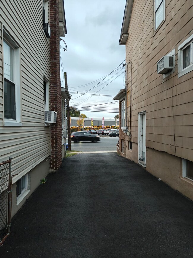
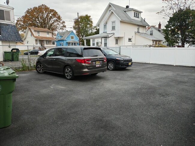
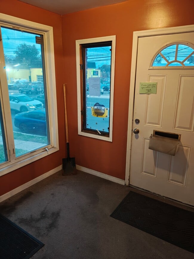
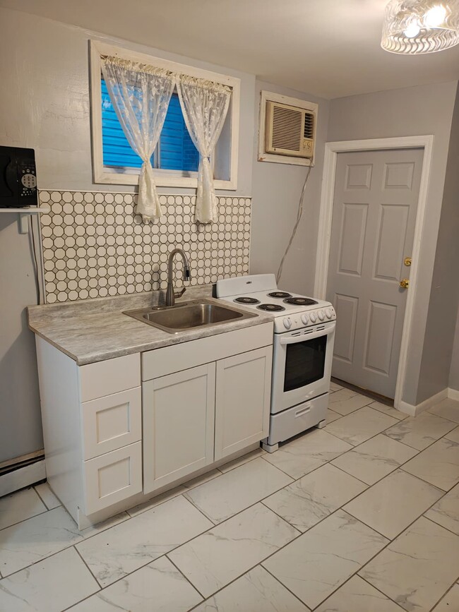
Basment Studio For Rent – 645 E St Georges Ave, Roselle, NJ Spacious home featuring 32 bedrooms and 1 bathroom on the main floor. Includes a large private parking lot in the back. Conveniently located near shops, schools, and Warinanco Park, with easy access to public transportation and major highways — perfect for families or professionals looking for comfort and convenience.
645 E St Georges Ave is a house located in Union County and the 07203 ZIP Code. This area is served by the Roselle Public attendance zone.
* Price shown is base rent. Excludes user-selected optional fees and variable or usage-based fees and required charges due at or prior to move-in or at move-out. Price, availability, fees, and any applicable rent special are subject to change without notice.
* Square footage definitions vary. Displayed square footage is approximate.
Fees and Policies
The fees below are based on community-supplied data and may exclude additional fees and utilities.
- One-Time Basics
- Due at Move-In
- Security Deposit - Refundable$2,100
- Due at Move-In
Property Fee Disclaimer: Based on community-supplied data and independent market research. Subject to change without notice. May exclude fees for mandatory or optional services and usage-based utilities.
Contact
- Listed by Dovid Leman
- Phone Number
- Contact
Location
Get Directions
Ideally located about 10 miles southwest of Newark and 18 miles from New York City, Roselle is a cozy borough for those looking for a quieter place to call home. First settled around 1664, Roselle was settled by farmers looking for better farmland. It was part of the first New Jersey settlement called Elizabethtown. The borough was officially incorporated in 1894 as Roselle.
Today, this terrific community features beautiful parks and great shopping. Warinanco Park, the borough's largest park, offers ball fields, a running track, a playground, pedal boats, an ice skating rink, a fitness trail, a bicycle path, fishing, a spray pool, tennis courts, picnic areas, and shuffleboard. Roselle's tree-lined streets are mainly residential, with a shopping district located between Westfield Avenue and West 1st Avenue.
Learn more about living in Roselle
Education
| Colleges & Universities | Distance | ||
|---|---|---|---|
| Colleges & Universities | Distance | ||
| Drive: | 7 min | 2.9 mi | |
| Drive: | 9 min | 3.7 mi | |
| Drive: | 14 min | 5.1 mi | |
| Drive: | 16 min | 9.0 mi |
645 E St Georges Ave is within 7 minutes or 2.9 miles from Union County Coll., Elizabeth. It is also near Kean University and Union County College, Cranford.
Schools


Public Elementary School
Grades PK & 1-4
301 Students
Attendance Zone
Public Elementary School
Grades K
200 Students
Attendance Zone
Public Elementary School
Grades 5-6
436 Students
Attendance Zone
Public Elementary School
Grades PK-5
290 Students
Nearby
Public Middle School
Grades 7-8
435 Students
Attendance Zone
Public High School
Grades 9-12
884 Students
Attendance Zone
Private Elementary School
Grades PK-6
Nearby
Private Elementary & Middle School
Grades PK-8
199 Students
Nearby
Private High School
Grades 9-12
354 Students
Nearby
School data provided by
 The GreatSchools Rating helps parents compare schools within a state based on a variety of school quality indicators and provides a helpful picture of how effectively each school serves all of its students. Ratings are on a scale of 1 (below average) to 10 (above average) and can include test scores, college readiness, academic progress, advanced courses, equity, discipline and attendance data. We also advise parents to visit schools, consider other information on school performance and programs, and consider family needs as part of the school selection process.
View GreatSchools Rating Methodology
Data provided by GreatSchools.org © 2025. All rights reserved.
View GreatSchools Rating Methodology
Data provided by GreatSchools.org © 2025. All rights reserved.
Transportation options available in Roselle include Military Park, located 9.5 miles from 645 E St Georges Ave. 645 E St Georges Ave is near Newark Liberty International, located 10.0 miles or 18 minutes away, and LaGuardia, located 32.0 miles or 51 minutes away.
| Transit / Subway | Distance | ||
|---|---|---|---|
| Transit / Subway | Distance | ||
|
|
Drive: | 16 min | 9.5 mi |
|
|
Drive: | 16 min | 10.0 mi |
|
|
Drive: | 17 min | 10.5 mi |
| Drive: | 18 min | 10.6 mi | |
|
|
Drive: | 19 min | 11.8 mi |
| Commuter Rail | Distance | ||
|---|---|---|---|
| Commuter Rail | Distance | ||
|
|
Drive: | 3 min | 1.5 mi |
|
|
Drive: | 6 min | 2.3 mi |
|
|
Drive: | 8 min | 3.0 mi |
|
|
Drive: | 8 min | 3.4 mi |
|
|
Drive: | 8 min | 4.0 mi |
| Airports | Distance | ||
|---|---|---|---|
| Airports | Distance | ||
|
Newark Liberty International
|
Drive: | 18 min | 10.0 mi |
|
LaGuardia
|
Drive: | 51 min | 32.0 mi |
Time and distance from 645 E St Georges Ave.
| Shopping Centers | Distance | ||
|---|---|---|---|
| Shopping Centers | Distance | ||
| Walk: | 18 min | 0.9 mi | |
| Drive: | 4 min | 1.3 mi | |
| Drive: | 3 min | 1.4 mi |
645 E St Georges Ave has 3 shopping centers within 1.4 miles, which is about a 3-minute walk. The miles and minutes will be for the farthest away property.
| Parks and Recreation | Distance | ||
|---|---|---|---|
| Parks and Recreation | Distance | ||
|
Hawk Rise Sanctuary
|
Drive: | 9 min | 3.9 mi |
|
William Miller Sperry Observatory
|
Drive: | 12 min | 5.0 mi |
|
Merrill Park
|
Drive: | 13 min | 5.6 mi |
|
Liberty State Park
|
Drive: | 14 min | 6.6 mi |
|
Staten Island Industrial Park
|
Drive: | 13 min | 8.0 mi |
645 E St Georges Ave has 5 parks within 8.0 miles, including Hawk Rise Sanctuary, William Miller Sperry Observatory, and Merrill Park.
| Hospitals | Distance | ||
|---|---|---|---|
| Hospitals | Distance | ||
| Drive: | 7 min | 2.8 mi | |
| Drive: | 7 min | 3.1 mi | |
| Drive: | 14 min | 6.5 mi |
645 E St Georges Ave has 3 hospitals within 6.5 miles, the nearest is Trinitas Regional Medical Center which is 2.8 miles away and a 7 minute drive.
| Military Bases | Distance | ||
|---|---|---|---|
| Military Bases | Distance | ||
| Drive: | 16 min | 6.0 mi | |
| Drive: | 14 min | 6.4 mi | |
| Drive: | 23 min | 14.9 mi |
645 E St Georges Ave has 3 military bases within 14.9 miles, the nearest is Tamdques Reservation which is 6.0 miles away and a 16 minute drive.
You May Also Like
Similar Rentals Nearby


What Are Walk Score®, Transit Score®, and Bike Score® Ratings?
Walk Score® measures the walkability of any address. Transit Score® measures access to public transit. Bike Score® measures the bikeability of any address.
What is a Sound Score Rating?
A Sound Score Rating aggregates noise caused by vehicle traffic, airplane traffic and local sources
645 E St Georges Ave
Roselle, NJ 07203