

$4,000
/ Month
1841 SW 29th Ave
Miami, FL 33145
Today
|
Edit
Favorites
561-897-6475
-
Bedrooms
3
-
Bathrooms
2
-
Square Feet
3,460 sq ft
-
Available
Available Now
1841 SW 29th Ave

Favorites
About This Home
Available Now
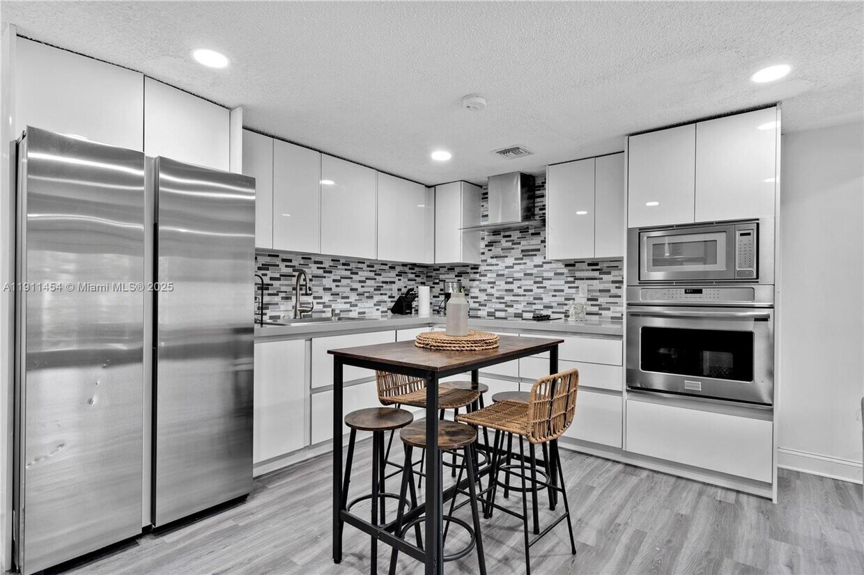
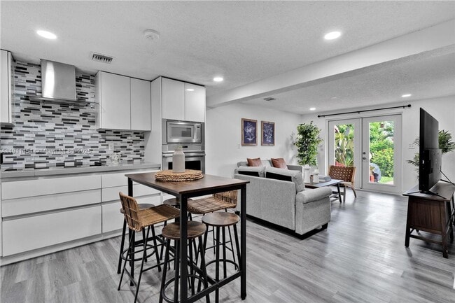
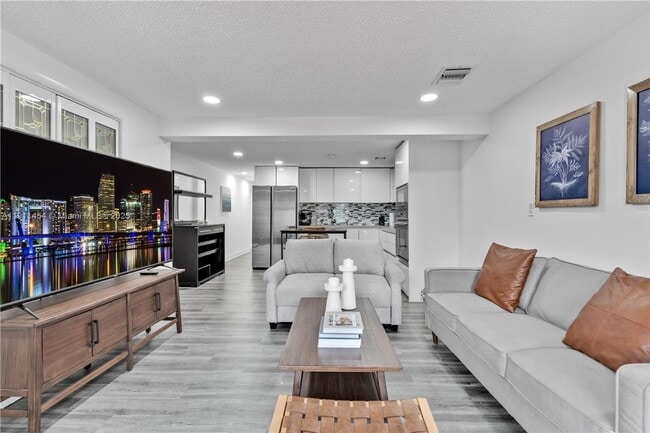
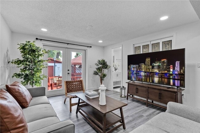
Courtesy of Luxe Properties Posted by Andrew Coleman with EXP Realty . Move-in ready and fully furnished! This charming 3-bedroom, 2-bath home offers comfort and convenience from day one. Featuring stylish furnishings, a spacious layout, and a welcoming atmosphere, this property is perfect for those seeking a turnkey home. Just bring your suitcase--everything you need is already here!
Unique Features
- All Kitchen Appliances
1841 SW 29th Ave is a house located in Miami/Dade County and the 33145 ZIP Code. This area is served by the Miami-Dade County Public Schools attendance zone.
* Price shown is base rent. Excludes user-selected optional fees and variable or usage-based fees and required charges due at or prior to move-in or at move-out. Price, availability, fees, and any applicable rent special are subject to change without notice.
* Square footage definitions vary. Displayed square footage is approximate.
Contact
- Listed by Drew
- Phone Number
- Contact
Location
Get Directions
Amenities
- All Kitchen Appliances
Located just southwest of Brickell, Coral Way is a charming neighborhood brimming with historic character and banyan-tree-lined streets. Coral Way blends residential tranquility with commercial convenience, offering a variety of luxury apartments and condos available for rent, as well as a host of restaurants, markets, and shops on several major thoroughfares.
In addition to its unique charm, Coral Way is revered for its central location between Downtown Miami, Brickell, Coconut Grove, and Coral Gables. Residents enjoy quick access to desirable amenities such as the Venetian Pool, Vizcaya Museum and Gardens, the Shops at Merrick Park, the University of Miami, Historic Virginia Key Beach Park, and Crandon Park. Commuting from Coral Way is a breeze with access to the Metrorail, Interstate 95, and U.S. Route 1.
Learn more about living in Coral Way
Education
| Colleges & Universities | Distance | ||
|---|---|---|---|
| Colleges & Universities | Distance | ||
| Drive: | 2 min | 1.1 mi | |
| Drive: | 4 min | 1.8 mi | |
| Drive: | 9 min | 4.0 mi | |
| Drive: | 10 min | 4.4 mi |
1841 SW 29th Ave is within 2 minutes or 1.1 miles from Miami Dade Coll., InterAm.. It is also near USAHS and Univ. of Miami, Uhealth.
Schools


Public Elementary & Middle School
Grades PK-8
862 Students
Attendance Zone
Public Middle School
Grades 6-8
888 Students
Attendance Zone
Public High School
Grades 9-12
2,824 Students
Attendance Zone
Private Elementary School
Grades K-3
50 Students
Nearby
Private Elementary & Middle School
Grades 4-8
80 Students
Nearby
Private Elementary & High School
Grades 3-6 & 9-11
Nearby
Private Elementary, Middle & High School
Grades PK-12
Nearby
School data provided by
 The GreatSchools Rating helps parents compare schools within a state based on a variety of school quality indicators and provides a helpful picture of how effectively each school serves all of its students. Ratings are on a scale of 1 (below average) to 10 (above average) and can include test scores, college readiness, academic progress, advanced courses, equity, discipline and attendance data. We also advise parents to visit schools, consider other information on school performance and programs, and consider family needs as part of the school selection process.
View GreatSchools Rating Methodology
Data provided by GreatSchools.org © 2025. All rights reserved.
View GreatSchools Rating Methodology
Data provided by GreatSchools.org © 2025. All rights reserved.
Transportation options available in Miami include Financial District, located 3.6 miles from 1841 SW 29th Ave. 1841 SW 29th Ave is near Miami International, located 10.1 miles or 20 minutes away, and Fort Lauderdale/Hollywood International, located 26.4 miles or 38 minutes away.
| Transit / Subway | Distance | ||
|---|---|---|---|
| Transit / Subway | Distance | ||
|
|
Drive: | 8 min | 3.6 mi |
|
|
Drive: | 8 min | 3.6 mi |
|
|
Drive: | 8 min | 3.8 mi |
|
|
Drive: | 8 min | 3.9 mi |
|
|
Drive: | 9 min | 4.0 mi |
| Commuter Rail | Distance | ||
|---|---|---|---|
| Commuter Rail | Distance | ||
|
|
Drive: | 2 min | 1.2 mi |
|
|
Drive: | 5 min | 2.4 mi |
|
|
Drive: | 6 min | 3.2 mi |
|
|
Drive: | 9 min | 3.8 mi |
|
|
Drive: | 8 min | 3.9 mi |
| Airports | Distance | ||
|---|---|---|---|
| Airports | Distance | ||
|
Miami International
|
Drive: | 20 min | 10.1 mi |
|
Fort Lauderdale/Hollywood International
|
Drive: | 38 min | 26.4 mi |
Time and distance from 1841 SW 29th Ave.
| Shopping Centers | Distance | ||
|---|---|---|---|
| Shopping Centers | Distance | ||
| Walk: | 8 min | 0.4 mi | |
| Walk: | 12 min | 0.6 mi | |
| Walk: | 14 min | 0.8 mi |
1841 SW 29th Ave has 3 shopping centers within 0.8 mile, which is about a 14-minute walk. The miles and minutes will be for the farthest away property.
| Parks and Recreation | Distance | ||
|---|---|---|---|
| Parks and Recreation | Distance | ||
|
The Barnacle Historic State Park
|
Drive: | 5 min | 2.3 mi |
|
Miami Science Museum - Closed
|
Drive: | 6 min | 2.7 mi |
|
Vizcaya Museum and Gardens
|
Drive: | 8 min | 2.9 mi |
|
The Kampong
|
Drive: | 7 min | 3.5 mi |
|
Gifford Arboretum
|
Drive: | 9 min | 4.6 mi |
1841 SW 29th Ave has 5 parks within 4.6 miles, including The Barnacle Historic State Park, Miami Science Museum - Closed, and Vizcaya Museum and Gardens.
| Hospitals | Distance | ||
|---|---|---|---|
| Hospitals | Distance | ||
| Drive: | 8 min | 3.9 mi | |
| Drive: | 7 min | 4.1 mi | |
| Drive: | 10 min | 4.1 mi |
1841 SW 29th Ave has 3 hospitals within 4.1 miles, the nearest is Jackson Health System which is 3.9 miles away and a 8 minute drive.
You May Also Like
Similar Rentals Nearby


What Are Walk Score®, Transit Score®, and Bike Score® Ratings?
Walk Score® measures the walkability of any address. Transit Score® measures access to public transit. Bike Score® measures the bikeability of any address.
What is a Sound Score Rating?
A Sound Score Rating aggregates noise caused by vehicle traffic, airplane traffic and local sources

1841 SW 29th Ave
Miami, FL 33145