
Skyline On Stokes
2132 Stokes Blvd,
Cleveland, OH 44106
$1,199 - $3,395
Studio - 2 Beds

At Liberty Fairchild Apartments in Cleveland, OH, you've discovered your new home. The 10820-10822 Carnegie Ave location in Cleveland's 44106 Zip code is an ideal place for residents. Here at this community, the community staff is ready to match you with your new home. Be sure to come for a visit to check out the current floorplan options. Drop by to schedule a tour.
Liberty Fairchild Apartments is an apartment community located in Cuyahoga County and the 44106 ZIP Code. This area is served by the Cleveland Metropolitan attendance zone.
High Speed Internet Access
Tub/Shower
Smoke Free
Heating
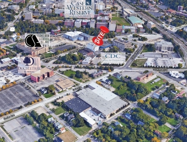
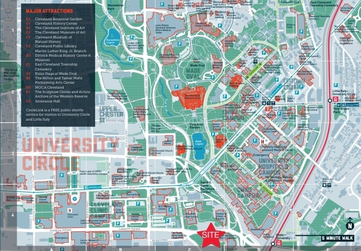
The upbeat neighborhood of University Circle houses world-renowned museums, prestigious universities, locally owned restaurants, and numerous community parks. This area is appealing, affordable, and exciting for potential renters. Just five miles from downtown Cleveland, University Circle is conveniently located and offers public transportation that will take you straight to downtown and wherever else you need to go in the surrounding area.
Case Western Reserve University, Cleveland Institute of Music, and Cleveland Institute of Art reside in University Circle. These highly rated universities bring a warm, college town feel to the neighborhood. History is easy to find, and there are multiple museums to visit. The Cleveland Museum of Art and the Cleveland Museum of Natural History are two tourist attractions and local gems in University Circle.
Learn more about living in University Circle| Colleges & Universities | Distance | ||
|---|---|---|---|
| Colleges & Universities | Distance | ||
| Walk: | 14 min | 0.7 mi | |
| Drive: | 3 min | 1.2 mi | |
| Drive: | 3 min | 1.2 mi | |
| Drive: | 9 min | 3.7 mi |

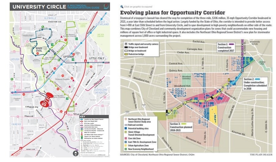
Transportation options available in Cleveland include Cedar - University, located 0.3 mile from Liberty Fairchild Apartments. Liberty Fairchild Apartments is near Cleveland-Hopkins International, located 16.7 miles or 30 minutes away.
| Transit / Subway | Distance | ||
|---|---|---|---|
| Transit / Subway | Distance | ||
|
|
Walk: | 5 min | 0.3 mi |
|
|
Walk: | 14 min | 0.8 mi |
| Drive: | 4 min | 1.3 mi | |
|
|
Drive: | 3 min | 1.6 mi |
|
|
Drive: | 5 min | 2.1 mi |
| Commuter Rail | Distance | ||
|---|---|---|---|
| Commuter Rail | Distance | ||
|
|
Drive: | 16 min | 5.9 mi |
| Drive: | 21 min | 10.7 mi | |
| Drive: | 23 min | 12.5 mi | |
| Drive: | 31 min | 18.3 mi | |
|
Boston Mill
|
Drive: | 38 min | 23.4 mi |
| Airports | Distance | ||
|---|---|---|---|
| Airports | Distance | ||
|
Cleveland-Hopkins International
|
Drive: | 30 min | 16.7 mi |
Time and distance from Liberty Fairchild Apartments.
| Shopping Centers | Distance | ||
|---|---|---|---|
| Shopping Centers | Distance | ||
| Drive: | 4 min | 1.2 mi | |
| Drive: | 4 min | 1.4 mi | |
| Drive: | 4 min | 1.8 mi |
| Parks and Recreation | Distance | ||
|---|---|---|---|
| Parks and Recreation | Distance | ||
|
Children's Museum of Cleveland
|
Walk: | 6 min | 0.4 mi |
|
Cleveland Botanical Garden
|
Walk: | 17 min | 0.9 mi |
|
Cleveland Museum of Natural History
|
Drive: | 3 min | 1.3 mi |
|
Nature Center at Shaker Lakes
|
Drive: | 6 min | 2.8 mi |
|
Ohio & Erie Canal Reservation
|
Drive: | 12 min | 6.0 mi |
| Hospitals | Distance | ||
|---|---|---|---|
| Hospitals | Distance | ||
| Walk: | 12 min | 0.7 mi | |
| Walk: | 12 min | 0.7 mi | |
| Walk: | 14 min | 0.8 mi |
| Military Bases | Distance | ||
|---|---|---|---|
| Military Bases | Distance | ||
| Drive: | 104 min | 85.5 mi | |
| Drive: | 107 min | 86.7 mi |
What Are Walk Score®, Transit Score®, and Bike Score® Ratings?
Walk Score® measures the walkability of any address. Transit Score® measures access to public transit. Bike Score® measures the bikeability of any address.
What is a Sound Score Rating?
A Sound Score Rating aggregates noise caused by vehicle traffic, airplane traffic and local sources

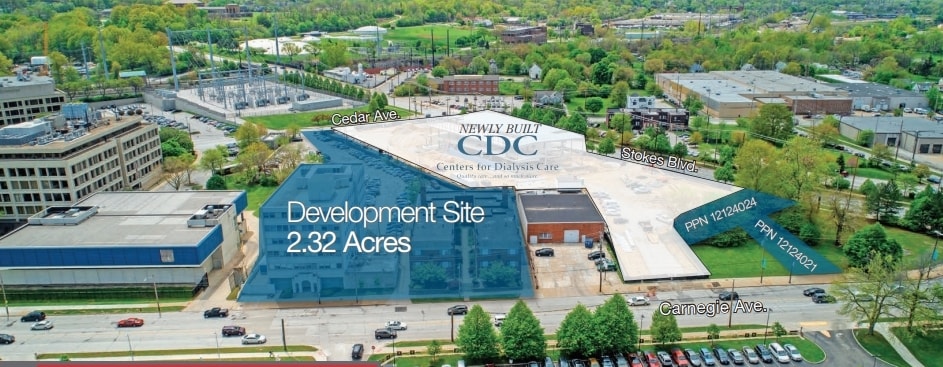
10820-10822 Carnegie Ave
Cleveland, OH 44106


")


