
19 East
19 E 19th St,
Bayonne, NJ 07002
$2,200 - $3,200 Total Monthly Price
Studio - 2 Beds
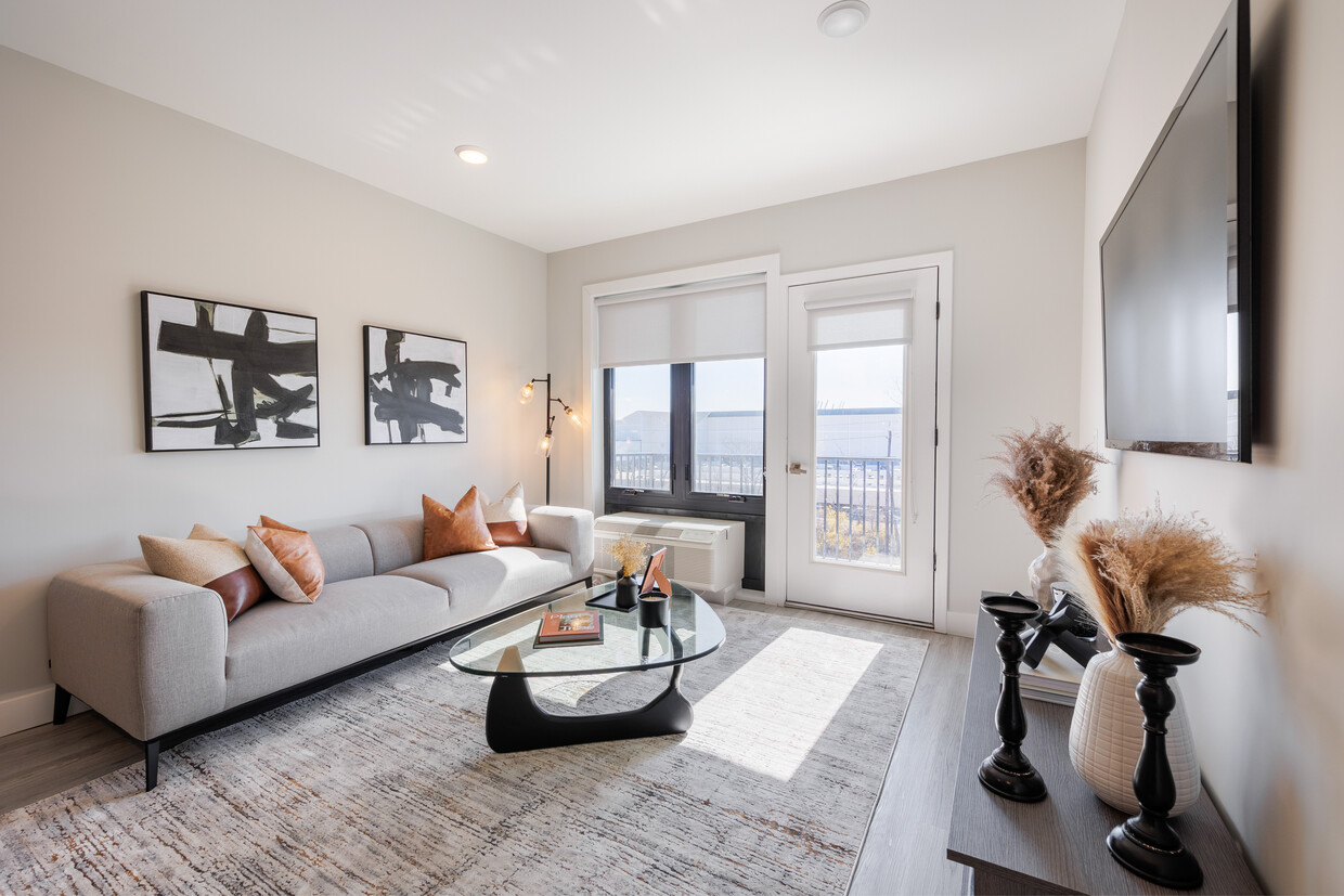

LARGEST UNITS IN BAYONNE! Legacy Lofts in Bayonne offers modern, bright oversized homes including 1 bedroom + dens, 2 bedrooms + dens, and unique duplex 2 bedroom + dens with additional loft and home office space. These no-fee luxury rentals also feature state-of-the-art appliances, high ceilings and stunning city views.
Legacy Lofts is an apartment community located in Hudson County and the 07002 ZIP Code. This area is served by the Bayonne School District attendance zone.
Unique Features
Fitness Center
Doorman
Roof Terrace
Controlled Access
Air Conditioning
Dishwasher
Refrigerator
Tub/Shower
Bayonne sits on a narrow peninsula between Newark Bay and New York Harbor, giving it a geography that shapes nearly everything about daily life here. The city occupies just 12 square miles, yet it carries a distinct identity rooted in maritime history, close-knit blocks, and an increasingly sought-after position within the broader New York metro. A well-connected Hudson-Bergen Light Rail system with stops at 8th, 22nd, 34th, and 45th Streets makes Jersey City and Hoboken straightforward commutes, while the Bayonne Bridge links the city to Staten Island.
Neighborhoods range from the historic streets of Bergen Point near the southern tip to the waterfront development at Peninsula at Bayonne Harbor, where the former Military Ocean Terminal has been reimagined as a residential and recreational destination. The Uptown area around 34th Street anchors everyday commerce, while Broadway serves as the city's main corridor throughout.
Learn more about living in Bayonne| Colleges & Universities | Distance | ||
|---|---|---|---|
| Colleges & Universities | Distance | ||
| Drive: | 7 min | 2.9 mi | |
| Drive: | 9 min | 5.6 mi | |
| Drive: | 10 min | 5.7 mi | |
| Drive: | 19 min | 8.6 mi |


Transportation options available in Bayonne include 34Th Street, located 0.5 mile from Legacy Lofts. Legacy Lofts is near Newark Liberty International, located 5.5 miles or 9 minutes away, and LaGuardia, located 17.9 miles or 35 minutes away.
| Transit / Subway | Distance | ||
|---|---|---|---|
| Transit / Subway | Distance | ||
|
|
Walk: | 9 min | 0.5 mi |
|
|
Drive: | 3 min | 1.2 mi |
|
|
Drive: | 4 min | 1.7 mi |
|
|
Drive: | 4 min | 1.7 mi |
|
|
Drive: | 5 min | 2.3 mi |
| Commuter Rail | Distance | ||
|---|---|---|---|
| Commuter Rail | Distance | ||
|
|
Drive: | 8 min | 5.1 mi |
|
|
Drive: | 21 min | 9.2 mi |
|
|
Drive: | 20 min | 9.5 mi |
|
|
Drive: | 21 min | 9.9 mi |
|
|
Drive: | 20 min | 11.7 mi |
| Airports | Distance | ||
|---|---|---|---|
| Airports | Distance | ||
|
Newark Liberty International
|
Drive: | 9 min | 5.5 mi |
|
LaGuardia
|
Drive: | 35 min | 17.9 mi |
Scores provided by
Traffic
BusyAirport
CalmBusinesses
ActiveScores provided by
HowLoud What is a Sound Score Rating? A Sound Score Rating aggregates noise caused by vehicle traffic, airplane traffic and local sources. How It WorksTime and distance from Legacy Lofts.
| Shopping Centers | Distance | ||
|---|---|---|---|
| Shopping Centers | Distance | ||
| Walk: | 7 min | 0.4 mi | |
| Walk: | 11 min | 0.6 mi | |
| Walk: | 21 min | 1.1 mi |
| Parks and Recreation | Distance | ||
|---|---|---|---|
| Parks and Recreation | Distance | ||
|
Stephen Gregg Park
|
Drive: | 4 min | 1.2 mi |
|
G. Thomas DiDomenico Park
|
Drive: | 6 min | 2.2 mi |
|
Snug Harbor Cultural Center & Botanical Garden
|
Drive: | 15 min | 7.7 mi |
|
Staten Island Children's Museum
|
Drive: | 15 min | 7.7 mi |
|
Mahoney Playground
|
Drive: | 16 min | 8.6 mi |
| Hospitals | Distance | ||
|---|---|---|---|
| Hospitals | Distance | ||
| Walk: | 16 min | 0.8 mi | |
| Drive: | 8 min | 4.4 mi | |
| Drive: | 9 min | 6.1 mi |
| Military Bases | Distance | ||
|---|---|---|---|
| Military Bases | Distance | ||
| Drive: | 4 min | 1.7 mi | |
| Drive: | 22 min | 9.5 mi | |
| Drive: | 18 min | 10.1 mi |
What Are Walk Score®, Transit Score®, and Bike Score® Ratings?
Walk Score® measures the walkability of any address. Transit Score® measures access to public transit. Bike Score® measures the bikeability of any address.
What is a Sound Score Rating?
A Sound Score Rating aggregates noise caused by vehicle traffic, airplane traffic and local sources.

678 Ave E
Bayonne, NJ 07002


