
Venue Residences
3688 Overland Ave,
Los Angeles, CA 90034
$2,695 - $5,650
Studio - 2 Beds

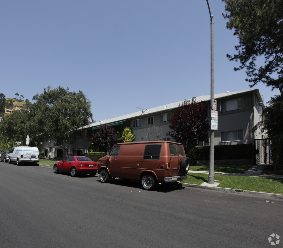
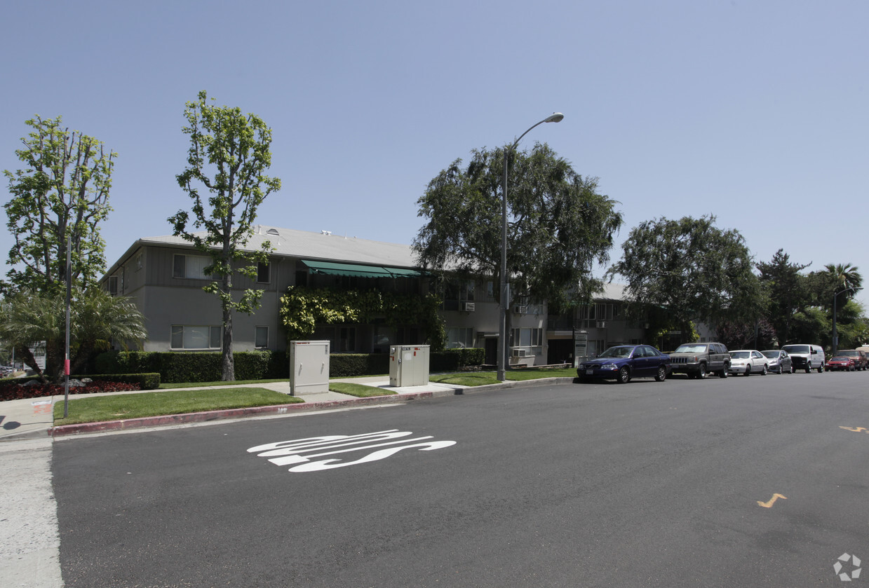
Find a new home at Laurel Gardens in Los Angeles, CA. These apartments are located in the 90046 area of Los Angeles. From amenities to location, the professional leasing staff is ready to help you find your perfect fit. Come for a visit to see the current floorplan options. Get a head start on your move right now. Contact or stop by the Laurel Gardens leasing office to schedule a tour today.
Laurel Gardens is an apartment community located in Los Angeles County and the 90046 ZIP Code. This area is served by the Los Angeles Unified Rocp School District attendance zone.
Air Conditioning
High Speed Internet Access
Walk-In Closets
Disposal
Los Angeles sprawls across nearly 500 square miles between the Pacific Ocean and the San Gabriel Mountains, making it one of the few places where you can surf in the morning and hike through chaparral-covered hills by afternoon. Sunshine, open-air farmers markets, and a food scene that pulls from dozens of culinary traditions are a staple of living in the city.
Neighborhoods each have a distinct personality surrounding a particular focus, whether it be culture or nature. Westwood keeps residents close to entertainment at UCLA and the Hammer Museum's rotating art exhibitions. Koreatown is a cultural and food destination, known for authentic restaurants and shops paired with a bustling street energy and nightlife.
The city overflows with iconic landmarks, from natural to man-made. Griffith Park, one of the largest urban parks in the country, offers hiking trails, sweeping skyline views, and the iconic Griffith Observatory.
Learn more about living in Los Angeles| Colleges & Universities | Distance | ||
|---|---|---|---|
| Colleges & Universities | Distance | ||
| Drive: | 4 min | 1.5 mi | |
| Drive: | 6 min | 2.3 mi | |
| Drive: | 10 min | 5.1 mi | |
| Drive: | 11 min | 5.7 mi |


Transportation options available in Los Angeles include Hollywood/Highland Station, located 1.4 miles from Laurel Gardens. Laurel Gardens is near Bob Hope, located 9.9 miles or 19 minutes away, and Los Angeles International, located 12.5 miles or 25 minutes away.
| Transit / Subway | Distance | ||
|---|---|---|---|
| Transit / Subway | Distance | ||
|
|
Drive: | 4 min | 1.4 mi |
|
|
Drive: | 5 min | 2.2 mi |
|
|
Drive: | 7 min | 3.1 mi |
|
|
Drive: | 9 min | 4.3 mi |
|
|
Drive: | 10 min | 4.8 mi |
| Commuter Rail | Distance | ||
|---|---|---|---|
| Commuter Rail | Distance | ||
|
|
Drive: | 15 min | 7.4 mi |
|
|
Drive: | 16 min | 7.8 mi |
|
|
Drive: | 16 min | 8.6 mi |
|
|
Drive: | 18 min | 8.8 mi |
| Drive: | 18 min | 9.3 mi |
| Airports | Distance | ||
|---|---|---|---|
| Airports | Distance | ||
|
Bob Hope
|
Drive: | 19 min | 9.9 mi |
|
Los Angeles International
|
Drive: | 25 min | 12.5 mi |
Scores provided by
Traffic
-Airport
-Businesses
-Scores provided by
HowLoud What is a Sound Score Rating? A Sound Score Rating aggregates noise caused by vehicle traffic, airplane traffic and local sources. How It WorksTime and distance from Laurel Gardens.
| Shopping Centers | Distance | ||
|---|---|---|---|
| Shopping Centers | Distance | ||
| Walk: | 5 min | 0.3 mi | |
| Walk: | 6 min | 0.3 mi | |
| Walk: | 8 min | 0.5 mi |
| Parks and Recreation | Distance | ||
|---|---|---|---|
| Parks and Recreation | Distance | ||
|
Runyon Canyon
|
Drive: | 3 min | 1.1 mi |
|
La Brea Tar Pits
|
Drive: | 7 min | 3.2 mi |
|
Zimmer Children's Museum
|
Drive: | 7 min | 3.3 mi |
|
Franklin Canyon Park
|
Drive: | 17 min | 5.7 mi |
|
Sooky Goldman Nature Center
|
Drive: | 19 min | 6.1 mi |
| Hospitals | Distance | ||
|---|---|---|---|
| Hospitals | Distance | ||
| Drive: | 6 min | 2.5 mi | |
| Drive: | 6 min | 2.6 mi | |
| Drive: | 7 min | 3.2 mi |
| Military Bases | Distance | ||
|---|---|---|---|
| Military Bases | Distance | ||
| Drive: | 25 min | 14.1 mi | |
| Drive: | 47 min | 33.0 mi | |
| Drive: | 50 min | 35.3 mi |
Pets Allowed Fitness Center Pool Maintenance on site High-Speed Internet Controlled Access EV Charging
What Are Walk Score®, Transit Score®, and Bike Score® Ratings?
Walk Score® measures the walkability of any address. Transit Score® measures access to public transit. Bike Score® measures the bikeability of any address.
What is a Sound Score Rating?
A Sound Score Rating aggregates noise caused by vehicle traffic, airplane traffic and local sources.
1632 N Laurel Ave
Los Angeles, CA 90046


