
1213 Walnut
1213 Walnut St,
Philadelphia, PA 19107
$1,945 - $7,060
Studio - 2 Beds
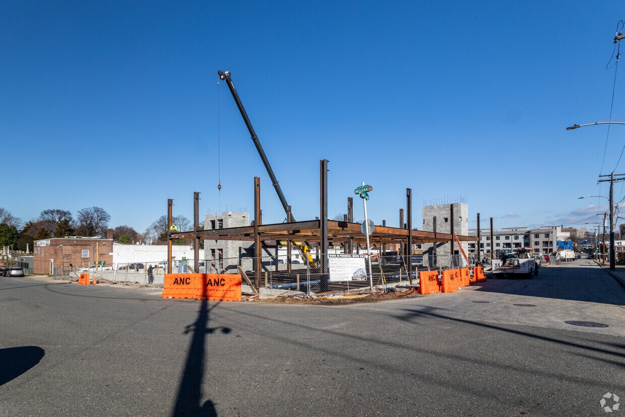
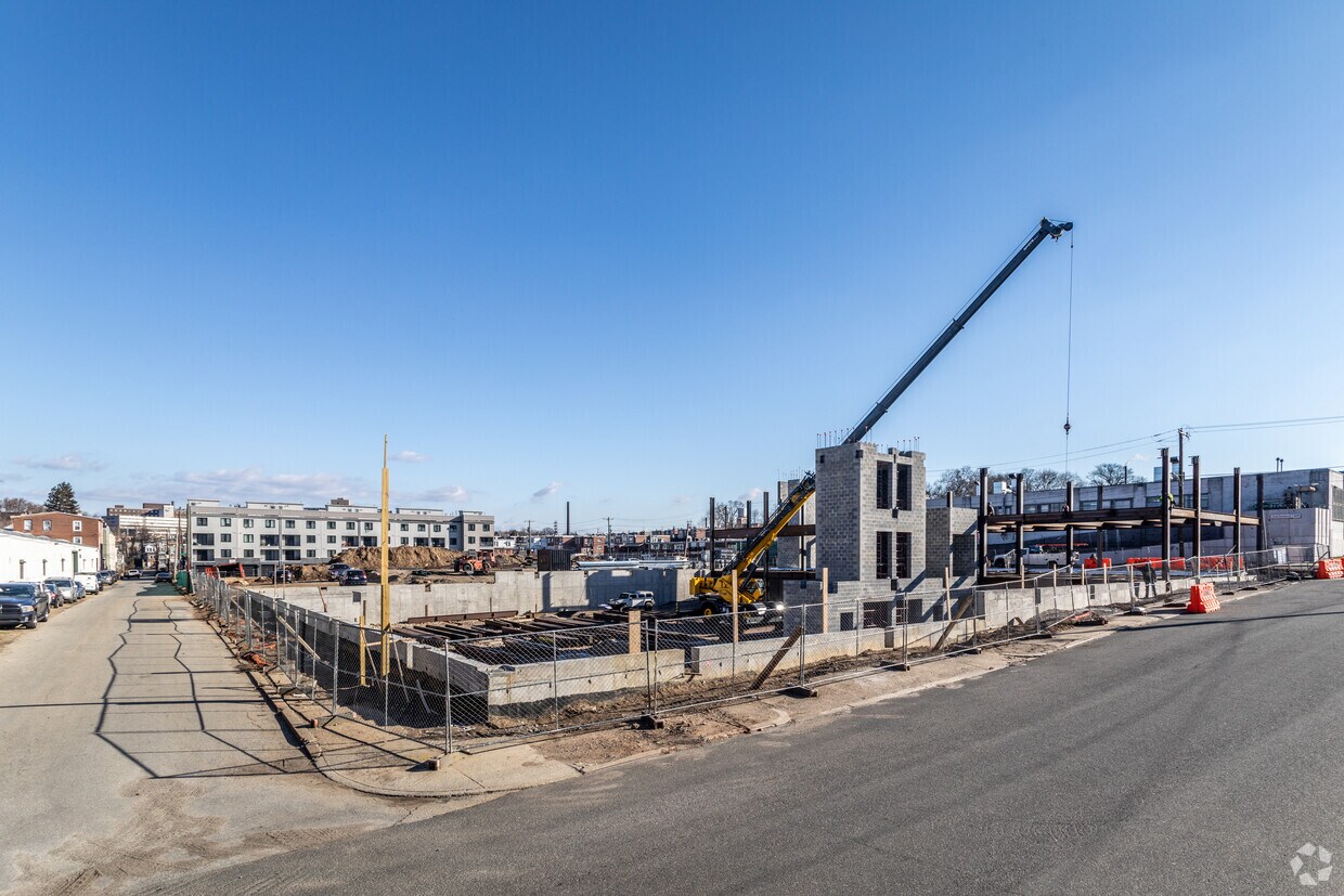
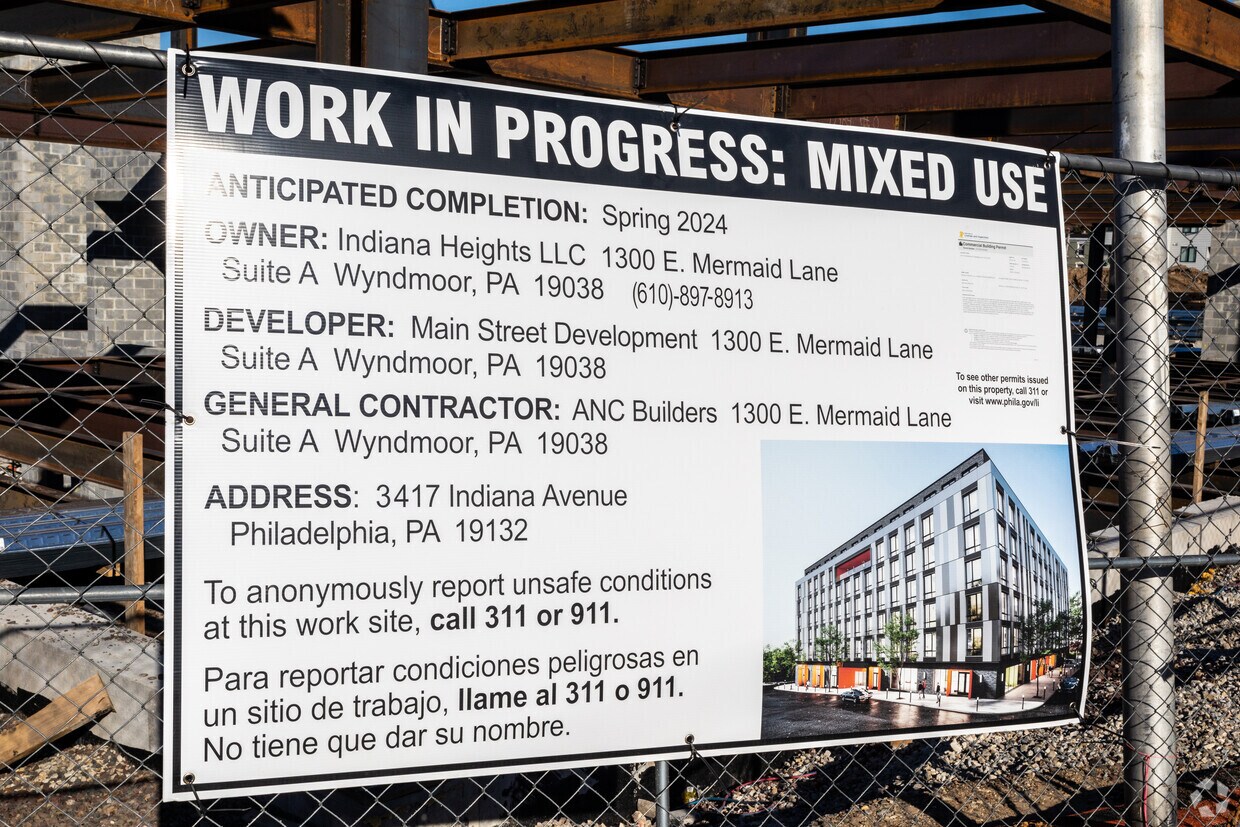

Experience Philadelphia living at 3417 W Indiana Ave. This community is located in the Allegheny West area of Philadelphia. The leasing staff is ready to help you find your perfect home. Contact us or stop by today.
Indiana Heights is an apartment community located in Philadelphia County and the 19132 ZIP Code. This area is served by the The School District of Philadelphia attendance zone.
Fitness Center
Elevator
Roof Terrace
24 Hour Access
Air Conditioning
Microwave
Refrigerator
Tub/Shower
Allegheny West, a neighborhood in North Philadelphia, sits three miles north of the Liberty Bell in the downtown portion of the city. Featuring a wide range of housing options that include apartments, single family homes, and townhomes, residents enjoy living in a central location surrounded by multiple bus lines just minutes from U.S. Route 13.
The neighborhood incorporates several vacant industrial sites that found new function as locations for film and television productions. Bordered to the northwest by the Roosevelt Expressway, to the east by Schuylkill River, to the south by West Lehigh Avenue, and with a portion of North Broad Street to the east, Allegheny West is considered one of North Philly's most affordable neighborhoods.
Learn more about living in Allegheny WestCompare neighborhood and city base rent averages by bedroom.
| Allegheny West | Philadelphia, PA | |
|---|---|---|
| Studio | $1,299 | $1,433 |
| 1 Bedroom | $1,693 | $1,786 |
| 2 Bedrooms | $2,328 | $2,227 |
| 3 Bedrooms | - | $2,919 |
| Colleges & Universities | Distance | ||
|---|---|---|---|
| Colleges & Universities | Distance | ||
| Drive: | 5 min | 1.7 mi | |
| Drive: | 6 min | 2.0 mi | |
| Drive: | 6 min | 2.4 mi | |
| Drive: | 5 min | 2.5 mi |


Transportation options available in Philadelphia include Allegheny - Bsl, located 1.9 miles from Indiana Heights. Indiana Heights is near Philadelphia International, located 14.2 miles or 27 minutes away, and Trenton Mercer, located 33.5 miles or 53 minutes away.
| Transit / Subway | Distance | ||
|---|---|---|---|
| Transit / Subway | Distance | ||
| Drive: | 4 min | 1.9 mi | |
| Drive: | 6 min | 2.1 mi | |
|
|
Drive: | 5 min | 2.2 mi |
| Drive: | 6 min | 2.4 mi | |
|
|
Drive: | 6 min | 2.7 mi |
| Commuter Rail | Distance | ||
|---|---|---|---|
| Commuter Rail | Distance | ||
|
|
Drive: | 3 min | 1.1 mi |
|
|
Drive: | 3 min | 1.3 mi |
|
|
Drive: | 5 min | 2.0 mi |
|
|
Drive: | 6 min | 2.1 mi |
|
|
Drive: | 6 min | 2.2 mi |
| Airports | Distance | ||
|---|---|---|---|
| Airports | Distance | ||
|
Philadelphia International
|
Drive: | 27 min | 14.2 mi |
|
Trenton Mercer
|
Drive: | 53 min | 33.5 mi |
Scores provided by
Traffic
-Airport
-Businesses
-Scores provided by
HowLoud What is a Sound Score Rating? A Sound Score Rating aggregates noise caused by vehicle traffic, airplane traffic and local sources. How It WorksTime and distance from Indiana Heights.
| Shopping Centers | Distance | ||
|---|---|---|---|
| Shopping Centers | Distance | ||
| Drive: | 3 min | 1.2 mi | |
| Drive: | 3 min | 1.3 mi | |
| Drive: | 4 min | 1.6 mi |
| Parks and Recreation | Distance | ||
|---|---|---|---|
| Parks and Recreation | Distance | ||
|
Wagner Free Institute of Science
|
Drive: | 7 min | 2.6 mi |
|
Shofuso - Japanese House and Garden
|
Drive: | 7 min | 3.0 mi |
|
Fairmount Park
|
Drive: | 8 min | 3.1 mi |
|
Please Touch Museum
|
Drive: | 7 min | 3.3 mi |
|
Philadelphia Zoo
|
Drive: | 10 min | 3.3 mi |
| Hospitals | Distance | ||
|---|---|---|---|
| Hospitals | Distance | ||
| Drive: | 5 min | 2.3 mi | |
| Drive: | 5 min | 2.4 mi | |
| Drive: | 7 min | 2.7 mi |
| Military Bases | Distance | ||
|---|---|---|---|
| Military Bases | Distance | ||
| Drive: | 20 min | 10.5 mi | |
| Drive: | 36 min | 17.8 mi | |
| Drive: | 38 min | 20.3 mi |
What Are Walk Score®, Transit Score®, and Bike Score® Ratings?
Walk Score® measures the walkability of any address. Transit Score® measures access to public transit. Bike Score® measures the bikeability of any address.
What is a Sound Score Rating?
A Sound Score Rating aggregates noise caused by vehicle traffic, airplane traffic and local sources.

3417 W Indiana Ave
Philadelphia, PA 19132


