
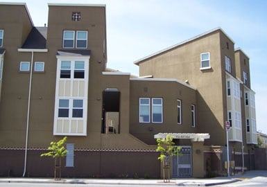
344 Pennsylvania Dr
344 Pennsylvania Dr,
Watsonville, CA 95076
$3,350 Total Monthly Price
2 Beds 12 Month Lease
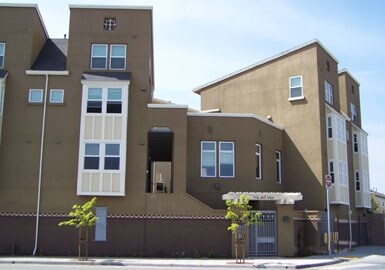

Discover your new place at Independence Square in Watsonville, CA. Situated in the 95076 Zip code of Watsonville on Madison St., renters have an easy connection to a mixture of points of interest in the surrounding area. Be sure to see the available floorplan options. Here at this community, the team of leasing professionals is ready to match you with your perfect apartment. At Independence Square you're new apartment awaits.
Independence Square is an apartment community located in Santa Cruz County and the 95076 ZIP Code. This area is served by the Pajaro Valley Unified School District attendance zone.
Watsonville sits at the southern end of Santa Cruz County, where the Pajaro Valley's agricultural fields stretch toward Monterey Bay and the everyday rhythm of life stays rooted in the land. The city has long anchored the region's strawberry and apple industries, earning a reputation as one of California's most productive farming communities. That agricultural identity shapes the city's character in real ways, from the well-attended weekly farmers market to the Santa Cruz County Fair, held here each September and drawing crowds from across the county. Watsonville is compact at roughly seven square miles, yet its downtown core, surrounding residential streets, and outlying areas each carry a distinct feel. Santa Cruz sits about 23 miles to the northwest and Monterey is a comparable drive south, giving residents access to two coastal cities without the price tags those markets carry.
Learn more about living in Watsonville| Colleges & Universities | Distance | ||
|---|---|---|---|
| Colleges & Universities | Distance | ||
| Drive: | 17 min | 11.7 mi | |
| Drive: | 35 min | 22.0 mi | |
| Drive: | 34 min | 22.2 mi | |
| Drive: | 36 min | 24.4 mi |


Scores provided by
Traffic
-Airport
-Businesses
-Scores provided by
HowLoud What is a Sound Score Rating? A Sound Score Rating aggregates noise caused by vehicle traffic, airplane traffic and local sources. How It WorksPets Allowed Fitness Center Pool In Unit Washer & Dryer Clubhouse Stainless Steel Appliances Package Service
What Are Walk Score®, Transit Score®, and Bike Score® Ratings?
Walk Score® measures the walkability of any address. Transit Score® measures access to public transit. Bike Score® measures the bikeability of any address.
What is a Sound Score Rating?
A Sound Score Rating aggregates noise caused by vehicle traffic, airplane traffic and local sources.
1355 Madison St
Watsonville, CA 95076


