
Millhouse
1985-1988 NW Savier St,
Portland, OR 97209
$1,409 - $4,140 Total Monthly Price
Studio - 2 Beds
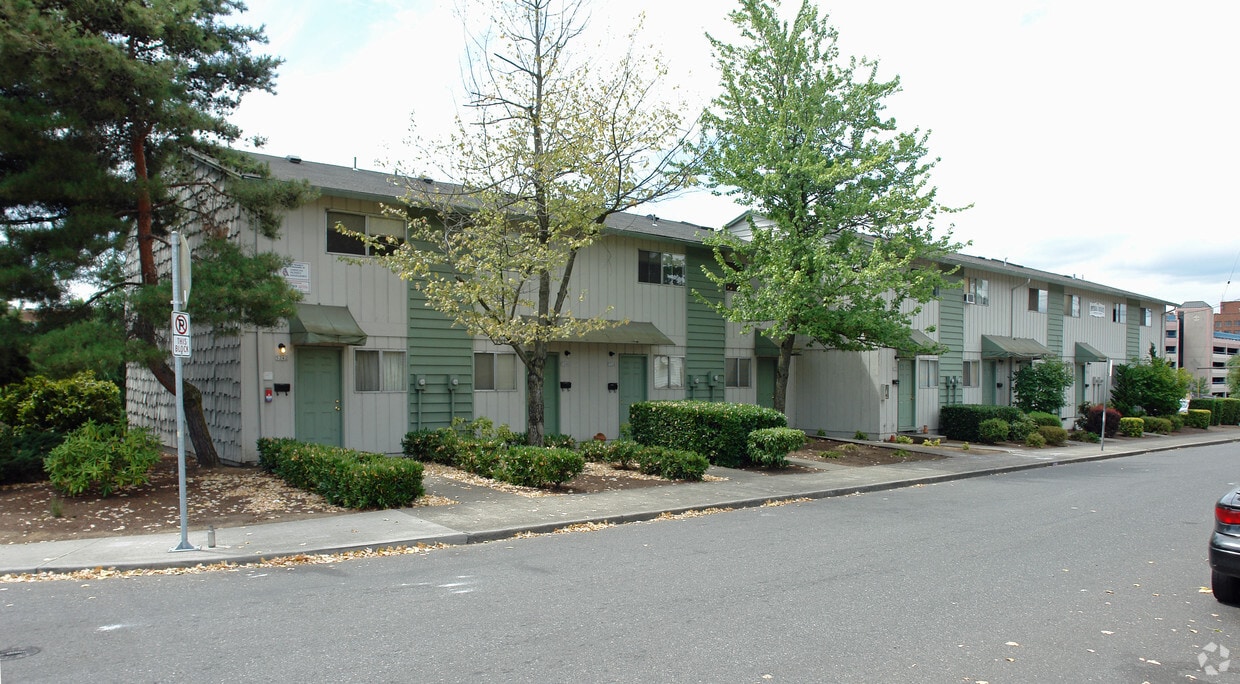
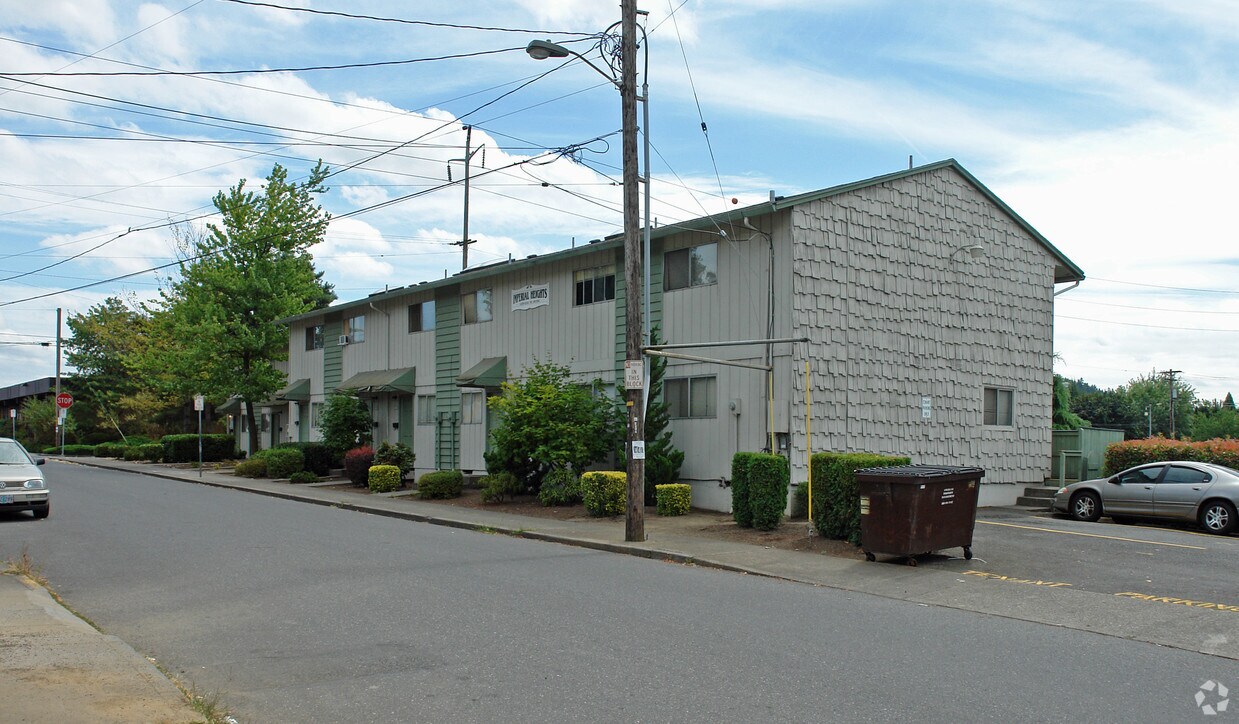
Discover your new home at Imperial Heights in Portland. The location of this community is in Portland at 5220-5242 Ne Irving St. in the 97213 area. Come by to check out the apartment floorplan options. The team of leasing professionals is excited to help you find the perfect new home. Come see Imperial Heights today.
Imperial Heights is an apartment community located in Multnomah County and the 97213 ZIP Code. This area is served by the Portland School District 1j attendance zone.
Portland sits where the Willamette and Columbia rivers meet, tucked between mountain ranges with more than 10,000 acres of protected parkland woven into the city's fabric. Washington Park alone offers 15 miles of hiking paths, the Oregon Zoo, and the Portland Japanese Garden. The city's MAX light rail, Portland Streetcar, and extensive bike lane network make getting around effortless, and Powell's City of Books on Burnside has anchored the local literary scene for decades.
Renters here have no shortage of options, from sleek high-rise apartments in South Waterfront to Craftsman-style townhomes in Irvington and industrial lofts throughout Central Eastside. Neighborhoods like the Pearl District, Hawthorne, and Sellwood-Moreland each carry their own personality — from converted warehouse lofts and gallery rows to vintage shops and riverfront trails.
Portland State University keeps the city energized, bringing a creative pulse to the downtown area.
Learn more about living in PortlandCompare neighborhood and city base rent averages by bedroom.
| Rose City Park | Portland, OR | |
|---|---|---|
| Studio | $1,105 | $1,248 |
| 1 Bedroom | $1,258 | $1,519 |
| 2 Bedrooms | $1,391 | $1,801 |
| 3 Bedrooms | $2,691 | $2,095 |
| Colleges & Universities | Distance | ||
|---|---|---|---|
| Colleges & Universities | Distance | ||
| Drive: | 10 min | 3.2 mi | |
| Drive: | 11 min | 4.5 mi | |
| Drive: | 11 min | 4.9 mi | |
| Drive: | 13 min | 5.3 mi |

Transportation options available in Portland include Hollywood/Ne 42Nd Ave Max Station, located 1.9 miles from Imperial Heights. Imperial Heights is near Portland International, located 6.0 miles or 16 minutes away.
| Transit / Subway | Distance | ||
|---|---|---|---|
| Transit / Subway | Distance | ||
| Drive: | 5 min | 1.9 mi | |
|
|
Drive: | 7 min | 2.9 mi |
|
|
Drive: | 7 min | 3.1 mi |
|
|
Drive: | 8 min | 4.1 mi |
|
|
Drive: | 8 min | 4.1 mi |
| Commuter Rail | Distance | ||
|---|---|---|---|
| Commuter Rail | Distance | ||
|
|
Drive: | 12 min | 4.9 mi |
|
|
Drive: | 22 min | 12.0 mi |
|
|
Drive: | 23 min | 13.1 mi |
|
|
Drive: | 25 min | 13.5 mi |
|
|
Drive: | 25 min | 15.0 mi |
| Airports | Distance | ||
|---|---|---|---|
| Airports | Distance | ||
|
Portland International
|
Drive: | 16 min | 6.0 mi |
Scores provided by
Traffic
-Airport
-Businesses
-Scores provided by
HowLoud What is a Sound Score Rating? A Sound Score Rating aggregates noise caused by vehicle traffic, airplane traffic and local sources. How It WorksTime and distance from Imperial Heights.
| Shopping Centers | Distance | ||
|---|---|---|---|
| Shopping Centers | Distance | ||
| Walk: | 17 min | 0.9 mi | |
| Drive: | 4 min | 1.4 mi |
| Parks and Recreation | Distance | ||
|---|---|---|---|
| Parks and Recreation | Distance | ||
|
Rose City Park
|
Drive: | 4 min | 1.2 mi |
|
Rosemont Bluff Natural Area
|
Drive: | 4 min | 1.4 mi |
|
Grant Park and Beverly Cleary Sculpture Garden
|
Drive: | 7 min | 1.8 mi |
|
Laurelhurst Park
|
Drive: | 6 min | 1.9 mi |
|
Mt. Tabor Park
|
Drive: | 10 min | 2.5 mi |
| Hospitals | Distance | ||
|---|---|---|---|
| Hospitals | Distance | ||
| Walk: | 7 min | 0.4 mi | |
| Drive: | 10 min | 4.5 mi | |
| Drive: | 11 min | 4.8 mi |
| Military Bases | Distance | ||
|---|---|---|---|
| Military Bases | Distance | ||
| Drive: | 13 min | 4.6 mi | |
| Drive: | 40 min | 22.5 mi |
Pets Allowed Fitness Center Dishwasher Refrigerator Kitchen In Unit Washer & Dryer
Pets Allowed Fitness Center In Unit Washer & Dryer Walk-In Closets Elevator Rooftop Deck
What Are Walk Score®, Transit Score®, and Bike Score® Ratings?
Walk Score® measures the walkability of any address. Transit Score® measures access to public transit. Bike Score® measures the bikeability of any address.
What is a Sound Score Rating?
A Sound Score Rating aggregates noise caused by vehicle traffic, airplane traffic and local sources.

5220-5242 NE Irving St
Portland, OR 97213


