
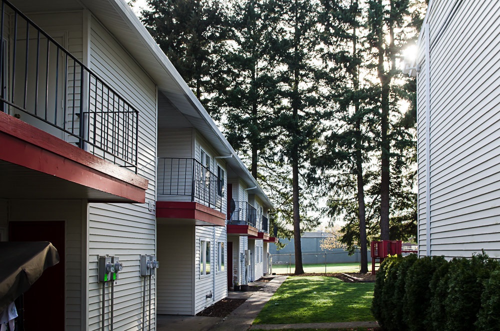
Millhouse
1985-1988 NW Savier St,
Portland, OR 97209
$1,349 - $4,135
Studio - 2 Beds
You will love the enormous backyard amazing for gatherings and pets. Near Albertsons, Walgreens, Starbucks, Toms pizza. New Gresham 24 hr. fitness a few Blocks over on 181st. Located In Reynolds School District. Call today for more information on Leasing this Gorgeous Home Water, sewer, trash Included in rent! *Spacious living room *Dining room separate from living room *Spacious bedrooms *Plenty of cabinets and counter space *Plenty of off-street parking
Fircrest Apartments 1159-F is an apartment community located in Multnomah County and the 97230 ZIP Code. This area is served by the Reynolds School District 7 attendance zone.
High Speed Internet Access
Patio
Smoke Free
Dining Room
Nestled on the banks of the Columbia River, North Gresham is a suburban oasis just minutes from the heart of Gresham and less than 20 miles east of Portland. From easy access to big-city amenities to the lush greenery and outdoor recreation in Mount Hood National Forest, North Gresham is a great place to put down roots. Neighborhood parks, shopping centers, and residential streets can be found in North Gresham, but north of Halsey Street is mainly industrial with a variety of big-name warehouses like Frito-Lay. In the south end of North Gresham, discover abundant apartments and condos available for rent ranging from mid-range to upscale.
Learn more about living in North GreshamCompare neighborhood and city base rent averages by bedroom.
| North Gresham | Portland, OR | |
|---|---|---|
| Studio | $962 | $1,236 |
| 1 Bedroom | $1,010 | $1,500 |
| 2 Bedrooms | $1,316 | $1,792 |
| 3 Bedrooms | $1,562 | $2,113 |
| Colleges & Universities | Distance | ||
|---|---|---|---|
| Colleges & Universities | Distance | ||
| Drive: | 6 min | 2.7 mi | |
| Drive: | 11 min | 4.7 mi | |
| Drive: | 12 min | 7.2 mi | |
| Drive: | 16 min | 9.6 mi |


Transportation options available in Portland include Rockwood/E 188Th Transit Center, located 1.4 miles from Fircrest Apartments 1159-F. Fircrest Apartments 1159-F is near Portland International, located 10.2 miles or 17 minutes away.
| Transit / Subway | Distance | ||
|---|---|---|---|
| Transit / Subway | Distance | ||
|
|
Drive: | 4 min | 1.4 mi |
|
|
Drive: | 3 min | 1.7 mi |
|
|
Drive: | 4 min | 1.9 mi |
|
|
Drive: | 4 min | 2.1 mi |
|
|
Drive: | 5 min | 2.5 mi |
| Commuter Rail | Distance | ||
|---|---|---|---|
| Commuter Rail | Distance | ||
|
|
Drive: | 21 min | 13.5 mi |
|
|
Drive: | 27 min | 17.7 mi |
|
|
Drive: | 28 min | 19.2 mi |
|
|
Drive: | 35 min | 22.2 mi |
|
|
Drive: | 34 min | 23.6 mi |
| Airports | Distance | ||
|---|---|---|---|
| Airports | Distance | ||
|
Portland International
|
Drive: | 17 min | 10.2 mi |
Time and distance from Fircrest Apartments 1159-F.
| Shopping Centers | Distance | ||
|---|---|---|---|
| Shopping Centers | Distance | ||
| Walk: | 14 min | 0.8 mi | |
| Walk: | 20 min | 1.1 mi | |
| Drive: | 3 min | 1.3 mi |
| Parks and Recreation | Distance | ||
|---|---|---|---|
| Parks and Recreation | Distance | ||
|
Nadaka Nature Park
|
Drive: | 3 min | 1.3 mi |
|
Blue Lake Regional Park
|
Drive: | 8 min | 3.5 mi |
|
Springwater Corridor
|
Drive: | 9 min | 3.8 mi |
|
John Luby Park
|
Drive: | 10 min | 4.0 mi |
|
Planetarium Sky Theater
|
Drive: | 10 min | 4.5 mi |
| Hospitals | Distance | ||
|---|---|---|---|
| Hospitals | Distance | ||
| Drive: | 7 min | 3.5 mi | |
| Drive: | 15 min | 8.7 mi | |
| Drive: | 16 min | 10.4 mi |
| Military Bases | Distance | ||
|---|---|---|---|
| Military Bases | Distance | ||
| Drive: | 17 min | 9.5 mi | |
| Drive: | 41 min | 24.2 mi |
What Are Walk Score®, Transit Score®, and Bike Score® Ratings?
Walk Score® measures the walkability of any address. Transit Score® measures access to public transit. Bike Score® measures the bikeability of any address.
What is a Sound Score Rating?
A Sound Score Rating aggregates noise caused by vehicle traffic, airplane traffic and local sources

19511 NE Halsey St
Portland, OR 97230


