
Avelle
1001 N Shoreline Blvd,
Mountain View, CA 94043
$5,580 - $6,755
1-3 Beds


Next to Creek Edge Park, which has a play area for children Next to Stevens Creek Trail Close to Caltrain Station Close to Light Rail Station Close to Highways 85 / 237 Close to Middlefield Road Close to Central Expressway
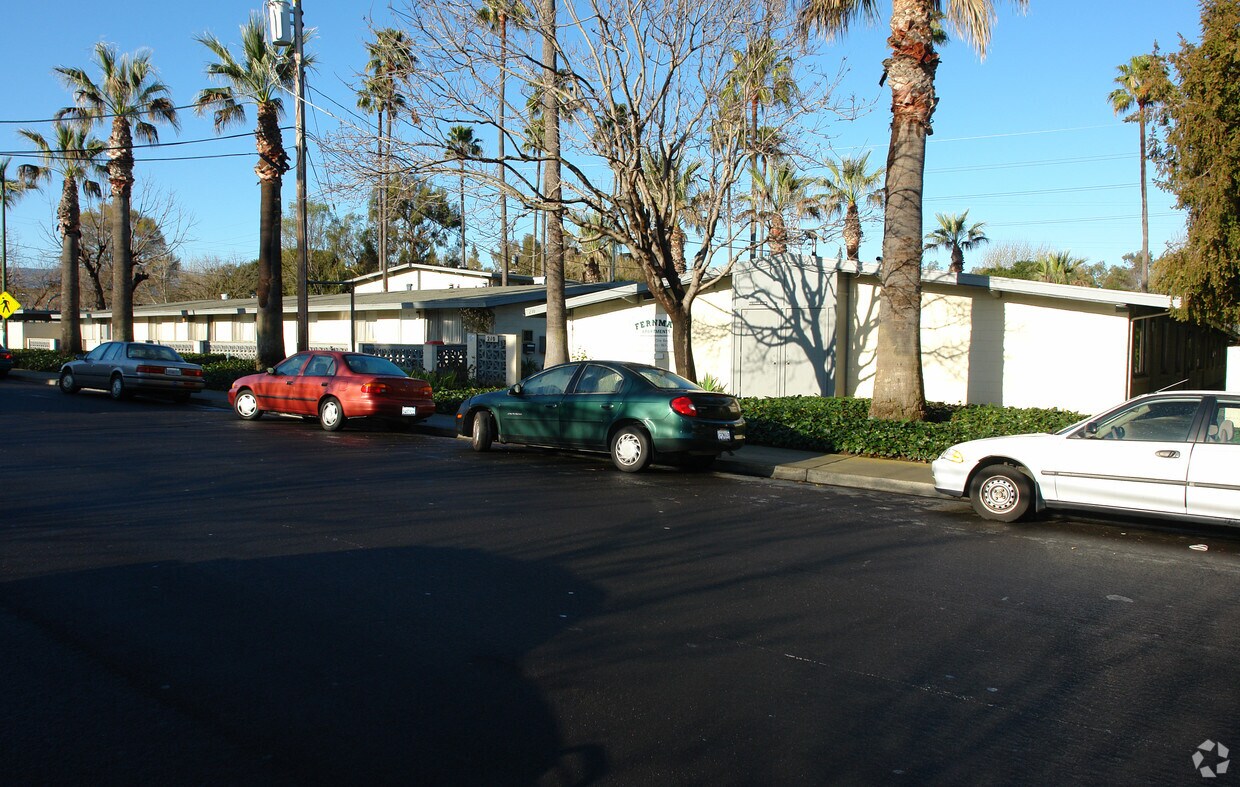
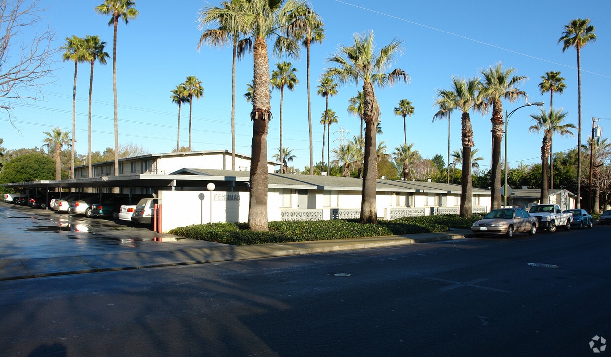
Fernmar is an apartment community located in Santa Clara County and the 94043 ZIP Code. This area is served by the Mountain View Whisman attendance zone.
High Speed Internet Access
Refrigerator
Smoke Free
Oven
Known for its fantastic views of the Santa Cruz Mountains, the Wagon Wheel neighborhood of Mountain View, California lies 12 miles southeast of Palo Alto via US-101S. Residents of Wagon Wheel's apartments and home rentals enjoy convenient transportation via light rail, bus, and private shuttle. Featuring an online chat group, this community values resident participation in planning activities such as ice cream socials, community breakfasts, and pumpkin festivals at the local park.
Two parks serve this neighborhood where residents can picnic, relax in an arbor, or join a pick-up baseball game. Whisman Park provides access to the Stevens Creek Trail, with its paved paths for walking, biking, or jogging through scenic natural areas.
Learn more about living in Wagon Wheel| Colleges & Universities | Distance | ||
|---|---|---|---|
| Colleges & Universities | Distance | ||
| Drive: | 7 min | 3.5 mi | |
| Drive: | 14 min | 5.9 mi | |
| Drive: | 17 min | 7.1 mi | |
| Drive: | 12 min | 7.3 mi |


Transportation options available in Mountain View include Whisman Station, located 0.8 mile from Fernmar. Fernmar is near Norman Y Mineta San Jose International, located 9.2 miles or 14 minutes away, and San Francisco International, located 25.4 miles or 32 minutes away.
| Transit / Subway | Distance | ||
|---|---|---|---|
| Transit / Subway | Distance | ||
|
|
Walk: | 16 min | 0.8 mi |
| Walk: | 18 min | 1.0 mi | |
|
|
Walk: | 19 min | 1.0 mi |
|
|
Drive: | 3 min | 1.1 mi |
| Drive: | 3 min | 1.6 mi |
| Commuter Rail | Distance | ||
|---|---|---|---|
| Commuter Rail | Distance | ||
| Drive: | 6 min | 2.1 mi | |
| Drive: | 6 min | 2.1 mi | |
| Drive: | 7 min | 3.0 mi | |
| Drive: | 7 min | 3.6 mi | |
| Drive: | 10 min | 4.9 mi |
| Airports | Distance | ||
|---|---|---|---|
| Airports | Distance | ||
|
Norman Y Mineta San Jose International
|
Drive: | 14 min | 9.2 mi |
|
San Francisco International
|
Drive: | 32 min | 25.4 mi |
Time and distance from Fernmar.
| Shopping Centers | Distance | ||
|---|---|---|---|
| Shopping Centers | Distance | ||
| Walk: | 15 min | 0.8 mi | |
| Drive: | 3 min | 1.3 mi | |
| Drive: | 5 min | 2.0 mi |
| Parks and Recreation | Distance | ||
|---|---|---|---|
| Parks and Recreation | Distance | ||
|
Stevens Creek Shoreline Nature Study Area
|
Drive: | 8 min | 3.3 mi |
|
J. Pearce Mitchell Park
|
Drive: | 10 min | 4.3 mi |
|
Terman Park
|
Drive: | 11 min | 4.8 mi |
|
Esther Clark Nature Preserve
|
Drive: | 13 min | 5.8 mi |
|
Redwood Grove
|
Drive: | 13 min | 6.1 mi |
| Hospitals | Distance | ||
|---|---|---|---|
| Hospitals | Distance | ||
| Drive: | 6 min | 2.7 mi | |
| Drive: | 13 min | 8.4 mi | |
| Drive: | 14 min | 8.5 mi |
| Military Bases | Distance | ||
|---|---|---|---|
| Military Bases | Distance | ||
| Drive: | 7 min | 2.4 mi |
What Are Walk Score®, Transit Score®, and Bike Score® Ratings?
Walk Score® measures the walkability of any address. Transit Score® measures access to public transit. Bike Score® measures the bikeability of any address.
What is a Sound Score Rating?
A Sound Score Rating aggregates noise caused by vehicle traffic, airplane traffic and local sources
210 Easy St
Mountain View, CA 94043


