
Edison Austin
4711 E Riverside Dr,
Austin, TX 78741
$1,095 - $2,445
Studio - 2 Beds

Bedrooms
1 - 3 bd
Bathrooms
1 - 2 ba
Square Feet
750 - 1,100 sq ft
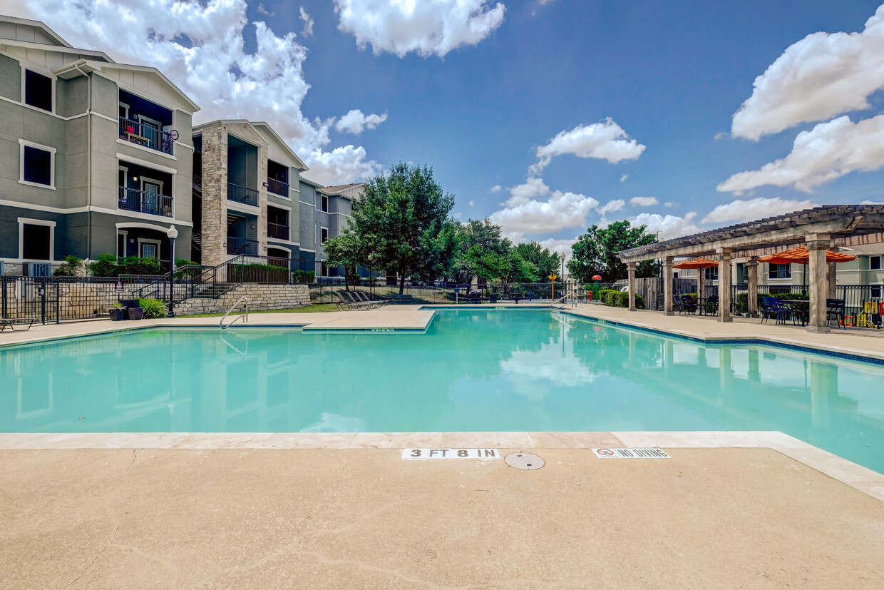
Welcome to Eryngo Hills, named after the wildflower which grows native next door at the Indiangrass Wildlife Sanctuary, symbolizing strength and independence. Eryngo Hills offers an affordable luxurious lifestyle featuring world-class resort-style amenities including a refreshing swimming pool, picnic areas with barbecue grills, and beautiful interiors. Our pet-friendly community is located near Walnut Creek, just minutes from hiking/biking trails, retail, restaurants, and major employers. Select from our spacious one, two, and three bedroom apartment homes featuring designer kitchens with energy-efficient appliances, spacious patios/balconies and so much more. Our prime location located in northeast Austin just off US 290 puts you close to I35, 130, and Hwy 183. Professionally managed by Willow Bridge, contact us today to learn more!
Eryngo Hills is an apartment community located in County and the 78724 ZIP Code. This area is served by the Austin Independent attendance zone.
Unique Features
Pool
Fitness Center
Playground
Clubhouse
Air Conditioning
Dishwasher
Washer/Dryer Hookup
Walk-In Closets
Microwave
Refrigerator
Tub/Shower
Disposal
Settled about eight miles northeast of Downtown Austin, Walnut Creek is a peaceful, industrial area that features fantastic commuter options. Between the public bus routes, access to both Highway 290 and 183, and proximity to the Austin-Bergstrom International Airport, travel is a breeze. Though Walnut Creek is mainly industrial, there are many suburban streets around the town filled with homes and apartments for rent.
Walnut Creek, named after the creek that runs through the neighborhood, boasts many outdoor spaces like the Big Walnut Creek Nature Preserve. Take a stroll down the scenic Walnut Creek trail, or travel a few miles to the Walter Long Metropolitan Park. This city park has a large lake that’s perfect for swimming, fishing, and kayaking on a warm Austin day. Along the major roads in the neighborhood, you’ll find businesses, services, and casual restaurants, along with unique finds like Meridian Hive Meadery.
Learn more about living in Walnut CreekCompare neighborhood and city base rent averages by bedroom.
| Walnut Creek | Austin, TX | |
|---|---|---|
| Studio | $1,071 | $1,226 |
| 1 Bedroom | $1,222 | $1,380 |
| 2 Bedrooms | $1,548 | $1,786 |
| 3 Bedrooms | $1,948 | $2,392 |
| Colleges & Universities | Distance | ||
|---|---|---|---|
| Colleges & Universities | Distance | ||
| Drive: | 13 min | 6.9 mi | |
| Drive: | 11 min | 7.3 mi | |
| Drive: | 14 min | 8.8 mi | |
| Drive: | 15 min | 9.2 mi |


Transportation options available in Austin include Highland Station, located 5.0 miles from Eryngo Hills. Eryngo Hills is near Austin-Bergstrom International, located 16.0 miles or 26 minutes away.
| Transit / Subway | Distance | ||
|---|---|---|---|
| Transit / Subway | Distance | ||
| Drive: | 7 min | 5.0 mi | |
| Drive: | 9 min | 6.0 mi | |
| Drive: | 11 min | 6.4 mi | |
| Drive: | 13 min | 8.1 mi | |
| Drive: | 14 min | 8.5 mi |
| Commuter Rail | Distance | ||
|---|---|---|---|
| Commuter Rail | Distance | ||
|
|
Drive: | 16 min | 10.0 mi |
|
|
Drive: | 34 min | 27.6 mi |
| Airports | Distance | ||
|---|---|---|---|
| Airports | Distance | ||
|
Austin-Bergstrom International
|
Drive: | 26 min | 16.0 mi |
Time and distance from Eryngo Hills.
| Shopping Centers | Distance | ||
|---|---|---|---|
| Shopping Centers | Distance | ||
| Drive: | 3 min | 1.8 mi | |
| Drive: | 4 min | 2.5 mi | |
| Drive: | 5 min | 2.7 mi |
| Parks and Recreation | Distance | ||
|---|---|---|---|
| Parks and Recreation | Distance | ||
|
Jourdan-Bachman Pioneer Farms
|
Drive: | 10 min | 4.3 mi |
|
Thinkery
|
Drive: | 10 min | 5.1 mi |
|
Elisabet Ney Museum
|
Drive: | 10 min | 6.2 mi |
|
Walter E. Long Park
|
Drive: | 12 min | 6.6 mi |
|
Copperfield Nature Trail and Park
|
Drive: | 12 min | 6.9 mi |
| Hospitals | Distance | ||
|---|---|---|---|
| Hospitals | Distance | ||
| Drive: | 5 min | 2.6 mi | |
| Drive: | 9 min | 4.9 mi | |
| Drive: | 10 min | 6.6 mi |
| Military Bases | Distance | ||
|---|---|---|---|
| Military Bases | Distance | ||
| Drive: | 85 min | 71.8 mi | |
| Drive: | 90 min | 74.1 mi |
What Are Walk Score®, Transit Score®, and Bike Score® Ratings?
Walk Score® measures the walkability of any address. Transit Score® measures access to public transit. Bike Score® measures the bikeability of any address.
What is a Sound Score Rating?
A Sound Score Rating aggregates noise caused by vehicle traffic, airplane traffic and local sources
9345 E State Highway 290
Austin, TX 78724


