
Parkway Lofts
5 Lawrence St,
Bloomfield, NJ 07003
$1,800 - $3,855
Studio - 2 Beds
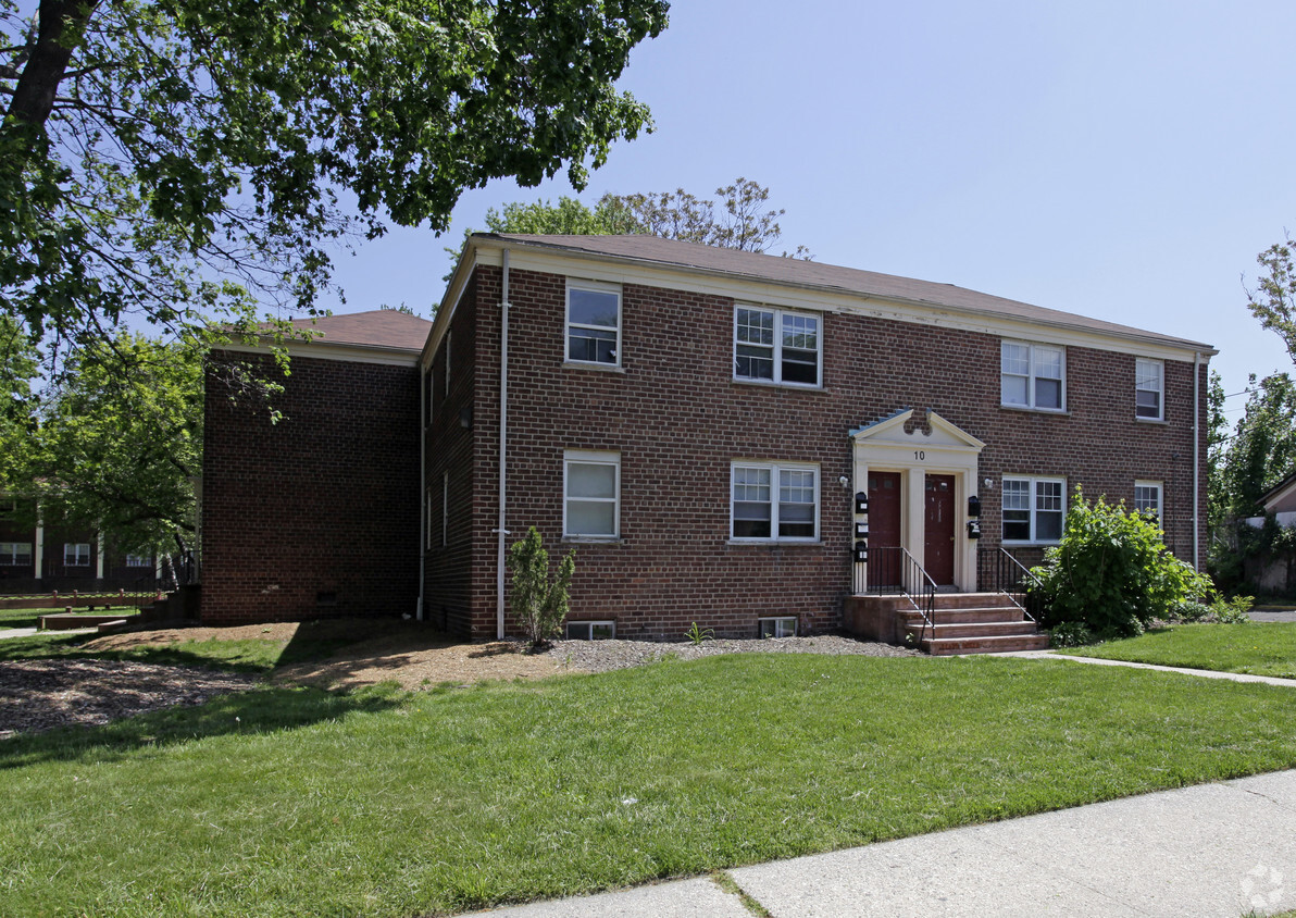
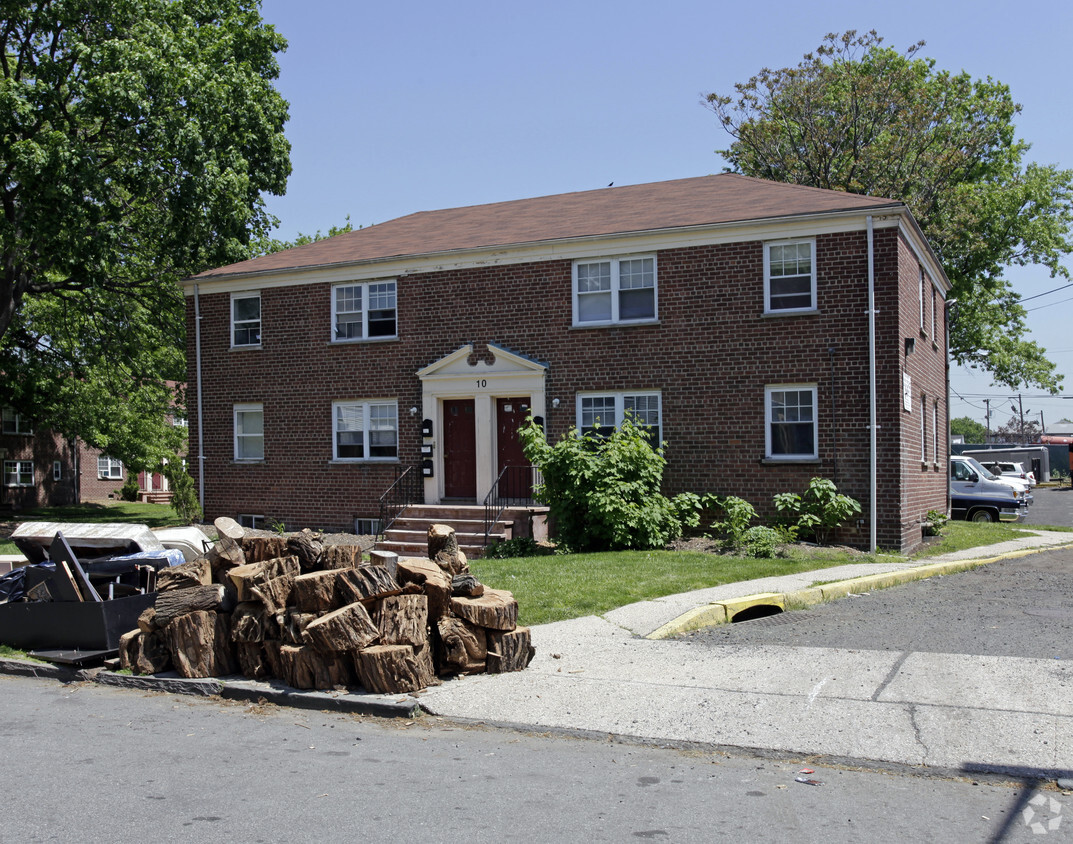

Come enjoy East Orange living at Ellington Street. Located at 10 Ellington St in East Orange, this community has much to offer its residents. Offering 1 to 2 bedroom floor plans, your new home is right here. Let the professional leasing staff show you everything this community has in store. It's time to love where you live. Stop by for a visit today.
Ellington Street is an apartment community located in Essex County and the 07017 ZIP Code. This area is served by the East Orange attendance zone.
East Orange, New Jersey sits just 12 miles from Manhattan, combining historic charm with contemporary city living. Tree-lined streets showcase the area's architectural heritage, from pre-war apartment buildings to classic single-family homes. Current rental rates show one-bedroom apartments average $1,407, while two-bedrooms typically rent for $1,897, with annual increases of 1-2% across all unit sizes.
The city features established neighborhoods like Greenwood, known for its architectural character, and the Central Avenue Commercial District. Elmwood Park provides recreational opportunities with its swimming pool, tennis courts, and walking track. The East Orange Campus High School stands on the historic grounds of the former Upsala College, while the Whitney E. Houston Academy of Creative & Performing Arts honors the legendary singer's local roots. Two NJ Transit train stations offer direct service to New York City, making the area particularly accessible for commuters.
Learn more about living in East Orange| Colleges & Universities | Distance | ||
|---|---|---|---|
| Colleges & Universities | Distance | ||
| Drive: | 6 min | 2.5 mi | |
| Drive: | 5 min | 2.5 mi | |
| Drive: | 5 min | 2.6 mi | |
| Drive: | 6 min | 2.7 mi |


Transportation options available in East Orange include Park Avenue, located 0.9 mile from Ellington Street. Ellington Street is near Newark Liberty International, located 8.4 miles or 15 minutes away, and LaGuardia, located 28.6 miles or 44 minutes away.
| Transit / Subway | Distance | ||
|---|---|---|---|
| Transit / Subway | Distance | ||
|
|
Walk: | 17 min | 0.9 mi |
|
|
Drive: | 3 min | 1.2 mi |
|
|
Drive: | 3 min | 1.2 mi |
|
|
Drive: | 4 min | 1.4 mi |
|
|
Drive: | 4 min | 1.5 mi |
| Commuter Rail | Distance | ||
|---|---|---|---|
| Commuter Rail | Distance | ||
|
|
Drive: | 4 min | 1.6 mi |
|
|
Drive: | 4 min | 1.8 mi |
|
|
Drive: | 5 min | 2.1 mi |
|
|
Drive: | 5 min | 2.3 mi |
|
|
Drive: | 5 min | 2.3 mi |
| Airports | Distance | ||
|---|---|---|---|
| Airports | Distance | ||
|
Newark Liberty International
|
Drive: | 15 min | 8.4 mi |
|
LaGuardia
|
Drive: | 44 min | 28.6 mi |
Time and distance from Ellington Street.
| Shopping Centers | Distance | ||
|---|---|---|---|
| Shopping Centers | Distance | ||
| Walk: | 15 min | 0.8 mi | |
| Drive: | 4 min | 1.2 mi | |
| Drive: | 3 min | 1.3 mi |
| Parks and Recreation | Distance | ||
|---|---|---|---|
| Parks and Recreation | Distance | ||
|
Branch Brook Park
|
Drive: | 5 min | 1.9 mi |
|
Newark Museum and Dreyfuss Planetarium
|
Drive: | 6 min | 2.7 mi |
|
Edison National Historic Site
|
Drive: | 8 min | 3.3 mi |
|
Kearny Marsh
|
Drive: | 11 min | 5.1 mi |
|
Richard W. DeKorte Park
|
Drive: | 15 min | 6.8 mi |
| Hospitals | Distance | ||
|---|---|---|---|
| Hospitals | Distance | ||
| Drive: | 4 min | 2.0 mi | |
| Drive: | 5 min | 2.2 mi | |
| Drive: | 5 min | 2.4 mi |
| Military Bases | Distance | ||
|---|---|---|---|
| Military Bases | Distance | ||
| Drive: | 20 min | 12.3 mi | |
| Drive: | 30 min | 14.2 mi | |
| Drive: | 36 min | 20.3 mi |
What Are Walk Score®, Transit Score®, and Bike Score® Ratings?
Walk Score® measures the walkability of any address. Transit Score® measures access to public transit. Bike Score® measures the bikeability of any address.
What is a Sound Score Rating?
A Sound Score Rating aggregates noise caused by vehicle traffic, airplane traffic and local sources

10-46 Ellington St
East Orange, NJ 07017


