
-
Monthly Rent
$1,273 - $3,542
-
Bedrooms
Studio - 3 bd
-
Bathrooms
1 - 2 ba
-
Square Feet
606 - 1,490 sq ft
Experience Austin living at Elina. Located at 7163 Union Park Lane in Austin, this community has much to offer its residents. From amenities to availability, the leasing staff is excited to help you find your new place. Contact us or stop by today.
Highlights
- Pickleball Court
- Pet Washing Station
- Yard
- Pool
- Walk-In Closets
- Pet Play Area
- Controlled Access
- Island Kitchen
- Gated
Pricing & Floor Plans
-
Unit Building 1-1226price $1,354square feet 682availibility Now
-
Unit Building 1-1137price $1,404square feet 682availibility Now
-
Unit Building 1-1211price $1,404square feet 682availibility Now
-
Unit Building 3-3108price $1,414square feet 770availibility Now
-
Unit Building 3-3104price $1,414square feet 770availibility Now
-
Unit Building 1-1213price $1,464square feet 855availibility Now
-
Unit Building 1-1325price $1,674square feet 862availibility Now
-
Unit Building 1-1427price $1,724square feet 862availibility Now
-
Unit Building 1-1425price $1,724square feet 862availibility Now
-
Unit Building 1-1127price $2,018square feet 862availibility Now
-
Unit Building 1-1133price $2,454square feet 1,046availibility Now
-
Unit Building 4-4306price $1,799square feet 1,170availibility Now
-
Unit Building 2-2211price $1,849square feet 1,170availibility Now
-
Unit Building 3-3106price $1,874square feet 1,170availibility Now
-
Unit Building 2-2312price $2,239square feet 1,268availibility Now
-
Unit Building 2-2308price $2,239square feet 1,268availibility Now
-
Unit Building 2-2408price $2,289square feet 1,268availibility Now
-
Unit Building 1-1233price $2,299square feet 1,299availibility Now
-
Unit Building 1-1232price $2,299square feet 1,299availibility Now
-
Unit Building 1-1333price $2,349square feet 1,299availibility Now
-
Unit Building 3-3301price $2,349square feet 1,288availibility Now
-
Unit Building 3-3311price $2,349square feet 1,288availibility Now
-
Unit Building 1-1239price $2,374square feet 1,311availibility Now
-
Unit Building 4-4107price $2,739square feet 1,170availibility Now
-
Unit Building 2-2302price $2,286square feet 1,476availibility Now
-
Unit Building 1-1202price $2,474square feet 1,476availibility Now
-
Unit Building 1-1302price $2,524square feet 1,476availibility Now
-
Unit Building 2-2202price $2,449square feet 1,476availibility Now
-
Unit Building 2-2218price $2,649square feet 1,484availibility Now
-
Unit Building 2-2318price $2,699square feet 1,484availibility Now
-
Unit Building 1-1209price $2,724square feet 1,484availibility Now
-
Unit Building 1-1231price $2,724square feet 1,490availibility Now
-
Unit Building 1-1331price $2,774square feet 1,490availibility Now
-
Unit Building 1-1431price $2,824square feet 1,490availibility Now
-
Unit Building 1-1109price $2,774square feet 1,484availibility Now
-
Unit Building 1-1131price $2,774square feet 1,490availibility Now
-
Unit Building 2-2102price $3,542square feet 1,484availibility Now
-
Unit Building 1-1226price $1,354square feet 682availibility Now
-
Unit Building 1-1137price $1,404square feet 682availibility Now
-
Unit Building 1-1211price $1,404square feet 682availibility Now
-
Unit Building 3-3108price $1,414square feet 770availibility Now
-
Unit Building 3-3104price $1,414square feet 770availibility Now
-
Unit Building 1-1213price $1,464square feet 855availibility Now
-
Unit Building 1-1325price $1,674square feet 862availibility Now
-
Unit Building 1-1427price $1,724square feet 862availibility Now
-
Unit Building 1-1425price $1,724square feet 862availibility Now
-
Unit Building 1-1127price $2,018square feet 862availibility Now
-
Unit Building 1-1133price $2,454square feet 1,046availibility Now
-
Unit Building 4-4306price $1,799square feet 1,170availibility Now
-
Unit Building 2-2211price $1,849square feet 1,170availibility Now
-
Unit Building 3-3106price $1,874square feet 1,170availibility Now
-
Unit Building 2-2312price $2,239square feet 1,268availibility Now
-
Unit Building 2-2308price $2,239square feet 1,268availibility Now
-
Unit Building 2-2408price $2,289square feet 1,268availibility Now
-
Unit Building 1-1233price $2,299square feet 1,299availibility Now
-
Unit Building 1-1232price $2,299square feet 1,299availibility Now
-
Unit Building 1-1333price $2,349square feet 1,299availibility Now
-
Unit Building 3-3301price $2,349square feet 1,288availibility Now
-
Unit Building 3-3311price $2,349square feet 1,288availibility Now
-
Unit Building 1-1239price $2,374square feet 1,311availibility Now
-
Unit Building 4-4107price $2,739square feet 1,170availibility Now
-
Unit Building 2-2302price $2,286square feet 1,476availibility Now
-
Unit Building 1-1202price $2,474square feet 1,476availibility Now
-
Unit Building 1-1302price $2,524square feet 1,476availibility Now
-
Unit Building 2-2202price $2,449square feet 1,476availibility Now
-
Unit Building 2-2218price $2,649square feet 1,484availibility Now
-
Unit Building 2-2318price $2,699square feet 1,484availibility Now
-
Unit Building 1-1209price $2,724square feet 1,484availibility Now
-
Unit Building 1-1231price $2,724square feet 1,490availibility Now
-
Unit Building 1-1331price $2,774square feet 1,490availibility Now
-
Unit Building 1-1431price $2,824square feet 1,490availibility Now
-
Unit Building 1-1109price $2,774square feet 1,484availibility Now
-
Unit Building 1-1131price $2,774square feet 1,490availibility Now
-
Unit Building 2-2102price $3,542square feet 1,484availibility Now
Fees and Policies
The fees listed below are community-provided and may exclude utilities or add-ons. All payments are made directly to the property and are non-refundable unless otherwise specified. Use the Cost Calculator to determine costs based on your needs.
-
Utilities & Essentials
-
Trash Disposal ServiceAmount for shared trash/waste hauling services. Charged per unit.$19 / mo
-
Community Amenity FeeAmount for community amenity use and services. Charged per unit.$20 / mo
-
Valet Trash ServiceAmount for doorstep trash collection. Charged per unit.$25 / mo
-
Utility Billing Admin FeeAmount to manage utility billback services. Charged per unit.$4.95 / mo
-
Pest ControlAmount for pest control services. Charged per unit.$5 / mo
-
Package Convenience FeeA monthly recurring charge for the management and notification services of personal deliveries. Charged per unit.$5 / mo
-
Internet ServiceCommunity provided internet access, through our preferred provider. Charged per unit.$70 / mo
-
Electric ServiceAmount for provision and consumption of electric paid to a third party provider. Charged per unit. Payable to 3rd PartyUsage-Based
-
Water / SewerAmount for provision and/or consumption of water and sewer services. Charged per unit.Usage-Based
-
Gas ServiceAmount for provision and consumption of natural gas. Charged per unit.Usage-Based
-
Stormwater/DrainageAmount for the public drainage system to manage stormwater runoff. Charged per unit.Varies / mo
-
Renters Liability InsuranceAmount of renters liability insurance obtained through resident's provider of choice. Charged per unit. Payable to 3rd PartyVaries / mo
-
-
One-Time Basics
-
Due at Application
-
AdministrativeAmount to process application, account setup, and administrative costs. Charged per unit.$74
-
ApplicationAmount to process application and initiate background screening. Charged per unit.$75
-
-
Due at Move-In
-
Security Deposit (Refundable)Amount to be held through residency. Refunds processed per application and lease terms. Charged per unit.$200 - $500
-
-
Due at Application
-
Dogs
-
Pet FeeMax of 2. Two (2) pet maximum per apartment home. Breed and other restrictions may apply. See Leasing Professional for more details. Charged per pet.$350
-
Pet RentMax of 2. Monthly amount per authorized pet living in the rental apartment. Charged per pet.$25 / mo
0 lbs. Weight Limit -
-
Cats
-
Pet FeeMax of 2. Two (2) pet maximum per apartment home. Breed and other restrictions may apply. See Leasing Professional for more details. Charged per pet.$350
-
Pet RentMax of 2. Monthly amount per authorized pet living in the rental apartment. Charged per pet.$25 / mo
0 lbs. Weight Limit -
-
Garage Lot
-
Parking FeeMax of 1. Amount for optional garage. Spaces subject to availability. Charged per vehicle.$165 - $200 / mo
CommentsMax of 1Read More Read Less -
-
Carport
-
Parking FeeCharged per vehicle.$0 - $125 / mo
-
Parking FeeMax of 1. Amount for optional carport. Spaces subject to availability. Charged per vehicle.$50 / mo
Comments -
-
Garage - Detached
-
Parking FeeCharged per vehicle.$0 - $150 / mo
-
-
Storage RentalMax of 1. Amount for optional storage rental. Spaces subject to availability. Charged per rentable item.$50 - $75 / mo
-
Pet ManagementThird-party service for pet screening, per pet due at move-in and renewal. Fee range based on payment type. Charged per unit. Payable to 3rd Party$25 - $30
-
Cable ServiceCable obtained through third party provider. Charged per unit. Payable to 3rd PartyVaries / mo
-
Flexible Rent Payment ServiceThird-party service for flexible rent payment. Charged per unit. Payable to 3rd PartyVaries / mo
-
Conditional Deposit (Refundable)May be required if application screening is conditionally approved. Amount to be held through residency. Refunds processed per application and lease terms. Charged per unit.Varies one-time
Property Fee Disclaimer: Based on community-supplied data and independent market research. Subject to change without notice. May exclude fees for mandatory or optional services and usage-based utilities.
Details
Lease Options
-
15 - 18 Month Leases
Property Information
-
Built in 2024
-
352 units/4 stories
About Elina
Experience Austin living at Elina. Located at 7163 Union Park Lane in Austin, this community has much to offer its residents. From amenities to availability, the leasing staff is excited to help you find your new place. Contact us or stop by today.
Elina is an apartment community located in Travis County and the 78744 ZIP Code. This area is served by the Del Valle Independent School District attendance zone.
Unique Features
- Closet - Walk In
- EV Charging Stations
- Washer & Dryer
- Wood-inspired plank flooring
Community Amenities
Pool
Fitness Center
Elevator
Clubhouse
Controlled Access
Business Center
Grill
Gated
Property Services
- Package Service
- Controlled Access
- Maintenance on site
- Property Manager on Site
- Trash Pickup - Door to Door
- Pet Care
- Pet Play Area
- Pet Washing Station
- EV Charging
Shared Community
- Elevator
- Business Center
- Clubhouse
- Lounge
- Conference Rooms
Fitness & Recreation
- Fitness Center
- Pool
- Gameroom
- Pickleball Court
Outdoor Features
- Gated
- Courtyard
- Grill
Apartment Features
Washer/Dryer
Air Conditioning
Dishwasher
High Speed Internet Access
Walk-In Closets
Island Kitchen
Yard
Microwave
Indoor Features
- High Speed Internet Access
- Wi-Fi
- Washer/Dryer
- Air Conditioning
- Heating
- Ceiling Fans
- Double Vanities
- Tub/Shower
Kitchen Features & Appliances
- Dishwasher
- Disposal
- Ice Maker
- Stainless Steel Appliances
- Pantry
- Island Kitchen
- Eat-in Kitchen
- Kitchen
- Microwave
- Oven
- Refrigerator
- Quartz Countertops
Model Details
- Vinyl Flooring
- Views
- Walk-In Closets
- Large Bedrooms
- Balcony
- Yard
Although it is the state capital and located deep in the heart of Texas, Austin generally has more in common with places like Portland, Oregon rather than other large Lone Star State cities like Dallas or Houston. Consistently named one of the best places to live in America, Austin combines passions for food, live music, entrepreneurship, iconoclastic attitudes, and Texas traditions into a wholly unique cocktail that people just can’t get enough of.
The expansion of the tech industry and the wild popularity of music festivals like Austin City Limits and South by Southwest have boosted Austin’s profile as one of America’s most in-demand communities of the 21st century so far, attracting people from all walks of life and every corner of the world.
Regardless of their atypical culture, Texas pride runs deep in Austinites. Many of the city’s hip, young entrepreneurs are more than happy to deal in classic regional staples like Tex-Mex food, cowboy boots, and country music.
Learn more about living in Austin- Package Service
- Controlled Access
- Maintenance on site
- Property Manager on Site
- Trash Pickup - Door to Door
- Pet Care
- Pet Play Area
- Pet Washing Station
- EV Charging
- Elevator
- Business Center
- Clubhouse
- Lounge
- Conference Rooms
- Gated
- Courtyard
- Grill
- Fitness Center
- Pool
- Gameroom
- Pickleball Court
- Closet - Walk In
- EV Charging Stations
- Washer & Dryer
- Wood-inspired plank flooring
- High Speed Internet Access
- Wi-Fi
- Washer/Dryer
- Air Conditioning
- Heating
- Ceiling Fans
- Double Vanities
- Tub/Shower
- Dishwasher
- Disposal
- Ice Maker
- Stainless Steel Appliances
- Pantry
- Island Kitchen
- Eat-in Kitchen
- Kitchen
- Microwave
- Oven
- Refrigerator
- Quartz Countertops
- Vinyl Flooring
- Views
- Walk-In Closets
- Large Bedrooms
- Balcony
- Yard
| Monday | 9am - 6pm |
|---|---|
| Tuesday | 9am - 6pm |
| Wednesday | 9am - 6pm |
| Thursday | 9am - 6pm |
| Friday | 9am - 6pm |
| Saturday | 10am - 5pm |
| Sunday | 1pm - 5pm |
| Colleges & Universities | Distance | ||
|---|---|---|---|
| Colleges & Universities | Distance | ||
| Drive: | 14 min | 6.8 mi | |
| Drive: | 15 min | 7.3 mi | |
| Drive: | 15 min | 7.8 mi | |
| Drive: | 17 min | 10.1 mi |


View GreatSchools Rating Methodology
Data provided by GreatSchools.org © 2026. All rights reserved.
Transportation options available in Austin include Downtown Station, located 9.7 miles from Elina. Elina is near Austin-Bergstrom International, located 7.6 miles or 18 minutes away.
| Transit / Subway | Distance | ||
|---|---|---|---|
| Transit / Subway | Distance | ||
| Drive: | 16 min | 9.7 mi | |
| Drive: | 16 min | 10.4 mi | |
| Drive: | 19 min | 11.1 mi |
| Commuter Rail | Distance | ||
|---|---|---|---|
| Commuter Rail | Distance | ||
|
|
Drive: | 20 min | 11.3 mi |
|
|
Drive: | 38 min | 28.9 mi |
|
|
Drive: | 55 min | 46.3 mi |
| Airports | Distance | ||
|---|---|---|---|
| Airports | Distance | ||
|
Austin-Bergstrom International
|
Drive: | 18 min | 7.6 mi |
Scores provided by
Traffic
-Airport
-Businesses
-Scores provided by
HowLoud What is a Sound Score Rating? A Sound Score Rating aggregates noise caused by vehicle traffic, airplane traffic and local sources. How It WorksTime and distance from Elina.
| Shopping Centers | Distance | ||
|---|---|---|---|
| Shopping Centers | Distance | ||
| Drive: | 5 min | 2.4 mi | |
| Drive: | 6 min | 3.3 mi | |
| Drive: | 6 min | 3.4 mi |
| Parks and Recreation | Distance | ||
|---|---|---|---|
| Parks and Recreation | Distance | ||
|
McKinney Falls State Park
|
Drive: | 8 min | 2.3 mi |
|
Onion Creek Greenbelt Park
|
Drive: | 9 min | 3.0 mi |
|
Goat Cave Nature Preserve
|
Drive: | 12 min | 6.1 mi |
|
Blunn Creek Nature Preserve
|
Drive: | 14 min | 8.0 mi |
|
Lady Bird Lake
|
Drive: | 15 min | 9.2 mi |
| Hospitals | Distance | ||
|---|---|---|---|
| Hospitals | Distance | ||
| Drive: | 13 min | 6.5 mi | |
| Drive: | 13 min | 6.6 mi | |
| Drive: | 15 min | 8.2 mi |
| Military Bases | Distance | ||
|---|---|---|---|
| Military Bases | Distance | ||
| Drive: | 80 min | 63.9 mi | |
| Drive: | 87 min | 81.6 mi | |
| Drive: | 109 min | 91.4 mi |
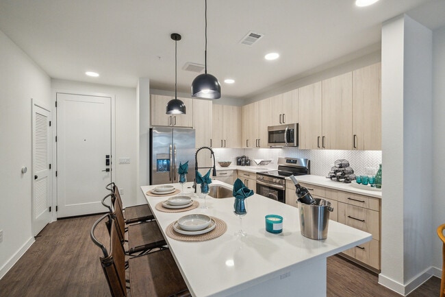
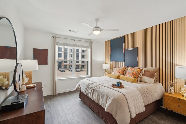
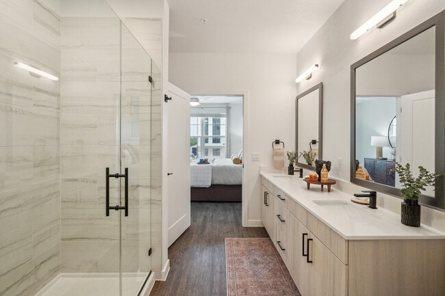
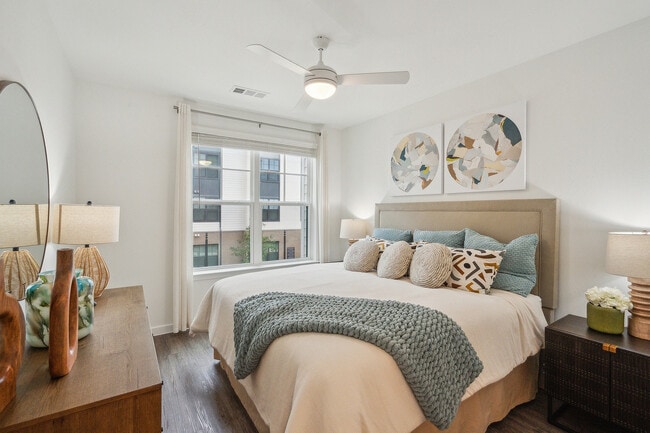
Elina Photos
-
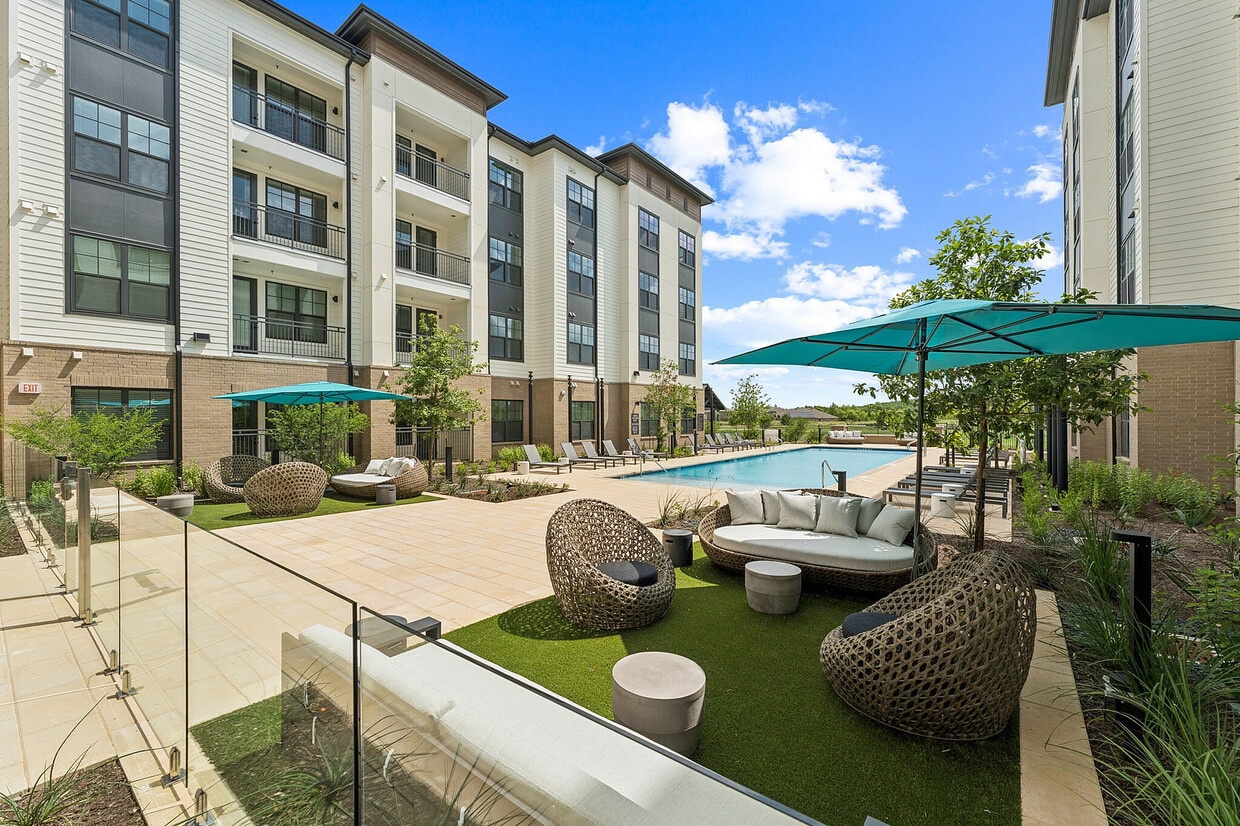
Enjoy sunny days relaxing by the resort-style pool
-
Functional design meets contemporary charm
-
Your private retreat for rest and relaxation
-
Clean lines and contemporary touches in every detail
-
Serene bedrooms designed for comfort
-
Peaceful spaces for sweet dreams
-
Refresh and recharge in sleek surroundings
-
Elegant bathrooms designed with you in mind
-
Spacious closets with in-unit washers and dryers
Models
-
S1
-
A1
-
A2
-
A3
-
B1
-
B2
Nearby Apartments
Within 50 Miles of Elina
Elina has units with in‑unit washers and dryers, making laundry day simple for residents.
Utilities are not included in rent. Residents should plan to set up and pay for all services separately.
Parking is available at Elina. Fees may apply depending on the type of parking offered. Contact this property for details.
Elina has studios to three-bedrooms with rent ranges from $1,273/mo. to $3,542/mo.
Yes, Elina welcomes pets. Breed restrictions, weight limits, and additional fees may apply. View this property's pet policy.
A good rule of thumb is to spend no more than 30% of your gross income on rent. Based on the lowest available rent of $1,273 for a one-bedroom, you would need to earn about $50,920 per year to qualify. Want to double-check your budget? Calculate how much rent you can afford with our Rent Affordability Calculator.
Elina is not currently offering any rent specials. Check back soon, as promotions change frequently.
While Elina does not offer Matterport 3D tours, renters can request a tour directly through our online platform.
7163 Union Park Lane
Austin, TX 78744