
Presidential Towers
555 W Madison St,
Chicago, IL 60661
$1,590 - $9,445
Studio - 2 Beds

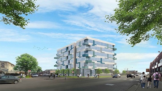
El Zocalo in Chicago is ready for you to visit. The prime W. 47th St. setting in the 60632 Zip code of Chicago is a great place to move into. Come by to see the current floorplan options. The leasing team is ready for you to visit. Your new home awaits you at El Zocalo. Contact or drop by to check the current floorplan availability today.
El Zocalo is an apartment community located in Cook County and the 60632 ZIP Code. This area is served by the Chicago Public Schools attendance zone.
Air Conditioning
Refrigerator
Disposal
Heating
Brighton Park is a unique blend of residential homes and apartments, commercial buildings, and industrial zones. There are two railroad landmarks that make up Brighton Park’s transportation gateway: Corwith Intermodal Facility and Brighton Park Crossing. Residents enjoy the convenient access to Interstate 55 and the Chicago Transit Authority’s Orange Line.
South Archer Avenue is your go-to road for local restaurants, convenience stores, and banks. Brighton Park’s own Kelly Park provides residents with outdoor recreational opportunities, as does nearby McKinley Park. Chicago Midway International Airport is four miles away.
Learn more about living in Brighton ParkCompare neighborhood and city base rent averages by bedroom.
| Brighton Park | Chicago, IL | |
|---|---|---|
| Studio | - | $1,598 |
| 1 Bedroom | $863 | $1,974 |
| 2 Bedrooms | $818 | $2,485 |
| 3 Bedrooms | $1,087 | $3,005 |
| Colleges & Universities | Distance | ||
|---|---|---|---|
| Colleges & Universities | Distance | ||
| Drive: | 8 min | 4.4 mi | |
| Drive: | 11 min | 5.3 mi | |
| Drive: | 11 min | 5.7 mi | |
| Drive: | 11 min | 5.8 mi |


Transportation options available in Chicago include Kedzie Station (Orange Line), located 0.4 mile from El Zocalo. El Zocalo is near Chicago Midway International, located 3.1 miles or 6 minutes away, and Chicago O'Hare International, located 21.6 miles or 37 minutes away.
| Transit / Subway | Distance | ||
|---|---|---|---|
| Transit / Subway | Distance | ||
|
|
Walk: | 7 min | 0.4 mi |
|
|
Drive: | 3 min | 1.3 mi |
|
|
Drive: | 2 min | 1.4 mi |
|
|
Drive: | 4 min | 2.2 mi |
|
|
Drive: | 6 min | 3.0 mi |
| Commuter Rail | Distance | ||
|---|---|---|---|
| Commuter Rail | Distance | ||
|
|
Drive: | 7 min | 4.0 mi |
|
|
Drive: | 8 min | 4.3 mi |
| Drive: | 9 min | 4.9 mi | |
|
|
Drive: | 9 min | 4.9 mi |
|
|
Drive: | 13 min | 6.8 mi |
| Airports | Distance | ||
|---|---|---|---|
| Airports | Distance | ||
|
Chicago Midway International
|
Drive: | 6 min | 3.1 mi |
|
Chicago O'Hare International
|
Drive: | 37 min | 21.6 mi |
Time and distance from El Zocalo.
| Shopping Centers | Distance | ||
|---|---|---|---|
| Shopping Centers | Distance | ||
| Walk: | 3 min | 0.2 mi | |
| Walk: | 4 min | 0.2 mi | |
| Walk: | 12 min | 0.7 mi |
| Parks and Recreation | Distance | ||
|---|---|---|---|
| Parks and Recreation | Distance | ||
|
McKinley Park
|
Drive: | 4 min | 2.0 mi |
|
Gage Park
|
Drive: | 4 min | 2.2 mi |
|
Marquette Park
|
Drive: | 5 min | 2.9 mi |
|
Douglas Park and Community Center
|
Drive: | 8 min | 4.2 mi |
|
Ogden Park
|
Drive: | 10 min | 5.2 mi |
| Hospitals | Distance | ||
|---|---|---|---|
| Hospitals | Distance | ||
| Drive: | 7 min | 3.4 mi | |
| Drive: | 7 min | 3.8 mi | |
| Drive: | 10 min | 5.3 mi |
What Are Walk Score®, Transit Score®, and Bike Score® Ratings?
Walk Score® measures the walkability of any address. Transit Score® measures access to public transit. Bike Score® measures the bikeability of any address.
What is a Sound Score Rating?
A Sound Score Rating aggregates noise caused by vehicle traffic, airplane traffic and local sources
3246 W 47th St
Chicago, IL 60632


