
Edge Worcester
8 Grafton St,
Worcester, MA 01604
$1,750 - $3,350 Total Monthly Price
Studio - 2 Beds 12 Month Lease
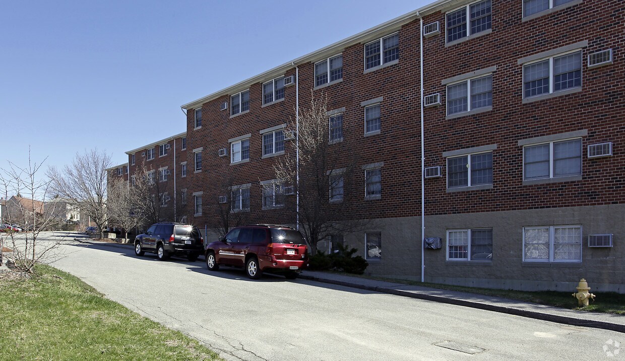
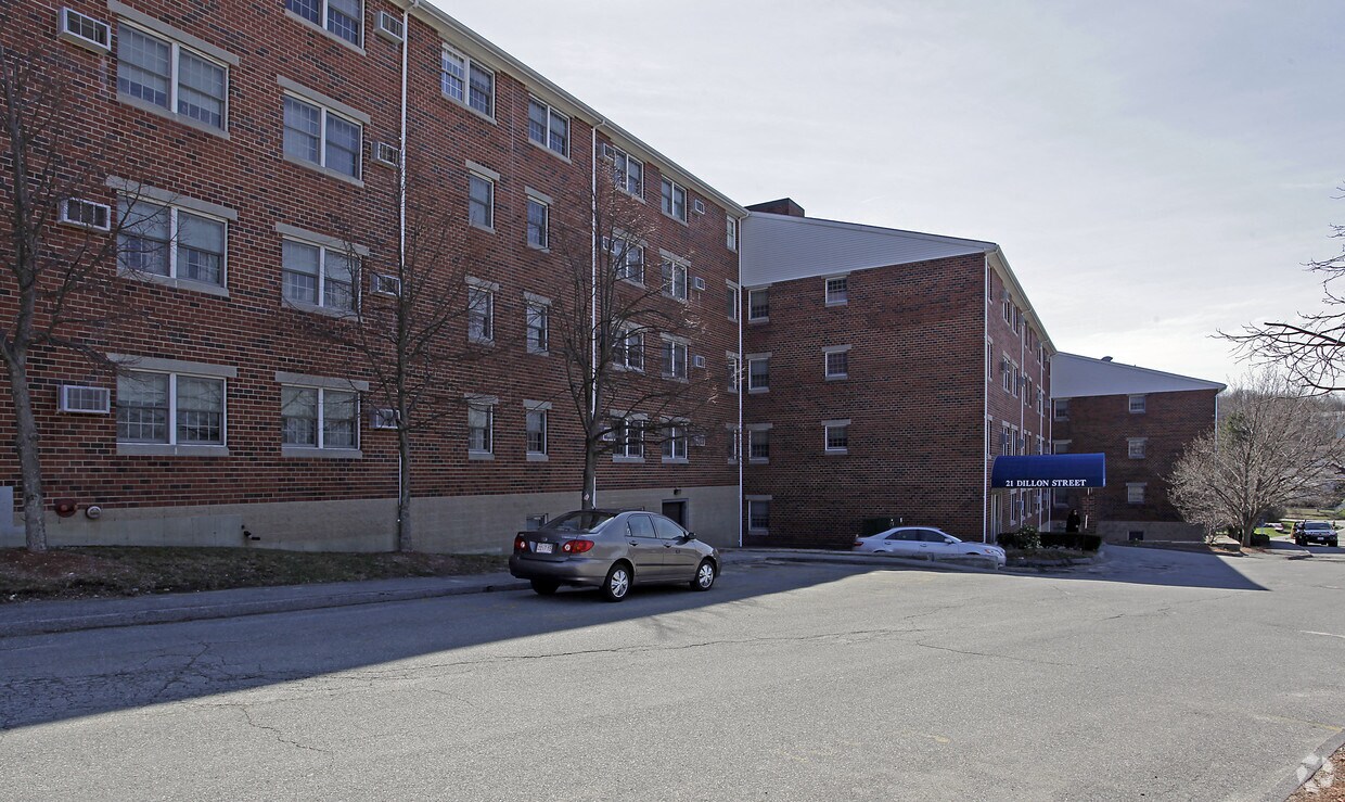
At Dillon Heights Apartments in Worcester, experience fine living. This community can be found in the 01604 area of Worcester. This community has a variety of available amenities and features. Some of these include: disposal chutes, convenient on-site parking options, and a game room. From amenities to availability, the leasing staff is ready to help you find the perfect new place. Experience a new standard at Dillon Heights Apartments.
Dillon Heights is an apartment community located in Worcester County and the 01604 ZIP Code. This area is served by the Worcester School District attendance zone.
Laundry Facilities
Elevator
Controlled Access
Recycling
Air Conditioning
High Speed Internet Access
Refrigerator
Tub/Shower
Worcester is the second-most populous city in Massachusetts and the undisputed anchor of Central New England, sitting near the geographic center of the state and earning its nickname, the Heart of the Commonwealth. It grew as an industrial powerhouse in the 19th century, and that history shows in its architecture, from converted mill buildings along the Canal District to the classic triple-decker neighborhoods that define much of the residential landscape. Several universities, including Clark University, Worcester Polytechnic Institute, and the College of the Holy Cross, give the city a strong educational foundation and a steady intellectual energy year-round. Neighborhoods range from the lively Shrewsbury Street corridor and the arts-forward downtown core to quieter hillside areas like College Hill and the green surroundings near Lake Quinsigamond.
Learn more about living in WorcesterCompare neighborhood and city base rent averages by bedroom.
| Vernon Hill | Worcester, MA | |
|---|---|---|
| Studio | $1,067 | $1,636 |
| 1 Bedroom | $1,349 | $1,870 |
| 2 Bedrooms | - | $2,181 |
| 3 Bedrooms | $1,330 | $2,465 |
| Colleges & Universities | Distance | ||
|---|---|---|---|
| Colleges & Universities | Distance | ||
| Drive: | 4 min | 1.8 mi | |
| Drive: | 6 min | 2.2 mi | |
| Drive: | 5 min | 2.5 mi | |
| Drive: | 5 min | 2.7 mi |


Scores provided by
Traffic
ActiveAirport
CalmBusinesses
ActiveScores provided by
HowLoud What is a Sound Score Rating? A Sound Score Rating aggregates noise caused by vehicle traffic, airplane traffic and local sources. How It WorksPets Allowed Fitness Center Dishwasher Refrigerator Kitchen In Unit Washer & Dryer
Pets Allowed Fitness Center Pool Dishwasher Refrigerator In Unit Washer & Dryer

Pets Allowed Refrigerator Oven
Pets Allowed Fitness Center Pool Walk-In Closets Stainless Steel Appliances Lounge
Pets Allowed Fitness Center Pool Dishwasher Refrigerator Walk-In Closets
Pets Allowed Maintenance on site Elevator

What Are Walk Score®, Transit Score®, and Bike Score® Ratings?
Walk Score® measures the walkability of any address. Transit Score® measures access to public transit. Bike Score® measures the bikeability of any address.
What is a Sound Score Rating?
A Sound Score Rating aggregates noise caused by vehicle traffic, airplane traffic and local sources.

21 Dillon St
Worcester, MA 01604


