
Adara
888 N 4th St,
Phoenix, AZ 85004
$824 - $3,400
Studio - 4 Beds
Bedrooms
1 bd
Bathrooms
1 ba
Square Feet
550 sq ft
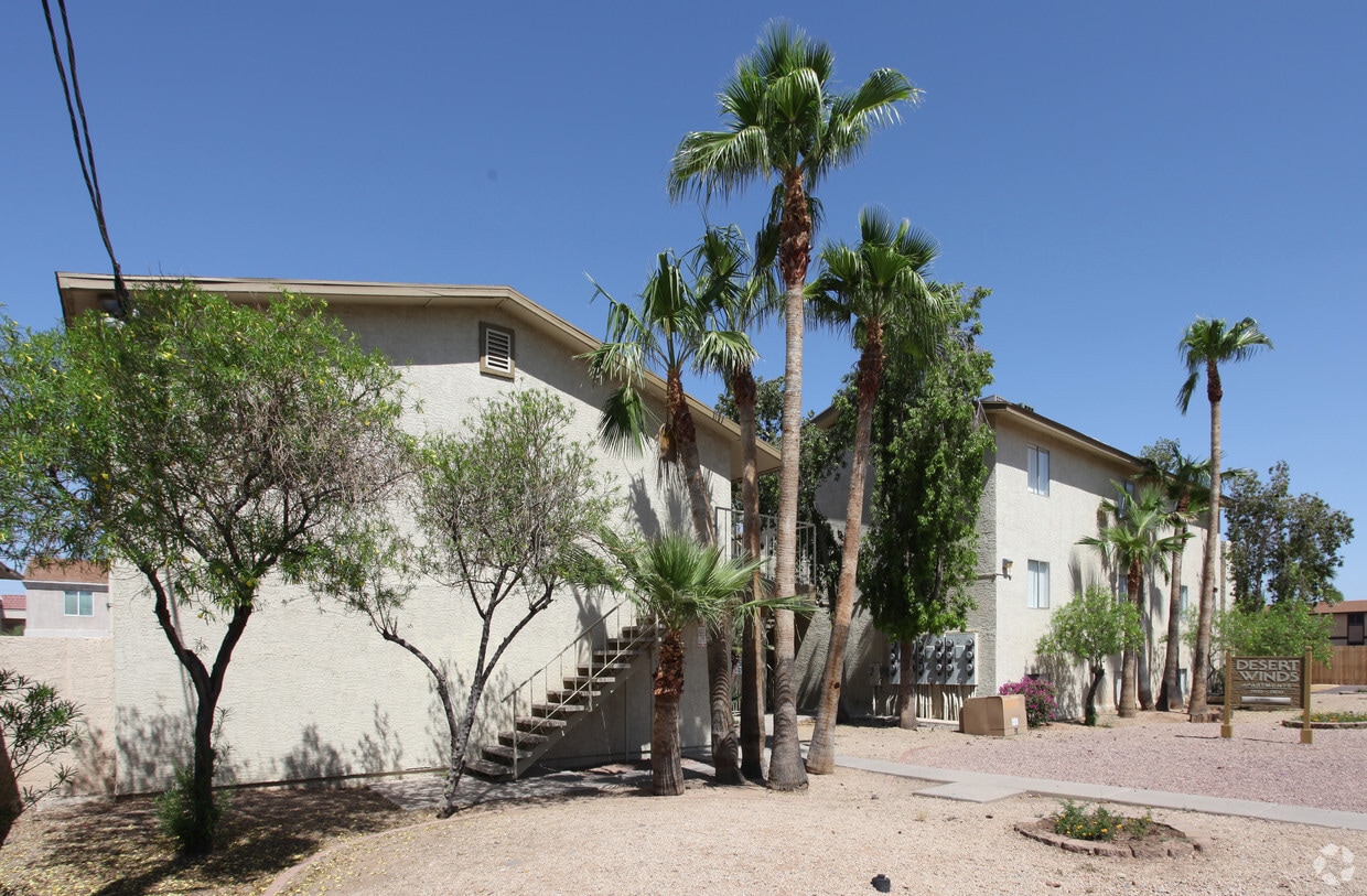
Welcome to Desert Wind! Located in Phoenix, AZ offers spacious one and two-bedroom apartment homes perfectly priced for any budget. Our residents enjoy living close to local shopping, dining, the bus line, and easy access to I-10 and I-17. Come find your new home TODAY!
Welcome to Desert Wind! Located in Phoenix, AZ offers spacious one and two-bedroom apartment homes perfectly priced for any budget. Our residents enjoy living close to local shopping, dining, the bus line, and easy access to I-10 and I-17. Come find your new home TODAY!
Desert Winds is an apartment community located in Maricopa County and the 85027 ZIP Code. This area is served by the Deer Valley Unified District attendance zone.
Deer Valley is a family-friendly suburb and residential neighborhood that’s constantly evolving. There are abundant outdoor recreational opportunities in Deer Valley because of its proximity to several natural attractions like Deem Hills and Cave Buttes, both known for scenic hiking and mountain biking trails. Residents have easy access to abundant shopping opportunities without having to leave town at places like Deer Valley Towne Center and Bell Towne Plaza. Deer Valley is home to good public schools and is the ideal suburb for those commuting to Downtown Phoenix and beyond, located less than 20 miles south of town along Interstate 17.
Learn more about living in Deer Valley| Colleges & Universities | Distance | ||
|---|---|---|---|
| Colleges & Universities | Distance | ||
| Drive: | 11 min | 5.9 mi | |
| Drive: | 12 min | 6.6 mi | |
| Drive: | 14 min | 8.0 mi | |
| Drive: | 17 min | 8.7 mi |


Transportation options available in Phoenix include Metro Pkwy, located 7.6 miles from Desert Winds. Desert Winds is near Phoenix Sky Harbor International, located 23.7 miles or 33 minutes away.
| Transit / Subway | Distance | ||
|---|---|---|---|
| Transit / Subway | Distance | ||
|
|
Drive: | 11 min | 7.6 mi |
|
|
Drive: | 12 min | 8.0 mi |
|
|
Drive: | 12 min | 8.8 mi |
|
|
Drive: | 14 min | 9.3 mi |
|
|
Drive: | 15 min | 10.3 mi |
| Airports | Distance | ||
|---|---|---|---|
| Airports | Distance | ||
|
Phoenix Sky Harbor International
|
Drive: | 33 min | 23.7 mi |
Time and distance from Desert Winds.
| Shopping Centers | Distance | ||
|---|---|---|---|
| Shopping Centers | Distance | ||
| Walk: | 12 min | 0.7 mi | |
| Walk: | 15 min | 0.8 mi | |
| Walk: | 20 min | 1.1 mi |
| Parks and Recreation | Distance | ||
|---|---|---|---|
| Parks and Recreation | Distance | ||
|
Adobe Mountain Park
|
Drive: | 4 min | 1.9 mi |
|
Paseo Highlands Park
|
Drive: | 5 min | 2.6 mi |
|
Adobe Dam Regional Park
|
Drive: | 7 min | 3.8 mi |
|
Conocido Park
|
Drive: | 6 min | 3.8 mi |
|
Turtle Rock Basin
|
Drive: | 10 min | 5.2 mi |
| Hospitals | Distance | ||
|---|---|---|---|
| Hospitals | Distance | ||
| Walk: | 14 min | 0.7 mi | |
| Drive: | 3 min | 1.6 mi | |
| Drive: | 12 min | 7.5 mi |
| Military Bases | Distance | ||
|---|---|---|---|
| Military Bases | Distance | ||
| Drive: | 30 min | 22.0 mi | |
| Drive: | 34 min | 23.5 mi | |
| Drive: | 110 min | 85.1 mi |

What Are Walk Score®, Transit Score®, and Bike Score® Ratings?
Walk Score® measures the walkability of any address. Transit Score® measures access to public transit. Bike Score® measures the bikeability of any address.
What is a Sound Score Rating?
A Sound Score Rating aggregates noise caused by vehicle traffic, airplane traffic and local sources

21420 N 23rd Ave
Phoenix, AZ 85027


