
Dovetree
5480 Dovetree Blvd,
Dayton, OH 45439
$1,295 - $1,695
1-2 Beds
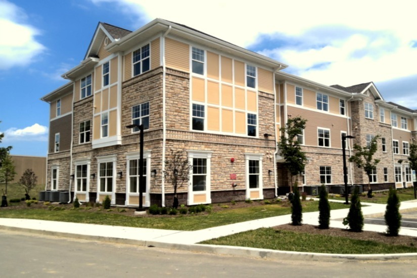
NEW CONSTRUCTION! Darby Run is a 50-unit new construction, housing community in Kettering, Montgomery County, Ohio. The elevator building contains a mix of one-, two-, and three-bedroom apartments. Apartments feature Energy Star appliances, washer and dryer hook-ups, large walk-in closets, and vinyl plank flooring. The common area of the community includes a community room, resident storage, bike storage, and leasing office space. The project is located in close proximity to fixed-route public transportation, shops and restaurants, entertainment and leisure facilities, cultural arts, public library, employment, and highly rated public schools. Contact us today for an application. Only 50 total units. Don't miss out to live in this brand-new community! Income and rent restrictions apply. Rents subject to change.
Darby Run is an apartment community located in Montgomery County and the 45440 ZIP Code. This area is served by the Kettering City School District attendance zone.
Laundry Facilities
Elevator
Controlled Access
24 Hour Access
Air Conditioning
Dishwasher
Washer/Dryer Hookup
Walk-In Closets
Dayton sits in Ohio's Miami Valley region where the Great Miami River runs through a city built on genuine invention — Orville and Wilbur Wright called it home, and that spirit of ingenuity still shapes the place today. Wright-Patterson Air Force Base anchors a strong aerospace and defense economy, while the University of Dayton and Wright State University give the city a steady pulse of academic energy. Healthcare is another major pillar, with regional health systems providing some of the area's largest employment. Downtown and Webster Station draw renters to lofts and mid-rise apartment communities steps from Day Air Ballpark and RiverScape MetroPark, while the Oregon District offers historic streets full of character. St. Anne's Hill and South Park are known for restored Victorian architecture and a quieter residential feel.
Learn more about living in Dayton| Colleges & Universities | Distance | ||
|---|---|---|---|
| Colleges & Universities | Distance | ||
| Drive: | 11 min | 5.0 mi | |
| Drive: | 14 min | 7.3 mi | |
| Drive: | 20 min | 11.8 mi | |
| Drive: | 32 min | 17.1 mi |


Scores provided by
Traffic
-Airport
-Businesses
-Scores provided by
HowLoud What is a Sound Score Rating? A Sound Score Rating aggregates noise caused by vehicle traffic, airplane traffic and local sources. How It WorksWhat Are Walk Score®, Transit Score®, and Bike Score® Ratings?
Walk Score® measures the walkability of any address. Transit Score® measures access to public transit. Bike Score® measures the bikeability of any address.
What is a Sound Score Rating?
A Sound Score Rating aggregates noise caused by vehicle traffic, airplane traffic and local sources.

4300 Hempstead Station Dr
Dayton, OH 45440


