Beacon
3510 Beacon Ave,
Fremont, CA 94538
$2,695 - $3,740
Studio - 2 Beds


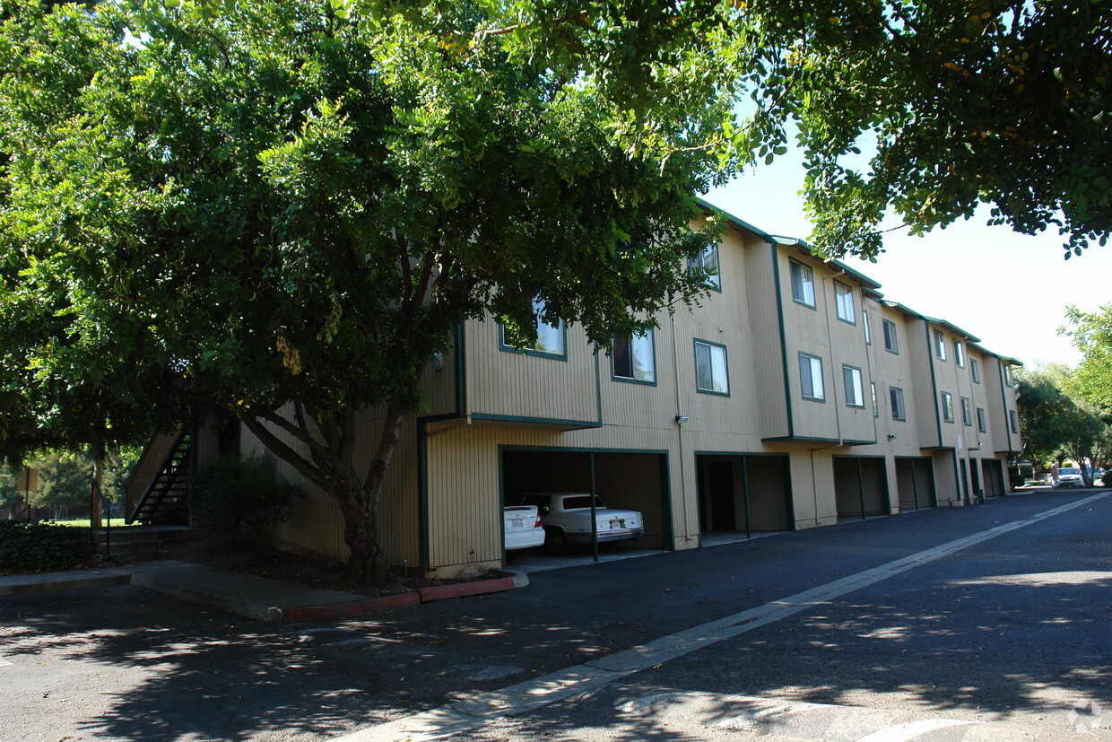
Thanks for visiting Crossroads Village in Fremont, CA. Located at 39438 Stratton Cmn in Fremont, this community is perfectly situated for work or play. Let the leasing team show you everything this community has in store. Contact us today to schedule a tour and see Crossroads Village.
Crossroads Village is an apartment community located in Alameda County and the 94538 ZIP Code. This area is served by the Fremont Unified attendance zone.
Piscina exterior
Instalaciones de lavandería
Parque infantil
Centro de negocios
Lavavajillas
Acceso a Internet de alta velocidad
Nevera
Bañera/Ducha
Sundale is a family-friendly neighborhood in central Fremont. Sundale is safe and has several good schools and childcare centers located in the neighborhood. Sundale offers mid-range to upscale housing options for every style, from cozy, single-family homes to modern apartments. Sundale is best known for housing the Fremont Hub, a sprawling al-fresco commercial center with eclectic restaurants, popular retailers, specialty shops, and big-box department stores. To enjoy the excellent weather California is known for, Sundale residents can walk over to Central Park, a sprawling lakeside green space. Renters also flock to Sundale because the community neighbors Downtown Fremont, which is known for its dynamic dining and multicultural scenes. Residents enjoy Sundale’s central location that allows for easy travel to other Bay Area cities, also attracting renters who work for tech companies in this Silicon Valley neighborhood.
Learn more about living in Sundale| Colleges & Universities | Distance | ||
|---|---|---|---|
| Colleges & Universities | Distance | ||
| Drive: | 6 min | 3.0 mi | |
| Drive: | 11 min | 4.8 mi | |
| Drive: | 19 min | 12.9 mi | |
| Drive: | 20 min | 13.8 mi |


Transportation options available in Fremont include Fremont Station, located 1.3 miles from Crossroads Village. Crossroads Village is near Norman Y Mineta San Jose International, located 16.9 miles or 24 minutes away, and Metro Oakland International, located 21.7 miles or 29 minutes away.
| Transit / Subway | Distance | ||
|---|---|---|---|
| Transit / Subway | Distance | ||
|
|
Drive: | 3 min | 1.3 mi |
|
|
Drive: | 4 min | 1.4 mi |
|
|
Drive: | 9 min | 4.6 mi |
|
|
Drive: | 12 min | 5.8 mi |
|
|
Drive: | 18 min | 11.7 mi |
| Commuter Rail | Distance | ||
|---|---|---|---|
| Commuter Rail | Distance | ||
| Drive: | 5 min | 2.0 mi | |
| Drive: | 5 min | 2.1 mi | |
| Drive: | 20 min | 14.5 mi | |
| Drive: | 22 min | 15.0 mi | |
| Drive: | 22 min | 15.1 mi |
| Airports | Distance | ||
|---|---|---|---|
| Airports | Distance | ||
|
Norman Y Mineta San Jose International
|
Drive: | 24 min | 16.9 mi |
|
Metro Oakland International
|
Drive: | 29 min | 21.7 mi |
Time and distance from Crossroads Village.
| Shopping Centers | Distance | ||
|---|---|---|---|
| Shopping Centers | Distance | ||
| Walk: | 6 min | 0.3 mi | |
| Walk: | 7 min | 0.4 mi | |
| Walk: | 12 min | 0.6 mi |
| Parks and Recreation | Distance | ||
|---|---|---|---|
| Parks and Recreation | Distance | ||
|
Central Park (Lake Elizabeth)
|
Drive: | 5 min | 2.0 mi |
|
Quarry Lakes Regional Recreation Area
|
Drive: | 7 min | 3.6 mi |
|
Niles Canyon Railway
|
Drive: | 8 min | 3.8 mi |
|
Alameda Creek Regional Trail
|
Drive: | 8 min | 3.9 mi |
|
Niles Community Park
|
Drive: | 10 min | 4.3 mi |
| Hospitals | Distance | ||
|---|---|---|---|
| Hospitals | Distance | ||
| Walk: | 17 min | 0.9 mi | |
| Drive: | 4 min | 1.6 mi | |
| Drive: | 16 min | 10.7 mi |
| Military Bases | Distance | ||
|---|---|---|---|
| Military Bases | Distance | ||
| Drive: | 29 min | 19.7 mi |
What Are Walk Score®, Transit Score®, and Bike Score® Ratings?
Walk Score® measures the walkability of any address. Transit Score® measures access to public transit. Bike Score® measures the bikeability of any address.
What is a Sound Score Rating?
A Sound Score Rating aggregates noise caused by vehicle traffic, airplane traffic and local sources
39438 Stratton Cmn
Fremont, CA 94538


