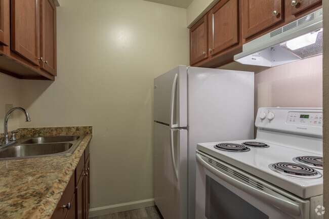
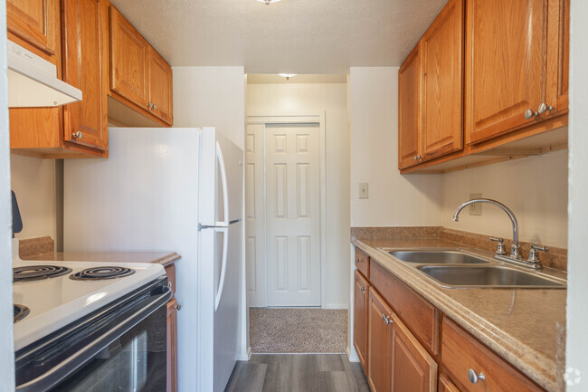
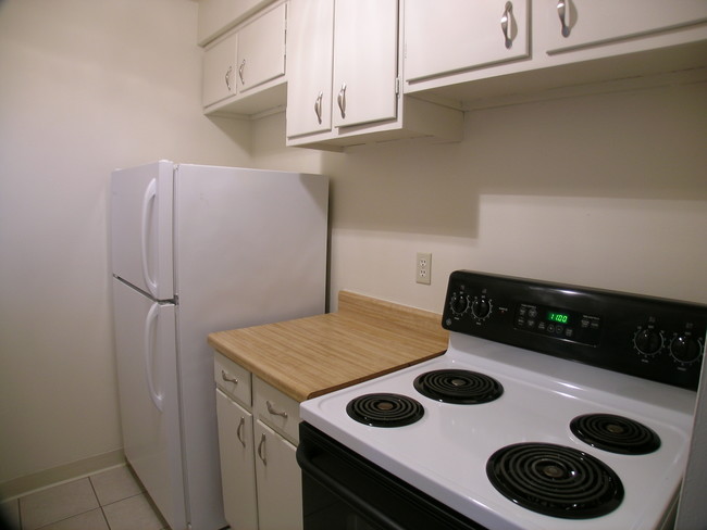
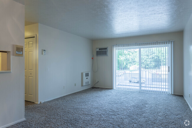
Located at 4260 Rocky River Dr in Cleveland, Ohio, this single-floor unit offers a straightforward, functional layout designed for comfortable everyday living. The living area is generously proportioned, featuring wall-to-wall carpeting in a neutral tone that carries throughout the main spaces. A ceiling fan overhead provides airflow, while a wall-mounted air conditioning unit ensures climate control year-round. Vertical blinds frame a sliding glass door that floods the room with natural light and provides outdoor access, giving the living space an open, airy feel. A partial wall with a pass-through window connects the living area to the kitchen, which features wood-toned cabinetry, a range, and tile-style flooring. This layout keeps the kitchen functional while maintaining a visual connection to the main living space. An interior door adjacent to the pass-through leads further into the unit. The bedroom is a well-sized, carpeted room highlighted by a broad window fitted with horizontal blinds, offering natural light and outdoor views. A baseboard heating unit runs along the base of the window wall, ensuring warmth during Cleveland's colder months. The bathroom features wood-look vinyl flooring, a white vanity with ample cabinet storage, a mirrored medicine cabinet with overhead lighting, and a tub-shower combination. The clean, neutral palette throughout the unit creates a bright and move-in ready atmosphere.
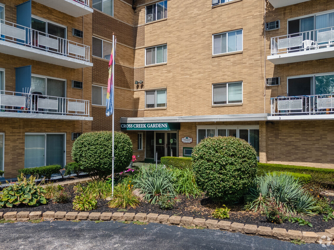
Cross Creek Garden Apartments
4298 Rocky River Dr,
Cleveland,
OH
44135
-
Monthly Rent
$875 - $1,250
-
Bedrooms
1 - 3 bd
-
Bathrooms
1 - 2 ba
-
Square Feet
600 - 1,100 sq ft
Highlights
- Walk-In Closets
- Controlled Access
- Elevator
- Grill
- Balcony
- Property Manager on Site
- Patio
Pricing & Floor Plans
Check Back Soon for Upcoming Availability
| Beds | Baths | Average SF | Availability |
|---|---|---|---|
| 1 Bedroom 1 Bedroom 1 Br | 1 Bath 1 Bath 1 Ba | 618 SF | Call for Availability |
| 2 Bedrooms 2 Bedrooms 2 Br | 1 Bath 1 Bath 1 Ba | 825 SF | Call for Availability |
| 2 Bedrooms 2 Bedrooms 2 Br | 1.5 Baths 1.5 Baths 1.5 Ba | 858 SF | Call for Availability |
| 3 Bedrooms 3 Bedrooms 3 Br | 2 Baths 2 Baths 2 Ba | 1,100 SF | Call for Availability |
Fees and Policies
The fees listed below are community-provided and may exclude utilities or add-ons. All payments are made directly to the property and are non-refundable unless otherwise specified.
-
One-Time Basics
-
Application Fee Per Applicant$40
-
-
Cats
-
Pet DepositMax of 2. Charged per pet.$400
-
Monthly Pet FeeMax of 2. Charged per pet.$40 / mo
-
-
Surface Lot
Property Fee Disclaimer: Based on community-supplied data and independent market research. Subject to change without notice. May exclude fees for mandatory or optional services and usage-based utilities.
Details
Utilities Included
-
Water
-
Heat
-
Trash Removal
-
Sewer
Lease Options
-
12 mo
Property Information
-
Built in 1965
-
136 units/4 stories
Specialty Housing Details
-
This property is intended and operated for occupancy by students, faculty and staff in higher education, but applications from individuals not involved in higher education may be accepted.
Matterport 3D Tours
About Cross Creek Garden Apartments
Qualified Candidates - Not accepting section 8 or vouchers. 675 Credit Score needed. Location is our key to your new home. We offer a fabulous location near the revitalized Kamm's Corner area, close to downtown via I-71, I-480 and seconds to the airport and major businesses.
Cross Creek Garden Apartments is an apartment community located in Cuyahoga County and the 44135 ZIP Code. This area is served by the Cleveland Metropolitan School District attendance zone.
Unique Features
- Balcony Or Patio With Most Suites
- Close to Airport & Rapid Station
- Close to Shopping, Nightlife and Restaurants
- Dishwasher In Select Units
- Elevator In Main Building
- Free Heat
- Free Water
- Near Public Transportation
- On-Site Laundry
- RTA Busline
- Upgraded Kitchen & Bath In Select Suites
- Westpark - Walk to Kamm's Corner
Contact
Community Amenities
Laundry Facilities
Elevator
Controlled Access
Grill
- Laundry Facilities
- Controlled Access
- Property Manager on Site
- Public Transportation
- Elevator
- Walk-Up
- Courtyard
- Grill
Apartment Features
Air Conditioning
Dishwasher
Walk-In Closets
Refrigerator
- Air Conditioning
- Heating
- Cable Ready
- Tub/Shower
- Dishwasher
- Kitchen
- Oven
- Refrigerator
- Carpet
- Tile Floors
- Walk-In Closets
- Window Coverings
- Balcony
- Patio
Kamm's Corners, a suburban community within the western border of Cleveland, Ohio, provides an eclectic mix of residential, commercial, and industrial development. This popular neighborhood, named for Oswald Kamm from the 1800s, features apartments for rent near Highway 237 in the area's central section. Close recreational venues include the Mastick Woods and Little Met golf courses.
Neighborhood residents can reach Downtown Cleveland in less than 15 minutes, and the Cleveland Hopkins International Airport sits about 10 minutes away. During summer and fall, locals enjoy shopping for local produce while socializing at the Kamm's Corners Farmers Market. There are plenty of restaurants and bars that surround the area, welcoming residents who gather to watch Cleveland Browns or Ohio State games.
Learn more about living in Kamm's CornersCompare neighborhood and city base rent averages by bedroom.
| Kamm's Corners | Cleveland, OH | |
|---|---|---|
| Studio | $833 | $1,207 |
| 1 Bedroom | $897 | $1,384 |
| 2 Bedrooms | $1,283 | $1,743 |
| 3 Bedrooms | $1,253 | $2,165 |
- Laundry Facilities
- Controlled Access
- Property Manager on Site
- Public Transportation
- Elevator
- Walk-Up
- Courtyard
- Grill
- Balcony Or Patio With Most Suites
- Close to Airport & Rapid Station
- Close to Shopping, Nightlife and Restaurants
- Dishwasher In Select Units
- Elevator In Main Building
- Free Heat
- Free Water
- Near Public Transportation
- On-Site Laundry
- RTA Busline
- Upgraded Kitchen & Bath In Select Suites
- Westpark - Walk to Kamm's Corner
- Air Conditioning
- Heating
- Cable Ready
- Tub/Shower
- Dishwasher
- Kitchen
- Oven
- Refrigerator
- Carpet
- Tile Floors
- Walk-In Closets
- Window Coverings
- Balcony
- Patio
| Monday | 8:30am - 4:30pm |
|---|---|
| Tuesday | 8:30am - 4:30pm |
| Wednesday | 8:30am - 4:30pm |
| Thursday | 8:30am - 4:30pm |
| Friday | 8:30am - 4:30pm |
| Saturday | By Appointment |
| Sunday | Closed |
| Colleges & Universities | Distance | ||
|---|---|---|---|
| Colleges & Universities | Distance | ||
| Drive: | 11 min | 5.1 mi | |
| Drive: | 15 min | 6.2 mi | |
| Drive: | 18 min | 8.6 mi | |
| Drive: | 17 min | 10.4 mi |


View GreatSchools Rating Methodology
Data provided by GreatSchools.org © 2026. All rights reserved.
Transportation options available in Cleveland include Brookpark Station, located 2.1 miles from Cross Creek Garden Apartments. Cross Creek Garden Apartments is near Cleveland-Hopkins International, located 3.2 miles or 9 minutes away.
| Transit / Subway | Distance | ||
|---|---|---|---|
| Transit / Subway | Distance | ||
| Drive: | 5 min | 2.1 mi | |
| Drive: | 5 min | 2.1 mi | |
| Drive: | 6 min | 2.3 mi | |
| Drive: | 5 min | 2.3 mi | |
| Drive: | 8 min | 3.0 mi |
| Commuter Rail | Distance | ||
|---|---|---|---|
| Commuter Rail | Distance | ||
|
|
Drive: | 23 min | 11.0 mi |
| Drive: | 23 min | 14.0 mi | |
| Drive: | 26 min | 15.5 mi | |
|
|
Drive: | 27 min | 19.0 mi |
| Drive: | 34 min | 20.8 mi |
| Airports | Distance | ||
|---|---|---|---|
| Airports | Distance | ||
|
Cleveland-Hopkins International
|
Drive: | 9 min | 3.2 mi |
Scores provided by
Traffic
BusyAirport
BusyBusinesses
ActiveScores provided by
HowLoud What is a Sound Score Rating? A Sound Score Rating aggregates noise caused by vehicle traffic, airplane traffic and local sources. How It WorksTime and distance from Cross Creek Garden Apartments.
| Shopping Centers | Distance | ||
|---|---|---|---|
| Shopping Centers | Distance | ||
| Walk: | 19 min | 1.0 mi | |
| Walk: | 20 min | 1.0 mi | |
| Drive: | 3 min | 1.2 mi |
| Parks and Recreation | Distance | ||
|---|---|---|---|
| Parks and Recreation | Distance | ||
|
Rocky River Nature Center
|
Drive: | 10 min | 5.2 mi |
|
Big Creek Reservation
|
Drive: | 11 min | 6.0 mi |
|
Lakefront Reservation and Edgewater Park
|
Drive: | 16 min | 6.9 mi |
|
Cleveland Metroparks Zoo
|
Drive: | 13 min | 7.3 mi |
|
Lake Erie Nature and Science Center
|
Drive: | 19 min | 10.0 mi |
| Hospitals | Distance | ||
|---|---|---|---|
| Hospitals | Distance | ||
| Drive: | 2 min | 1.1 mi | |
| Drive: | 11 min | 5.8 mi | |
| Drive: | 14 min | 7.9 mi |
| Military Bases | Distance | ||
|---|---|---|---|
| Military Bases | Distance | ||
| Drive: | 88 min | 73.6 mi | |
| Drive: | 92 min | 74.9 mi |
Cross Creek Garden Apartments Photos
-
Cross Creek Garden Apartments
-
1BD, 1BA - 600-635SF
-
1BD, 1BA - 600-635SF
-
2BD, 1BA - 820-830SF
-
-
1BD, 1BA - 600-635SF
-
1BD, 1BA - 600-635SF
-
Efficiency 1BA - 295SF
-
Efficiency 1BA - 295SF
Nearby Apartments
Within 50 Miles of Cross Creek Garden Apartments
While Cross Creek Garden Apartments does not provide in‑unit laundry, on‑site laundry facilities are available for shared resident use.
Select utilities are included in rent at Cross Creek Garden Apartments, including water, heat, trash removal, and sewer. Residents are responsible for any other utilities not listed.
Parking is available at Cross Creek Garden Apartments. Contact this property for details.
Yes, Cross Creek Garden Apartments welcomes pets. Breed restrictions, weight limits, and additional fees may apply. View this property's pet policy.
A good rule of thumb is to spend no more than 30% of your gross income on rent. Based on the lowest available rent of $875 for a one-bedroom, you would need to earn about $35,000 per year to qualify. Want to double-check your budget? Calculate how much rent you can afford with our Rent Affordability Calculator.
Cross Creek Garden Apartments is offering Specials for eligible applicants, with rental rates starting at $875.
Yes! Cross Creek Garden Apartments offers 3 Matterport 3D Tours. Explore different floor plans and see unit level details, all without leaving home.

4298 Rocky River Dr
Cleveland, OH 44135
Property Manager Responded