
1213 Walnut
1213 Walnut St,
Philadelphia, PA 19107
$1,615 - $5,495
Studio - 2 Beds
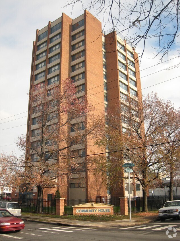
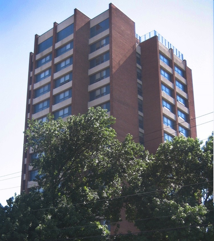
Experience Philadelphia living at Community House. With a location on N. 11th St. in Philadelphia's 19141 area, residents can easily connect with a number of points of interest in the surrounding area. Come for a visit to see the available floorplan options. The leasing staff is waiting to show you all that this community has to offer. Make your move to Community House. Contact or drop by the leasing office to talk about leasing your new apartment.
Community House is an apartment community located in Philadelphia County and the 19141 ZIP Code. This area is served by the The School District of Philadelphia attendance zone.
Logan-Ogontz-Fern Rock, located about 10 miles north of the heart of Philadelphia, is a lively urban neighborhood full of residential areas, modern amenities, and exciting attractions. This city is popular for commuters since Route 611 and Highway 1 run through different parts of the neighborhood. Public transportation is also accessible via the Olney Transportation Center, located in the center of Logan-Ogontz-Fern Rock. The area is great for students as well because La Salle University, a small private Catholic university, sits on the western border of town.
Find family-friendly attractions at sprawling parks and historical sites, including the Wister Woods Park and the Stenton Mansion. A variety of local eateries are gathered along North 5th Street and North Broad Street while large shopping plazas with a plethora of stores can be found off these roads as well. Affordable rentals ranging in size and style can be found throughout the neighborhood.
Learn more about living in Logan-Ogontz-Fern RockCompare neighborhood and city base rent averages by bedroom.
| Logan-Ogontz-Fern Rock | Philadelphia, PA | |
|---|---|---|
| Studio | $1,011 | $1,400 |
| 1 Bedroom | $1,039 | $1,727 |
| 2 Bedrooms | $1,181 | $2,173 |
| 3 Bedrooms | $1,348 | $3,010 |
| Colleges & Universities | Distance | ||
|---|---|---|---|
| Colleges & Universities | Distance | ||
| Walk: | 18 min | 1.0 mi | |
| Drive: | 4 min | 1.3 mi | |
| Drive: | 8 min | 2.5 mi | |
| Drive: | 9 min | 3.6 mi |


Transportation options available in Philadelphia include Olney, located 0.5 mile from Community House. Community House is near Philadelphia International, located 17.7 miles or 33 minutes away, and Trenton Mercer, located 27.9 miles or 48 minutes away.
| Transit / Subway | Distance | ||
|---|---|---|---|
| Transit / Subway | Distance | ||
|
|
Walk: | 9 min | 0.5 mi |
|
|
Walk: | 12 min | 0.6 mi |
|
|
Walk: | 12 min | 0.6 mi |
|
|
Walk: | 20 min | 1.0 mi |
|
|
Drive: | 5 min | 1.5 mi |
| Commuter Rail | Distance | ||
|---|---|---|---|
| Commuter Rail | Distance | ||
|
|
Walk: | 15 min | 0.8 mi |
|
|
Walk: | 19 min | 1.0 mi |
|
|
Drive: | 6 min | 1.5 mi |
|
|
Drive: | 6 min | 1.7 mi |
|
|
Drive: | 7 min | 2.5 mi |
| Airports | Distance | ||
|---|---|---|---|
| Airports | Distance | ||
|
Philadelphia International
|
Drive: | 33 min | 17.7 mi |
|
Trenton Mercer
|
Drive: | 48 min | 27.9 mi |
Time and distance from Community House.
| Shopping Centers | Distance | ||
|---|---|---|---|
| Shopping Centers | Distance | ||
| Walk: | 19 min | 1.0 mi | |
| Drive: | 5 min | 1.3 mi | |
| Drive: | 5 min | 1.5 mi |
| Parks and Recreation | Distance | ||
|---|---|---|---|
| Parks and Recreation | Distance | ||
|
Awbury Arboretum
|
Drive: | 6 min | 2.1 mi |
|
Tacony Creek Park
|
Drive: | 9 min | 3.4 mi |
|
Wagner Free Institute of Science
|
Drive: | 14 min | 4.4 mi |
|
Edgar Allan Poe Nat'l Historic Site
|
Drive: | 16 min | 5.9 mi |
|
Lorimer Park
|
Drive: | 16 min | 6.9 mi |
| Hospitals | Distance | ||
|---|---|---|---|
| Hospitals | Distance | ||
| Walk: | 10 min | 0.5 mi | |
| Drive: | 7 min | 2.3 mi | |
| Drive: | 6 min | 2.4 mi |
| Military Bases | Distance | ||
|---|---|---|---|
| Military Bases | Distance | ||
| Drive: | 26 min | 13.2 mi |
What Are Walk Score®, Transit Score®, and Bike Score® Ratings?
Walk Score® measures the walkability of any address. Transit Score® measures access to public transit. Bike Score® measures the bikeability of any address.
What is a Sound Score Rating?
A Sound Score Rating aggregates noise caused by vehicle traffic, airplane traffic and local sources

5501 N 11th St
Philadelphia, PA 19141


