
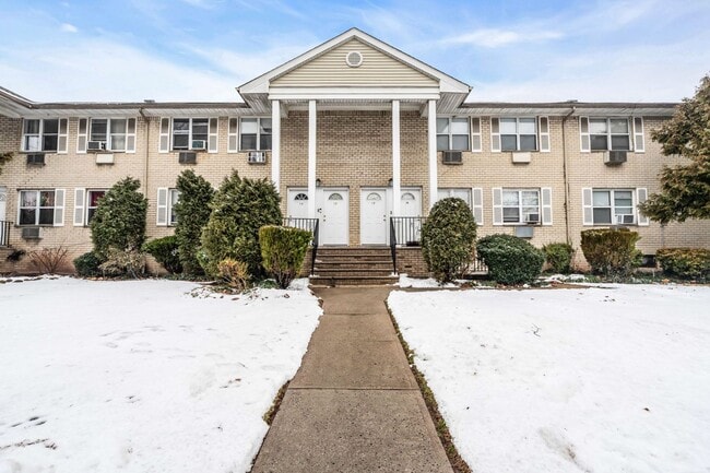
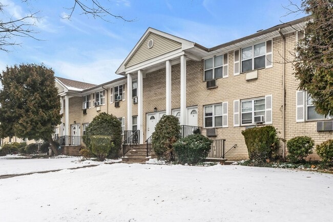
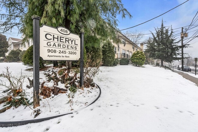
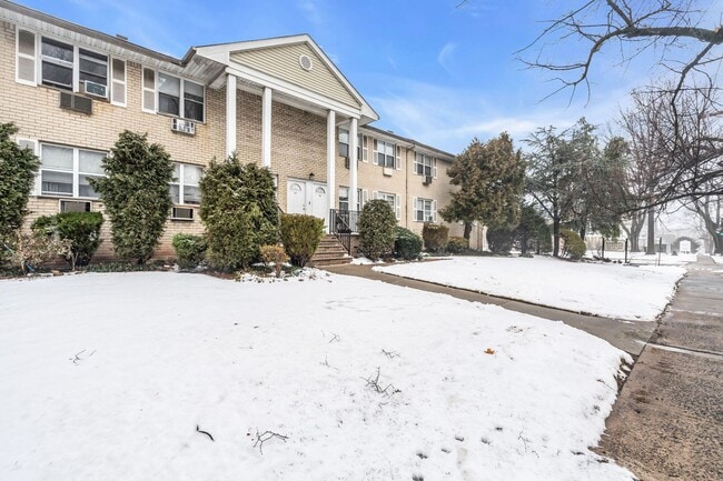
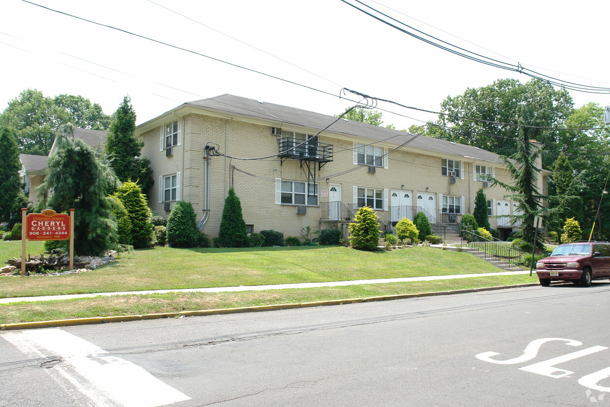
Cheryl Gardens
408 Chestnut St,
Roselle,
NJ
07203
-
Monthly Rent
$1,800
-
Bedrooms
1 bd
-
Bathrooms
1 ba
-
Square Feet
580 sq ft

Adéntrese en una comunidad diseñada pensando en usted. Cheryl Gardens ofrece un estilo de vida moderno y espacioso en una ubicación privilegiada, lo que lo convierte en el lugar perfecto para llamar hogar. Cada apartamento cuenta con distribuciones cuidadosamente diseñadas, interiores luminosos y acabados de alta calidad que combinan estilo y funcionalidad para la comodidad diaria. Disfrute de un estilo de vida a su medida con comodidades que le harán sentir cada día más cómodo. La ubicación lo es todo, y Cheryl Gardens lo coloca cerca de todo lo que necesita. Con fácil acceso a Nueva York, restaurantes locales, tiendas y entretenimiento, siempre estará cerca de la emoción y disfrutará de un ambiente tranquilo. Cheryl Gardens no es solo un lugar para vivir, es un lugar para sentirse como en casa. ¡Programe su visita hoy mismo y descubra lo que hace de Cheryl Gardens el lugar perfecto para llamar hogar!
Pricing & Floor Plans
Fees and Policies
The fees listed below are community-provided and may exclude utilities or add-ons. All payments are made directly to the property and are non-refundable unless otherwise specified. Use the Cost Calculator to determine costs based on your needs.
-
One-Time Basics
-
Due at Application
-
Application Fee Per ApplicantCharged per applicant.$40
-
-
Due at Application
Property Fee Disclaimer: Based on community-supplied data and independent market research. Subject to change without notice. May exclude fees for mandatory or optional services and usage-based utilities.
Details
Property Information
-
Built in 1973
-
32 units/2 stories
About Cheryl Gardens
Adéntrese en una comunidad diseñada pensando en usted. Cheryl Gardens ofrece un estilo de vida moderno y espacioso en una ubicación privilegiada, lo que lo convierte en el lugar perfecto para llamar hogar. Cada apartamento cuenta con distribuciones cuidadosamente diseñadas, interiores luminosos y acabados de alta calidad que combinan estilo y funcionalidad para la comodidad diaria. Disfrute de un estilo de vida a su medida con comodidades que le harán sentir cada día más cómodo. La ubicación lo es todo, y Cheryl Gardens lo coloca cerca de todo lo que necesita. Con fácil acceso a Nueva York, restaurantes locales, tiendas y entretenimiento, siempre estará cerca de la emoción y disfrutará de un ambiente tranquilo. Cheryl Gardens no es solo un lugar para vivir, es un lugar para sentirse como en casa. ¡Programe su visita hoy mismo y descubra lo que hace de Cheryl Gardens el lugar perfecto para llamar hogar!
Cheryl Gardens is an apartment community located in Union County and the 07203 ZIP Code. This area is served by the Roselle Public attendance zone.
Unique Features
- Basura
- Gas
- Agua/Alcantarillado
Contact
Ideally located about 10 miles southwest of Newark and 18 miles from New York City, Roselle is a cozy borough for those looking for a quieter place to call home. First settled around 1664, Roselle was settled by farmers looking for better farmland. It was part of the first New Jersey settlement called Elizabethtown. The borough was officially incorporated in 1894 as Roselle.
Today, this terrific community features beautiful parks and great shopping. Warinanco Park, the borough's largest park, offers ball fields, a running track, a playground, pedal boats, an ice skating rink, a fitness trail, a bicycle path, fishing, a spray pool, tennis courts, picnic areas, and shuffleboard. Roselle's tree-lined streets are mainly residential, with a shopping district located between Westfield Avenue and West 1st Avenue.
Learn more about living in Roselle- Basura
- Gas
- Agua/Alcantarillado
| Monday | By Appointment |
|---|---|
| Tuesday | By Appointment |
| Wednesday | By Appointment |
| Thursday | By Appointment |
| Friday | By Appointment |
| Saturday | By Appointment |
| Sunday | By Appointment |
| Colleges & Universities | Distance | ||
|---|---|---|---|
| Colleges & Universities | Distance | ||
| Drive: | 7 min | 2.7 mi | |
| Drive: | 8 min | 3.3 mi | |
| Drive: | 12 min | 4.0 mi | |
| Drive: | 19 min | 10.2 mi |


View GreatSchools Rating Methodology
Data provided by GreatSchools.org © 2026. All rights reserved.
Transportation options available in Roselle include Military Park, located 9.1 miles from Cheryl Gardens. Cheryl Gardens is near Newark Liberty International, located 12.2 miles or 18 minutes away, and LaGuardia, located 27.4 miles or 52 minutes away.
| Transit / Subway | Distance | ||
|---|---|---|---|
| Transit / Subway | Distance | ||
|
|
Drive: | 16 min | 9.1 mi |
|
|
Drive: | 17 min | 9.6 mi |
| Drive: | 19 min | 10.0 mi | |
|
|
Drive: | 17 min | 10.5 mi |
|
|
Drive: | 17 min | 11.0 mi |
| Commuter Rail | Distance | ||
|---|---|---|---|
| Commuter Rail | Distance | ||
|
|
Drive: | 4 min | 1.3 mi |
|
|
Drive: | 5 min | 2.4 mi |
|
|
Drive: | 7 min | 2.7 mi |
|
|
Drive: | 7 min | 2.9 mi |
|
|
Drive: | 8 min | 3.6 mi |
| Airports | Distance | ||
|---|---|---|---|
| Airports | Distance | ||
|
Newark Liberty International
|
Drive: | 18 min | 12.2 mi |
|
LaGuardia
|
Drive: | 52 min | 27.4 mi |
Time and distance from Cheryl Gardens.
| Shopping Centers | Distance | ||
|---|---|---|---|
| Shopping Centers | Distance | ||
| Drive: | 3 min | 1.1 mi | |
| Drive: | 3 min | 1.3 mi | |
| Drive: | 4 min | 1.3 mi |
| Parks and Recreation | Distance | ||
|---|---|---|---|
| Parks and Recreation | Distance | ||
|
William Miller Sperry Observatory
|
Drive: | 10 min | 3.8 mi |
|
Hawk Rise Sanctuary
|
Drive: | 12 min | 4.8 mi |
|
Merrill Park
|
Drive: | 15 min | 6.5 mi |
|
Staten Island Industrial Park
|
Drive: | 15 min | 7.4 mi |
|
Liberty State Park
|
Drive: | 16 min | 7.5 mi |
| Hospitals | Distance | ||
|---|---|---|---|
| Hospitals | Distance | ||
| Drive: | 8 min | 3.0 mi | |
| Drive: | 10 min | 3.9 mi | |
| Drive: | 13 min | 7.6 mi |
| Military Bases | Distance | ||
|---|---|---|---|
| Military Bases | Distance | ||
| Drive: | 17 min | 7.3 mi | |
| Drive: | 15 min | 7.7 mi | |
| Drive: | 23 min | 16.0 mi |
Cheryl Gardens Photos
-
Cheryl Gardens
-
-
-
-
-
-
-
-
Nearby Apartments
Within 50 Miles of Cheryl Gardens
-
5th Avenue Apartments
127-135 E 5th Ave
Roselle, NJ 07203
$1,800
1 Br 0.1 mi
-
Sunrise Village Apartments!
145 Jerome St
Roselle Park, NJ 07204
$1,800 - $2,395
1-2 Br 1.0 mi
-
Astoria Manor
854 W Grand St
Elizabeth, NJ 07202
$1,800
1 Br 1.3 mi
-
Edgar Gardens
249 W Jersey Ave
Elizabeth, NJ 07202
$1,895 - $2,395
1-2 Br 2.1 mi
-
Chilton Hall Apartments
127 Chilton St
Elizabeth, NJ 07202
$1,895 - $2,395
1-2 Br 2.2 mi
-
Palisades Manor Apartments – Modern Living in the Heart of Palisades Park
504-542 F Broad Ave
Palisades Park, NJ 07650
$2,200
1 Br 19.6 mi
Cheryl Gardens does not offer in-unit laundry or shared facilities. Please contact the property to learn about nearby laundry options.
Utilities are not included in rent. Residents should plan to set up and pay for all services separately.
Contact this property for parking details.
Cheryl Gardens has one-bedroom apartments renting for $1,800/mo.
Cheryl Gardens does not allow pets, though service animals are always welcome in accordance with applicable laws.
A good rule of thumb is to spend no more than 30% of your gross income on rent. Based on the lowest available rent of $1,800 for a one-bedroom, you would need to earn about $72,000 per year to qualify. Want to double-check your budget? Calculate how much rent you can afford with our Rent Affordability Calculator.
Cheryl Gardens is not currently offering any rent specials. Check back soon, as promotions change frequently.
While Cheryl Gardens does not offer Matterport 3D tours, renters can request a tour directly through our online platform.
Statewide service is free, confidential, multilingual and always open. Three easy ways to reach Social Services in NJ: Dial 2-1-1; text your zip code to 898-211; or chat at https://www.nj211.org
What Are Walk Score®, Transit Score®, and Bike Score® Ratings?
Walk Score® measures the walkability of any address. Transit Score® measures access to public transit. Bike Score® measures the bikeability of any address.
What is a Sound Score Rating?
A Sound Score Rating aggregates noise caused by vehicle traffic, airplane traffic and local sources
408 Chestnut St
Roselle, NJ 07203
Property Manager Responded