Charring Cross

522 Knights Way, Westerville, OH 43081

Share Listing
Favorites
Charring Cross
Share Listing
Favorites

About Charring Cross

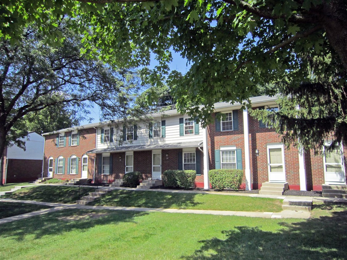
Best Kept Secret in Westerville. A cooperative family community of townhomes and ranch style homes. Gas Heat, Water, and Sewer are paid, W/D Hook-ups, Central Air and a whole lot more! Please note we do not accept pets.

Charring Cross is an apartment community located in Franklin County and the 43081 ZIP Code. This area is served by the Westerville City School District attendance zone.

Unique Features

  • Central AC/Carpeting
  • Children's Playground
  • Community Building Rental Available
  • Full Basement in Townhomes
  • Westerville Schools
  • Washer/Dryer Hookups

Community Amenities

  • Maintenance on site
  • Walk-Up

Apartment Features

Air Conditioning

Refrigerator

Disposal

Range

  • Air Conditioning
  • Disposal
  • Range
  • Refrigerator
Location
522 Knights Way, Westerville,
OH 43081
Get Directions
Neighborhood

Around 15 miles outside of the center of Columbus, Ohio, Outer Northeast Columbus includes the neighborhoods of Westerville and Huber Ridge. The area has an abundant selection of parks, lakes and golf courses, attracting people who seek outdoor recreation. Both Interstate 71 and Highway 270 border Outer Northeast Columbus, making travel to downtown and other areas of the city simple and convenient.

Many families flock to outer northeast Columbus for its recreation and amenities. Westerville includes plenty of dining and shopping options, along with excellent residential neighborhoods and schools. Residents find refuge from busier areas of the city while enjoying the benefits of easy commutes, along with plenty of opportunities for fun and entertainment.

Learn more about living in Northeast Columbus 
Education
Colleges & Universities Distance
Drive: 4 min 2.0 mi
Drive: 15 min 9.5 mi
Drive: 21 min 12.5 mi
Drive: 22 min 13.0 mi
Charring Cross is within 4 minutes or 2.0 miles from Otterbein College. It is also near Ohio Dominican University and The Ohio State University.
Schools
Public Elementary School
Grades K-5
Attendance Zone
Public Elementary School
Grades K-5
Nearby
Public Middle School
Grades 6-8
Attendance Zone
Public High School
Grades 9-12
Attendance Zone
Private Elementary School
Grades PK-5
Nearby
Private Elementary School
Grades PK-5
Nearby
Private Elementary, Middle & High School
Grades K-12
Nearby
Transportation

Charring Cross is near John Glenn Columbus International, located 11.3 miles or 17 minutes away, and Rickenbacker International, located 25.7 miles or 35 minutes away.

Airports Distance
Airports Distance
John Glenn Columbus International
Drive: 17 min 11.3 mi
Rickenbacker International
Drive: 35 min 25.7 mi

Walkability Near Charring Cross

Getting Around
Moderately Walkable
Walkability
60 / 100
Limited Public Transit
Transit
20 / 100
Exceptionally Drivable
Drivability
90 / 100
Moderately Bikeable
Bikeability
60 / 100

Scores provided by

What do Walkability, Transit, Drivability, and Bikeability mean? Walkability measures the walking distance to day-to-day needs. Transit measures access to public transportation. Drivability measures congestion, parking availability, and access to major roads. Bikeability measures the suitability for cycling. How It Works
Active
Soundscore
78 / 100

Traffic

Active

Airport

Calm

Businesses

Active

Scores provided by

HowLoud What is a Sound Score Rating? A Sound Score Rating aggregates noise caused by vehicle traffic, airplane traffic and local sources. How It Works
Points of Interest

Time and distance from Charring Cross.

Shopping Centers Distance
Walk: 7 min 0.4 mi
Walk: 7 min 0.4 mi
Walk: 11 min 0.6 mi
Charring Cross has 3 shopping centers within 0.6 mile, which is about a 11-minute walk. The miles and minutes will be for the farthest away property.
Parks and Recreation Distance
Weitkamp Observatory
Drive: 4 min 1.9 mi
Sharon Woods Metro Park
Drive: 8 min 2.2 mi
Inniswood Gardens
Drive: 8 min 2.6 mi
Rocky Fork Metro Park
Drive: 7 min 3.7 mi
Blendon Woods Metro Park
Drive: 13 min 6.1 mi
Charring Cross has 5 parks within 6.1 miles, including Weitkamp Observatory, Sharon Woods Metro Park, and Inniswood Gardens.
Hospitals Distance
Hospitals Distance
Drive: 3 min 1.5 mi
Drive: 10 min 4.7 mi
Drive: 15 min 9.9 mi
Charring Cross has 3 hospitals within 9.9 miles, the nearest is Mount Carmel St. Ann's which is 1.5 miles away and a 3 minute drive.
Military Bases Distance
Drive: 38 min 27.0 mi
Drive: 79 min 62.8 mi
Drive: 89 min 74.3 mi
Charring Cross has 3 military bases within 74.3 miles, the nearest is Rickenbacker Air Force Base which is 27.0 miles away and a 38 minute drive.

Explore Similar Rentals Nearby