
Woodland Park
45 Newell Rd,
East Palo Alto, CA 94303
$1,685 - $3,300
Studio - 3 Beds

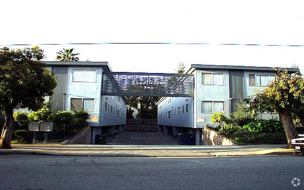
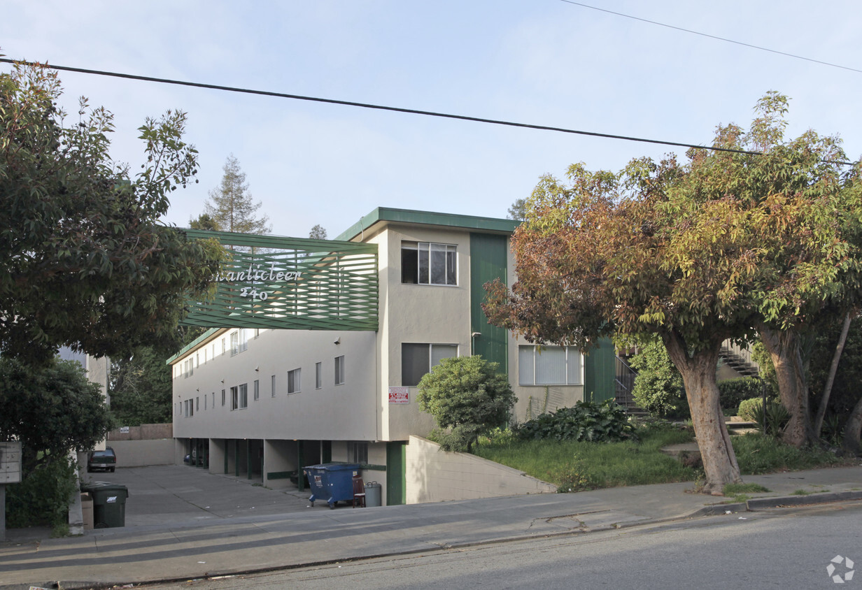

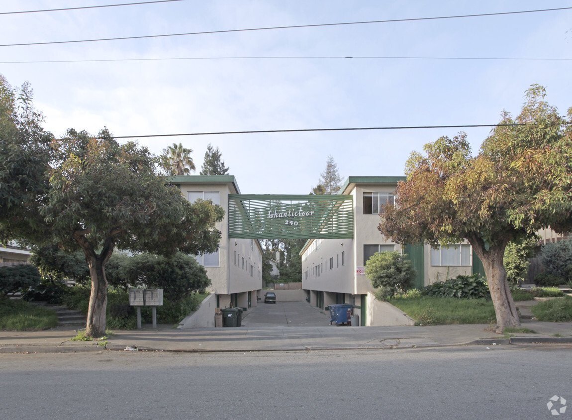
Chanticleer Apartments in East Palo Alto is ready for your visit. The 94303 location in East Palo Alto is an ideal place to move. The professional leasing team is ready for you to come by for a visit. Make a visit to view the available floorplans. Contact us or stop by today.
Chanticleer Apartments is an apartment community located in San Mateo County and the 94303 ZIP Code. This area is served by the Cupertino Union attendance zone.
Situated on the coast of the San Francisco Bay on the San Francisco Peninsula, East Palo Alto is a bustling city on the rise with the influx of tech companies. Friendly neighbors and distant mountain views define this small coastal town.
With its central location between San Francisco and San Jose, entertainment options are endless. Explore the delicious cuisine and fantastic bars in San Jose, or visit the plentiful museums and waterfront green space in San Francisco. Stanford University is a quick commute for East Palo Alto residents, located just five miles southwest of town, so be sure to check out its beautiful campus in nearby Stanford.
East Palo Alto offers an accessible rocky shoreline overlooking the glistening San Francisco Bay, as well as sports fields, open green space, and playgrounds in its well-kept community parks.
Learn more about living in East Palo Alto| Colleges & Universities | Distance | ||
|---|---|---|---|
| Colleges & Universities | Distance | ||
| Drive: | 10 min | 3.5 mi | |
| Drive: | 12 min | 3.7 mi | |
| Drive: | 10 min | 5.0 mi | |
| Drive: | 20 min | 9.4 mi |


Transportation options available in East Palo Alto include Bayshore Nasa Station, located 7.4 miles from Chanticleer Apartments. Chanticleer Apartments is near Norman Y Mineta San Jose International, located 14.9 miles or 21 minutes away, and San Francisco International, located 19.0 miles or 26 minutes away.
| Transit / Subway | Distance | ||
|---|---|---|---|
| Transit / Subway | Distance | ||
| Drive: | 11 min | 7.4 mi | |
|
|
Drive: | 12 min | 7.5 mi |
| Drive: | 12 min | 7.8 mi | |
|
|
Drive: | 12 min | 7.8 mi |
|
|
Drive: | 13 min | 7.9 mi |
| Commuter Rail | Distance | ||
|---|---|---|---|
| Commuter Rail | Distance | ||
| Drive: | 6 min | 1.9 mi | |
| Drive: | 7 min | 2.6 mi | |
| Drive: | 9 min | 3.9 mi | |
| Drive: | 10 min | 4.3 mi | |
| Drive: | 11 min | 5.8 mi |
| Airports | Distance | ||
|---|---|---|---|
| Airports | Distance | ||
|
Norman Y Mineta San Jose International
|
Drive: | 21 min | 14.9 mi |
|
San Francisco International
|
Drive: | 26 min | 19.0 mi |
Time and distance from Chanticleer Apartments.
| Shopping Centers | Distance | ||
|---|---|---|---|
| Shopping Centers | Distance | ||
| Drive: | 5 min | 1.5 mi | |
| Drive: | 5 min | 1.8 mi | |
| Drive: | 5 min | 2.2 mi |
| Parks and Recreation | Distance | ||
|---|---|---|---|
| Parks and Recreation | Distance | ||
|
Seminary Oaks Park
|
Walk: | 20 min | 1.0 mi |
|
Hopkins Creekside Park
|
Drive: | 4 min | 1.3 mi |
|
Rinconada Park
|
Drive: | 6 min | 1.8 mi |
|
Junior Museum and Zoo
|
Drive: | 6 min | 1.8 mi |
|
El Palo Alto Park
|
Drive: | 6 min | 1.9 mi |
| Hospitals | Distance | ||
|---|---|---|---|
| Hospitals | Distance | ||
| Drive: | 9 min | 2.8 mi | |
| Drive: | 11 min | 3.4 mi | |
| Drive: | 9 min | 5.4 mi |
| Military Bases | Distance | ||
|---|---|---|---|
| Military Bases | Distance | ||
| Drive: | 14 min | 7.8 mi |
What Are Walk Score®, Transit Score®, and Bike Score® Ratings?
Walk Score® measures the walkability of any address. Transit Score® measures access to public transit. Bike Score® measures the bikeability of any address.
What is a Sound Score Rating?
A Sound Score Rating aggregates noise caused by vehicle traffic, airplane traffic and local sources
240 E Okeefe St
East Palo Alto, CA 94303


